The Sargasso Sea
The only sea with no coast: a gyre held together by four currents, a floating golden rainforest, the nursery of both Atlantic eels, and the birthplace of a seaweed belt that now spans an ocean.
The Sargasso Sea is the western sub-tropical Atlantic enclosed by the Gulf Stream, North Atlantic Current, Canary Current and North Atlantic Equatorial Current. Because no land bounds it, its edges shift with the currents. Its surface is built on two holopelagic Sargassum species that reproduce only by fragmentation and float on gas-filled bladders, sheltering ten endemic species and the juveniles of hundreds more. It is the only known spawning area for the European and American eels, a nursery for sea turtles and a corridor for sharks, rays, cetaceans and tuna. Since 2011 a new Sargassum population has formed outside the sea, the Great Atlantic Sargassum Belt, which has become a perennial feature and set records in 2018 and 2023. The sea is also a sink for plastics and a test case for high seas governance: the Hamilton Declaration of 2014 created the Sargasso Sea Commission, which has stewardship but no management authority.
In this article
- 1What is the Sargasso Sea?
- 2A sea with no coasts
- 3The Sargassum itself
- 4The floating rainforest
- 5Who lives there
- 6The eel: a critically endangered resident
- 7The 2011 shift
- 8The Great Atlantic Sargassum Belt
- 9Record years
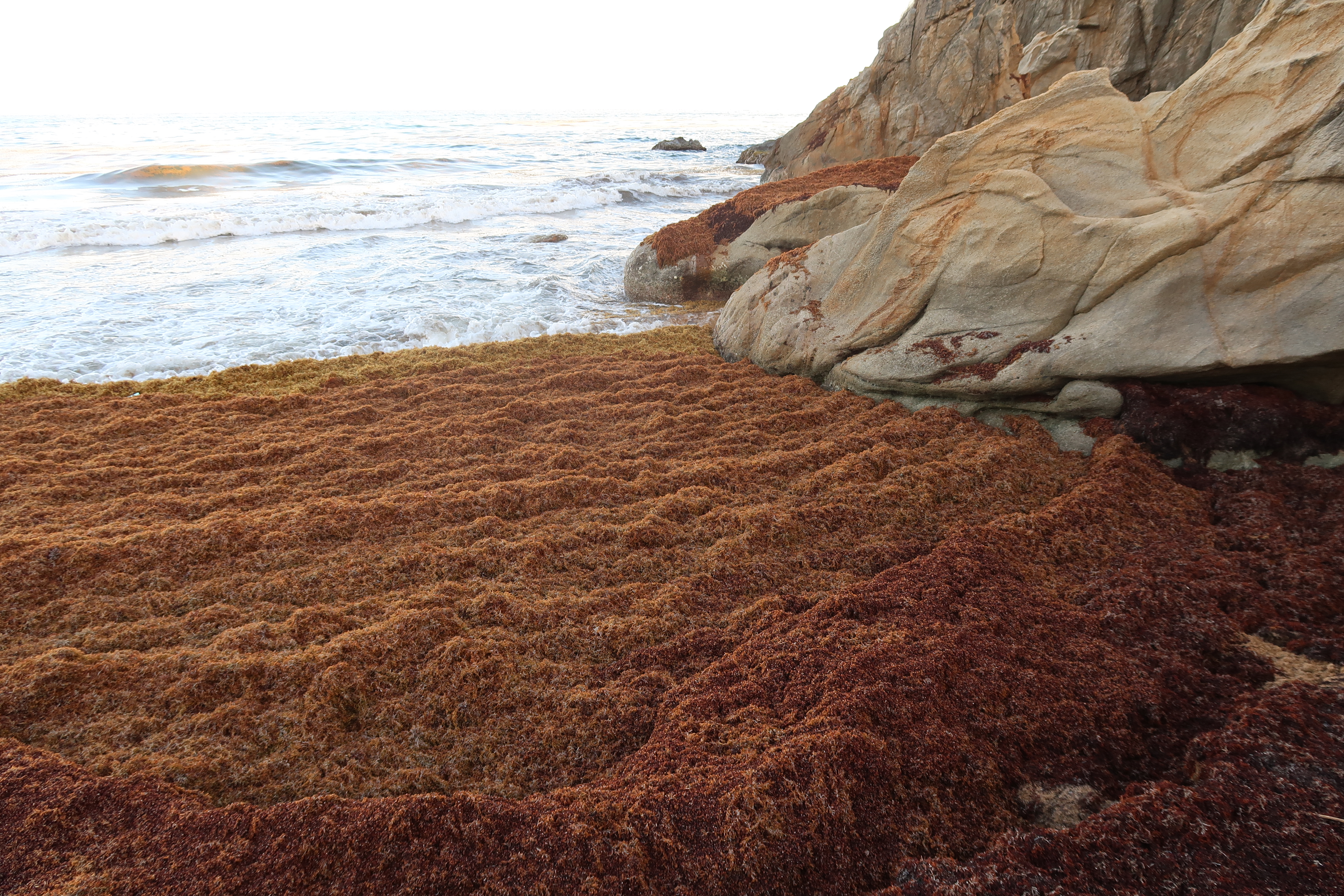
- 10When it comes ashore
- 11The Hamilton Declaration
- 12Threats
- 13Why it matters
- 14The longest spawn run of any eel
- 15A weed that keeps a hundred species alive
- 16How big is it really?
- 17Reading the weed as a warning
- 18Timeline
- 19Frequently asked questions
- 20Knowledge graph
What is the Sargasso Sea?
The Sargasso Sea is a region of the Atlantic Ocean bounded by four currents forming an ocean gyre, and it is the only named sea without land boundaries. Every other sea is defined at least partly by land; the Sargasso Sea is defined only by ocean currents.
Four currents enclose the Sargasso Sea: a clockwise-circulating system that forms the North Atlantic Gyre, and the sea has no land boundary. The Gulf Stream is its western boundary, with the North Atlantic Current to the north, the Canary Current east and the North Atlantic Equatorial Current south.
The sea lies between 20° and 35° north and 40° and 70° west, and is roughly 1,100 kilometres wide by 3,200 km long. Because boundary currents define it, the sea's borders are dynamic and track roughly with the Azores High for a given season.
Its water is distinctive for its deep blue colour and exceptional clarity, with underwater visibility reaching up to 60 m. The Sargasso Sea is the only place where Sargassum grows in truly open ocean, far from land.
1. A sea with no coasts
The Sargasso Sea is defined only by ocean currents and lies within the Northern Atlantic Subtropical Gyre. A 2011 analysis put the sea's boundaries at between 22°–38°N and 76°–43°W, centred on 30°N and 60°W, an area of around 4,163,499 km².
Because the Sargasso Sea is bordered by oceanic currents rather than coasts, its borders can and do change.
It is the only sea without land boundaries, and its depths run from Bermuda's surface coral reefs to abyssal plains at 4500 m. As open ocean the sea is part of the High Seas, the near-50% of Earth's surface beyond any national jurisdiction.
Bermuda is the only landmass in the middle of the Sargasso Sea.
2. The Sargassum itself
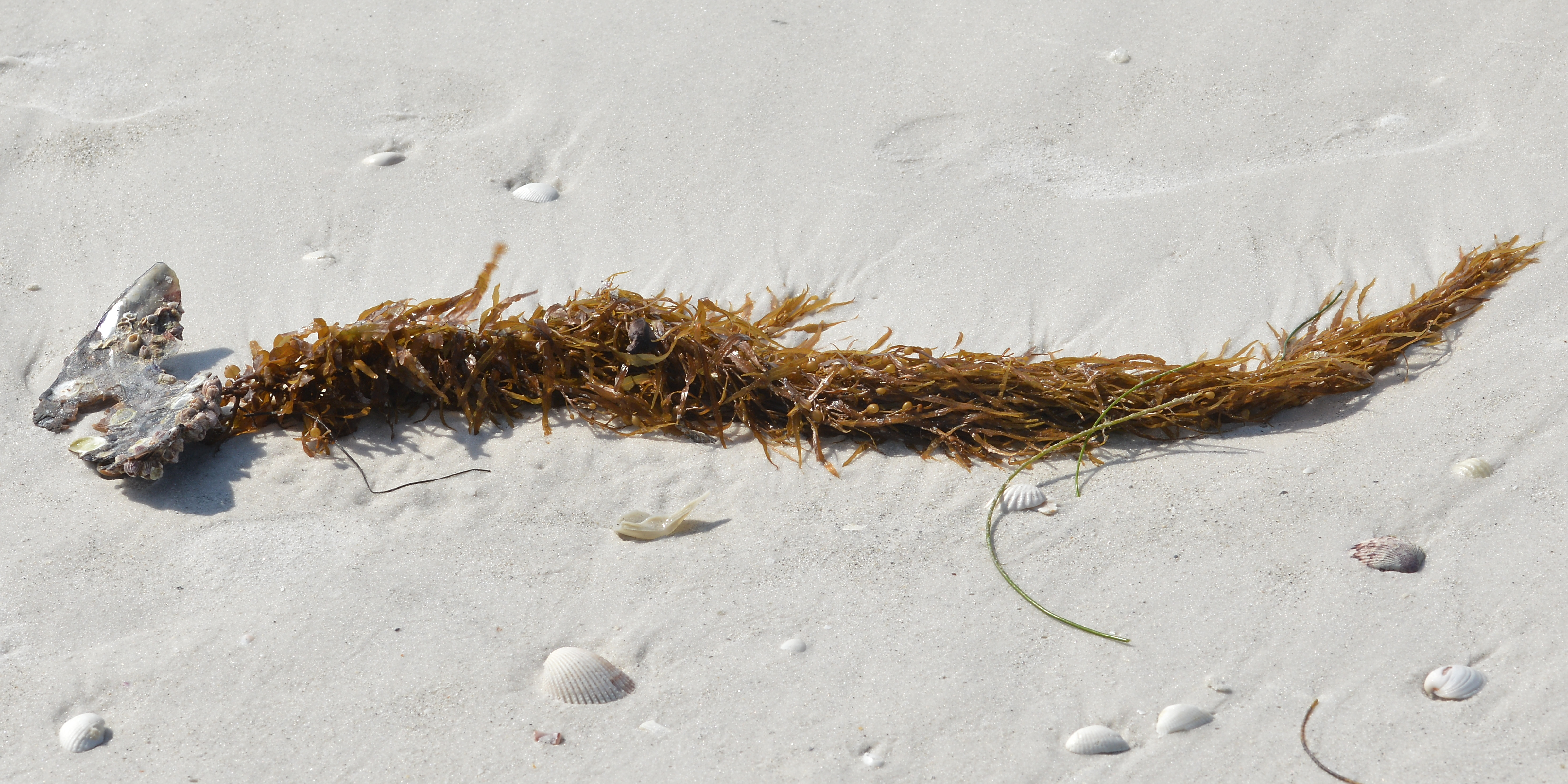
Sargassum is a genus of over 300 species of brown macroalgae (seaweed) in the order Fucales, class Phaeophyceae. Sargassum is a genus of large brown seaweed that floats in island-like masses.
Only two species are holopelagic, Sargassum natans and Sargassum fluitans, and they are distinguished by reproducing solely through clonal fragmentation. Leaf form separates the species: S. natans carries fine foliage while S. fluitans carries large lanceolate leaves on the same gas-filled floats.
Both species are golden brown and float on small gas-filled bladders; S. natans has fine leaves and S. fluitans large lanceolate ones. The name comes from sargaço, the Portuguese word for grape, after sailors noticed the small air-filled bladders that keep the weed afloat.
Most Sargassum species carry spherical, gas-filled bladders called pneumatocysts that provide buoyancy and hold the fronds near the surface for photosynthesis.
Floating Sargassum evolved more than 40 million years ago from bottom-dwelling species.
3. The floating rainforest
Sargassum is a brown algae that builds a unique and highly productive floating ecosystem on the open ocean surface. Sylvia Earle, former chief scientist of NOAA, called Sargassum a golden floating rainforest.
Sargassum mats shelter more than 11 phyla and over 100 different species. More than 150 invertebrate species live on or in association with the Sargassum.
In total 81 fish species from 36 families live in the Sargassum or use it for part of their life cycle. Sargassum supports ten endemic species and acts as critical nursery habitat for many pelagic fishes and several sea turtle species.
Ten species are known to be endemic to floating Sargassum, including the sargassum crab, shrimp, pipefish, anemone, slug, snail and two amphipods.
No other marine region anywhere in the world is known to support a community of holopelagic algae.
4. Who lives there
Sargassum gives essential habitat to shrimp, crab, fish and other species that have adapted specifically to this floating algae. Turtles use Sargassum mats as nurseries where hatchlings find food and shelter.
Sargassum is an essential feature of designated critical habitat for loggerhead sea turtles and proposed critical habitat for green turtles. Floating rafts can stretch for miles, providing food, refuge and breeding grounds for fishes, sea turtles, marine birds, crabs and shrimp.
The sea is a spawning site for threatened and endangered eels, and also for white marlin, porbeagle shark and dolphinfish. The sea is the only known spawning area for two endangered anguillid eels, which move from marine breeding grounds to freshwater feeding grounds.
Humpback whales migrate through the Sargasso Sea every year. It also serves as a migratory corridor for several species of sharks, rays and cetaceans.
Commercial fish such as tuna, and seabirds, migrate through the sea and depend on it for food.
5. The eel: a critically endangered resident
The European eel, Anguilla anguilla, is listed as Critically Endangered on the IUCN Red List. It spends most of its life in European rivers draining to the Atlantic, Mediterranean and Baltic, then migrates to the western subtropical Atlantic to breed.
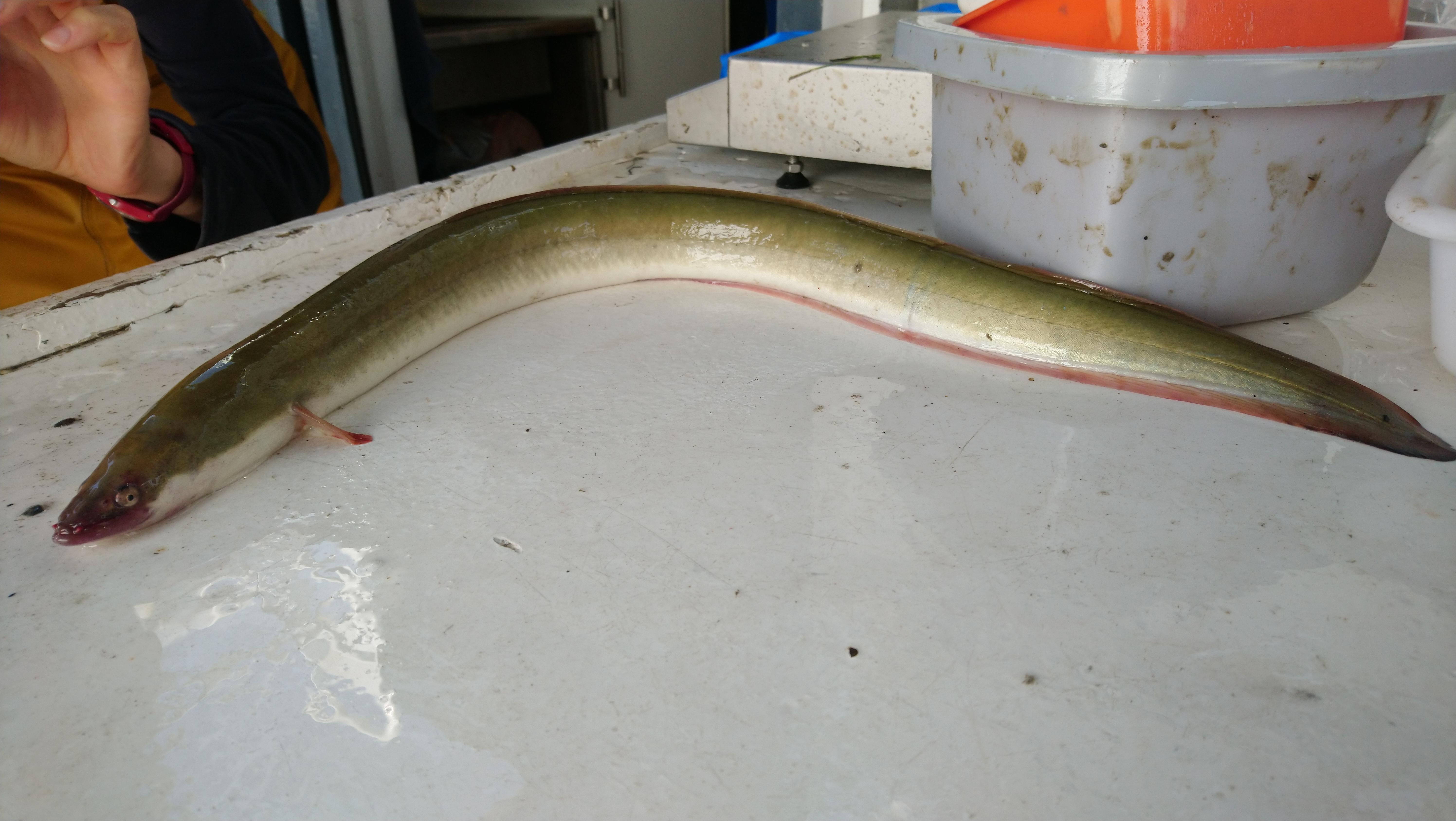
In 2020 the European eel remained Critically Endangered, in the same category as the Northern Right Whale.
The eel was added to CMS Appendix II at COP11 in 2014 and CMS is preparing an action plan for it. Possible conservation measures for the European eel were discussed at two international meetings in Malmö in 2018 and 2019 convened by CMS and the Sargasso Sea Commission.
6. The 2011 shift
Before 2011 the weed was present but too sparse to see from satellites; since then it has exploded into huge aggregations. Before 2011 most pelagic Sargassum was found in patches around the Gulf of Mexico and the Sargasso Sea.
Satellite data indicate a possible regime shift in Sargassum blooms from 2011 onward. Major blooms occurred annually from 2011 through 2018 except in 2013.
Hu, who led the 2019 study, concluded that on 20 years of data the belt is very likely to be a new normal.
In the winter of 2009–2010 the westerlies shifted south of their average latitude and blew more due east than northeast. The annual average North Atlantic Oscillation index for 2010 was the lowest on record, in reconstructions reaching back to 1900.
By summer 2011 a patchy belt of Sargassum spanned the whole tropical Atlantic and masses were being swept into the Caribbean and Gulf of Mexico. The belt has recurred in every year since 2011 except 2013 and often stretching from West Africa to the Gulf of Mexico.
7. The Great Atlantic Sargassum Belt
USF scientists used NASA satellite data to discover the Great Atlantic Sargassum Belt, which began in 2011. That new open-ocean population is what scientists call the Great Atlantic Sargassum Belt.
The Great Atlantic Sargassum Belt is now a perennial feature of the tropical Atlantic rather than a one-off event. Since it developed in 2011 the Atlantic Sargassum belt appears to be getting larger, according to Barnes and his colleagues.
The belt forms seasonally in response to two nutrient inputs, one human-derived and one natural. In spring and summer Amazon River discharge adds nutrients, and those nutrients may have increased through deforestation and fertiliser use.
In winter, upwelling off the West African coast lifts nutrients from deep water to the surface where Sargassum grows.
8. Record years
July 2018 set a record abundance of 20 million tons, wreaking havoc on shorelines across the tropical Atlantic. In 2018 more than 20 million tons floated in surface waters, a mass heavier than 200 fully loaded aircraft carriers.
A 2019 study in Science estimated more than 20 million metric tons of Sargassum blanketed the Atlantic in the Great Atlantic Sargassum Belt.
In March 2023 the amount of Sargassum floating in the belt was the largest of any March on record. USF researchers estimated the March 2023 belt at about 13 million tons, a record for that time of year.
In March 2023 scientists measured the largest amount of Sargassum in the belt of any March on record.
9. When it comes ashore
Rotten Sargassum on a beach releases hydrogen sulfide gas and smells like rotten eggs.
Barbados declared a national emergency in 2018 over the toll the seaweed took on tourism.
After the 2018 blooms, doctors in Martinique and Guadeloupe reported thousands of people seeking care for breathing trouble from rotting weed.
Sargassum also carries high levels of arsenic and other heavy metals, organic contaminants and marine debris.
In patchy doses the weed contributes to ocean health, providing habitat for turtles, invertebrates, fish and birds and producing oxygen by photosynthesis.
10. The Hamilton Declaration
On 11 March 2014 governments met in Bermuda and signed the Hamilton Declaration on Collaboration for the Conservation of the Sargasso Sea. The Azores, Bermuda, Monaco, the UK and the US signed first; the British Virgin Islands, the Bahamas, Canada, the Cayman Islands and the Dominican Republic followed.
The Hamilton Declaration is a non-binding political statement, not a treaty. The Commission has no management authority; it exercises a stewardship role and keeps the sea's health, productivity and resilience under continual review.
Bermuda keeps exclusive management authority over its EEZ, while shipping and fishing beyond national jurisdiction stay with IMO, ICCAT and NAFO.
The Sargasso Sea Alliance, founded in 2010 and led by Bermuda's government, sought protection through bodies with authority beyond national jurisdiction. The alliance was formed in 2010 under Bermuda's leadership with scientists, conservation groups and private donors.
A 2016 UNESCO and IUCN report found the Sargasso Sea among five high seas sites that could be recognised under the World Heritage Convention. None of those five sites could be inscribed on the World Heritage List, because all lie outside any national jurisdiction.
11. Threats
Surface currents concentrate non-biodegradable plastic waste in the sea, which holds the North Atlantic garbage patch. Shipping, fishing, plastic and other pollutants, and climate change are among the pressures on the sea.
Less than 0.5% of global high seas fisheries catch is taken inside the Sargasso Sea. The sea is a major shipping route, exposing cetaceans to ship strikes and noise and the ecosystem to discharges and oil-related impacts.
Seabed mining is a possible future threat that could damage or destroy unique, slow-growing deep-sea ecosystems.
12. Why it matters
The wealth of data and its stressed condition make the sea an ideal sentinel ecosystem for monitoring the global ocean-climate linkage. The sea provides migratory corridors and spawning grounds for eels, whales, turtles and fish, linking oceans and economies.
The Sargasso Sea is a fundamentally important part of the world ocean, inside the North Atlantic sub-tropical gyre and bounded by its currents. The Sargasso Sea is a two-million square mile open ocean ecosystem bounded by the circulating currents of the North Atlantic Gyre.
13. The longest spawn run of any eel
The European eel is critically endangered and has suffered a 95% decline in recruitment since the 1980s.
As an adult the European eel makes the longest spawning migration of any anguillid, 5,000 to 10,000 km across the Atlantic.
The 1920–1922 Dana expeditions, led by Johannes Schmidt, determined that the European eel's breeding sites lay in the Sargasso Sea.
14. A weed that keeps a hundred species alive
More than 145 invertebrate species and at least 127 fish species have been recorded in the Sargassum.
Sargassum supports ten endemic species that spend their whole lives on the open sea. Fully ten endemic animals are adapted to spend their entire lives on floating Sargassum far out on the open sea.
It is also a critical nursery habitat for many pelagic fish and for all species of Atlantic sea turtle.
15. How big is it really?
Stretching over 5 million km², the Sargasso Sea is a high seas ecosystem inside the North Atlantic subtropical gyre. The sea is unique among seas in having no land borders at all.
Four Atlantic currents form the clockwise North Atlantic Gyre, enclosing an area some 1,100 km wide and 3,200 km long.
16. Reading the weed as a warning
The 2011 explosion and the snowy 2010–11 US winter may share an origin: an extreme, long-lasting negative phase of the North Atlantic Oscillation during 2010.
Models indicated that by spring 2010 the seaweed would have reached waters offshore of Gibraltar, at the tip of the Iberian Peninsula.
17. Timeline
- 1492Columbus records the weedColumbus's crew found sargassum in some places so thick that it seemed to hold back the ships, according to the ship's log entry for 20 September 1492.
- 1609Sea Venture wrecked on BermudaThe English vessel Sea Venture was blown ashore on Bermuda, one of the earliest recorded arrivals in the region.
- 1920-1922Schmidt's Dana expeditionsJohannes Schmidt's larval surveys located the smallest eel larvae in the sea, making it the presumed breeding place of the European eel.
- 1972First Sargassum plastic surveyCarpenter and Smith reported 50 to 12,000 plastic particles per square kilometre, with the highest counts near 34°N in the sea.
- 2010Sargasso Sea Alliance formedBermuda's government assembled scientists, conservation groups and donors to pursue protection of the high seas ecosystem.
- 2011The Sargassum regime shiftSargassum expanded beyond its usual range into the central Atlantic, and the Great Atlantic Sargassum Belt began.
- 2011Hope Spot designationMission Blue recognised the Sargasso Sea as a Hope Spot, with the Sargasso Sea Commission later acting as champion.
- 2014Hamilton Declaration signedFive governments signed in Bermuda on 11 March; the Sargasso Sea Commission was established under the declaration.
- 2016World Heritage shortlistUNESCO and IUCN named the sea among five high seas sites that could be recognised under the World Heritage Convention.
- 2018Record bloom yearMore than 20 million tons of Sargassum floated in Atlantic surface waters, fouling Caribbean and Gulf coastlines.
- 2022Eels tracked to the seaSatellite tags on 26 Azorean eels produced the first direct evidence of adult European eels reaching their spawning area.
- 2023Largest March bloom on recordSatellite estimates put the belt at about 13 million tons, the biggest March in the record.
- 2024Tenth anniversary of the Hamilton DeclarationRepresentatives of the signatory governments and the Commissioners met at Cambridge Beaches, Bermuda, ten years after the first signing, to coordinate two new projects on the science case and a conservation plan.
- 2026Socio-Ecosystem Diagnostic AnalysisThe Sargasso Sea Commission released the first diagnostic analysis of a high seas ecosystem, built by more than 25 experts.
18. Frequently asked questions
How large is the Sargasso Sea?
The Sargasso Sea Commission cites an area of two million square miles of open ocean4The Sargasso Sea · Sargasso Sea Commission ↗. One source describes the ecosystem as stretching over 5 million km².
How many invertebrate and fish species have been recorded in the Sargassum?
More than 145 invertebrate species and at least 127 fish species have been recorded in the Sargassum6Sargasso Sea · High Seas Alliance ↗.
How severe is the decline of the European eel?
The European eel has suffered about a 95% recruitment decline since the 1980s7First direct evidence of adult European eels migrating to their breeding place in the Sargasso Sea · Scientific Reports (Nature Portfolio) ↗.
When was plastic debris first reported from the Sargasso Sea?
High concentrations of plastic debris were first reported from the Sargasso Sea by WHOI scientists Carpenter and Smith in 1972, the first such report from any ocean10Plastic Particles Permeate the Atlantic · Woods Hole Oceanographic Institution (Oceanus) ↗. Their highest plastic counts came at about 34°N latitude in the Sargasso Sea10.
What did the Hamilton Declaration establish, and who has joined it?
The Hamilton Declaration is a non-binding political statement rather than a treaty, and the Commission it created has no management authority, exercising a stewardship role that keeps the sea's health, productivity and resilience under continual review12The Hamilton Declaration · Sargasso Sea Commission ↗. The Cayman Islands became the ninth signatory on 3 January 201712, and the Dominican Republic became the tenth on 6 April 201812.
Has the Sargasso Sea been considered for World Heritage status?
A 2016 UNESCO and IUCN report found the Sargasso Sea among five high seas sites that could be recognised under the World Heritage Convention16Sargasso Sea among spots in the High Seas identified as potential World Heritage sites · IUCN ↗. None of those five sites could be inscribed on the World Heritage List, because all lie outside any national jurisdiction16.
References (17)
- 1Sargasso Sea — Wikipedia WebView source
- 2What is the Sargasso Sea? — NOAA National Ocean Service WebView source
- 3Sargassum — Wikipedia WebView source
- 4The Sargasso Sea — Sargasso Sea Commission Web↩View source
- 5Ecological Value of the Sargasso Sea — Sargasso Sea Commission WebView source
- 6Sargasso Sea — High Seas Alliance Web↩View source
- 7First direct evidence of adult European eels migrating to their breeding place in the Sargasso Sea — Scientific Reports (Nature Portfolio) Journal↩View source
- 8Scientists Discover the Biggest Seaweed Bloom in the World — University of South Florida College of Marine Science 2019 WebView source
- 9A Massive Seaweed Bloom in the Atlantic — NASA Earth Observatory WebView source
- 10Plastic Particles Permeate the Atlantic — Woods Hole Oceanographic Institution (Oceanus) Web↩View source
- 11Microplastic levels in Sargasso Sea comparable to Great Pacific Garbage Patch — Greenpeace International WebView source
- 12The Hamilton Declaration — Sargasso Sea Commission Web↩View source
- 13Life in the North Atlantic depends on this floating seaweed — National Geographic WebView source
- 14Sargasso Sea Alliance Honored with 2013 International SeaKeepers Award — IUCN 2013 WebView source
- 15New Science Makes the Strongest Case Yet for Protecting the Sargasso Sea Hope Spot — Mission Blue 2026 WebView source
- 16Sargasso Sea among spots in the High Seas identified as potential World Heritage sites — IUCN Web↩View source
- 17Sargasso Sea Commission Celebrates the 10th Anniversary of the Signing of the Hamilton Declaration — Government of Bermuda WebView source