Mount Everest
The highest point on Earth: a fossil seabed pushed 8,848.86 metres into the jet stream, and the mountain people keep dying to climb.
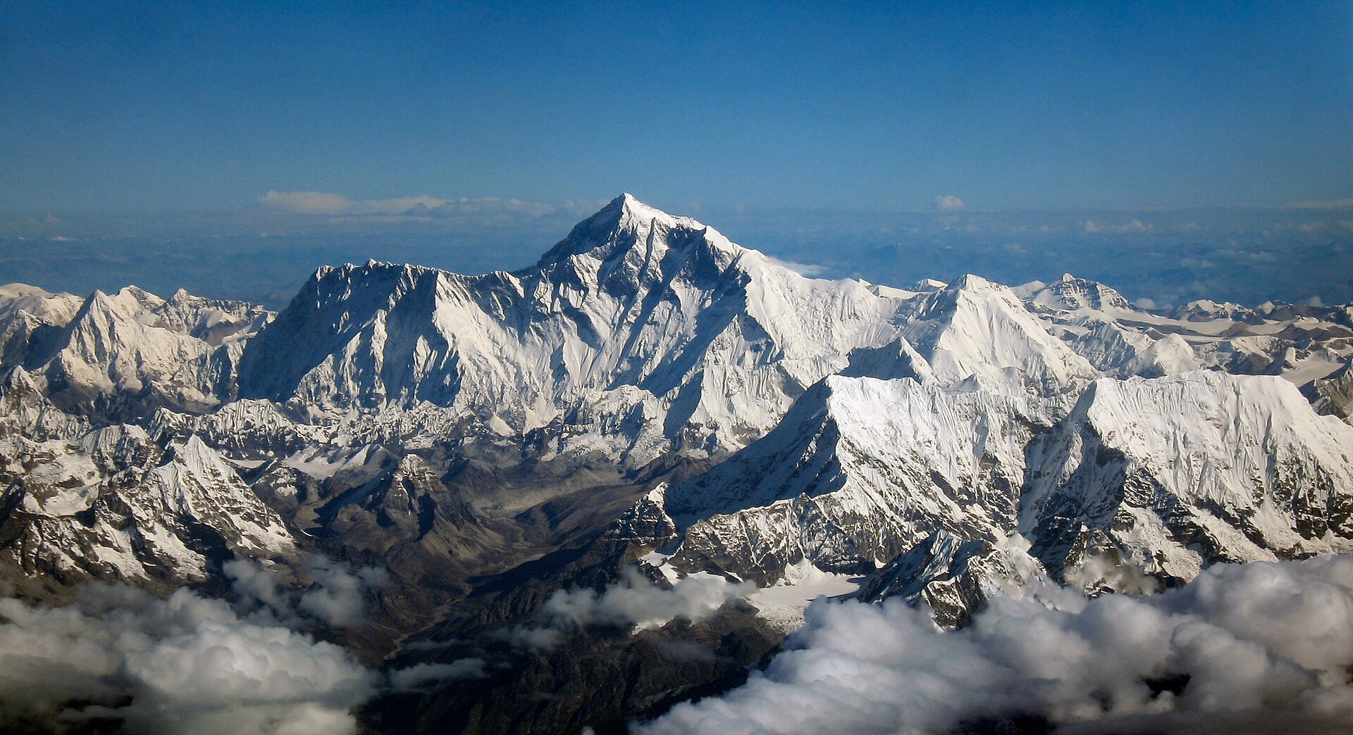
Mount Everest, Sagarmatha in Nepali and Qomolangma in Tibetan, is the highest point on Earth's surface at an official 8,848.86 metres, a figure Nepal and China announced jointly on 8 December 2020 after a decades-long argument over whether to measure snow or bare rock. The summit itself is Ordovician limestone laid down in a shallow sea about 450 million years ago and thrust upward when India met Asia. Above 8,000 metres the mountain passes into the death zone, where oxygen pressure cannot sustain human life for long; the Khumbu Icefall, avalanches and the jet stream do the rest. Climbers have reached the top since 1953, but the death toll, permit economy, crowding and roughly fifty tonnes of abandoned waste are all part of the same story.
The Nepali remeasurement
Mount Everest rises on the crest of the Great Himalayas of southern Asia, its summit set on the border between Nepal and China's Tibet Autonomous Region. Its official elevation is 8,848.86 metres, or 29,031.7 feet, a figure Nepal and China jointly announced in December 2020. Britannica gives the same joint value as 29,031.69 feet, or 8,848.86 metres, and records that the 2020 figure was subsequently widely accepted.
The mountain carries more than one name. The Tibetan Qomolangma means “holy mother”, while the Nepali Sagarmatha carries the literal sense of “head in the sky”. Britannica renders the Sanskrit Sagarmatha as literally “Peak of Heaven” and the Tibetan Chomolungma as “Goddess Mother of the World”. The Tibetan name was recorded in a Chinese transcription in the 1721 Kangxi Atlas and reached Europe in 1733 on a map by the French geographer D'Anville.
Nepal's Survey Department treated the summit as the basis of a national measurement programme, reporting the height as 8848.86 metres and naming the effort the National Initiative on Measurement of Height of Sagarmatha. The work combined precise levelling, trigonometrical levelling, a gravity survey to define the local geoid, GNSS survey work and a summit observation campaign. A two-person survey team with supporting Sherpas reached the summit and ran a GNSS observation for 1 hour 16 minutes, alongside ground-penetrating radar to measure snow depth. Precise levelling carried height over 248 kilometres from Maadar in Siraha district, while GNSS observations were completed at 298 control points and Everest was observed trigonometrically from 12 stations. The survey took a mix of five methods, and the coordinator of the Everest Height Measurement Secretariat put the margin of error within centimetres.
Nepal had worked towards its own measurement for years, spending about $1.3 million and working with six international firms before the project formally got under way in 2017. The remeasurement was driven partly by concern that the 2015 earthquake might have shifted the mountain, and by the political will created when Xi Jinping visited Nepal the year before the announcement. The survey coordinator said the measurement was accurate within centimetres, and the data from the Nepali and Chinese teams was processed jointly to calculate the height. China settled on a snow-surface height tied to the International Height Reference System, which is the basis on which the joint figure was declared.
The dispute that the 2020 figure ended was 15 years old and turned on whether the official height should be the snow height or the rock height. China's 2005 survey reported 8,844.43 metres because it measured bare rock and excluded the snow cap, which the Chinese side argued changes constantly. That Chinese figure was a rock height with accuracy of plus or minus 0.21 m, and the team measured a snow-ice depth of 3.5 m on top of it. The 2020 declaration averaged over that argument by adopting a snow-surface height, and the rock height was not announced at all.
Earlier attempts to fix the summit's rock surface produced their own figures. In 1999 an American expedition anchored a GPS unit into the highest bedrock and obtained a rock head elevation of 8,850 m, with snow and ice about a metre higher. Britannica notes that the summit is capped by rock-hard snow under a softer layer that fluctuates annually by 5 to 20 feet, deepest in September after the monsoon and thinnest in May.
British surveyors declared the height of Peak XV to be 8,778 metres back in 1847 — the first of a long series of contested figures. Triangulation from 1849 to 1855 produced a mean computed height of 29,002 ft, or 8,839.80 metres, and the peak was then named after Sir George Everest. The long-accepted 8,848 metres, or 29,028 feet, came from the Survey of India in 1954 using trigonometric methods observed from Bihar.
1. Altitude and the death zone
Mount Everest is built of three stacked rock units: the Qomolangma Formation at the summit, the North Col Formation beneath it, and the Rongbuk Formation at the base 2Mount Everest · Wikipedia ↗. The summit-forming Qomolangma Formation runs from the top down to the Yellow Band at about 8,600 m and consists of Ordovician limestone interbedded with dolomite and siltstone 2. Britannica identifies the Yellow Band just below the summit pyramid as a limestone formation and the higher rocks as remnants of the ancient floor of the Tethys Sea 1Mount Everest · Encyclopaedia Britannica ↗. Below 7,000 m the Rongbuk Formation is schist and gneiss intruded by leucogranite sills, part of the Higher Himalayan leucogranite belt 2.
The summit rocks are Ordovician limestones laid down in a warm shallow sea roughly 450 million years ago 8The Ordovician rocks of Mount Everest · International Union of Geological Sciences (IUGS) Geoheritage ↗. They still hold fossils of marine animals including brachiopods, conodonts and crinoids from the Great Ordovician Biodiversification Event 8. The summit limestone was pushed into place when India collided with Asia about 55 million years ago, thrusting an ancient Tethyan seafloor skyward 8. The IUGS describes the highest rocks on the planet as fossiliferous marine limestone, which is why the Ordovician rocks of Everest earned protected geological-heritage recognition 8. Climbers near the summit are crossing softer sedimentary rock formed from the skeletons of sea creatures, not the hard igneous rock of volcanoes 9The World's Tallest Mountain · NASA Earth Observatory ↗.
The summit of Mount Everest is marine limestone, a fact that is a treatise in itself on the movements of the Earth's surface.
John McPhee, quoted by NASA 9
Everest is still rising by roughly 2 mm a year, driven by the thrust tectonics that stacked its rock units 2. Its identity as the highest point on Earth was not established until 1852 when the Survey of India settled the question; it was renamed for George Everest thirteen years later 1. The Survey of India's triangulation work of 1952 to 1954 fixed the height at 8,847.73 m, and a Chinese measurement in 1975 reaffirmed 8,848.13 m; both measured the snow cap rather than the rock head 2.
In mountaineering the death zone is the altitude above which oxygen pressure is insufficient to sustain human life for an extended period, generally taken as 8,000 m 10Death zone · Wikipedia ↗. At 8,000 m atmospheric pressure falls below 356 millibars, against a sea-level standard of 1013.25 millibar 10. The concept was introduced in 1953 by the Swiss doctor Edouard Wyss-Dunant, who called it the lethal zone 10. Death-zone deaths arise both directly from loss of vital functions and indirectly from impaired judgement, such as failing to turn back in deteriorating conditions 10. Climbers on the South Col enter the death zone and can typically endure no more than two or three days at that altitude before descending 2.
Air pressure at the Everest summit is about one-third of sea-level pressure, and winds reaching the summit can cut available oxygen by up to 14 percent through Bernoulli effects 2. At the summit oxygen availability is only about 30 percent of the sea-level value, which is why the vast majority of climbers use oxygen masks and cylinders there 11Everest crowds: Traffic jam at the top of the world · BBC News ↗. Britannica records that summit oxygen is one-third of the sea-level value, and that a January average of about -33 degrees Celsius can fall still lower to -60 1. The summit is exposed to the fast, freezing winds of the jet stream, which commonly reach 160 km/h and once hit 280 km/h there in February 2004 2.
National Geographic notes that the human body cannot remain indefinitely above 19,000 feet, with pulmonary edema, cerebral edema and blood embolisms the rising risks 12Want to climb Mount Everest? Here's what you need to know · National Geographic ↗.
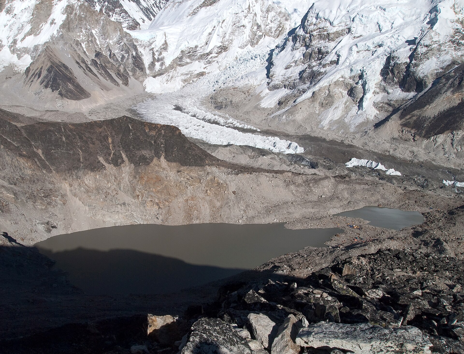
The Khumbu Icefall sits at 5,486 m at the head of the Khumbu Glacier, just above Base Camp, and is regarded as one of the most dangerous sections of the South Col route 13Khumbu Icefall · Wikipedia ↗.
2. The 2014 avalanche
The Khumbu Icefall is the first great obstacle of the South Col route and the one that most reliably extracts a price. The Khumbu Glacier moves an estimated 0.9 to 1.2 m down the mountain's flank every day, so the icefall's route through crevasses and seracs must be rebuilt each season. Overhanging ice blocks called seracs, from several tons to thousands of tons, can collapse without warning, and rope and ladder networks cannot prevent loss of life. Most climbers try to pass the icefall before sunrise, while night-time freezing keeps the ice less mobile.
The record of loss in the icefall is long and uneven. The Himalayan Database records 44 deaths in the Khumbu Icefall between 1953 and 2016 and none at all between 2017 and 2021. On 5 April 1970 six Sherpas were killed in the Khumbu Icefall by a serac while supporting the filming of The Man Who Skied Down Everest.
On 18 April 2014 seracs on Everest's western spur collapsed at about 06:45 local time, sending an ice avalanche into the Khumbu Icefall that killed sixteen climbing Sherpas. The victims were fixing ropes and preparing the South Col route for paying climbers; 25 men were buried, only 13 bodies were recovered, and nine were injured. Roughly 350 to 450 people, mostly Nepalese Sherpas, are hired each two-month season to support foreign climbers on Everest.
The disaster became an industrial dispute. After the 2014 avalanche Sherpas demanded compensation and a memorial, and on 22 April announced they would not work on Everest for the rest of the season. The Nepalese government's immediate relief of about $400 each was dismissed by the Nepal Mountaineering Association as covering only funeral costs.
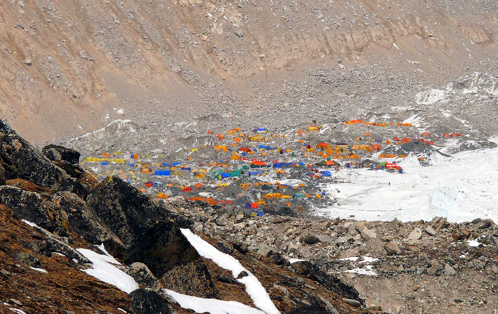
On 25 April 2015 a magnitude 7.8 earthquake triggered an avalanche off Pumori that swept into Base Camp and killed at least 24 people, the deadliest disaster on the mountain. Between 700 and 1,000 people were on or near Everest when the quake struck, including 359 climbers at Base Camp, many back after the aborted 2014 season. An Indian Army mountaineering team recovered 19 bodies from Base Camp and rescued at least 61 stranded climbers in the aftermath. No one climbed Everest in the spring of 2015 — the first time that had happened in 41 years — and that season was the second consecutive one closed by avalanches.
On 10 and 11 May 1996 eight climbers were caught by a blizzard above the South Col and died while descending from the summit, and 12 people died that season. Among the dead were guides Rob Hall and Scott Fischer; four members of Adventure Consultants died on the South Col side and three Indo-Tibetan Border Police officers on the north. The toll made that season Everest's deadliest until it was overtaken by 2014 and then the 23 deaths of the April 2015 earthquake avalanches. Jon Krakauer, on assignment for Outside magazine, survived the storm and published the bestseller Into Thin Air the following year. Britannica lists overcrowding, inexperience, ignored schedules and questionable decisions under pressure among the contributing factors to the 1996 disaster.
In 2019 Nepal issued a record 381 climbing permits, with roughly as many again to guides and Sherpas, and about 140 more permitted climbers attempted the peak from Tibet. A photo by Nirmal Purja showing a near-continuous line of hundreds of climbers bottlenecked on the summit ridge drew global attention to crowding that May. Because there is only one fixed rope at the summit, ascending and descending climbers must share it, producing two opposing rows of people. The season's death toll reached 11 and the toll across Himalayan 8,000 m peaks that spring reached 21 in total.
The commercial machinery behind the queues is substantial. Nepal's Ministry of Tourism collected $5.2 million in Everest permit fees in 2018 while a place on a commercial team can now cost somewhere between forty and a hundred thousand dollars.
3. Permits and fees
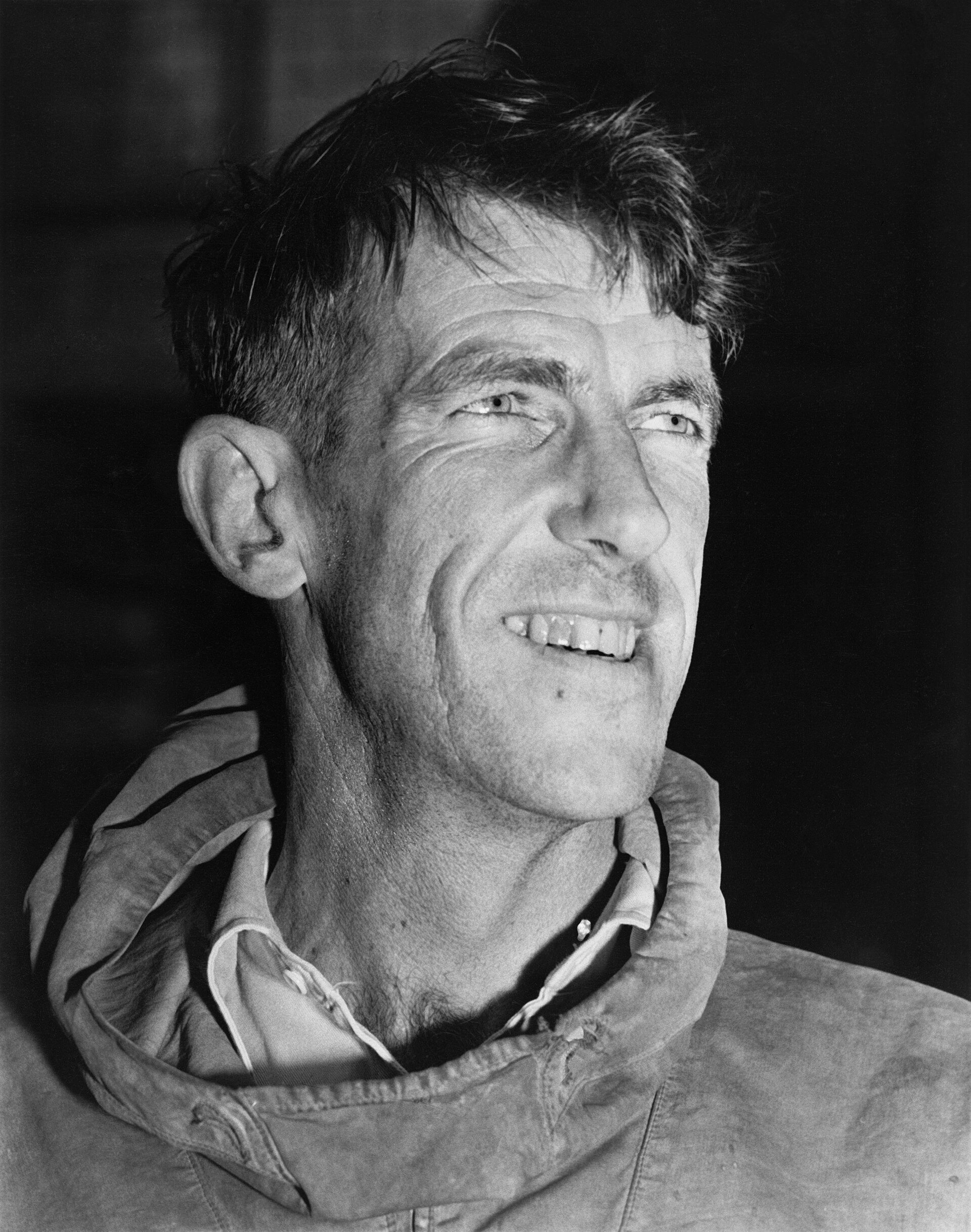
Edmund Hillary, a New Zealand beekeeper, and the Nepalese Sherpa Tenzing Norgay became the first people on the summit on 29 May 1953 via the south-east ridge. The ascent came four days before the coronation of Elizabeth II, and Hillary was knighted before the expedition had even left the mountains. The line they opened is now called the Southeast Ridge and remains the standard route from Nepal.
Earlier attempts left an unresolved question. George Mallory and Andrew Irvine made a final summit attempt on 8 June 1924 and never returned, leaving open whether they reached the top before Hillary and Tenzing. A Chinese team of Wang Fuzhou, Gonpo and Qu Yinhua made the first reported ascent from the North Ridge on 25 May 1960 via the north face. Reinhold Messner and Peter Habeler made the first ascent without supplemental oxygen in 1978 and Messner summited solo without bottled oxygen two years later.
Nepal replaced its group-based fee system with a flat $11,000 per-climber spring royalty on the normal route at the start of 2015. From September 2025 the spring fee for foreigners on the south route rose from $11,000 to $15,000 while autumn rose from $5,500 to $7,500 and winter and monsoon fees reached $3,750 each. The spring permit for Nepali climbers on the normal route doubled from Rs 75,000 to Rs 150,000 under the same revision.
Nepal's permit count has swung widely, rising from 160 in 2008 to a record 408 by 2021 while none at all were issued during the pandemic year of 2020 and 381 went out back in 2019. By December 2024 the Himalayan Database had recorded just under 13,000 summits of Everest by around 7,200 different people.
An estimated more than fifty tonnes of waste and more than 200 bodies remain on Everest, and five annual army clean-ups had by 2024 collected 119 tonnes of rubbish and 14 corpses. Nepal's army began annual clean-ups in 2019 amid concern about overcrowding and climbers queuing in dangerous conditions, and 2024 rules required tracking devices and that climbers bring back their own waste. Nepal's army removed eleven tonnes of rubbish, four corpses and one skeleton from Everest, Nuptse and Lhotse over 55 days in 2024.
As much as 12,000 kg of human excrement is left on the mountain each season, strewn across the route's upper camps. In 2019 the Khumbu Pasanglhamu Rural Municipality launched a campaign to collect nearly 10,000 kg of garbage from Everest.
A retrospective study of the Himalayan Database found the overall mortality rate above base camp fell from 1.4 percent to 0.7 percent between the 1921-2006 and 2007-2024 periods. From 2007 to 2024 fatal incidents involving climbers on the standard routes averaged 7,970 m, higher than the 6,894 m average for Sherpas. Most climbers who died, 76.5 percent, did so on summit day, whereas 82.2 percent of Sherpa deaths happened during route preparation. Climber mortality on the summit descent fell from 3.0 percent to 0.8 percent between the 1982-2006 and 2007-2024 periods, while Sherpa descent mortality in the later period was just 0.1 percent. As of May 2024 a total of 340 people had died on Everest and more than 200 bodies remain on the mountain because recovery is too dangerous.
By 2016 most guided Everest services cost anywhere between US$35000 and US$200000 apiece, and a well-known celebrity guide could command well over a hundred thousand pounds sterling. For a three-to-four-month expedition, Nepalese high-altitude workers typically earn between $2,500 and $5,000 a season.
The Himalayan Database is built on the expedition archives of Kathmandu journalist Elizabeth Hawley, covering expeditions from 1905 onward, with more than 11,800 expedition and 95,000 member records 24The Himalayan Database: The Expedition Archives of Elizabeth Hawley · The Himalayan Database (American Alpine Club) ↗.
4. Climate
Mount Everest is the tallest of the fourteen peaks on Earth that stand above 8,000 m and serves as the standard against which other mountains are measured. Its summit lies about 8.8 km above sea level while most polar-orbiting satellites fly at 705 km which is why the great peaks look like blotches of shadow from orbit. The National Geographic encyclopedic entry states the summit at 8,850 metres and explains that Sagarmatha carries various meanings in Nepali.
The mountain's geological story began about 40 million years ago when the Indian subcontinent began its slow collision with Asia. The closest sea to the summit is the Bay of Bengal almost 700 km away so a climb of Everest's full elevation from sea level is a different feat.
Everest's summit has an ice-cap climate with every month averaging well below freezing and January winds typically around 270 km/h.
Seventeen distinct routes have been pioneered to the summit but almost everyone climbs one of two: the Southeast Ridge from Nepal or the North Ridge from China. Climbers fly into Lukla at 2,860 m from Kathmandu pass through Namche Bazaar and hike six to eight days to Base Camp for acclimatisation. Base camp sits at 5,380 m on the south side and climbing usually begins from camps above 5,000 m with about 6,000 m of elevation gain from Lukla.
Junko Tabei became the first woman to summit Everest in 1975 after climbing from the South Col with the first all-women expedition. The Polish team led by Andrzej Zawada made the first winter ascent in 1980 when Cichy and Wielicki reached the top after establishing Camp IV on the South Col.
Sherpa is the name of an ethnic group not a job title though the word is widely used to mean mountain guide. Most climbs of Everest would be impossible without Sherpa logistical help and knowledge and their high-altitude upbringing leaves them accustomed to low oxygen.
On the Nepalese side Everest is protected within Sagarmatha National Park while on the Chinese side it lies in the Qomolangma National Nature Reserve. Sagarmatha National Park covers 124,400 hectares in the Solu-Khumbu district spans an elevation range of 6,000 m and holds seven peaks above 7,000 m besides Everest. The park was inscribed as a UNESCO World Heritage Site in 1979 under natural criterion (vii) and hosts more than 20 villages and over 6,000 Sherpas. It is home to rare species including the snow leopard and the red panda and was gazetted as a national park in 1976.
5. Mount Everest official elevation metres
Mount Everest's official elevation is 8,848.86 metres, or 29,031.7 feet, the figure Nepal and China jointly announced in December 2020.
The mountain's Tibetan name Qomolangma means “holy mother”. Its Nepali name Sagarmatha carries the literal sense of “head in the sky”.
The Tibetan name was recorded in a Chinese transcription in the 1721 Kangxi Atlas. It reached Europe in 1733 on a map by the French geographer D'Anville.
Mount Everest carries an official elevation of 8,848.86 metres, or 29,031.7 feet, a figure Nepal and China jointly announced in December 2020.
The mountain is known by more than one name. The Tibetan name Qomolangma means “holy mother”. The Nepali name Sagarmatha carries the literal sense of “head in the sky”.
The Tibetan name was recorded in a Chinese transcription in the 1721 Kangxi Atlas. It reached Europe in 1733 on a map by the French geographer D'Anville.
Mount Everest carries an official elevation of 8,848.86 metres, equivalent to 29,031.7 feet, a figure jointly announced by Nepal and China in December 2020.
The mountain is known in Tibetan as Qomolangma, a name whose meaning is rendered as “holy mother”. Its Nepali name Sagarmatha carries the literal sense of “head in the sky”.
The Tibetan name was recorded in a Chinese transcription in the 1721 Kangxi Atlas. It reached Europe in 1733 on a map by the French geographer D'Anville.
Mount Everest carries an official elevation of 8,848.86 metres, equivalent to 29,031.7 feet, a figure announced jointly by Nepal and China in December 2020.
The mountain is known by two names rooted in the languages of its neighbouring regions. The Tibetan name Qomolangma means “holy mother”. The Nepali name Sagarmatha carries the literal sense of “head in the sky”.
The Tibetan name entered the written record in a Chinese transcription in the 1721 Kangxi Atlas. It reached Europe in 1733 on a map by the French geographer D'Anville.
6. Timeline
- 1847First declared heightBritish surveyors in India put Peak XV at 8,778 metres, opening a century and a half of contested figures.
- 1852Recognised as the highest pointThe Survey of India establishes that the mountain is the highest on Earth's surface.
- 1856Named Mount EverestThe name is proposed for the peak, then called Peak XV, in a speech published in 1857.
- 8 June 1924Mallory and Irvine lostGeorge Mallory and Andrew Irvine make a final summit attempt and never return, leaving their fate unsettled.
- 29 May 1953First confirmed summitEdmund Hillary and Tenzing Norgay reach the summit via the Southeast Ridge, four days before Elizabeth II's coronation.
- 19548,848 metres adoptedThe Survey of India fixes the widely accepted height at 8,848 metres using trigonometry from Bihar.
- 25 May 1960First ascent from the northWang Fuzhou, Gonpo and Qu Yinhua make the first reported ascent via the North Ridge.
- 1975First woman on the summitJunko Tabei reaches the top from the South Col with the first all-women expedition.
- 1978Without bottled oxygenReinhold Messner and Peter Habeler make the first ascent without supplemental oxygen.
- 17 February 1980First winter ascentPolish climbers Leszek Cichy and Krzysztof Wielicki summit in winter after fixing Camp IV on the South Col.
- 10-11 May 1996Blizzard kills eightGuided expeditions are caught by a storm above the South Col; eight climbers die and 12 die that season.
- 1999GPS on the summit rockAn American expedition anchors a GPS unit into the highest bedrock and reports 8,850 m at the rock head.
- 2005China's rock heightA Chinese survey reports 8,844.43 metres for the rock height, ignoring the snow cap and triggering a dispute.
- 18 April 2014Khumbu Icefall avalancheA serac collapse kills sixteen climbing Sherpas preparing the route, and the season collapses amid a walkout.
- 25 April 2015Earthquake avalancheA 7.8 magnitude earthquake sends an avalanche off Pumori into Base Camp, killing at least 24 people.
- May 2019The queue on the summit ridgeA photograph of a long line of climbers on the summit ridge goes viral as Nepal issues a record 381 permits.
- 22 May 2019Nepal's summit GNSS surveyNepal's survey team summits and runs a GNSS observation for 1 hour 16 minutes plus ground-penetrating radar for snow depth.
- 8 December 20208,848.86 metres announcedNepal and China jointly announce the new official height of 8,848.86 metres based on a snow-surface measurement.
- 2024Army clean-up and fewer permitsThe army removes eleven tonnes of rubbish and four corpses from Everest, Nuptse and Lhotse, and permits fall to 421.
- 1 September 2025Permit fee raised to $15,000Nepal raises the spring royalty for foreigners on the south route from $11,000 to $15,000.
7. Frequently asked questions
What does the name Sagarmatha mean in Nepali?
Who was the first woman to reach the summit?
Junko Tabei became the first woman to summit Everest in 1975 after climbing from the South Col with the first all-women expedition 1.
How many routes lead to the top, and which do most climbers use?
Seventeen distinct routes have been pioneered to the summit, but almost everyone climbs one of two: the Southeast Ridge from Nepal or the North Ridge from China 12.
Is the mountain protected, and how large is the protected area?
Sagarmatha National Park covers 124,400 hectares in the Solu-Khumbu district, spans an elevation range of 6,000 m, and holds seven peaks above 7,000 m besides Everest 27Sagarmatha National Park · UNESCO World Heritage Centre ↗. The park was inscribed as a UNESCO World Heritage Site in 1979 under natural criterion (vii), and hosts more than 20 villages and over 6,000 Sherpas 27.
What is the highest wind speed ever recorded on the summit?
The summit is exposed to the fast, freezing winds of the jet stream, which commonly reach 160 km/h and once hit 280 km/h there in February 2004 2.
How long does the trek to Base Camp take?
References (27)
- 1Mount Everest — Encyclopaedia Britannica Web↩View source
- 2Mount Everest — Wikipedia Web↩View source
- 3National Initiative on Measurement of Height of Sagarmatha 8848.86 M — Survey Department, Government of Nepal WebView source
- 48,848.86 metres. That's the height of Mt Everest now — The Kathmandu Post 2020 WebView source
- 5Nepal and China reach consensus on announcing height of Everest — The Kathmandu Post 2020 WebView source
- 6President Xi Jinping and Nepalese President Bidya Devi Bhandari Exchange Letters to Jointly Announce New Height of Mount Qomolangma — Ministry of Foreign Affairs, People's Republic of China WebView source
- 7China, Nepal say Everest a bit higher than past measurements — Associated Press BookView source
- 8The Ordovician rocks of Mount Everest — International Union of Geological Sciences (IUGS) Geoheritage Web↩View source
- 9The World's Tallest Mountain — NASA Earth Observatory Web↩View source
- 10Death zone — Wikipedia Web↩View source
- 11Everest crowds: Traffic jam at the top of the world — BBC News Web↩View source
- 12Want to climb Mount Everest? Here's what you need to know — National Geographic Web↩View source
- 13Khumbu Icefall — Wikipedia Web↩View source
- 142014 Mount Everest ice avalanche — Wikipedia 2014 WebView source
- 152015 Mount Everest avalanches — Wikipedia 2015 WebView source
- 161996 Mount Everest disaster — Wikipedia 1996 WebView source
- 171996 Mount Everest disaster — Encyclopaedia Britannica 1996 WebView source
- 18Traffic jams are just one of the problems facing climbers on Everest — National Geographic WebView source
- 19Mount Everest death toll rises to 11 amid overcrowding concerns — CNN 2019 WebView source
- 20Hillary and Tenzing reach summit of Everest — NZHistory, Manatu Taonga — Ministry for Culture and Heritage (New Zealand) WebView source
- 21New Everest permit fee of $15,000 takes effect — The Kathmandu Post 2025 WebView source
- 22Eleven tonnes of rubbish taken off Himalayan peaks — BBC News WebView source
- 23Updates to mortality on Mount Everest: 1921-2024 (Journal of Physiology abstract) — The Himalayan Database / R. Dodge et al. 1921 WebView source
- 24The Himalayan Database: The Expedition Archives of Elizabeth Hawley — The Himalayan Database (American Alpine Club) Web↩View source
- 25The Eight-Thousanders — NASA Earth Observatory WebView source
- 26Mount Everest (encyclopedic entry) — National Geographic Society Education WebView source
- 27Sagarmatha National Park — UNESCO World Heritage Centre Web↩View source