Krakatoa
The 1883 eruption heard 4,800 km away that changed the world weather.
Overview
Krakatoa is a caldera in the Sunda Strait between the islands of Java and Sumatra in the Indonesian province of Lampung. It is an active stratovolcano lying on the far western rim of the Pacific Ring of Fire. The caldera forms part of a volcanic island group, the Krakatoa archipelago, comprising four islands.
The archipelago is small, volcanic and uninhabited, formed by the Krakatoa stratovolcano and set between the far larger islands of Java and Sumatra. Its islands belong to a dynamic volcanic system and have been reshaped continuously throughout recorded history, most dramatically in the 1883 eruption. At the time of that eruption the group comprised Lang, Verlaten and Krakatoa itself, the last an island 9 km (5.6 mi) long by 5 km (3.1 mi) wide. At least two further cones, Perboewatan and Danan, formed and eventually joined with Rakata to make up the main island of Krakatoa.
Indonesia has over 130 active volcanoes, the most of any nation. The name Krakatoa appears among the earliest in the Old Sundanese text Bujangga Manik, probably written in western Java in the late 15th century. European sources describe an island in the Sunda Strait with a pointed mountain before the name itself entered the western record, the earliest named mention being a 1611 map by Lucas Janszoon Waghenaer, who labelled the island Pulo Carcata, pulo being the Sundanese word for island.
In February 1681 Johann Wilhelm Vogel, a Dutch mining engineer at Salida in Sumatra near Padang, passed through the Sunda Strait on his way to Batavia, now Jakarta. His diary records that the island of Krakatoa, completely green and healthy with trees on his first trip to Sumatra in June 1679, lay completely burnt and barren before his eyes and was throwing up large chunks of fire at four locations.
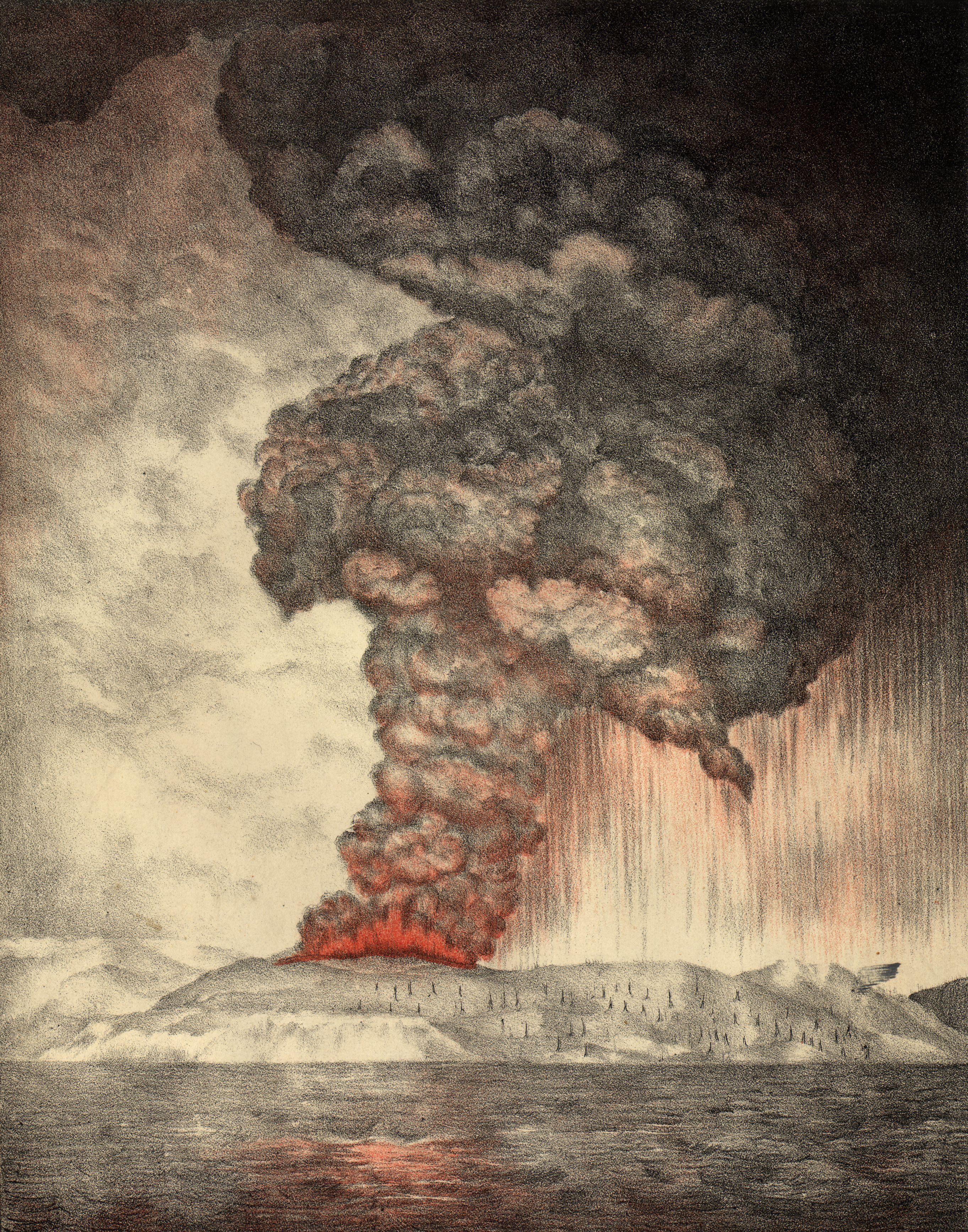
Between 19 May and 21 October 1883 the volcanic island of Krakatoa, then part of the Dutch East Indies and now in Indonesia, erupted for more than five months. The most notable eruptions culminated in a series of massive explosions over 26–27 August 1883, among the most violent volcanic events in recorded history. In 2004 an astronomer suggested that the blood-red sky of Edvard Munch's 1893 painting The Scream depicts the sky over Norway after the eruption.
David Keys, Ken Wohletz and others have postulated that a violent volcanic eruption, possibly of Krakatoa, in 535 was responsible for the global climate changes of 535–536. An older account describes the sea rising and inundating the land east of the mountain Batuwara as far as Rajabasa, the most southerly volcano in Sumatra, with the inhabitants of the northern part of the Sunda country drowned and swept away with all their property.
Ujung Kulon National Park, at the westernmost tip of Java in Sumur District of Pandeglang Regency, part of Banten province, once included the volcanic island group of Krakatoa in Lampung province, although current maps have suggested the group as its own protected area, the Pulau Anak Krakatau Marine Nature Reserve.
1. Name and Etymology
The name Krakatoa belongs to an island whose identity has been recorded under more than one spelling. The Smithsonian Institution's Global Volcanism Program cites the Indonesian name Krakatau as the correct name but says that Krakatoa is often employed.
The island also carried a distinct label in early European cartography. A 1611 map by Lucas Janszoon Waghenaer marked the island as Pulo Carcata.
The name is also tied to the geography of the group. The island of Rakata is the only remnant of an island also called Krakatoa, mostly destroyed by an eruption in 1883 which created the caldera. Two neighbouring islands of the group are known as Lang and Verlaten.
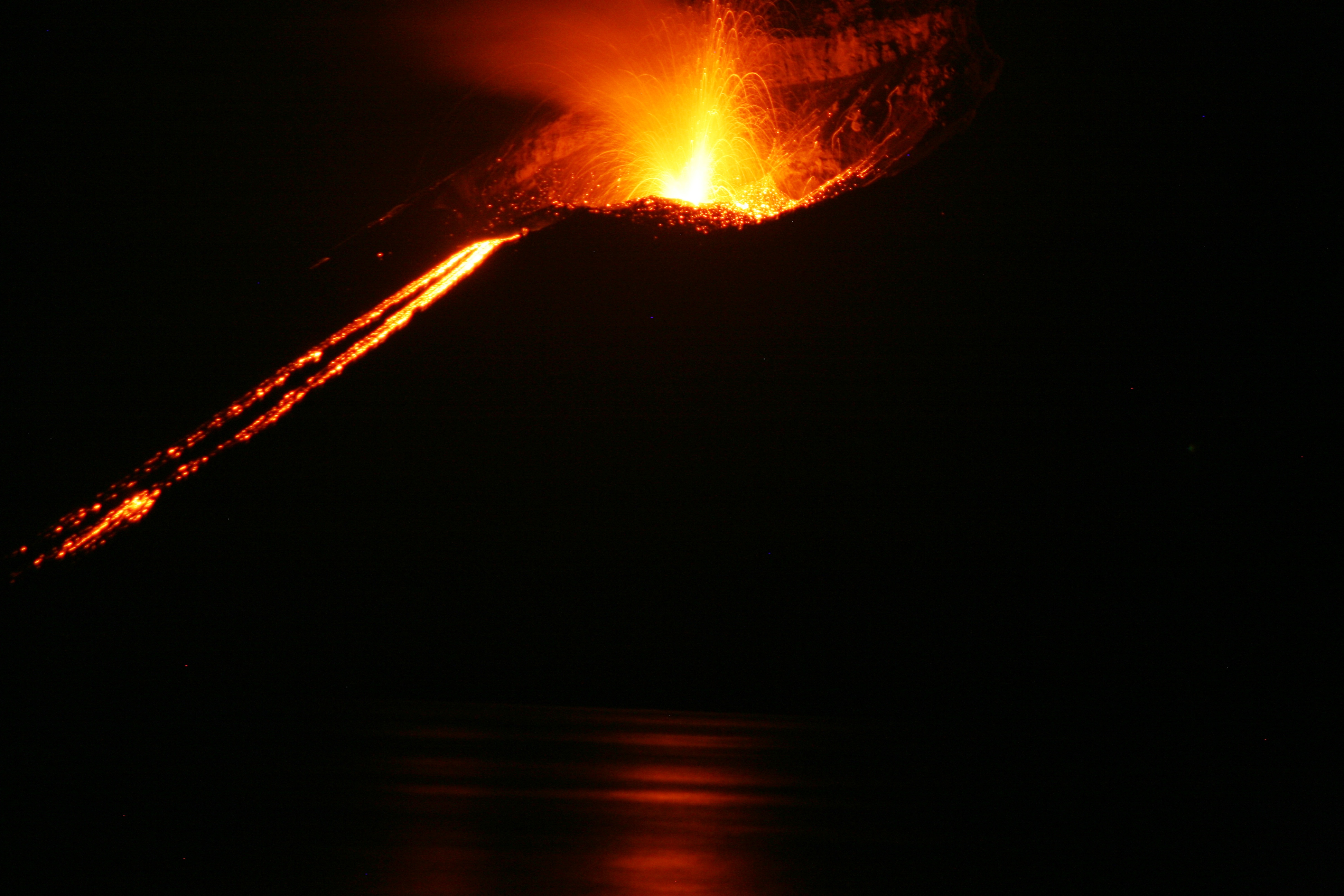
The naming of the site extends to the volcano that rose after the catastrophe. Eruptions in the area since 1927 have built a new island at the same location, named Anak Krakatau, which is Indonesian for "Child of Krakatoa".
The earliest recorded use of the name belongs to Old Sundanese literature. One of the earliest mentions of Krakatoa appears in the text Bujangga Manik, probably written in western Java in the late 15th century. European sources had described an island in the Sunda Strait with a "pointed mountain" before the name itself entered western records. In the Waghenaer label, pulo is the Sundanese word for "island".
The name attaches to a caldera, not simply to a single island. Krakatoa, also transcribed Krakatau, is a caldera in the Sunda Strait between the islands of Java and Sumatra in the Indonesian province of Lampung. That caldera belongs to a volcanic island group, the Krakatoa archipelago, comprising four islands. The archipelago is a small uninhabited group of volcanic islands formed by the Krakatoa stratovolcano, set in the Sunda Strait between the much larger islands of Java and Sumatra.
The island group has been repeatedly remade. As part of a dynamic volcanic system, the islands have been continuously reshaped throughout recorded history, most notably in the 1883 eruption of Krakatoa. At the time of that eruption the group comprised Lang, Verlaten, and Krakatoa itself, an island 9 km (5.6 mi) long by 5 km (3.1 mi) wide. Earlier, at least two more cones, Perboewatan and Danan, had formed and eventually joined with Rakata to form the main island of Krakatoa.
2. Geography and Setting
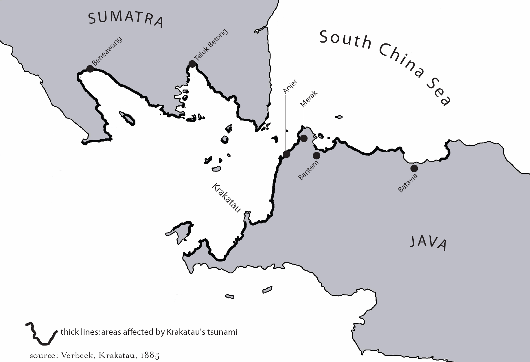
Krakatoa lies in the Sunda Strait, the waterway that separates Java from Sumatra. The strait occupies a bend in the axis of the island arc.
Administratively the archipelago lies entirely within Lampung, Indonesia. It forms part of Ujung Kulon National Park. Current maps suggest the island group as its own protected area, the Pulau Anak Krakatau Marine Nature Reserve.
Krakatoa is a caldera in the Sunda Strait between the islands of Java and Sumatra, within the Indonesian province of Lampung. The caldera belongs to a volcanic island group, the Krakatoa archipelago, comprising four islands. That archipelago is small and uninhabited, formed by the Krakatoa stratovolcano and set between the far larger islands of Java and Sumatra. As part of a dynamic volcanic system, the islands have been continuously reshaped throughout recorded history, most notably in the 1883 eruption.
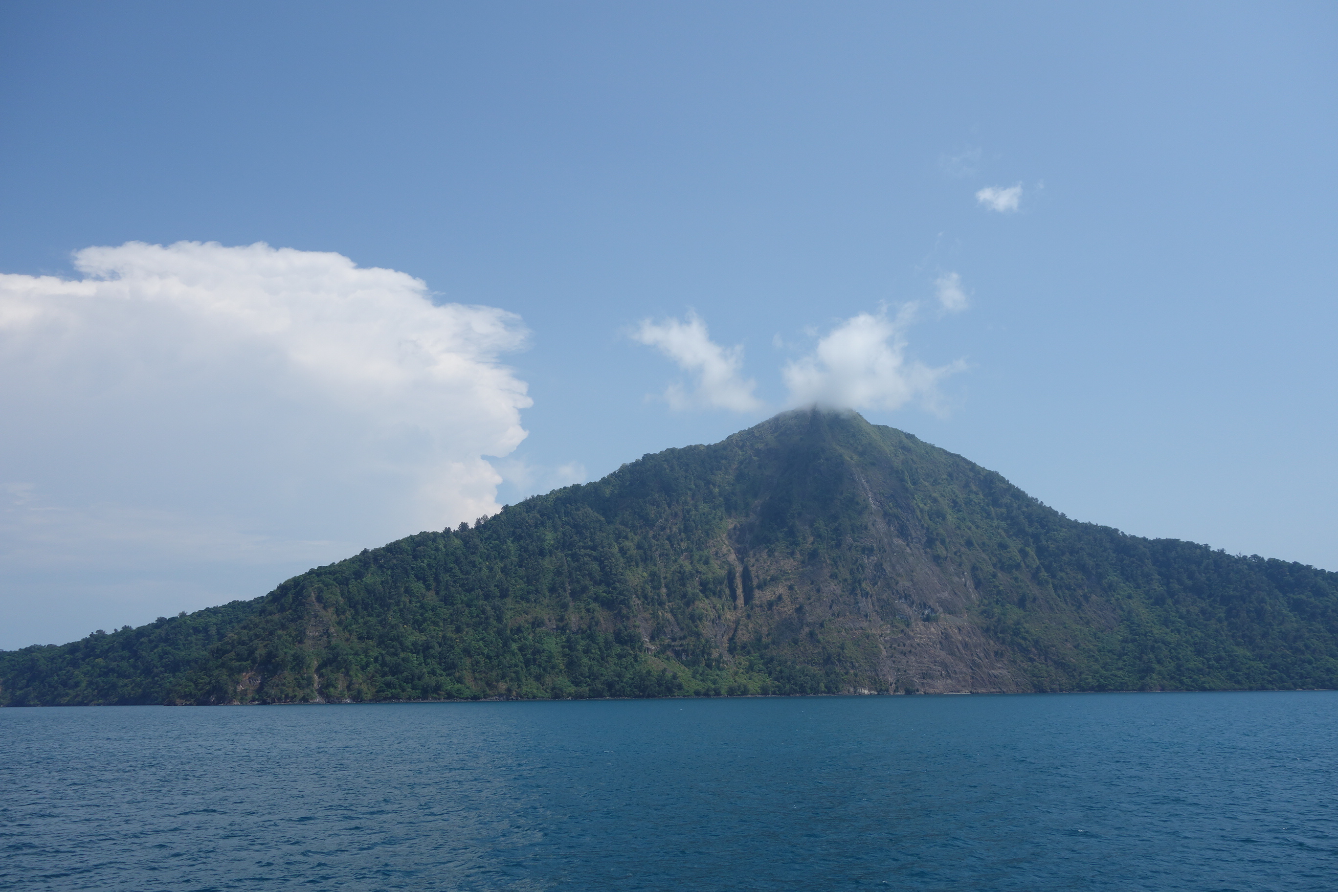
At the time of the 1883 eruption the group comprised Lang, Verlaten, and Krakatoa itself, an island 9 km (5.6 mi) long by 5 km (3.1 mi) wide. At least two further cones, Perboewatan and Danan, formed and eventually joined with Rakata to form the main island of Krakatoa. Verlaten Island sits within the Krakatoa Archipelago, above the volcano.
The name Krakatoa appears in the Old Sundanese text Bujangga Manik, probably written in western Java in the late 15th century. Earlier European sources described an island in the Sunda Strait with a pointed mountain, but the earliest mention of Krakatoa by name in the western world was on a 1611 map by Lucas Janszoon Waghenaer, who labelled the island Pulo Carcata. In February 1681 the Dutch mining engineer Johann Wilhelm Vogel, travelling from Salida in Sumatra toward Batavia, passed through the Sunda Strait. In his diary Vogel recorded that the island of Krakatoa, on his first trip to Sumatra in June 1679 completely green and healthy with trees, lay completely burnt and barren before his eyes and was throwing up large chunks of fire at four locations.
Between 19 May and 21 October 1883 the volcanic island of Krakatoa, then part of the Dutch East Indies and now in modern-day Indonesia, erupted for more than five months. The most notable eruptions culminated in a series of massive explosions over 26–27 August 1883, among the most violent volcanic events in recorded history. In 2004 an astronomer suggested that the blood-red sky in Edvard Munch's 1893 painting The Scream depicts the sky over Norway after the eruption.
A violent volcanic eruption, possibly of Krakatoa, in 535 has been postulated by David Keys, Ken Wohletz and others as responsible for the global climate changes of 535–536. An older Sundanese account describes the sea rising and inundating the land east of the mountain Batuwara as far as the mountain Rajabasa, the most southerly volcano in Sumatra, drowning the inhabitants of the northern part of the Sunda country and sweeping them away with all their property.
3. Islands and Cones
The archipelago comprises four islands: Lang and Verlaten, Rakata (the only remnant of an island also called Krakatoa, mostly destroyed by the 1883 eruption which created the caldera), and Anak Krakatoa.
At the time of the 1883 eruption the group comprised Lang, Verlaten and Krakatoa itself, an island 9 km (5.6 mi) long by 5 km (3.1 mi) wide. There were also the tree-covered islet near Lang (Poolsche Hoed) and several small rocky islets or banks between Krakatoa and Verlaten.
Three volcanic cones stood on Krakatoa Island: Rakata (820 m or 2,690 ft) to the south, Danan (450 m or 1,480 ft) near the center, and Perboewatan (120 m or 390 ft) to the north. Later at least two more cones (Perboewatan and Danan) formed and eventually joined with Rakata, forming the main island.
Verlaten suffered little damage in the 1883 eruption other than some minor collapse in the southeast closest to the main island.
Krakatoa is a caldera in the Sunda Strait, which lies between the islands of Java and Sumatra in the Indonesian province of Lampung. The caldera belongs to a volcanic island group known as the Krakatoa archipelago, a small uninhabited cluster of volcanic islands built by the Krakatoa stratovolcano and set between the far larger islands of Java and Sumatra. Java and Sumatra are themselves separated by the Sunda Strait, which sits at a bend in the axis of the island arc.
Because the group forms part of a dynamic volcanic system, its islands have been continuously reshaped throughout recorded history, most conspicuously in the 1883 eruption of Krakatoa.
4. Geology
Krakatoa is an active stratovolcano located in Indonesia, lying on the far western rim of the Pacific Ring of Fire. As part of a dynamic volcanic system the islands have been continuously reshaped throughout recorded history, most notably in the 1883 eruption of Krakatoa. The volcano is a notably powerful one, and the 1883 eruption stands as one of the deadliest and most destructive volcanic events in all of recorded history.
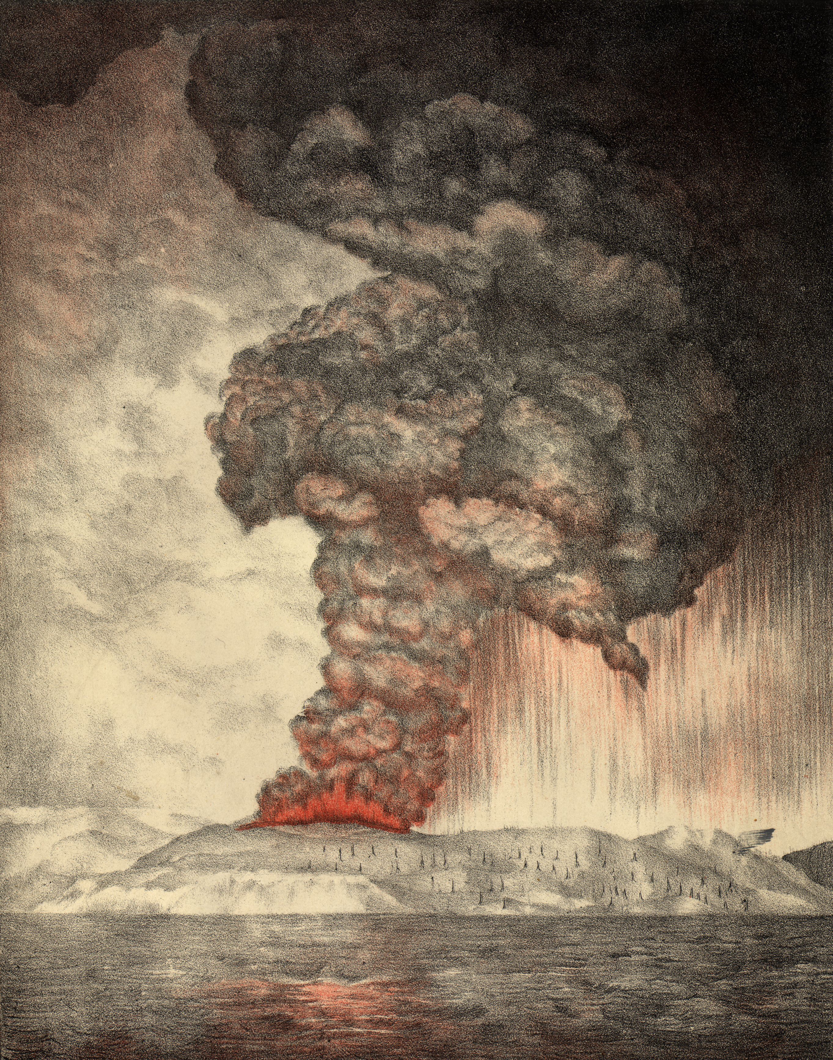
Krakatoa is a caldera in the Sunda Strait, set between the islands of Java and Sumatra within the Indonesian province of Lampung. The caldera belongs to a volcanic island group, the Krakatoa archipelago, which comprises four islands. That archipelago is small and uninhabited, formed by the Krakatoa stratovolcano and lying in the Sunda Strait between the far larger islands of Java and Sumatra.
The island group took its 1883 form from a set of cones. At least two further cones, Perboewatan and Danan, formed and in time joined with Rakata to make up the main island of Krakatoa. At the time of the 1883 eruption the group comprised Lang, Verlaten and Krakatoa itself, the last an island 9 km (5.6 mi) long by 5 km (3.1 mi) wide. Verlaten Island lies within the Krakatoa Archipelago, above the volcano.
Indonesia as a whole holds over 130 active volcanoes, more than any other nation. The most notable eruptions of Krakatoa culminated in a series of massive explosions over 26–27 August 1883, among the most violent volcanic events in recorded history. The volcanic island began erupting between 19 May and 21 October 1883 in the Sunda Strait, then part of the Dutch East Indies and now modern-day Indonesia, and the eruption lasted more than five months.
Early written traces of the name are Sundanese and European. One of the earliest mentions of Krakatoa appears in the Old Sundanese text Bujangga Manik, probably written in western Java in the late 15th century. The earliest mention of Krakatoa by name in the western world was on a 1611 map by Lucas Janszoon Waghenaer, who labelled the island "Pulo Carcata". In February 1681 the Dutch mining engineer Johann Wilhelm Vogel, stationed at Salida in Sumatra near Padang, passed through the Sunda Strait on his way to Batavia. In his diary Vogel recorded that the island of Krakatoa, completely green and healthy with trees on his first trip to Sumatra in June 1679, lay completely burnt and barren before his eyes and was throwing up large chunks of fire at four locations.
The eruption's reach extended into the arts. In 2004 an astronomer suggested that the blood-red sky in Edvard Munch's 1893 painting The Scream depicts the sky over Norway after the eruption. Krakatoa has also featured on the 100-rupiah banknote. The volcanic island group once fell within Ujung Kulon National Park, a national park at the westernmost tip of Java in Sumur District of Pandeglang Regency, part of Banten province; current maps have suggested the Krakatoa island group as its own protected area, the Pulau Anak Krakatau Marine Nature Reserve.
5. Historical Significance: The 1883 Eruption
Between 19 May and 21 October 1883 the volcanic island of Krakatoa, in the Sunda Strait, then part of the Dutch East Indies (modern-day Indonesia), began erupting, lasting more than five months.
The most notable eruptions of Krakatoa culminated in a series of massive explosions over 26–27 August 1883, which were among the most violent volcanic events in recorded history. The 1883 eruption was one of the deadliest and most destructive volcanic events in all of recorded history.
According to official records of the Dutch East Indies colony, 165 villages and towns were destroyed near Krakatoa and 132 were seriously damaged.
Following the eruption and the ensuing tsunami, reported to be 15 meters high, many of the peninsula's settlements were destroyed and never completely rebuilt.
At the time of the 1883 eruption the Krakatoa group comprised Lang, Verlaten, and Krakatoa itself, an island 9 km (5.6 mi) long by 5 km (3.1 mi) wide. Two of the group are known as Lang and Verlaten; another, Rakata, is the only remnant of an island, also called Krakatoa, mostly destroyed by an eruption in 1883 which created the caldera. As part of a dynamic volcanic system, the islands have been continuously reshaped throughout recorded history, most notably in the 1883 eruption of Krakatoa. Other than some minor collapse in the southeast, closest to the main island of Krakatoa, Verlaten suffered little damage in the 1883 eruption.
In 1927 a fourth island, Anak Krakatoa, or "Child of Krakatoa", emerged from the caldera formed in 1883. Eruptions in the area since 1927 have built a new island at the same location, named Anak Krakatau (which is Indonesian for "Child of Krakatoa").
In 2004 an astronomer suggested that the blood-red sky shown in Edvard Munch's famous 1893 painting The Scream depicts the sky over Norway after the eruption.
David Keys, Ken Wohletz, and others have postulated that a violent volcanic eruption, possibly of Krakatoa, in 535 was responsible for the global climate changes of 535–536. Drilling projects in Sunda Strait ruled out any possibility that an eruption took place in 535 AD.
6. Later Activity and Anak Krakatoa
Eruptions in the area since 1927 have built a new island at the same location, named Anak Krakatau (which is Indonesian for "Child of Krakatoa").
There has been new eruptive activity since the late 20th century. A large collapse caused the 2018 Sunda Strait tsunami.
In 1927 a fourth island, Anak Krakatoa, or "Child of Krakatoa", emerged from the caldera formed in 1883. The caldera itself is part of a volcanic island group, the Krakatoa archipelago, comprising four islands. Two of these are known as Lang and Verlaten; another, Rakata, is the only remnant of an island, also called Krakatoa, mostly destroyed by an eruption in 1883 which created the caldera. The archipelago is a small uninhabited group of volcanic islands formed by the Krakatoa stratovolcano, set in the Sunda Strait between the much larger islands of Java and Sumatra. As part of a dynamic volcanic system, the islands have been continuously reshaped throughout recorded history, most notably in the 1883 eruption of Krakatoa.
Before that eruption the Krakatoa group comprised Lang, Verlaten, and Krakatoa itself, an island 9 km (5.6 mi) long by 5 km (3.1 mi) wide. Krakatoa Island carried three volcanic cones: Rakata, at 820 m (2,690 ft) to the south; Danan, at 450 m (1,480 ft) near the center; and Perboe. At least two more cones, Perboewatan and Danan, formed later and eventually joined with Rakata, forming the main island of Krakatoa. There were also the tree-covered islet near Lang (Poolsche Hoed) and several small rocky islets or banks between Krakatoa and Verlaten.
The most notable eruptions of Krakatoa culminated in a series of massive explosions over 26–27 August 1883, which were among the most violent volcanic events in recorded history. Between 19 May and 21 October 1883 the volcanic island of Krakatoa, located in the Sunda Strait, then part of the Dutch East Indies—modern-day Indonesia—began erupting, lasting more than five months. In 2004 an astronomer suggested that the blood-red sky shown in Edvard Munch's famous 1893 painting The Scream depicts the sky over Norway after the eruption.
Administratively, the Krakatoa archipelago lies entirely within Lampung, Indonesia, and forms a part of Ujung Kulon National Park. It once included the volcanic island group of Krakatoa in Lampung province, although current maps have suggested the Krakatoa island group as its own protected area, the Pulau Anak Krakatau Marine Nature Reserve.
David Keys, Ken Wohletz, and others have postulated that a violent volcanic eruption, possibly of Krakatoa, in 535 was responsible for the global climate changes of 535–536.
7. Early Observations and the 535 Hypothesis
In February 1681 Johann Wilhelm Vogel, a Dutch mining engineer at Salida, Sumatra (near Padang), passed through the Sunda Strait on his way to Batavia (now Jakarta). In his diary he wrote that the island of Krakatoa, which on his first trip to Sumatra in June 1679 had been completely green and healthy with trees, now lay completely burnt and barren before their eyes and was throwing up large chunks of fire at four locations.
David Keys, Ken Wohletz and others postulated that a violent volcanic eruption, possibly of Krakatoa, in 535 was responsible for the global climate changes of 535–536.
The 535 hypothesis has not gone unchallenged. Drilling projects in the Sunda Strait ruled out any possibility that an eruption took place in 535 AD.
Krakatoa is a caldera in the Sunda Strait between the islands of Java and Sumatra in the Indonesian province of Lampung. The caldera belongs to a volcanic island group, the Krakatoa archipelago, comprising four islands. At least two more cones, Perboewatan and Danan, formed and eventually joined with Rakata to form the main island of Krakatoa. At the time of the 1883 eruption the Krakatoa group comprised Lang, Verlaten, and Krakatoa itself, an island 9 km (5.6 mi) long by 5 km (3.1 mi) wide.
Between 19 May and 21 October 1883 the volcanic island of Krakatoa, then part of the Dutch East Indies and now in modern-day Indonesia, began erupting, lasting more than five months. As part of a dynamic volcanic system, the islands have been continuously reshaped throughout recorded history, most notably in that eruption. In 2004 an astronomer suggested that the blood-red sky shown in Edvard Munch's famous 1893 painting The Scream depicts the sky over Norway after the eruption.
8. Cultural Depictions
In 2004 an astronomer suggested that the blood-red sky shown in Edvard Munch's famous 1893 painting The Scream depicts the sky over Norway after the eruption. Krakatoa featured in a 100-rupiah banknote.
Krakatoa is a caldera in the Sunda Strait, lying between Java and Sumatra in the Indonesian province of Lampung. The caldera belongs to a volcanic island group, the Krakatoa archipelago, made up of four islands. At least two further cones, Perboewatan and Danan, formed and in time joined with Rakata to create the main island. At the time of the 1883 eruption the group comprised Lang, Verlaten and Krakatoa itself, the last an island 9 km (5.6 mi) long by 5 km (3.1 mi) wide. As part of a dynamic volcanic system the islands have been reshaped continuously throughout recorded history, most notably in that eruption.
The name Krakatoa appears among the earliest in the Old Sundanese text Bujangga Manik, probably written in western Java in the late 15th century. European sources describe an island in the strait with a pointed mountain before the name itself was recorded in the west, the earliest such naming being Lucas Janszoon Waghenaer's 1611 map, which labelled the island Pulo Carcata. In February 1681 the Dutch mining engineer Johann Wilhelm Vogel, stationed at Salida in Sumatra near Padang, passed through the Sunda Strait on his way to Batavia. His diary records that the island he had seen green and healthy with trees on a first trip to Sumatra in June 1679 now lay completely burnt and barren, throwing up large chunks of fire at four locations.
Between 19 May and 21 October 1883 the volcanic island began erupting, an episode lasting more than five months. Its most notable eruptions culminated in a series of massive explosions over 26–27 August 1883, among the most violent volcanic events in recorded history. A much older eruption has been proposed as a driver of global climate change: David Keys, Ken Wohletz and others postulated that a violent volcanic eruption, possibly of Krakatoa, in 535 was responsible for the climate changes of 535–536. A Sundanese account likewise describes the sea rising and inundating the land east of the mountain Batuwara as far as the mountain Rajabasa, drowning the inhabitants of the northern part of the Sunda country and sweeping them away with all their property.
Indonesia has over 130 active volcanoes, more than any other nation. Ujung Kulon National Park occupies the westernmost tip of Java, in Sumur District of Pandeglang Regency within Banten province. It once included the volcanic island group of Krakatoa in Lampung province, though current maps suggest the group as its own protected area, the Pulau Anak Krakatau Marine Nature Reserve. The archipelago itself is a small uninhabited group of volcanic islands formed by the Krakatoa stratovolcano. Verlaten Island is part of the Krakatoa Archipelago, above the famous Krakatoa volcano.
9. Key dates
- 1611Although there are earlier descriptions in European sources of an island in th…Although there are earlier descriptions in European sources of an island in the Sunda Strait with a "pointed mountain", the earliest mention of Krakatoa by name in the western world was on a 1611 map by Lucas Janszoon Waghenaer , who labelled the island "Pulo Carcata" ( pulo is t
- 1679In his diary he wrote: ...I saw with amazement that the island of Krakatoa, on…In his diary he wrote: ...I saw with amazement that the island of Krakatoa, on my first trip to Sumatra [June 1679] completely green and healthy with trees, lay completely burnt and barren in front of our eyes and that at four locations was throwing up large chunks of fire.
- 1681In February 1681, Johann Wilhelm Vogel , a Dutch mining engineer at Salida, Su…In February 1681, Johann Wilhelm Vogel , a Dutch mining engineer at Salida, Sumatra (near Padang ), on his way to Batavia (now Jakarta ) passed through the Sunda Strait.
- 1883Historical significance Further information: 1883 eruption of Krakatoa In 2004…Historical significance Further information: 1883 eruption of Krakatoa In 2004, an astronomer suggested that the blood-red sky shown in Edvard Munch 's famous 1893 painting The Scream depicts the sky over Norway after the eruption.
- 1927Eruptions in the area since 1927 have built a new island at the same location…Eruptions in the area since 1927 have built a new island at the same location, named Anak Krakatau (which is Indonesian for "Child of Krakatoa").
- 1949Following the transfer of sovereignty in December 1949, Sulawesi became part o…Following the transfer of sovereignty in December 1949, Sulawesi became part of the federal United States of Indonesia, which in 1950 became absorbed into the unitary Republic of Indonesia.
- 2018There has been new eruptive activity since the late 20th century, with a large…There has been new eruptive activity since the late 20th century, with a large collapse causing the 2018 Sunda Strait tsunami.
10. Frequently asked questions
What did the Dutch colonial records count after the 1883 disaster?
According to the official records of the Dutch East Indies colony, 165 villages and towns were destroyed near Krakatoa, and 132 were seriously damaged 8Krakatoa · Wikipedia ↗.
Did anyone ever test the idea that Krakatoa erupted in 535?
Drilling projects in the Sunda Strait ruled out any possibility that an eruption took place in 535 AD 9Krakatoa · Wikipedia ↗.
What did the islands of the group look like on maps made before 1883?
Furneaux points out that in pre-1883 maps, Krakatoa does somewhat resemble an ant seen from above, with Lang and Verlaten lying to the sides like wings 5Krakatoa · Wikipedia ↗.
How did the eruption affect the neighbouring island of Verlaten?
Other than some minor collapse in the southeast, closest to the main island of Krakatoa, Verlaten suffered little damage in the 1883 eruption 11Verlaten Island · Wikipedia ↗.
Was Vogel's account of a burning Krakatoa corroborated by other travellers?
Neither Vogel nor Hesse mention Krakatoa in any real detail in their other passages, and no other travellers at the time mention an eruption or evidence of one 6Krakatoa · Wikipedia ↗.
References (13)
- 1Krakatoa — Wikipedia WebView source
- 2Poolsche Hoed — Wikipedia WebView source
- 3Krakatoa — Wikipedia WebView source
- 4Krakatoa — Wikipedia WebView source
- 5Krakatoa — Wikipedia Web↩View source
- 6Krakatoa — Wikipedia 1680 Web↩View source
- 71883 eruption of Krakatoa — Wikipedia 1883 WebView source
- 8Krakatoa — Wikipedia Web↩View source
- 9Krakatoa — Wikipedia Web↩View source
- 10Ujung Kulon National Park — Wikipedia WebView source
- 11Verlaten Island — Wikipedia Web↩View source
- 12Krakatoa — Wikipedia WebView source
- 13Sulawesi — Wikipedia WebView source