Volcano
The geology of volcanoes: magma and plate settings, eruption types and hazards, famous eruptions from Vesuvius to Pinatubo, and the science of volcano monitoring.
A volcano is a vent in Earth's crust from which molten rock, rock fragments and hot gases erupt, often building cone-shaped mountains and calderas. Most volcanoes form at the margins of tectonic plates, where magma rises at subduction zones and rift zones, while Hawaiian-style volcanism stems from hot spots in plate interiors. Eruptions range from quiet outpourings of fluid lava to catastrophic explosive blasts, and systematic monitoring of earthquakes, ground deformation, volcanic gas and satellite data now warns the millions of people who live near Vesuvius, Pinatubo, Mount St. Helens and other dangerous volcanoes.
Overview
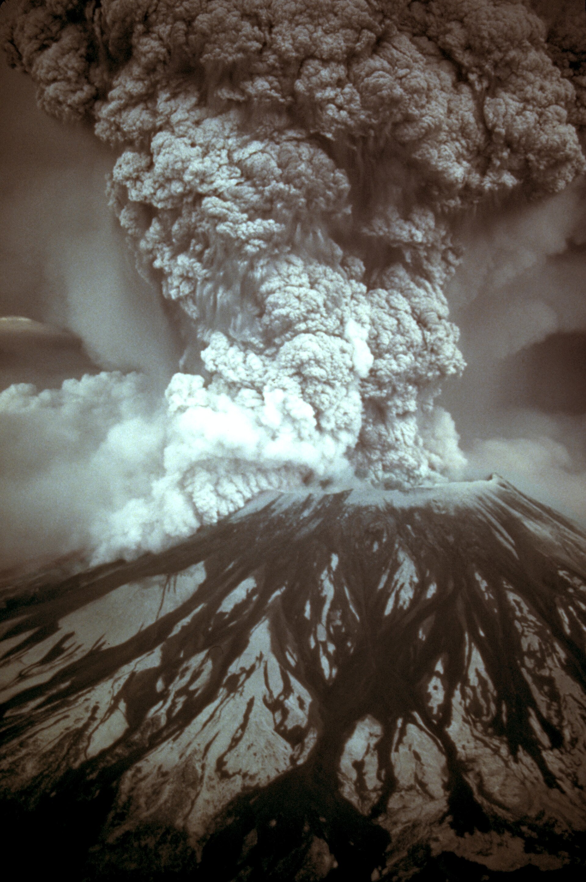
A volcano is a vent in the crust of Earth or another planet from which molten rock, rock fragments and hot gases erupt. The term applies equally to the vents themselves and to the cones and mountains built up around them. Eruptions issue gases, rock fragments and molten lava from within the Earth through such a vent.
1. How Volcanoes Work
Volcanic eruptions often begin with gas-rich magma accumulating in reservoirs near the surface and may be preceded by emissions of steam and gas and by swarms of small earthquakes. In some eruptions magma rises as thin, fluid lava that flows or fountains, while in others entrapped gases tear the magma apart and hurl viscous clots and ash-laden gas tens of thousands of metres into the air.
Explosive volcanic eruptions can inject gases all the way into the stratosphere, and the sulfur dioxide they emit combines with water to form tiny particles that can circle the globe.
A feared phenomenon accompanying some explosive eruptions is the nuee ardente, or pyroclastic flow, a fluidized mixture of hot gas and incandescent particles that sweeps down a volcano's flanks.
2. Types of Volcanoes
Volcanoes are grouped into eight types according to their size, shape, eruption style and magma composition, and among these the cinder cone, the composite volcano and the shield volcano are the three most common.
Cinder cones are small volcanoes of ash, cinders and other tephra piled around a vent, usually less than 1,000 feet tall. They are the most common type of volcano in the National Park System, with at least 24 units containing them.
Composite volcanoes are built by successive eruptions of domes, lava flows and pyroclastic flows, and they are capable of large blasts that destroy summit areas. Active composite volcanoes usually have a shallow magma chamber at depths of 3-6 miles (5-10 km). Their eruptive compositions range from basalt to rhyolite, with intermediate andesitic and dacitic magmas most common.
Shield volcanoes may stand 30 or more times taller than cinder cones and reach a volume 25,000 times that of a cinder cone. Mauna Loa is the largest active volcano on the planet; measured from its base on the sea floor, the mountain is almost 33,500 feet (10,211 m) tall.
Explosive calderas form during Volcanic Explosivity Index 6 to 8 eruptions, while summit calderas form during climactic eruptions of composite volcanoes and may exceed 10 miles in diameter.
3. Where Volcanoes Occur
Most volcanoes, such as those of Japan and Iceland, occur on the margins of the great rocky plates that make up Earth's surface, while others, such as the Hawaiian Islands, occur in the middle of a plate. Stratovolcanoes tend to form at subduction zones where an oceanic plate slides beneath a continental plate, while at rift zones shield volcanoes tend to form as plates pull apart and magma effuses upward through the gap.
About 16.5 million years ago an intense period of volcanism began near the borders of present-day Nevada, Oregon and Idaho, and subsequent volcanic eruptions can be traced across southern Idaho towards Yellowstone, where a 500-mile trail of more than 100 calderas was created as the North American plate moved southwesterly over a shallow body of magma.
4. Measuring and Classifying Eruptions
The magnitude and intensity of explosive eruptions is expressed in the Volcanic Explosivity Index, a scale that goes from 0 for effusive activity to 8 for apocalyptic super eruptions such as occurred at Yellowstone Caldera.
5. Notable Eruptions
The eruption of Mount Pinatubo in the Philippines on June 15 in 1991 was the second-largest volcanic eruption of the 20th century and by far the largest to affect a densely populated area. Timely forecasts by scientists from the Philippine Institute of Volcanology and Seismology and the U.S. Geological Survey enabled evacuations that saved at least 5,000 lives. In March and April 1991 molten rock rising from more than 20 miles beneath the volcano triggered small earthquakes and steam explosions that blasted three craters on the north flank. On June 15 the volcano ejected more than 1 cubic mile of material with the ash cloud rising 22 miles (35 kilometers) into the air, and the summit collapsed to form a caldera 1.6 miles across. Pyroclastic flows filled once-deep valleys with deposits as much as 660 feet thick.
Nearly 20 million tons of sulfur dioxide were injected into the stratosphere, and global temperatures dropped temporarily from 1991 through 1993 by about 1 °F.
Helens, located in Washington State, is the most active volcano in the Cascade Range and the most likely of the contiguous U.S. volcanoes to erupt in the future. Prior to 1980 it had the shape of a conical volcano sometimes called the Mount Fuji of America. The eruption removed the upper 400 m of the summit, leaving a horseshoe-shaped crater partially filled by a lava dome and a glacier.
At midday Vesuvius erupted: an explosion blew off the entire cone and a massive mushroom cloud of pumice rose 27 miles into the sky, an event calculated as 100,000 times more powerful than the bomb that devastated Hiroshima in 1945 during the final months of the Second World War.
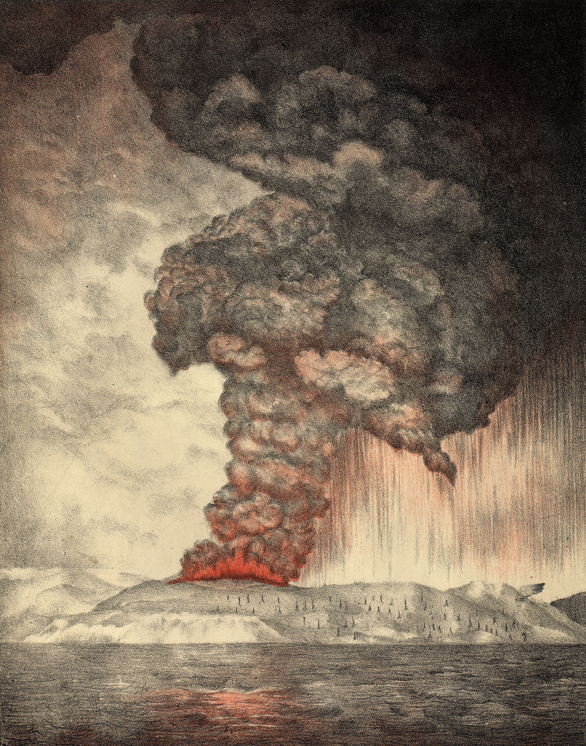
Krakatoa lies in the Sunda Strait between Java and Sumatra, along the convergence of the Indian-Australian and Eurasian tectonic plates. Its climactic explosion came on the morning of August 27 in 1883 and was heard 2,200 miles (3,500 km) away in Australia; the collapse of the volcano triggered tsunamis recorded as far away as South America and Hawaii, and the greatest wave reached 120 feet (37 metres) and took some 36,000 lives in coastal towns of Java and Sumatra. The discharge threw nearly 5 cubic miles (21 cubic km) of rock fragments into the air, and large quantities of ash fell over an area of some 300,000 square miles (800,000 square km).
Mount Tambora on the northern coast of Sumbawa island in Indonesia exploded in April 1815 in the largest volcanic eruption in recorded history. The eruption began on April 5 with small tremors and pyroclastic flows, and a shattering blast on the evening of April 10 blew the mountain apart, expelling as much as 150 cubic km of ash, pumice and aerosols. The blast, pyroclastic flows and tsunamis that followed killed at least 10,000 islanders and destroyed the homes of 35,000 more.
In 1912 the Novarupta-Katmai eruption in Alaska produced the largest eruption of the 20th century; the three-day eruption vented magma stored beneath Mount Katmai, which collapsed to form a 6-mi (10-km) diameter caldera.
With no immediate precursors, a magnitude 5.1 earthquake occurred at 8:32 a.m. on May 18 in 1980 and the volcano's northern bulge and summit slid away as a huge landslide, the largest debris avalanche on Earth in recorded history. The lateral blast of hot material overtook the debris avalanche and accelerated to at least 480 km per hr (300 mi per hr), devastating an area nearly 30 km (19 mi) from west to east. Beginning just after noon, swift pyroclastic flows poured out of the crater at 80 to 130 km per hr (50 to 80 mi per hr) and the Plinian phase continued for 9 hours.
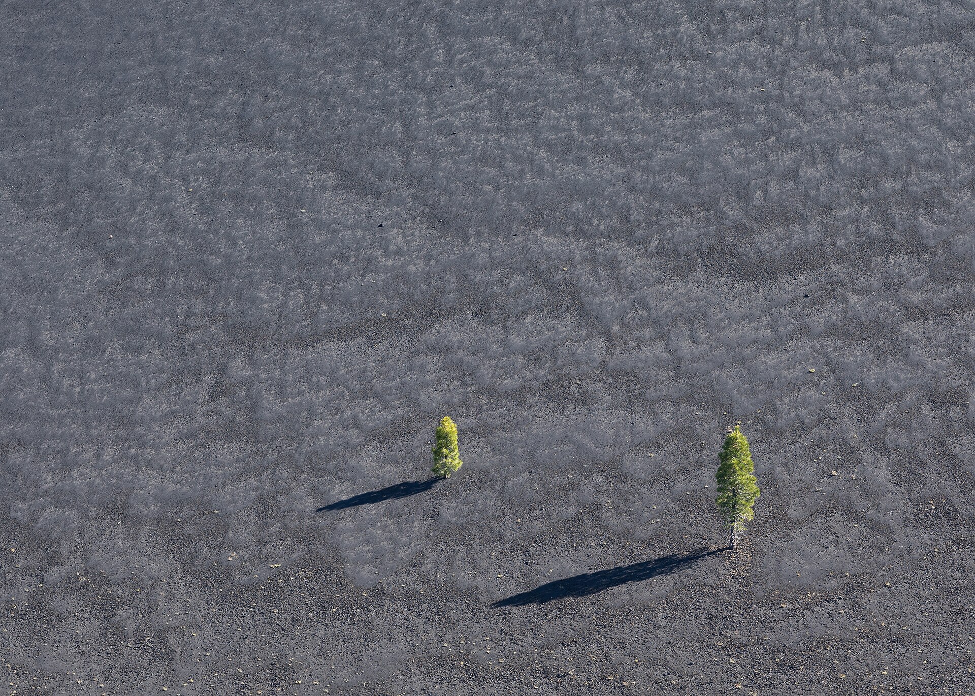
Lassen Peak in California experienced a series of eruptions from 1914 to 1917 that began with phreatic (steam) explosions.
Vesuvius had been dormant for centuries before the great eruption of 79 CE, which buried the cities of Pompeii, Oplontis and Stabiae under ashes and lapilli and the city of Herculaneum under a mudflow.
After centuries of quiescence, a series of earthquakes lasting six months and gradually increasing in violence preceded a major eruption that began on December 16 in 1631; many villages on the slopes were destroyed, about 3,000 people were killed and the skies were darkened for days.
Vesuvius erupted again in 1944 after a long period of dormancy, destroying buildings; the crater formed in this eruption remains at the summit of the cone.
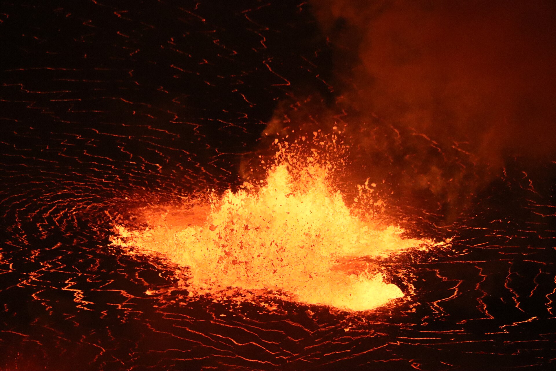
At Kilauea, the volcano erupted nearly continuously from 1983 to 2018 from the East Rift Zone; the Puʻuʻōʻō eruption was the longest documented eruption of the volcano.
A new period of activity built a lava dome inside the 1980 crater between 2004 and 2008.
6. Volcanoes and Climate
Sulfates from the enormous 1991 eruption of Mount Pinatubo cooled the atmosphere by 0. 5 C) and made 1992 and 1993 the coolest years in the past 35 years. Aerosols come in many forms: natural ones such as wildfire smoke, volcanic gases and salty sea spray, and human-made particles of air pollution and soot.
In 1816 parts of the world as far away as western Europe and eastern North America experienced heavy snow and killing frost through June, July and August, and the year became known as the year without a summer.
The January 15 2022 eruption of the Hunga Tonga-Hunga Ha'apai underwater volcano sent a volcanic plume into the middle atmosphere to altitudes of up to 57 km and injected about 150 Tg of water vapor; measurements showed that it led to the largest stratospheric aerosol perturbation in the last three decades.
Human contributions to the carbon cycle are more than 100 times those from all the volcanoes in the world combined. Human activities emit a Mount St. Helens-sized eruption of CO2 every 2.5 hours and a Mount Pinatubo-sized eruption of CO2 twice daily.
7. Hazards and Monitoring
Long-term hazards assessments identify locations at risk from volcanic hazards and are released as high-resolution hazards-zonation maps with explanations that help guide eruption preparedness plans.
Monitoring a volcano requires a variety of techniques that can hear and see activity inside a volcano, from earthquakes, ground movement, volcanic gas and rock and water chemistry to remote satellite analysis on a continuous or near-real-time basis. Before the 2004 eruption at Mount St. Helens monitoring equipment recorded a large increase in earthquake activity, and scientists examined gas, ground deformation and satellite imagery to assess whether magma or fluid was moving toward the surface.
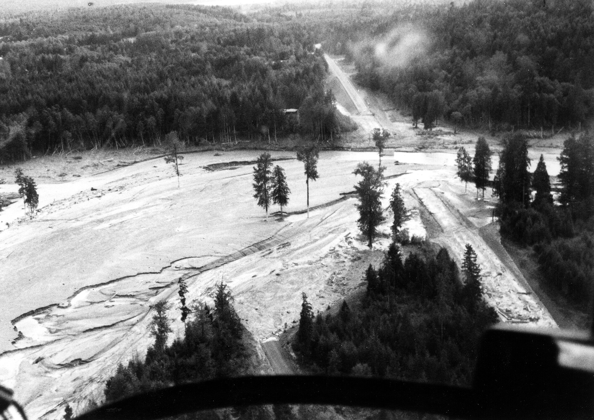
A volcano hazard assessment typically includes a summary of the specific hazards, their impact areas, and a map showing ground-hazard zones. These assessments are critical for planning long-term land-use and effective emergency-response measures, especially when a volcano begins to show signs of unrest.
The 2005 NVEWS assessment identified 57 priority volcanoes that were undermonitored for the threats they pose, making them targets for improved monitoring networks. The Yellowstone Volcano Observatory covers the Yellowstone Plateau volcanic field and its caldera; the Scientist-in-Charge also monitors volcanic activity in Montana, Wyoming, Colorado, Utah, New Mexico and Arizona.
Volcanic threat combines hazards — the destructive phenomena a volcano produces — with exposure, the people and property at risk, and the resulting scores rank U.S. volcanoes into five threat categories. On March 12 in 2019 Congress passed the John D. Dingell, Jr., Conservation, Management, and Recreation Act, which authorized the establishment of NVEWS within the U.S.
Volcanic earthquakes are caused by movement of magma and gases within and underneath a volcano, and volcanic tremor is a long-lasting release of seismic energy associated with magma in motion. Hydrothermal alteration takes place when hot volcanic gases mix with groundwater; it forms clay minerals and other minerals and weakens rocks, making altered areas of volcanoes more susceptible to erosion and mass wasting.
The United States has about 170 young volcanoes; roughly half are dangerous because of the way they erupt and the communities within their reach, and many have insufficient or obsolete monitoring systems.
8. Volcanoes in the United States
The United States contains roughly 160 potentially active volcanoes, distributed across a wide range of geologic settings.7Prehistoric and Historic Eruptions · National Park Service ↗
| Volcano or field | Location | Notable fact |
|---|---|---|
| Vesuvius | Italy | More than two million people live in the vicinity and on the lower slopes |
| Krakatoa | Sunda Strait, Indonesia | Climactic explosion on August 27, 1883 |
| Tambora | Sumbawa, Indonesia | Largest eruption in recorded history, April 1815 |
| Pinatubo | Philippines | Second-largest eruption of the 20th century, June 15, 1991 |
| Mount St. Helens | Washington State | Most active volcano in the Cascade Range |
| Novarupta/Katmai | Alaska | Largest eruption of the 20th century, 1912 |
| Mauna Loa | Hawaii | Largest active volcano on the planet |
| Kilauea | Hawaii | Erupted nearly continuously 1983-2018 |
| Yellowstone Caldera | Wyoming | Three super eruptions about 2.1 million, 1.3 million and 640,000 years ago |
| Hunga Tonga-Hunga Ha'apai | Tonga | Underwater eruption of January 15, 2022 |
9. Timeline: from Vesuvius in 79 CE to Hunga Tonga in 2022
- 24 August 79 CE (traditional date)Eruption of Vesuvius buries PompeiiVesuvius, dormant for centuries, buried Pompeii, Oplontis and Stabiae under ashes and lapilli and Herculaneum under a mudflow; Pliny the Younger described the catastrophe in two letters to Tacitus.
- 16 December 1631Major eruption of VesuviusAfter earthquakes lasting six months and gradually increasing in violence, Vesuvius erupted; many villages were destroyed, about 3,000 people were killed and the skies were darkened for days.
- April 1815Eruption of Mount TamboraThe largest volcanic eruption in recorded history began on April 5 and blew the mountain apart on April 10; at least 10,000 islanders were killed, and 1816 became the year without a summer in Europe and North America.
- 20 May — 27 August 1883Eruption of KrakatoaThe climax on August 27 was heard 2,200 miles (3,500 km) away and propelled ash to a height of 50 miles (80 km); tsunamis recorded as far away as South America and Hawaii took some 36,000 lives.
- 1912Novarupta-Katmai eruption, AlaskaNovarupta produced the largest eruption of the 20th century; the three-day eruption vented magma stored beneath Mount Katmai, which collapsed to form a 6-mi (10-km) diameter caldera.
- 1914–1917Eruptions of Lassen PeakLassen Peak experienced a series of eruptions that began with phreatic (steam) explosions.
- 1944Last eruption of VesuviusVesuvius erupted after a long period of dormancy, destroying buildings; the crater formed in this eruption remains at the summit of the cone.
- 18 May 1980Cataclysmic eruption of Mount St. HelensA magnitude 5.1 earthquake triggered the largest debris avalanche on Earth in recorded history, and the lateral blast accelerated to at least 480 km per hr (300 mi per hr).
- 15 June 1991Climactic eruption of Mount PinatuboThe second-largest eruption of the 20th century ejected more than 1 cubic mile (5 cubic kilometers) of material and the summit collapsed into a caldera 1.6 miles (2.5 kilometers) across; forecasts saved at least 5,000 lives.
- 2004–2008Dome-building eruption of Mount St. HelensA new period of activity built a lava dome inside the 1980 crater; before it began, monitoring equipment recorded a large increase in earthquake activity.
- 2005NVEWS conceivedThe USGS Volcano Hazards Program conceived the National Volcano Early Warning System, and the first assessment identified 57 priority volcanoes undermonitored for their threats.
- 1983–2018End of the Puʻuʻōʻō eruptionThe longest documented eruption of Kilauea, on the East Rift Zone, lasted from 1983 to 2018.
- 12 March 2019Dingell Act authorizes NVEWSCongress passed the John D. Dingell, Jr., Conservation, Management, and Recreation Act, authorizing the establishment of NVEWS within the U.S. Geological Survey.
- 15 January 2022Hunga Tonga-Hunga Ha'apai eruptionThe underwater eruption sent a volcanic plume to altitudes of up to 57 km and injected about 150 Tg of water vapor, producing the largest stratospheric aerosol perturbation in three decades.
References (22)
- 1Volcano — Encyclopaedia Britannica WebView source
- 2Anatomy of a Volcano — National Park Service WebView source
- 3Volcanic Processes — National Park Service WebView source
- 4Aerosols: Small Particles with Big Climate Effects — NASA Science WebView source
- 5Composite Volcanoes — National Park Service WebView source
- 6Shield Volcanoes — National Park Service WebView source
- 7Prehistoric and Historic Eruptions — National Park Service Web↩View source
- 8Volcano — Yellowstone National Park — National Park Service WebView source
- 9The Cataclysmic 1991 Eruption of Mount Pinatubo, Philippines (Fact Sheet 113-97) — U.S. Geological Survey 1991 WebView source
- 10Mount St. Helens — U.S. Geological Survey WebView source
- 11Pompeii — World History Encyclopedia WebView source
- 12Krakatoa — Encyclopaedia Britannica WebView source
- 13Mount Tambora — Encyclopaedia Britannica WebView source
- 141980 Cataclysmic Eruption — U.S. Geological Survey 1980 WebView source
- 15Vesuvius — Encyclopaedia Britannica WebView source
- 16Evolution of an Underwater Volcano (Aura mission feature) — NASA Science WebView source
- 17Graphic: Volcanoes and Climate Change — NASA Science WebView source
- 18Volcano Hazards Program — U.S. Geological Survey WebView source
- 19Comprehensive monitoring provides timely warnings of volcano reawakening — U.S. Geological Survey WebView source
- 20Volcano Hazard Assessments are based on the geologic record — U.S. Geological Survey WebView source
- 21National Volcano Early Warning System — monitoring volcanoes according to their threat — U.S. Geological Survey WebView source
- 22USGS operates five U.S. Volcano Observatories — U.S. Geological Survey WebView source
 Masada
 Palmyra