Tsunami
The story of tsunamis, the giant waves born on the ocean floor: how undersea earthquakes and volcanoes generate them, why they cross oceans at jet speed and rise into walls of water at the coast, the warning systems built after 2004, and the great tsunamis from Lisbon in 1755 to Sumatra in 2004 and Tohoku in 2011.
A tsunami is a series of long ocean waves generated when the sea floor is displaced suddenly, most often by a great subduction-zone earthquake, sometimes by a volcanic eruption or a landslide. In the deep ocean the waves are only centimetres high but travel at the speed of a jet aircraft across entire basins; as they enter shallow water they slow, shorten and rise, flooding coasts thousands of kilometres from their source. The 2004 Indian Ocean tsunami killed about 230,000 people around fourteen countries, and the 2011 Tohoku tsunami in Japan killed nearly 20,000 and overwhelmed a well-prepared warning system. The 1755 Lisbon tsunami helped start the scientific study of earthquakes. Today networks of seismographs, deep-ocean DART buoys and national warning centres aim to give coastal communities the minutes that save lives.
In this article
Overview
A tsunami is a series of enormous waves, sometimes over 30 metres high, created by a disturbance near or below the ocean surface. The waves arrive as a train rather than a single event, most often triggered by an earthquake or an undersea volcanic eruption. The name itself comes from Japanese, joining tsu, meaning harbour, with nami, meaning wave — a harbour wave.
1. Physical Characteristics
A tsunami travels as a wave train rather than a single crest, spreading outward in widening circles from its source. In the deep ocean the waves move at speeds of up to 800 km per hour, with wavelengths sometimes exceeding 500 km. Despite this energy, the deep-water height of the waves is only about 30 to 60 cm, and their periods range from five minutes to over an hour.
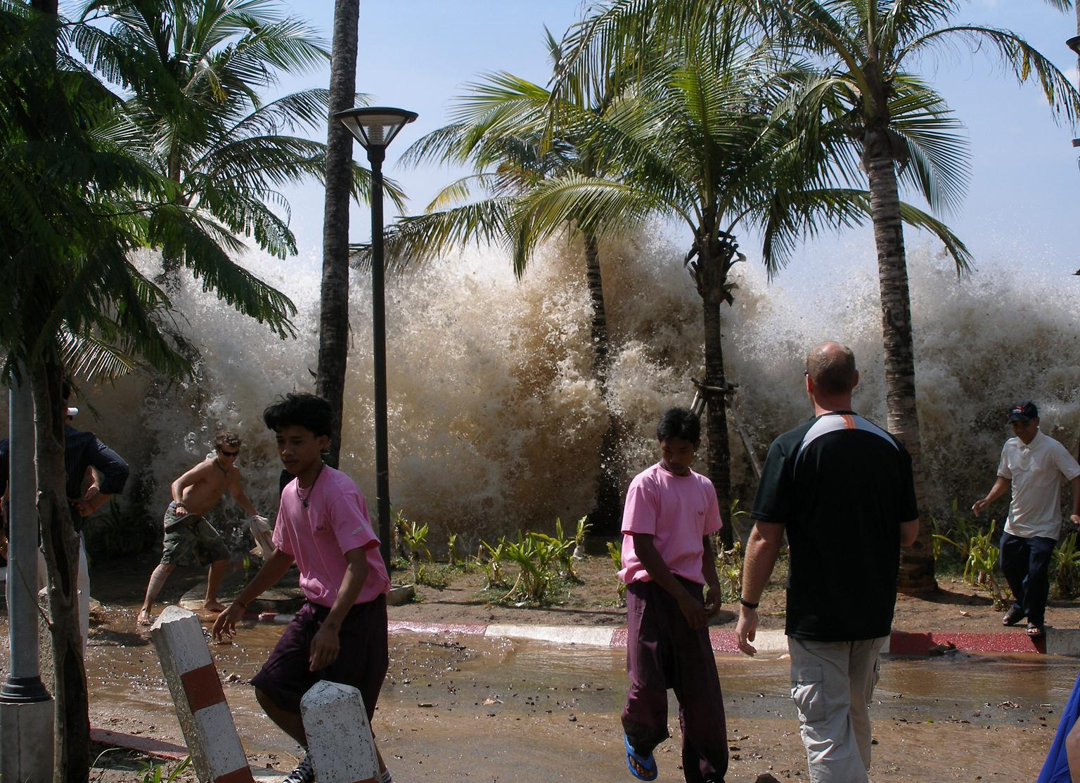
As the wave train reaches a continent, friction with the rising sea floor slows the waves, shortens their length and raises their height; coastal water can climb 30 metres in 10 to 15 minutes. The first wave is frequently not the largest, and the biggest may arrive hours later, with successive waves reaching the shore roughly every 5 to 60 minutes.
A tsunami rarely arrives as a giant breaking wall of water; it more often resembles a very rapidly rising tide or a fast-moving flood. Three to five major oscillations usually do most of the damage, and the outflow after a run-up can be at least as destructive as the run-up itself. Damage is greatest in bays and harbours and least in the deep open ocean.
2. Causes
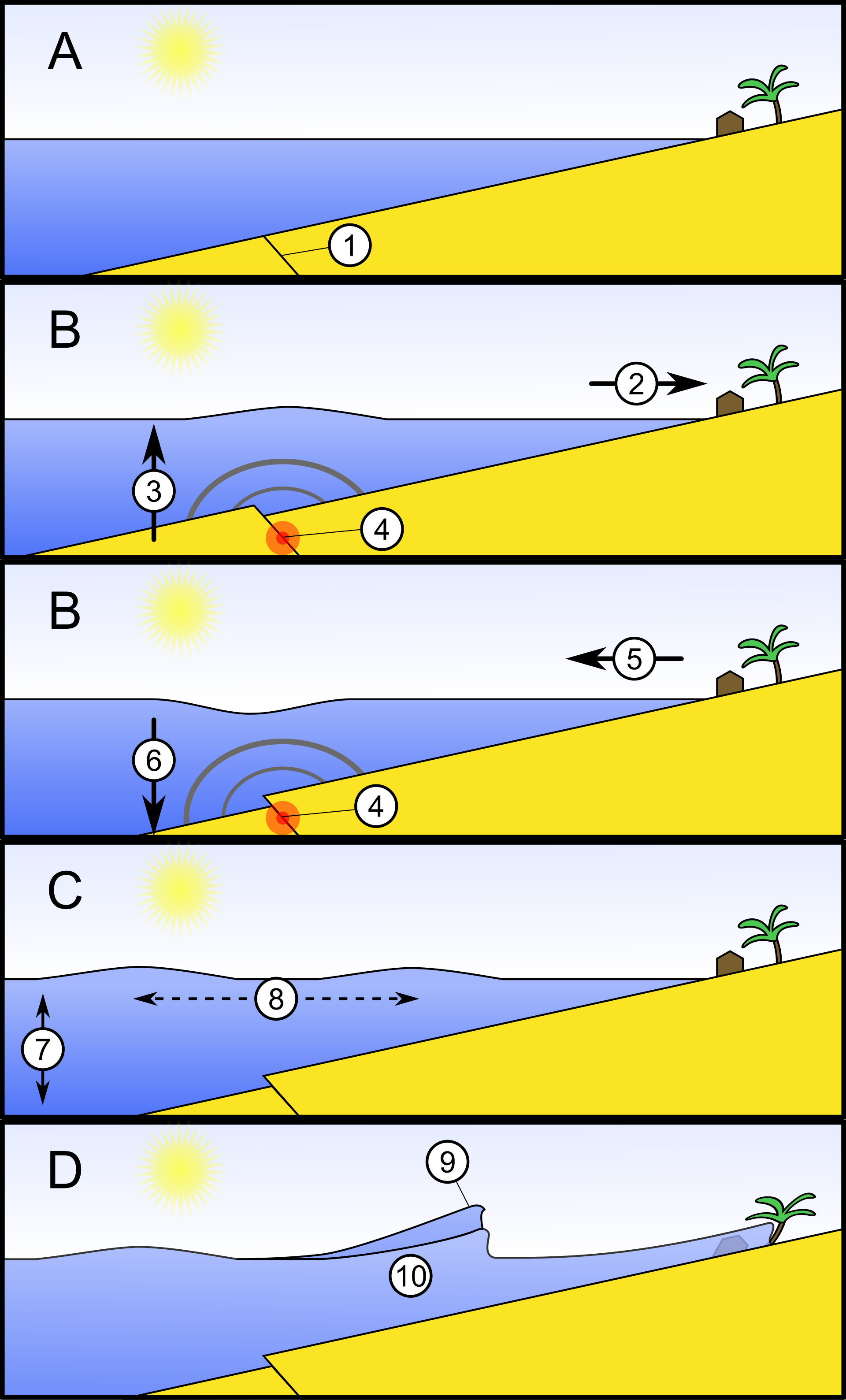
Most tsunamis are set in motion by earthquakes or by undersea volcanic eruptions. Earthquake-generated tsunamis account for nearly 90% of the historical record, and it is for this reason that warning systems concentrate their efforts on them.
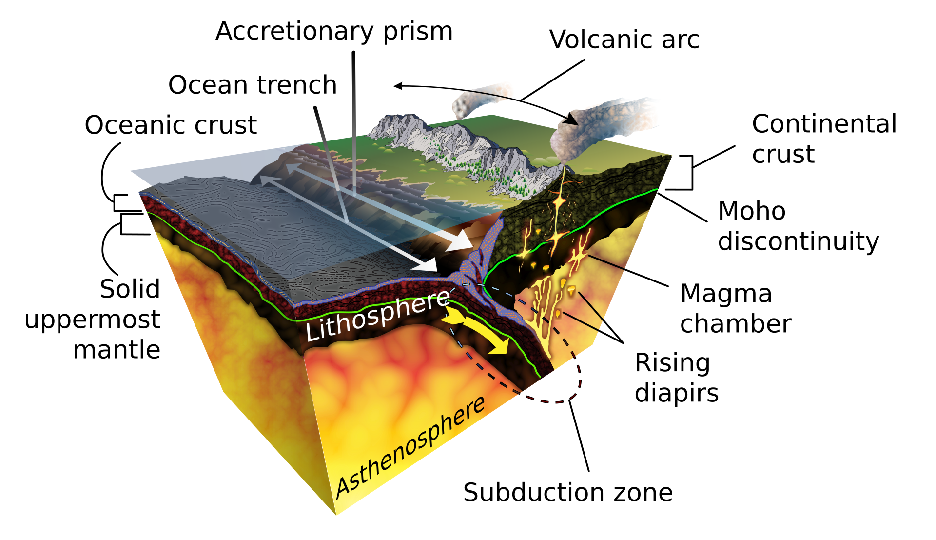
An earthquake produces a tsunami when it is strong and shallow, with vertical movement of the seafloor displacing the water above it. The conditions for such an event are a magnitude of at least 6.5 and a source less than 70 km down.
Other sources exist beyond the seismic. Coastal or underwater landslides can displace large amounts of water and generate a tsunami. Volcanic eruptions are a relatively infrequent tsunami source, acting either through the explosion itself or through a failure of the volcano's slope.
3. Local and Tele-tsunamis
A local tsunami begins close to the coast it strikes, so that the wave arrives with little time for warning. A tele-tsunami, by contrast, originates far across the ocean and, though less frequent, can affect an entire ocean basin.
Fatal tsunamis are overwhelmingly concentrated in the Pacific, and some part of that ocean suffers a locally damaging tsunami every one to two years on average. Local and regional events account for 99% of all tsunami casualties, a share that underscores how much of the danger lies close to shore rather than in the distant, basin-spanning waves.
4. Notable Events
The collapse of Krakatoa in 1883 sent waves up to 135 feet high through the Sunda Strait, killing 36,417 people in Java and Sumatra.
The Indian Ocean earthquake of 26 December 2004, of magnitude 9.3, generated a tsunami that acted as both a near-field and a far-field tsunami, reaching all 15 countries along the Indian Ocean coasts, with reported deaths including about 150,000 in Indonesia, 35,000 in Sri Lanka and 8,000 in Thailand. In the Banda Aceh region the wave reached a measured height of about 50 metres. Two hours after the earthquake waves up to nine metres high hit India and Sri Lanka, and within seven hours the tsunami washed ashore on the Horn of Africa more than 3,000 km away.
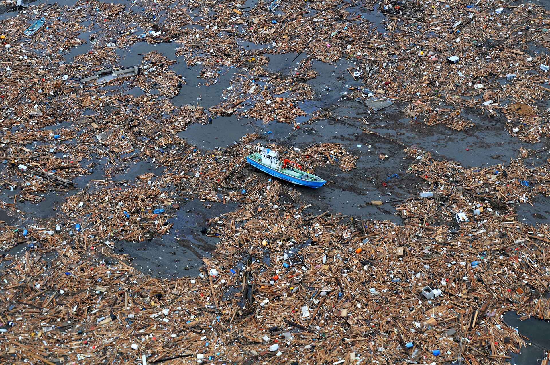
During the 2011 Tōhoku event a magnitude 9.1 earthquake struck off Honshu, and the tsunami arrived at the coast within 30 minutes, overtopping seawalls and leading to the disabling of three nuclear reactors within days. The earthquake and tsunami cost Japan an estimated $220 billion, making this the most expensive natural disaster in history, and left 15,901 dead with 2,519 missing and presumed dead as officially reported, while more than 123,000 houses were totally destroyed and nearly a million more damaged, with 98% of the damage attributed to the tsunami.
At Lisbon in 1755 the sea first drew back, exposing the bay floor, and many curious onlookers drowned when the crest returned only minutes later. The first wave in the Tagus estuary reached a runup of 12 metres and killed around a thousand more people, and the earthquake and tsunami together killed an estimated 60,000 in Lisbon alone. The Lisbon tsunami made waves about 20 metres high at Cádiz and crossed 6,100 km of ocean to Martinique in 10 hours. It reached Brest, flooded parts of the Scilly Islands, Cornwall and Cork, and spread via Madeira, the Canaries and the Azores as far as the West Indies.
The 1960 Chile tsunami followed a magnitude 9.5 earthquake, the largest ever measured, and was the first globally recorded tsunami, with waves seen throughout the Pacific and tide gauges logging them in the Atlantic and Indian Oceans. In Chile waves reached 25 metres and killed an estimated 2,000 people, while almost a day after the quake the tsunami hit Japan's Pacific coast, destroying almost 3,000 houses; in Hawaii it killed 61 people and injured 43 more.
On 1 April 1946 a magnitude 8.6 earthquake in the Aleutian Islands sent the deadliest tsunami in US history, killing 164 people, 158 of them in Hawaii, and that disaster led the United States to establish official tsunami warning capability in 1949. The magnitude 9.2 Prince William Sound earthquake of 27 March 1964 produced the most expensive US tsunami, with about $859 million in damage and some 124 deaths.
The 15 January 2022 eruption of Hunga Tonga-Hunga Ha'apai, rated 5 on the Volcanic Explosivity Index, produced a volcanic tsunami that killed four people in Tonga; a field survey found the maximum height on land was about 22 metres, measured on Tofua Island.
5. Historical and Prehistoric Records
On the Sanriku coast of Japan the village of Taro was hit hard by tsunamis in 1611 and by waves 15 metres high in 1896 and 10 metres high in 1933 — events that later shaped its sea walls.
Japanese records give the Cascadia earthquake an exact date of 26 January 1700 and an estimated magnitude between 8.7 and 9.2 on that scale.
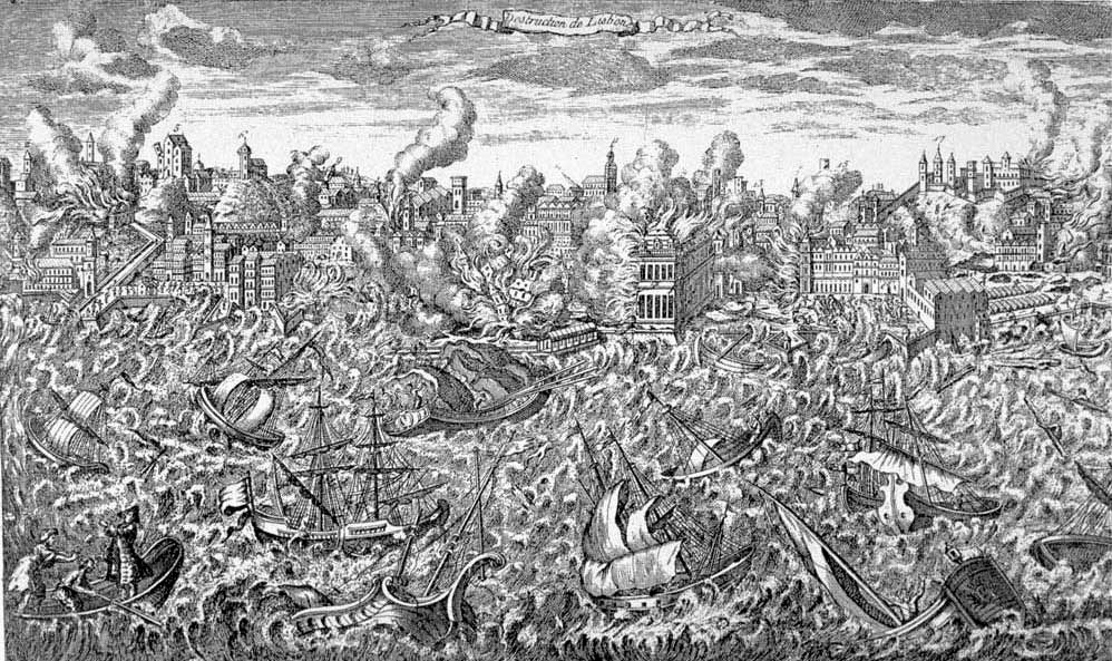
NCEI and the World Data Service for Geophysics maintain a Global Historical Tsunami Database covering events from 2000 B.C. to the present across the world's oceans and seas.
6. Detection and Warning Systems
The NOAA Tsunami Program operates as a partnership between federal and state agencies, spanning research, detection, forecasting, archiving, mitigation and international coordination. Its detection capability rests on coastal tide gauge stations together with thirty-nine deep-ocean stations kept in waters where earthquakes are likely to make tsunamis. Warning centres in Alaska and Hawaii watch the globe and issue guidance for every coastal region of the United States.
The DART array grew from an original six-buoy network completed in 2001 and expanded to a full network of 39 stations by March 2008. Each station pairs an anchored seafloor bottom pressure recorder with a moored surface buoy joined by an acoustic link for real-time reporting. A station runs in standard mode until its software detects an event, then switches to event mode sending 15-second readings followed by 1-minute averages. The two-way satellite link of DART II lets warning centres force stations into event mode or retrieve high-resolution data. The first-generation DART was triggered by a wave-height threshold, and DART II added on-demand two-way reporting for tsunamis below that threshold. PMEL's newest detection buoy is the DART ETD, an easy-to-deploy design.
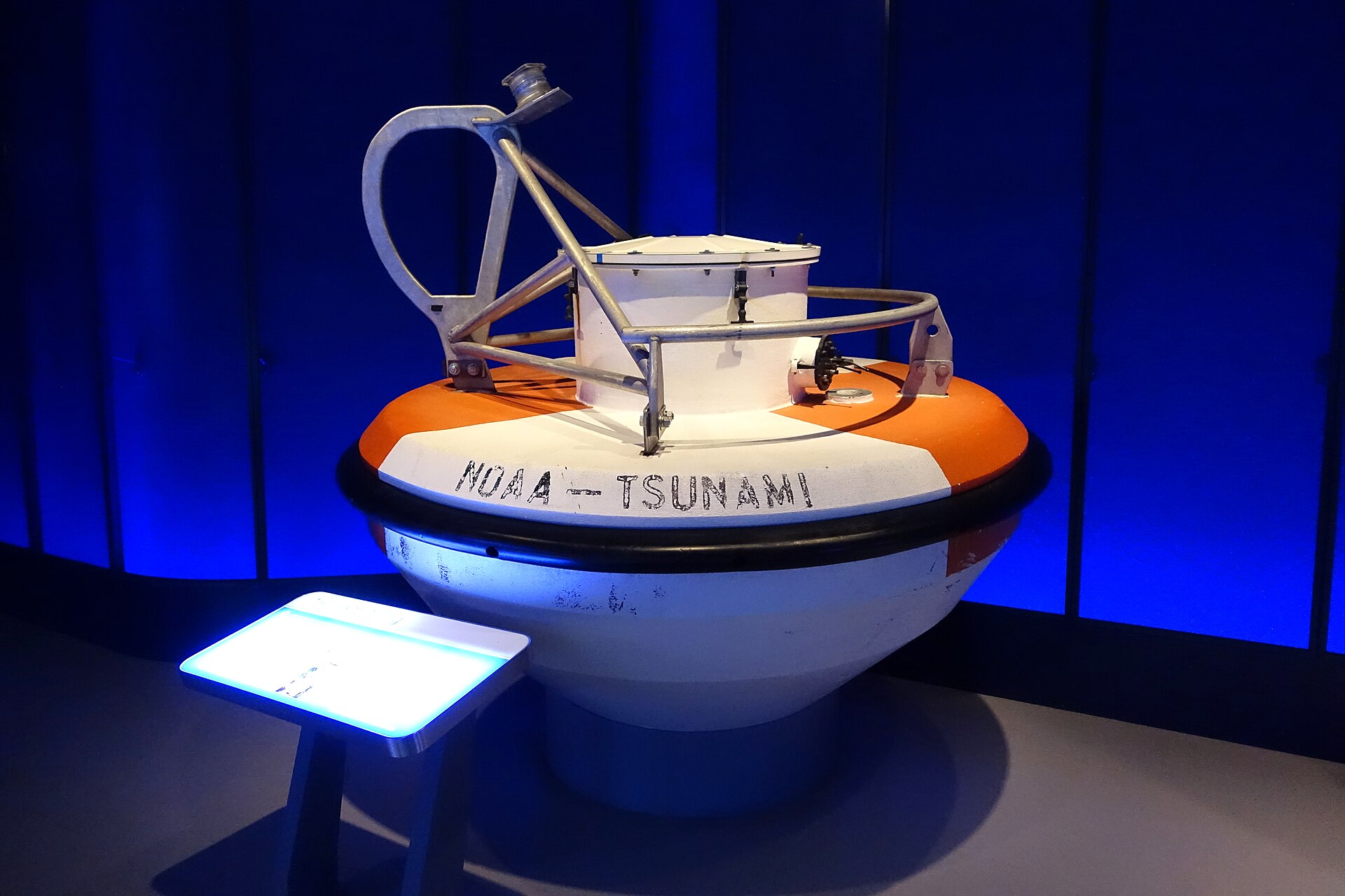
A tsunami forecast starts from seismic data alone. Passing DART buoys report sea levels that let centres refine the source estimate and issue watches, warnings or evacuations.
A tsunami watch alerts officials and the public to a possible future impact, rests on seismic data alone and may be upgraded or cancelled. A tsunami warning says widespread inundation is imminent, expected or occurring and is often issued on seismic information alone. A tsunami information statement usually signals no destructive threat to prevent unnecessary evacuations, though it can warn of possible local tsunamis.
Tsunami Service Providers watch seismic and sea level indicators around the clock, while national centres turn their bulletins into warnings for the public. The Japan Meteorological Agency issues regional tsunami warnings about three minutes after a quake, or as early as two minutes in some cases. For magnitude 8 or larger quakes its initial warning uses a predefined maximum magnitude and qualitative terms before updating with quantitative heights. A Major Tsunami Warning warns that wooden structures may be destroyed or washed away and that residents must evacuate coastal and river areas at once.
The Pacific Tsunami Warning and Mitigation System was established in 1965, after the 1960 tsunami showed that a Pacific-wide event could strike distant coasts within hours.
7. Preparedness and Public Awareness
Universal access to early warnings for storms, floods and tsunamis could cut asset losses by about 20%, preventing roughly $13 billion of damage each year. To be effective, such systems must reach every at-risk person, cover multiple hazards and be matched by communities ready to act quickly. The 2011 event showed that investment in warning systems pays off, yet even Japan — widely seen as the best-prepared country — still lost numerous lives. Tsunami memorials were built in devastated areas to keep the memory alive and teach younger generations who never saw the disaster.
The date of World Tsunami Awareness Day honours a Japanese farmer and village chief credited with saving many lives from a tsunami that struck on 24 December 1854 by the old Japanese calendar, and the United Nations created the day in December 2015.
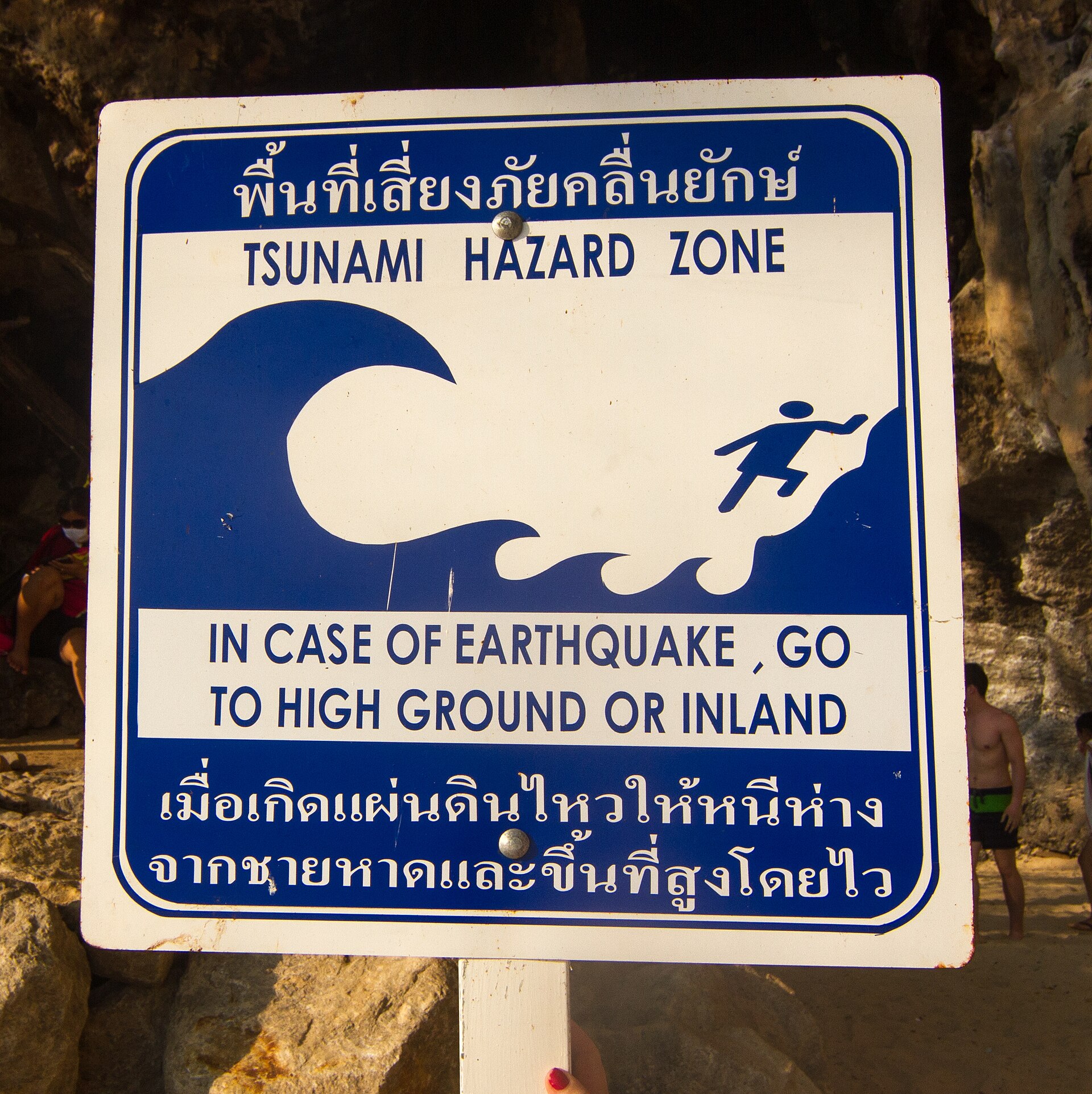
Three weeks after the disaster governments met in Kobe and adopted the Hyogo Framework for Action, and created the Indian Ocean Tsunami Warning and Mitigation System.
Fatality rates rise rapidly once tsunami height passes two metres and can reach 30% when the height approaches three metres.
Over the past century 58 tsunamis claimed more than 260,000 lives, an average of 4,600 per disaster, a toll greater than that of any other natural hazard.
8. Timeline
-
26 January 1700Cascadia earthquake sends an orphan tsunami across the PacificA wave crossed the ocean without a local earthquake 15The Orphan Tsunami of 1700 (USGS Professional Paper 1707) · U.S. Geological Survey ↗
-
27 August 1883Krakatoa's collapse drives deadly tsunamis through the Sunda StraitWaves destroyed coastal towns in Java and Sumatra 5World Tsunami Awareness Day — 5 November · United Nations ↗
-
1 April 1946A magnitude 8.6 Aleutian earthquake sends a tsunami to HawaiiThe Hilo disaster that built a US warning service 13NTHMP Tsunami Information Guide · NOAA National Weather Service / National Tsunami Hazard Mitigation Program ↗
-
1949Official US tsunami warning capability beginsAn official warning service for the United States 14Tsunami Warning Center History · NOAA / National Weather Service U.S. Tsunami Warning System ↗
-
22 May 1960The largest earthquake ever measured shakes ChileA Pacific-wide tsunami from Chile to Japan 11On This Day: 1960 Chilean Earthquake and Tsunami · NOAA National Centers for Environmental Information ↗
-
27 March 1964The Great Alaska earthquake and its tsunamisWaves from Prince William Sound caused the largest US losses 13
-
1965The Pacific Tsunami Warning System is establishedA warning system for the Pacific 11
-
26 December 2004Indian Ocean earthquake and tsunamiA disaster that reached every Indian Ocean country 6Damage and reconstruction after the 2004 Indian Ocean tsunami and the 2011 Great East Japan tsunami · Journal of Natural Disaster Science (Tohoku University) ↗
-
11 March 2011The Tohoku earthquake and tsunami hit JapanA huge wave struck the Sanriku coast 8On This Day: 2011 Tohoku Earthquake and Tsunami · NOAA National Centers for Environmental Information ↗
-
December 2015The United Nations creates World Tsunami Awareness DayA global day of awareness 5
-
15 January 2022The Hunga Tonga-Hunga Ha'apai eruption triggers a tsunamiA volcanic tsunami crossed the Pacific 3January 15, 2022 Tonga Volcanic Eruption and Tsunami · NOAA National Centers for Environmental Information ↗
9. Timeline: from the Cascadia orphan tsunami of 1700 to the warning systems of today
- 26 January 1700Cascadia earthquake sends an orphan tsunami across the PacificA great earthquake on the Cascadia subduction zone off North America's west coast generated a tsunami that crossed the ocean and struck Japan, where a merchant's notebook recorded it.
- 1 November 1755The Lisbon earthquake, fire and tsunamiA series of earthquakes destroyed much of Lisbon; fires burned for about six days and a tsunami swept the Tagus estuary about an hour after the shaking.
- 5 November 1854 (Japanese calendar)A village chief's warning saves lives — the origin of World Tsunami Awareness DayA Japanese farmer and village chief is credited with saving many lives from the tsunami of 24 December 1854; the date chosen for World Tsunami Awareness Day honours his actions.
- 27 August 1883Krakatoa's collapse drives deadly tsunamis through the Sunda StraitThe eruption and collapse of the volcano Krakatoa generated waves that destroyed coastal towns in Java and Sumatra and killed more than 36,000 people.
- 15 June 1896The Meiji Sanriku tsunamiThe Sanriku coast of Japan was struck by a tsunami with waves about 15 metres high; the village of Taro was among the places hit.
- 1 April 1946A magnitude 8.6 Aleutian earthquake sends a tsunami to HawaiiThe deadliest tsunami in US history killed 164 people, 158 of them in Hawaii, and led the United States to build an official tsunami warning service.
- 1949Official US tsunami warning capability beginsThe United States established official tsunami warning capability in response to the 1946 disaster at Hilo, co-locating the new centre with the Honolulu geomagnetic observatory.
- 22 May 1960The largest earthquake ever measured shakes ChileA magnitude 9.5 earthquake struck southern Chile and generated a tsunami that raged across the Pacific, killing people in Chile, Hawaii and Japan.
- 27 March 1964The Great Alaska earthquake and its tsunamisAn earthquake in Prince William Sound produced tsunamis that caused about $859 million in damage and roughly 124 deaths; a warning centre was later established at Palmer, Alaska.
- 1965The Pacific Tsunami Warning System is establishedThe global extent of the 1960 tsunami led to the creation of the Pacific Tsunami Warning and Mitigation System.
- 2001NOAA completes its first operational DART arraySix deep-ocean DART buoys came online, giving warning centres their first real-time deep-ocean tsunami measurements.
- 26 December 2004The Indian Ocean tsunami kills about 230,000 peopleAn earthquake off Sumatra that scientists later estimated at magnitude 9.3 sent tsunamis into 15 countries around the Indian Ocean, with waves as high as about 50 metres near Banda Aceh.
- 2005The world builds a tsunami warning system for the Indian OceanThree weeks after the disaster, governments met in Kobe and created the Indian Ocean Tsunami Warning and Mitigation System, alongside the Hyogo Framework for disaster risk reduction.
- 11 March 2011The Tohoku earthquake and tsunami hit JapanA magnitude 9.1 earthquake off Honshu generated a tsunami that overwhelmed sea walls, caused more than 18,000 deaths and triggered the Fukushima Daiichi nuclear accident.
- December 2015The United Nations creates World Tsunami Awareness DayThe UN General Assembly designated 5 November as World Tsunami Awareness Day, calling on countries and civil society to raise tsunami awareness.
- 15 January 2022The Hunga Tonga-Hunga Ha'apai eruption triggers a tsunamiThe eruption sent tsunami waves across ocean basins, caused four deaths in Tonga and produced a maximum measured wave height on land of about 22 metres.
References (19)
- 1What are tsunamis? — UNESCO IOC Tsunami Programme WebView source
- 2What is a tsunami? — NOAA National Ocean Service WebView source
- 3January 15, 2022 Tonga Volcanic Eruption and Tsunami — NOAA National Centers for Environmental Information 2022 Web↩View source
- 4Tsunami Programme — Pacific Ocean (ICG/PTWS) — UNESCO Intergovernmental Oceanographic Commission (IOC) WebView source
- 5World Tsunami Awareness Day — 5 November — United Nations Web↩View source
- 6Damage and reconstruction after the 2004 Indian Ocean tsunami and the 2011 Great East Japan tsunami — Journal of Natural Disaster Science (Tohoku University) 2004 Web↩View source
- 7tsunami — Encyclopaedia Britannica WebView source
- 8On This Day: 2011 Tohoku Earthquake and Tsunami — NOAA National Centers for Environmental Information 2011 Web↩View source
- 9Tsunami Historical Series: Lisbon — NOAA Science On a Sphere 1755 WebView source
- 10Lisbon earthquake of 1755 — Encyclopaedia Britannica 1755 WebView source
- 11On This Day: 1960 Chilean Earthquake and Tsunami — NOAA National Centers for Environmental Information 1960 Web↩View source
- 12Tsunami Historical Series: Chile — NOAA Science On a Sphere 1960 WebView source
- 13NTHMP Tsunami Information Guide — NOAA National Weather Service / National Tsunami Hazard Mitigation Program Web↩View source
- 14Tsunami Warning Center History — NOAA / National Weather Service U.S. Tsunami Warning System Web↩View source
- 15The Orphan Tsunami of 1700 (USGS Professional Paper 1707) — U.S. Geological Survey 1700 Web↩View source
- 16Tsunamis — Natural Hazards — NOAA National Centers for Environmental Information WebView source
- 17NOAA Tsunami Program — NOAA / National Weather Service WebView source
- 18About DART tsunami monitoring buoys — NOAA Pacific Marine Environmental Laboratory / Center for Tsunami Research WebView source
- 19Deep-ocean Assessment and Reporting of Tsunamis (DART) Description — NOAA National Data Buoy Center WebView source
 Japan
 The Periodic Table
 Ottoman Empire