Grand Canyon
The immense canyon of the Colorado River in northern Arizona — 277 miles of rock layers recording nearly two billion years of Earth history, homeland of eleven Native tribes, run by John Wesley Powell, and protected since 1919 as a national park and 1979 as a World Heritage Site.
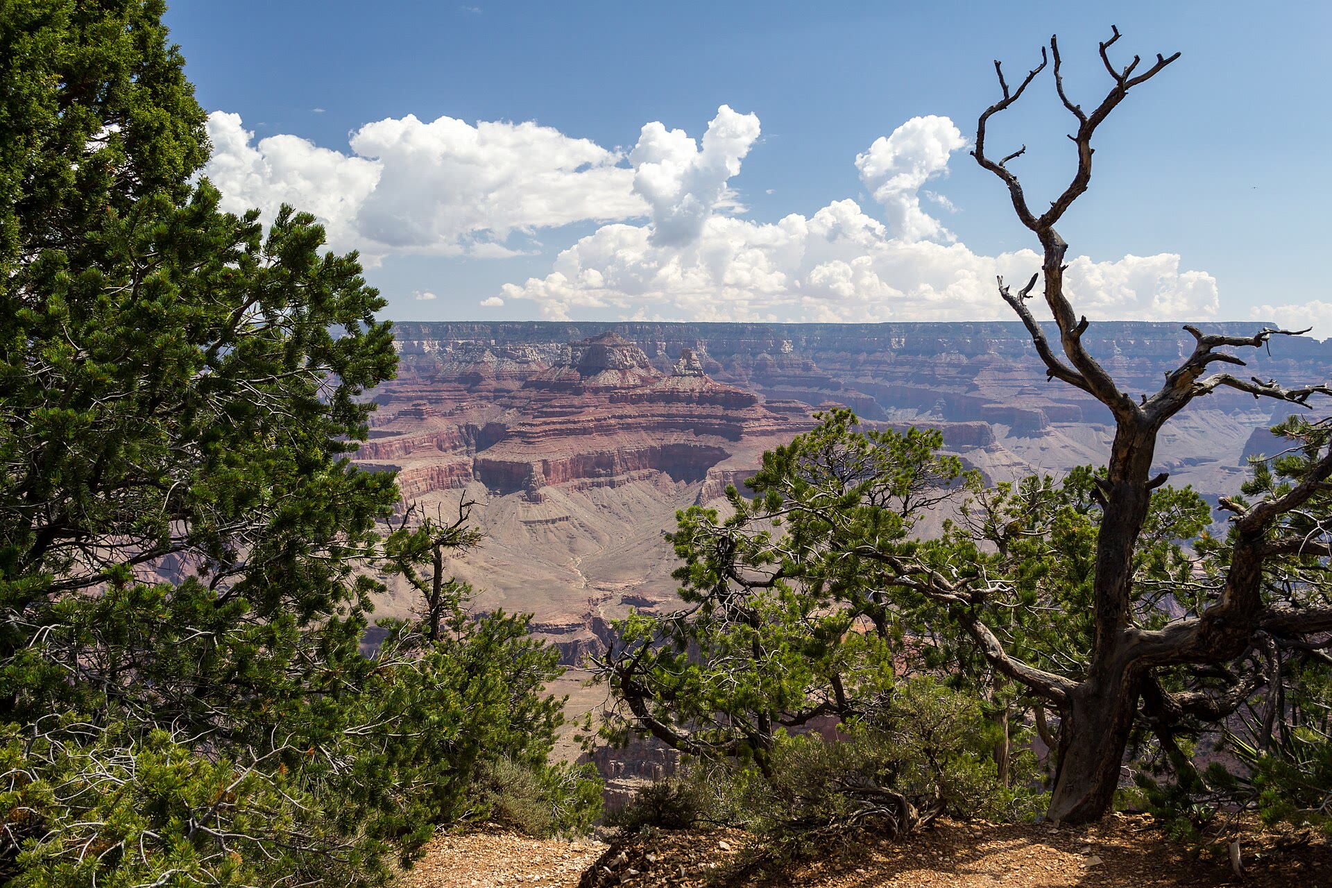
The Grand Canyon is a 277-mile (446 km) gorge cut by the Colorado River into the Colorado Plateau of northern Arizona, exposing nearly two billion years of rock in walls more than a mile deep. Its layered strata, from the Precambrian Vishnu Basement Rocks to the 270-million-year-old Kaibab Formation, record about a third of Earth's history, while the canyon itself was carved in the last five to six million years. The canyon is the ancestral homeland of eleven federally recognized tribes, was first run by John Wesley Powell's expedition in 1869, and became a national park in 1919 and a UNESCO World Heritage Site in 1979; it now receives several million visits a year.
In this article
- 1Overview
- 2Geological Setting and Dimensions
- 3Geological History and Rock Layers
- 4The Colorado River
- 5Ecology and Life Zones
- 6Human History and Exploration
- 7National Park and UNESCO World Heritage Site
- 8Cultural and Archaeological Significance
- 9Conservation and Modern Research
- 10Timeline: from deep time to the national park
- 11Frequently asked questions
- 12Knowledge graph
Overview
The Grand Canyon is a vast gorge carved by the Colorado River. The canyon lies within Grand Canyon National Park.
1. Geological Setting and Dimensions
The canyon it has cut reaches depths of up to about 6,000 feet (1,800 m) below the rims 1Grand Canyon National Park | Hiking, Wildlife & Geology · Encyclopaedia Britannica ↗.
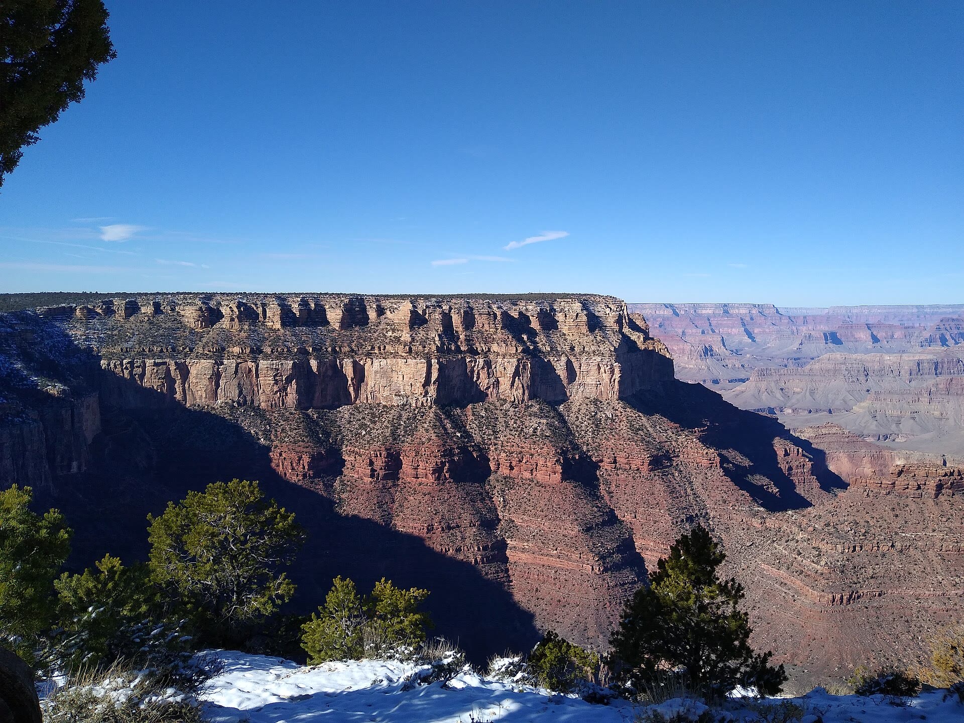
The rock record exposed in the walls spans an extraordinary interval. Nearly 40 identified rock layers form the canyon's walls, and since 1858 they have attracted students of earth history 2Geologic Formations - Grand Canyon National Park · U.S. National Park Service (NPS) ↗. If all the canyon's rocks were present in one spot, their total thickness would exceed 15,000 feet (4,600 m) 3Journey Through Time: Grand Canyon Geology (PDF) · U.S. National Park Service (NPS) ↗.
| Feature | Measurement | Source |
|---|---|---|
| Width | 0.1 to 18 miles (0.2 to 29 km) | britannica-grca-park |
| Depth | Up to about 6,000 feet (1,800 m) below the rims | britannica-grca-park |
| Rock layers | Nearly 40 identified layers | nps-geoformations |
| Total rock thickness | More than 15,000 feet (4,600 m) if present in one spot | nps-life-geology |
2. Geological History and Rock Layers
The formation of the Grand Canyon can be remembered by the letters D U D E, which stand for Deposition, Uplift, Down cutting and Erosion. Between 70 and 30 million years ago plate tectonics uplifted the whole region, producing the high and relatively flat Colorado Plateau. Beginning just 5-6 million years ago the Colorado River started to carve its way downward, and further erosion by tributary streams widened the canyon. The Colorado River has carved the Grand Canyon into four plateaus of the Colorado Plateau Province, a region of nearly horizontal sedimentary rocks lifted 5,000 to 13,000 feet above sea level.
Geologists have recognized three main packages of rocks exposed in Grand Canyon: the Vishnu Basement Rocks of the granite gorges, the tilted Grand Canyon Supergroup, and the flat-lying Layered Paleozoic Rocks. The Vishnu Basement Rocks formed and were intruded by igneous rocks in the deep crust nearly 2,000 million years ago, and their originally horizontal layering is now subvertical. The Grand Canyon Supergroup is exposed only in the eastern canyon; its late Precambrian sedimentary and volcanic rocks were deposited in rift basins from about 729 to 1,255 million years ago and are about 12,000 feet (3,600 m) thick. The Layered Paleozoic rocks are 3,000-5,000 feet thick and record changing environments from shallow oceans to large sand dunefields and the history of life on Earth about 530 to 270 million years ago.
The Law of Superposition holds that sediment is deposited in layers in sequence, with the oldest rocks at the bottom and the youngest at the top, a key part of determining the relative age of a rock layer. Grand Canyon has one of the world's most complete geologic records, yet more time is missing along its unconformities than is preserved. Rocks exposed in the canyon walls record approximately one third of the planet's history, from the Precambrian to the Permian Period of the Paleozoic Era, and contain important information about the evolution and history of life.
The Kaibab Limestone, the uppermost layer of rock at Grand Canyon, formed at the bottom of the ocean yet is found today at elevations up to 9,000 feet on top of the Colorado Plateau. The Redwall Limestone forms distinct red cliffs about mid-level in the canyon and was deposited about 340 million years ago. The only fossils known from the Coconino Sandstone are trace fossils, tracks of both invertebrates and vertebrates, with some tetrapod traces from approximately 280 million years ago. The red sandstones and siltstones of the Supai Group were deposited 315-285 million years ago during the Early Pennsylvanian Period.
3. The Colorado River
The Colorado River runs 1,450 miles (2,333 km) from its source in the Rocky Mountains of Colorado to the Gulf of California. Within the Grand Canyon it is a comparatively modest stream, averaging 300 feet (91 m) across and about 40 feet (12 m) deep, with a flow of 12,000 to 15,000 cubic feet per second. Over its journey through the canyon it descends about 2,000 feet (610 m).
Downcutting in the canyon is increased by three factors: the river's steep slope, its large volume, and its flow through an arid climate. Before the construction of Glen Canyon Dam, the river fell to as little as 500 to 1,000 cubic feet per second in late summer and swelled to 100,000 cubic feet per second or more during Rocky Mountain snowmelt. Dams now bracket the Grand Canyon, Glen Canyon Dam upstream and Hoover Dam downstream, and the river's dynamics have changed dramatically: gone are the large annual floods that carried hundreds of thousands of tons of sediment through the canyon each day.
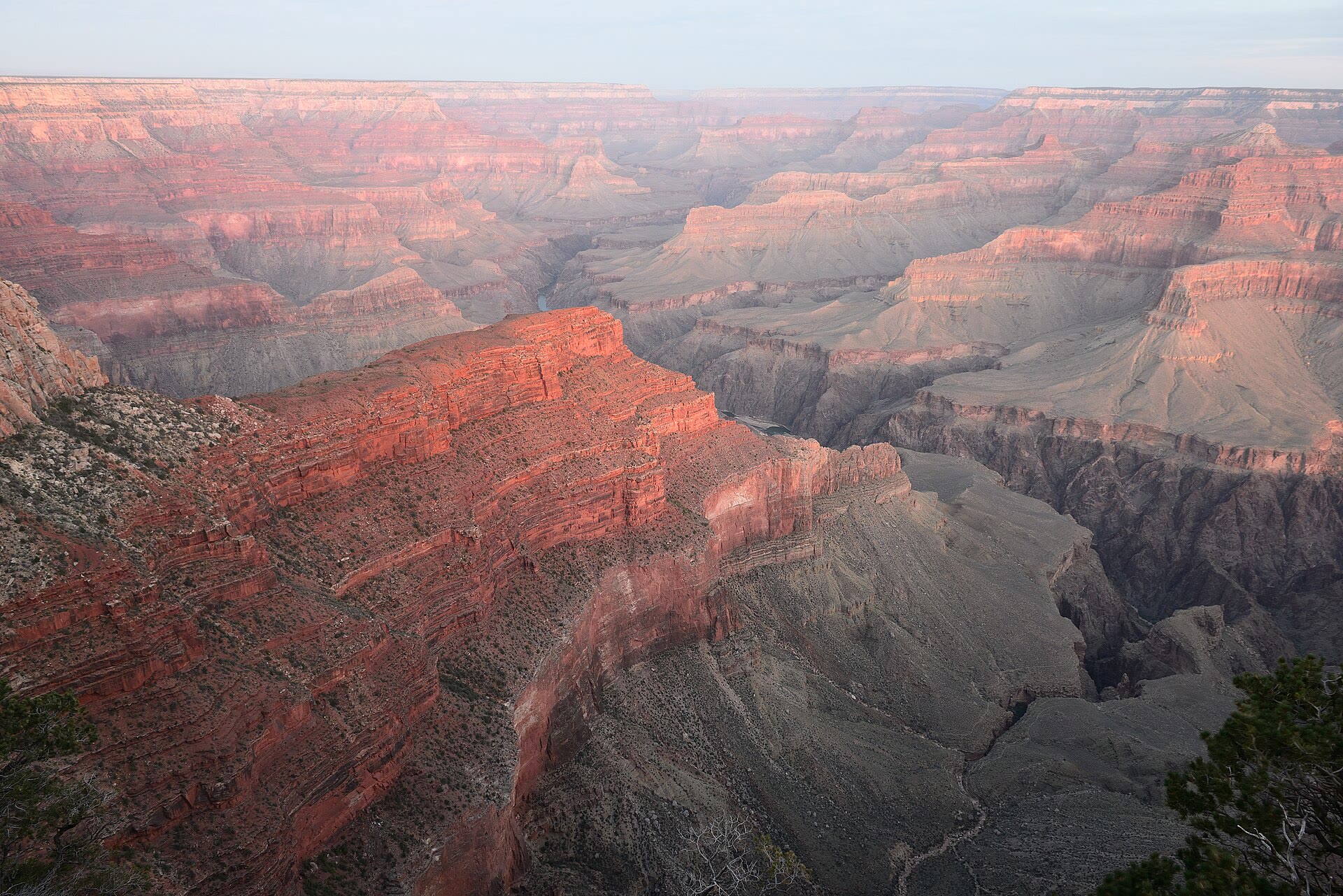
Side canyons scoured by summer thunderstorms and winter snowmelt produce much of the canyon's 10- to 16-mile (16 to 22 km) width. The north wall rises a thousand feet (305 m) higher than the South Rim, giving the North Rim nearly twice the annual precipitation of the South Rim.
4. Ecology and Life Zones
The great variation in elevation and the movement of the river foster five major ecosystems in the canyon: mixed conifer forest, ponderosa pine forest, pinyon juniper woodland, desert scrub, and riparian. The mixed conifer or boreal forest ecosystem is found only at the highest elevations of the Grand Canyon, on the North Rim from 8,200 to 9,200 feet. The ponderosa pine is the most common plant of its forest, and the Kaibab squirrel is found only in this ecosystem, relying on pine cones for food and branches for shelter.
Riparian ecosystems line the Colorado River and springs, defined by a constant presence of water. Though the smallest Grand Canyon ecosystem, they support the greatest biodiversity in both aquatic and terrestrial organisms. The humpback chub is a large freshwater fish that lives only in the Colorado River basin, and its decline was likely caused by changed river conditions after the Glen Canyon Dam was built and by competition from nonnative fish such as rainbow trout.
Exposed within the canyon's walls are five of North America's seven life zones, displaying the wide variety of plant and animal species present here through eons of time.
5. Human History and Exploration
The Grand Canyon entered written history through the eyes of outsiders. The first Europeans to see it were soldiers led by García López de Cárdenas, who in 1540 traveled north from Mexico City with Francisco Vázquez de Coronado's army in search of the Seven Cities of Cíbola. In the 16th century Spanish colonists became the first Europeans to see the canyon's sweeping views, but, more interested in accessing the Colorado River, they left after failing to descend the gorge. The Hopi deliberately guided the Spaniards along an exaggerated path and convinced them the area was an impenetrable wasteland, so Coronado dismissed further western exploration and Grand Canyon was left unexplored by Europeans for 235 years.
Systematic study began in the middle of the 19th century. In 1857 members of a U.S. Army Corps of Topographical Engineers survey expedition became the first non-indigenous individuals to view the Grand Canyon in the 200 years that had passed since the Spanish expedition. The first geologists who explored and studied Grand Canyon included John Strong Newberry, who was part of the Ives expedition of 1857-1858, and John Wesley Powell, who led the famous 1869 expedition down the Colorado River. Powell's first expedition began on May 24 in 1869 at Green River City, and he emerged from the Grand Canyon on August 29 with five of the nine men he had started with; four had deserted and three of those were killed by Indians. As the party prepared to enter the Grand Canyon on August 13, Powell wrote that they were now ready to start on their way down the Great Unknown, their boats tied to a common stake and chafing each other in the fretful river.
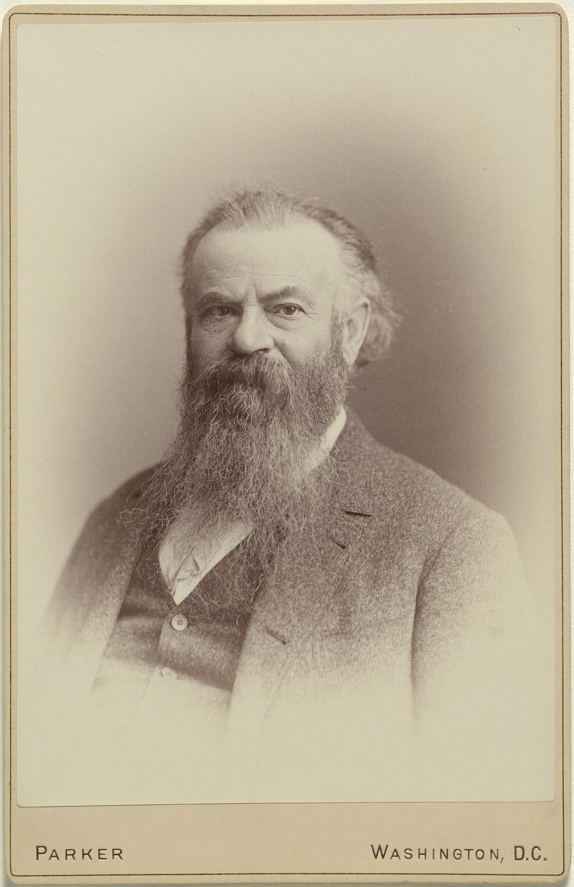

Powell returned to complete the work of description. After his notes were lost, he gathered a new crew of amateur scientists and educated men with full federal funding and began a second expedition on May 22 in 1871, entering the Grand Canyon at Lee's Ferry on August 17 in 1872 after wintering in Kanab, Utah. The canyon's three main rock sets — metamorphic basement rocks, the Precambrian Grand Canyon Supergroup, and Paleozoic strata — were first described by John Wesley Powell during his expeditions of the late 1860s and early 1870s. In 1875 the Smithsonian Institution published Powell's report on the first exploration of the Colorado River.
-
1540First Europeans reach the canyonSoldiers led by García López de Cárdenas, traveling north from Mexico City with Francisco Vázquez de Coronado's army in search of the Seven Cities of Cíbola, become the first Europeans to see the Grand Canyon 13Explorers - Grand Canyon National Park · U.S. National Park Service (NPS) ↗.
-
1857-1858Ives expeditionJohn Strong Newberry, part of the Ives expedition, is among the first geologists to explore and study the canyon 8Geoheritage of Grand Canyon National Park's Rock Record · U.S. National Park Service (NPS) ↗.
-
1869Powell's first expeditionJohn Wesley Powell begins his first expedition on May 24 at Green River City and emerges from the Grand Canyon on August 29 with five of the nine men he started with 14First through the Grand Canyon (John Wesley Powell, ed. Horace Kephart) · Project Gutenberg ↗.
-
1871-1872Powell's second expeditionWith full federal funding, Powell begins a second expedition on May 22 in 1871 and enters the Grand Canyon at Lee's Ferry on August 17 in 1872 after wintering in Kanab, Utah 13.
6. National Park and UNESCO World Heritage Site
Grand Canyon National Park was established on February 26, 1919, under 40 Stat 1175, formalizing protection for a landscape that had already drawn federal attention for a quarter-century. That earlier attention took the form of a Forest Reserve in 1893, a game preserve in 1903, and a national monument in 1908. The park as it stands covers 1,902 square miles (4,927 square km), and its area was greatly enlarged in 1975. In 1979 the property was inscribed as a UNESCO World Heritage site under criteria (vii), (viii), (ix) and (x), with an area of 493,270 hectares.
Annual visitation grew from 38,000 in 1919 to 108,000 in 1924 and to 4.7 million in 2022, a trajectory shaped as much by administration as by scenery. Over those decades park administrators built infrastructure, negotiated with concessionaires and responded to changing politics.
Grand Canyon National Park contains one of the best exposures of the rock record on the North American continent, presenting what is arguably the best-known stratigraphic column in the world. Within its boundaries lie 54 identified stratotypes, including 24 type sections, 16 type localities, 6 type areas, and 8 reference sections. Almost all of the park, 97 percent, is underlain by karst, with another 3 percent underlain by pseudokarst, and the park may contain as many as 2,500 caves.
7. Cultural and Archaeological Significance
The oldest human artifacts found in the park are nearly 12,000 years old and date to the Paleo-Indian period, with continuous use and occupation of the park since that time. There are currently 3,391 ancestral sites documented within the park, representing approximately 7.5 percent of park lands inventoried, plus 453 locations with evidence of historic Native American use. Archeological remains in the park represent Paleo-Indian, Archaic, Basketmaker, Ancestral Puebloan (Kayenta and Virgin branches), Cohonina, Cerbat, Pai, Southern Paiute, Zuni, Hopi, Navajo, and Euro-American culture groups.
There are 11 tribes with historic connections to the lands and resources now found within Grand Canyon National Park. Park staff have worked with tribal communities for more than 40 years, developing numerous innovative and collaborative tribal partnerships. Three Indian reservations border long stretches of the park: Navajo to the east and Havasupai and Hualapai to the south.
Between 2007 and 2009 the National Park Service, in cooperation with the Museum of Northern Arizona, undertook the first major archeological excavations along the river in 40 years. To build the suspension bridge across the Colorado River, nearly 40 tons of materials and supplies, including cables each 550 feet long and weighing 1,000 pounds, were carried on the shoulders of 15 Havasupai men.
8. Conservation and Modern Research
Federal protection of the Grand Canyon's riverine resources rests on the Grand Canyon Protection Act of 1992, the most recent authorizing legislation for efforts to protect resources downstream from Glen Canyon Dam. The United States Geological Survey circular on the state of the Colorado River ecosystem was prepared to implement that act. The report is a product of the Glen Canyon Dam Adaptive Management Program, a federally authorized initiative to ensure that the primary mandate of the Grand Canyon Protection Act is met through advances in information and resource management.
Since the completion of Glen Canyon Dam in 1963, the hydrological and ecological health of the Colorado River and its associated riparian zones have been altered and deteriorated.
In 2026 Arizona Geological Survey scientists contributed to a study revealing a precursor to the Grand Canyon: the arrival of Colorado River sediment into the Bidahochi Basin 6.6 million years ago set the stage for the river's integration and the canyon's formation. Research on the lower Colorado River found that the river arrived suddenly below the mouth of the Grand Canyon by about 5 million years ago and reached the Gulf of California by 4.6 million years ago.
Paleontology resources in the park include nearly 350 fossil localities ranging from 1.2-billion-year-old stromatolites to Paleozoic trilobites, plants, reptile tracks, and marine invertebrates, and Pleistocene megafauna in caves.
9. Timeline: from deep time to the national park
- about 1,840 million years agoVishnu Basement Rocks formThe oldest rocks exposed in Grand Canyon, the Vishnu Basement Rocks, form deep in the crust during continental collisions that built this part of North America.
- 1,255 to 729 million years agoGrand Canyon Supergroup depositedThe Unkar and Chuar groups are deposited in rift basins during the assembly and breakup of the supercontinent Rodinia, later tilted and eroded into the wedge-shaped remnants of the eastern canyon.
- about 270 million years agoKaibab Formation caps the rimsThe Kaibab Formation, the youngest layer of Grand Canyon rock, is deposited in warm shallow seas long before the age of dinosaurs; it now holds up both the North and South Rims.
- 6.6 million years agoColorado River sediment reaches the Bidahochi BasinSediment marking the arrival of the Colorado River appears in the Bidahochi Basin of northeastern Arizona, setting the stage for the river's integration and the canyon's formation.
- 5-6 million years agoThe Colorado River begins to carve the canyonThe Colorado River starts cutting downward through the uplifted plateau; the canyon through which it flows is estimated to be 5-6 million years old.
- 1540Cárdenas and the first EuropeansSoldiers led by García López de Cárdenas, guided by the Hopi during Coronado's search for the Seven Cities of Cíbola, become the first Europeans to see the Grand Canyon.
- May 24 to August 29, 1869Powell's first expeditionJohn Wesley Powell's party launches four boats at Green River City, Wyoming and completes the first documented boat passage through the Grand Canyon, emerging with five of the nine men.
- 1893Forest reservePresident Benjamin Harrison designates the Grand Canyon a forest reserve under Presidential Proclamation #45.
- 1908National monumentPresident Theodore Roosevelt establishes Grand Canyon National Monument under Presidential Proclamation #794.
- February 26, 1919Grand Canyon National ParkCongress designates Grand Canyon National Park by an act signed on February 26 (40 Stat 1175).
- 1963Glen Canyon Dam upstreamGlen Canyon Dam is completed, forming Lake Powell and changing the flow and sediment regime of the Colorado River through the canyon.
- January 3, 1975Park enlargedThe Grand Canyon National Park Enlargement Act brings the former Grand Canyon and Marble Canyon national monuments and other adjoining lands into the park.
- October 26, 1979World Heritage SiteGrand Canyon National Park is designated a UNESCO World Heritage Site.
- 2019International Dark Sky ParkThe park is designated an International Dark Sky Park by the International Dark-Sky Association in June, after receiving provisional status in 2016.
10. Frequently asked questions
How long, wide, and deep is the Grand Canyon?
How old are the rocks in the canyon, and when did the canyon itself form?
The oldest rocks exposed are the Vishnu Basement Rocks, about 1,840 million years old, while the youngest layer, the Kaibab Formation, is about 270 million years old 8. The carving of the canyon by the Colorado River began only 5–6 million years ago 4Geology - Grand Canyon National Park · U.S. National Park Service (NPS) ↗.
How many rock layers are visible in the canyon walls?
When did the Grand Canyon become a national park, and how many people visit it?
The park was established on February 26, 1919 10Park Statistics - Grand Canyon National Park · U.S. National Park Service (NPS) ↗, after earlier protections as a forest reserve in 1893, a game preserve in 1903, and a national monument in 1908 15. Visitation grew from 38,000 in 1919 to 4.7 million in 2022 17Building the National Park - Grand Canyon National Park · U.S. National Park Service (NPS) ↗.
Is the Grand Canyon a UNESCO World Heritage Site?
Yes, it was inscribed in 1979 under criteria (vii), (viii), (ix), and (x), with an area of 493,270 hectares 16Grand Canyon National Park - UNESCO World Heritage Centre · UNESCO World Heritage Centre ↗.
How many Native American tribes are associated with the Grand Canyon?
Eleven federally recognized tribes are traditionally associated with what is now Grand Canyon National Park 20Associated Tribes - Grand Canyon National Park · U.S. National Park Service (NPS) ↗.
References (22)
- 1Grand Canyon National Park | Hiking, Wildlife & Geology — Encyclopaedia Britannica Web↩View source
- 2Geologic Formations - Grand Canyon National Park — U.S. National Park Service (NPS) Web↩View source
- 3Journey Through Time: Grand Canyon Geology (PDF) — U.S. National Park Service (NPS) Web↩View source
- 4Geology - Grand Canyon National Park — U.S. National Park Service (NPS) Web↩View source
- 5Grand Canyon's Three Sets of Rocks — U.S. National Park Service (NPS) WebView source
- 6Geology of Grand Canyon National Park — U.S. Geological Survey (USGS) WebView source
- 7Grand Canyon Supergroup — U.S. National Park Service (NPS) WebView source
- 8Geoheritage of Grand Canyon National Park's Rock Record — U.S. National Park Service (NPS) Web↩View source
- 9Layered Paleozoic Rocks — U.S. National Park Service (NPS) WebView source
- 10Park Statistics - Grand Canyon National Park — U.S. National Park Service (NPS) Web↩View source
- 11Ecology of Grand Canyon National Park — U.S. Geological Survey (USGS) WebView source
- 12Grand Canyon National Park: World Heritage Site — U.S. National Park Service (NPS) WebView source
- 13Explorers - Grand Canyon National Park — U.S. National Park Service (NPS) Web↩View source
- 14First through the Grand Canyon (John Wesley Powell, ed. Horace Kephart) — Project Gutenberg Web↩View source
- 15Grand Canyon | Facts, Map, Geology, & Videos — Encyclopaedia Britannica Web↩View source
- 16Grand Canyon National Park - UNESCO World Heritage Centre — UNESCO World Heritage Centre Web↩View source
- 17Building the National Park - Grand Canyon National Park — U.S. National Park Service (NPS) Web↩View source
- 18NPS Geodiversity Atlas - Grand Canyon National Park, Arizona — U.S. National Park Service (NPS) WebView source
- 19Archaeological Resources - Grand Canyon National Park — U.S. National Park Service (NPS) WebView source
- 20Associated Tribes - Grand Canyon National Park — U.S. National Park Service (NPS) Web↩View source
- 21The State of the Colorado River Ecosystem in Grand Canyon (USGS Circular 1282) — U.S. Geological Survey (USGS) WebView source
- 22AZGS scientists contribute to breakthrough study on Colorado River and Grand Canyon history — Arizona Geological Survey (AZGS), University of Arizona WebView source