Victoria Falls
The Zambezi's mile-wide curtain of falling water on the Zambia–Zimbabwe border — its geology, discovery, spray-fed rainforest, national parks and World Heritage management.
Victoria Falls (Mosi-oa-Tunya, 'the Smoke that Thunders') is a waterfall on the Zambezi River at the border of Zambia and Zimbabwe, up to 108 metres high and 1,708 metres wide, plunging into a chasm and a zigzag series of eight gorges cut into Jurassic basalt. David Livingstone became the first European to see the falls in November 1855 and named them for Queen Victoria; the transboundary Mosi-oa-Tunya / Victoria Falls property was inscribed on the UNESCO World Heritage List in 1989 and is jointly managed by Zambia and Zimbabwe through their parks authorities and a Joint Integrated Management Plan.
In this article
- 1Overview
- 2Dimensions and Flow
- 3Geology and Geomorphology
- 4The Falls in the Zambezi System
- 5World Heritage and Protection
- 6Ecology
- 7Human History
- 8Exploration and Naming
- 9The Victoria Falls Bridge
- 10Tourism and Visitor Experience
- 11Conservation Concerns
- 12Timeline: from the Batoka basalts to the joint management era
- 13Knowledge graph
Overview
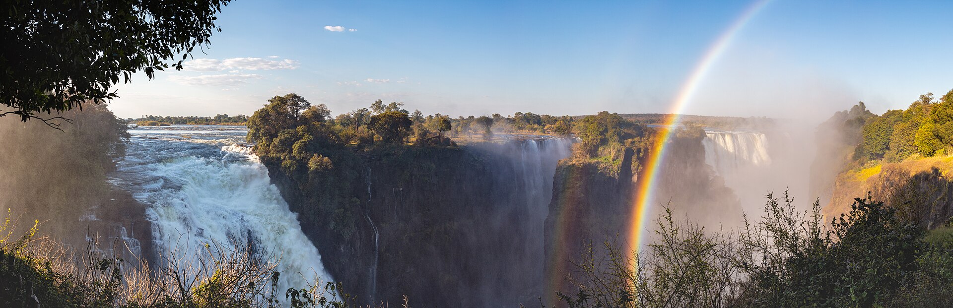
Victoria Falls ranks among the world's most spectacular waterfalls, where the Zambezi River, more than 2 km wide at this point, plunges noisily down a series of basalt gorges in a permanent cloud of mist. The falls mark a major break between the broad, low-gradient channel upstream and the steep, narrowly incised gorges downstream.
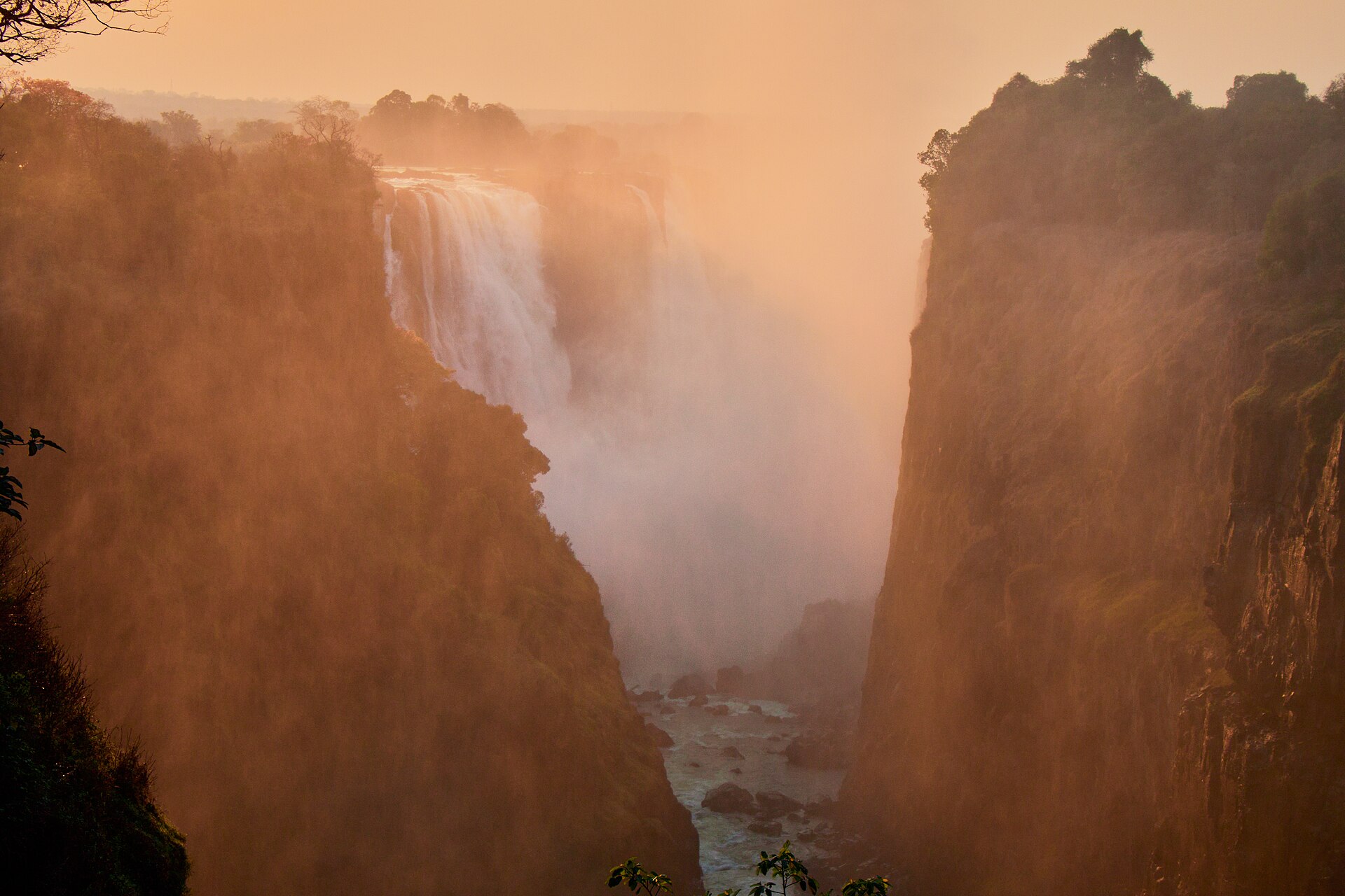
The Kololo tribe living in the area described the falls as Mosi-oa-Tunya — the Smoke that Thunders — for the immense spray and incredible noise caused by the rushing water. The falls transform the Zambezi from a placid river into a ferocious torrent cutting through a series of dramatic gorges, with a mist-soaked rain forest on the opposite wall and paths along the forest edge for viewing the falls.
The falls lie on the Zambia–Zimbabwe border, with their centre at 17°55′28″S 25°51′19″E, at an altitude of about 915 m above mean sea level.
1. Dimensions and Flow
| Attribute | Value |
|---|---|
| Height | 108 meters (355 feet) |
| Width | 1,708 meters (5,604 feet) |
| Mean flow | Almost 33,000 cubic feet (935 cubic metres) per second |
| Long-term mean annual flow | 1,100 cubic metres per second |
| Maximum recorded flow | 10,000 cubic metres per second (March 1958) |
| Lowest recorded flow | Annual mean of 390 cubic metres per second (1995/96 season) |
At peak flow the falls span 1,708 m and discharge up to 500 million litres per minute, generating spray that rises 500 m and is visible 20 km away 4Zambezi – Victoria Falls National Parks Management Plan 2024–2034 · Zimbabwe Parks and Wildlife Management Authority ↗.
Britannica describes Victoria Falls as approximately twice as wide and twice as deep as Niagara Falls, spanning the entire breadth of the Zambezi at one of its widest points, with a maximum drop of 355 feet and a mean flow near 33,000 cubic feet (935 cubic metres) per second 5Victoria Falls (waterfall, Zambia-Zimbabwe) · Encyclopaedia Britannica ↗, while the long-term mean annual flow is 1,100 cubic metres per second 6River Flows · Zambezi River Authority ↗.
The lowest flows recorded at the falls came in the 1995/96 season, with an annual mean of 390 cubic metres per second, while the maximum flow recorded was 10,000 cubic metres per second in March 1958, during the early construction phase of Kariba Dam 6.
2. Geology and Geomorphology
The falls mark the modern position of a west-migrating knickpoint that incised the lower gorges into Jurassic layered basalts, a development that followed the diversion of drainage off the Kalahari plateau into the mid-Zambezi, which occupies a deep graben. The positions of the falls are controlled by linear fault lines in the underlying basalt rocks.
Since the uplifting of the Makgadikgadi Pan some two million years ago the Zambezi has been cutting through the basalt plateau along east-west fissures, forming a series of retreating falls, and below the present falls the river enters a zigzag series of narrow gorges that are relicts of seven past waterfalls.

Intense river erosion has moved the falls upstream, elongating the zigzag gorge; prior positions of the strongly linear falls can be detected in the gorge, and the falls will continue to erode northward.
The waters drop into a chasm 25 to 75 metres wide whose only outlet is a narrow channel less than 65 metres wide and 120 metres long, through which the entire Zambezi flows.
Below the falls the river emerges into an enormous zigzag trough forming the beginning of Batoka Gorge, cut 120 to 240 metres deep through a basalt plateau for a distance of 100 km.
Criterion (viii) recognises the falls and their eight steep-sided gorges — an outstanding example of river capture in a tectonic basin — as the result of changing waterfall positions over geological time, with erosion still sculpting the hard basalt.
3. The Falls in the Zambezi System
The Zambezi, southern Africa's longest trans-boundary river, rises at 1,585 metres above sea level in north-western Zambia and flows some 2,700 kilometres through plains, gorges, rapids and cataracts to the Indian Ocean.
Victoria Falls is one of the hydrometric stations used in the day-to-day operations of the Kariba reservoir, and one of the eight where flow measurements are carried out.
4. World Heritage and Protection
The falls and their adjoining parklands were inscribed on the World Heritage List in 1989 under natural criteria (vii) and (viii), as a transboundary serial property straddling the Zambezi along the Zambia–Zimbabwe border.
Victoria Falls National Park runs from 6 km above the falls to Batoka Gorge 12 km below them, while the riverine strip of Zambezi National Park extends 9 km upstream along the right bank. Mosi-oa-Tunya National Park, one of Zambia's smallest, lies bordered by Livingstone town and the Zambezi and extends from the Batoka Gorge for about 12 km along the river above the falls.
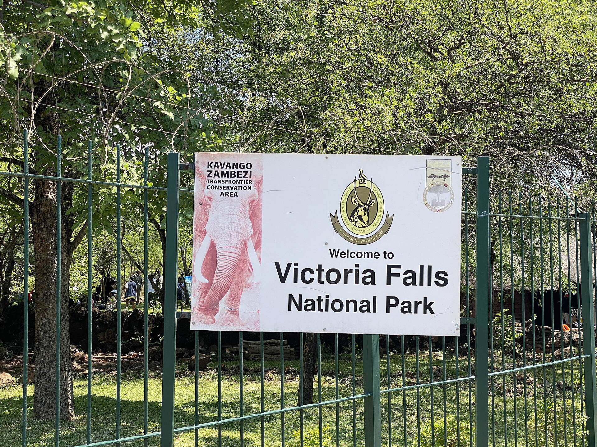
In Zambia the property is protected under the National Heritage Conservation Act of 1998 and the Zambia Wildlife Act, and in Zimbabwe under the Parks and Wildlife Act of 2008 (revised). A Joint Integrated Management Plan prepared in a participatory manner was approved by Zambia and Zimbabwe in November 2007 and is implemented through Joint Ministerial, Joint Technical and Joint Site Management committees. The parks also fall within three international conservation designations — the KAZA transfrontier conservation area, the Batoka Gorge Important Bird Area and a Ramsar site.
The Joint Integrated Management Plan 2025–2030 for the property was jointly validated and submitted on 30 June 2025, providing a unified framework covering tourism pressure, infrastructure development, biodiversity conservation and climate resilience. A boundary modification request has been formally submitted under UNESCO guidelines to define the property and its buffer zone more precisely.
The transboundary property covers 6,860 ha in total: 3,779 ha of Mosi-oa-Tunya National Park in Zambia, 2,340 ha of Victoria Falls National Park in Zimbabwe, and 741 ha of the riverine strip of Zambezi National Park in Zimbabwe.
5. Ecology
The riverine rainforest within the falls' splash zone is a fragile ecosystem dependent on abundant water and high humidity from the spray plume, which is visible from 50 km away on the Bulawayo road. This mist-forest is a discontinuous rainforest on sandy alluvium, with tree species including pod mahogany, ebony, strangler fig, ivory palm and wild date palm, alongside 70 shrub and 150 herbaceous species recorded for this rare habitat.
Some 35 raptors are found in the Batoka gorge below the falls, where about ten pairs of the Taita falcon breed alongside black eagles, peregrine falcons and augur buzzards. Bird surveys on the property are conducted twice a year, in January and July, and an annual vulture survey in Zambezi National Park monitors nesting site distribution and success with stakeholders such as the Victoria Falls Wildlife Trust.
6. Human History
-
three million years agoEarliest stone artefactsStone artefacts of Homo habilis have been found near the falls.8Mosi-oa-Tunya / Victoria Falls — World Heritage Datasheet · UNEP-WCMC / IUCN ↗
-
around 50,000 years agoMiddle Stone Age occupationMiddle Stone Age tools indicate occupation of the area.8
-
between 10,000 and 2,000 years agoLate Stone Age hunter-gatherersLate Stone Age hunter-gatherer material dates from this span.8
-
at least seven centuriesTonga presenceThe area has been home to the Tonga people for at least seven centuries.8
-
16 November 1855First European visitorDavid Livingstone was the first European to see the falls, naming them for Queen Victoria.5
The towns of Victoria Falls in Zimbabwe and Maramba, formerly Livingstone, in Zambia have about 40,000 and 100,000 inhabitants respectively.

7. Exploration and Naming
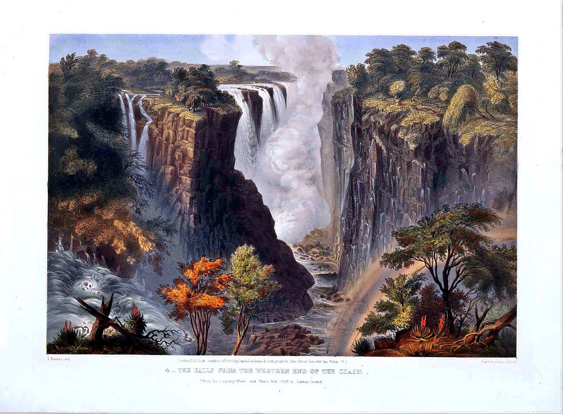
David Livingstone first heard of the great waterfall in 1851 and set out to visit it in 1855, spending the night on Kalai Island before landing on the island at the lip of the falls that now bears his name 3The Victoria Falls · Zambia Tourism Agency ↗. He was the first European to see the falls, on 16 November 1855, and named them for Queen Victoria 5. On 17 November 1855 he reached the waterfall that Africans called Mosi-oa-Tunya and named it Victoria Falls; mist rising from the falls could be seen from five or six miles away 13Livingstone Sees the Victoria Falls (Research Starter) · EBSCO Information Services (Mark C. Herman) ↗.
Livingstone had heard about the falls before seeing them: Sebetwane, leader of the Makololo, met him in 1851 and asked whether his country had smoke that sounds 14The Smoke That Thunders · David Livingstone Birthplace Museum ↗. He first sighted the columns of vapour he called smoke rising at a distance of five or six miles, five columns that bent with the wind and seemed to mingle with the clouds 15Missionary Travels and Researches in South Africa (David Livingstone, 1857) · Project Gutenberg ↗. On revisiting the falls on 9 August 1860 during his Zambezi expedition, he made an accurate measurement by lowering a rope weighted with bullets over the precipice 13.
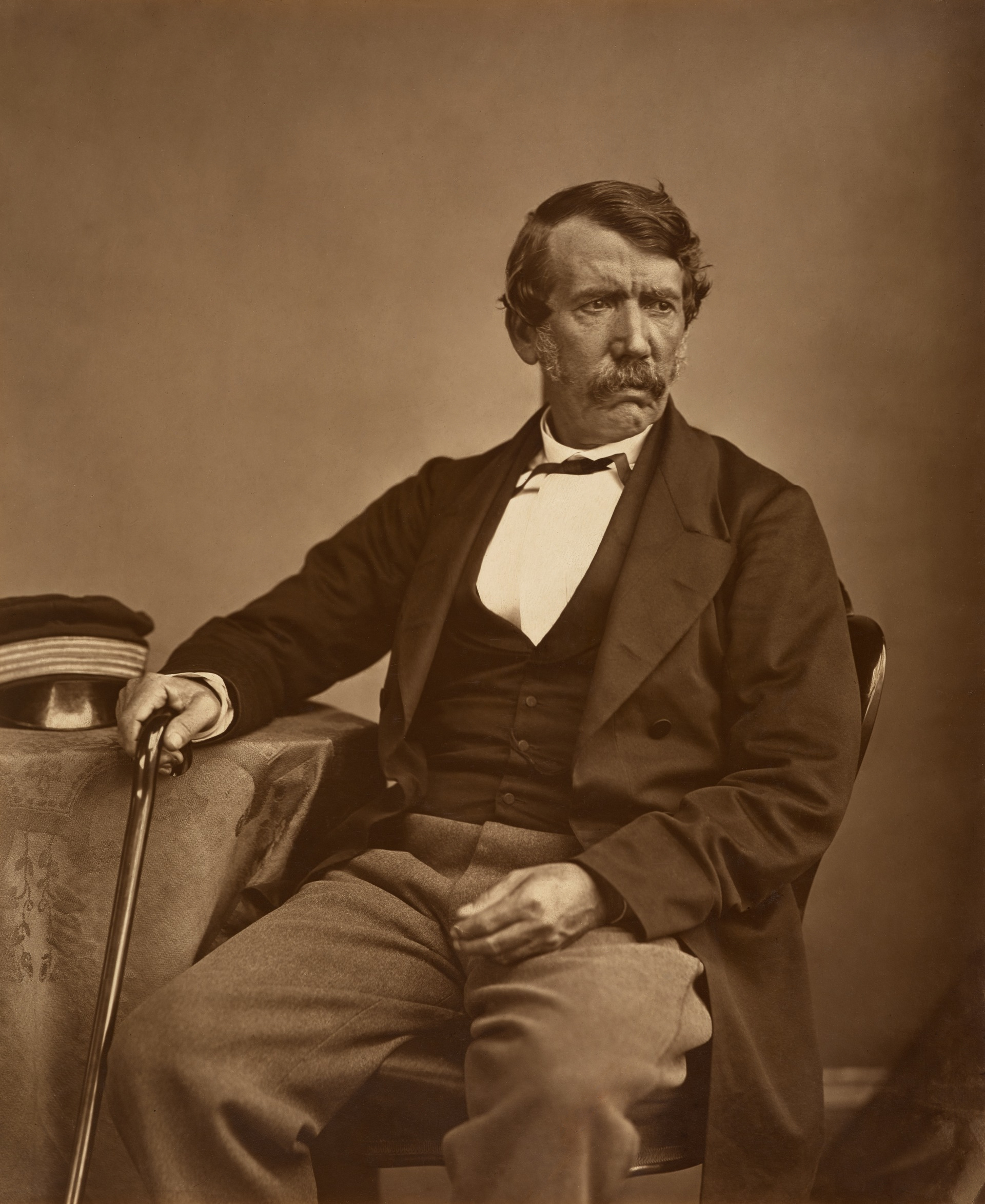

Creeping with awe to the verge, Livingstone peered down into a large rent made from bank to bank of the broad Zambezi, a stream a thousand yards broad leaping down a hundred feet and then compressed into fifteen or twenty yards.
David Livingstone
Livingstone wrote that no one could imagine the beauty of the view from anything witnessed in England; it had never been seen before by European eyes, and scenes so lovely must have been gazed upon by angels in their flight.
David Livingstone
Livingstone observed that two bright rainbows formed on the dense white cloud in the fissure beside the island, and a jet of vapour mounted 200 or 300 feet before condensing and returning as a constant shower.
David Livingstone
8. The Victoria Falls Bridge
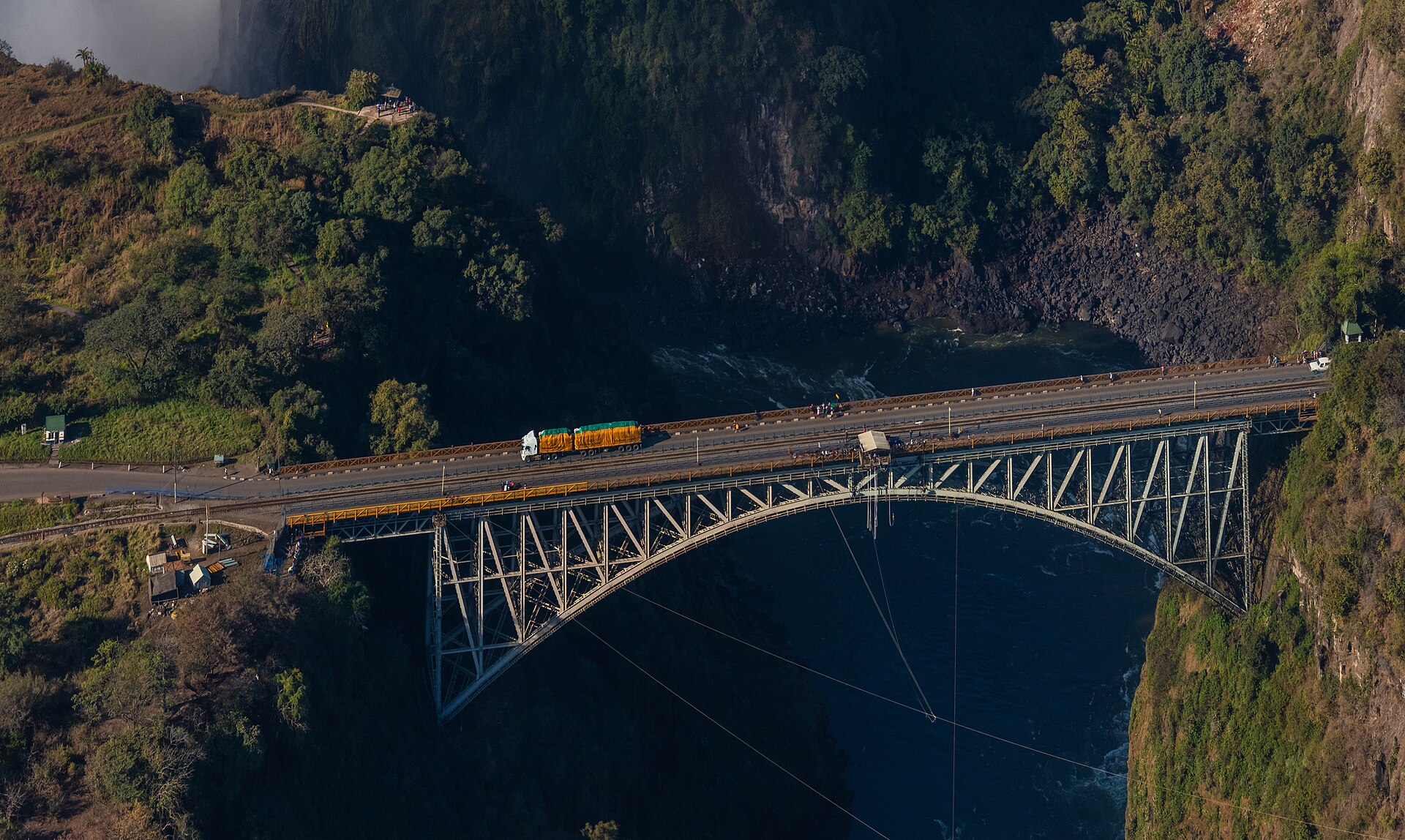
The Victoria Falls Bridge was completed in 1905, a steel parabolic arch with a span of 198 m and a deck standing 128 m above the river. At the time of its opening it was the highest bridge in the world. It connects Zimbabwe and Zambia, the Zambezi river forming the border between the two countries.
Cecil Rhodes instructed that the bridge be built across the Zambezi where the trains, as they pass, would catch the spray from the falls. Its components came from Britain, were shipped to Mozambique and carried to the site by rail. Workers fired a rocket with a thin cable across the gorge, the final cable weighing five tonnes.
9. Tourism and Visitor Experience
The Rain Forest, a 30 ha area opposite the falls, was fenced in 1986 and has become the parks authority's prime revenue generator, drawing around 400,000 visitors in 2019 who generated over 9.5 million US dollars through entry fees. The forest and surrounding grassland have approximately 3.5 km of concrete paths with 16 official viewpoints. Previous studies capped sustainable annual visitor numbers at 100,000 to 150,000, but 1,700 visitors per day were recorded over Christmas 2013 — far above the cap.
Different seasons give different experiences: the peak flood is around March and April when spray can hide the full width, while by November and December parts of the falls dry up and the basalt cliffs and abyss can be fully appreciated.
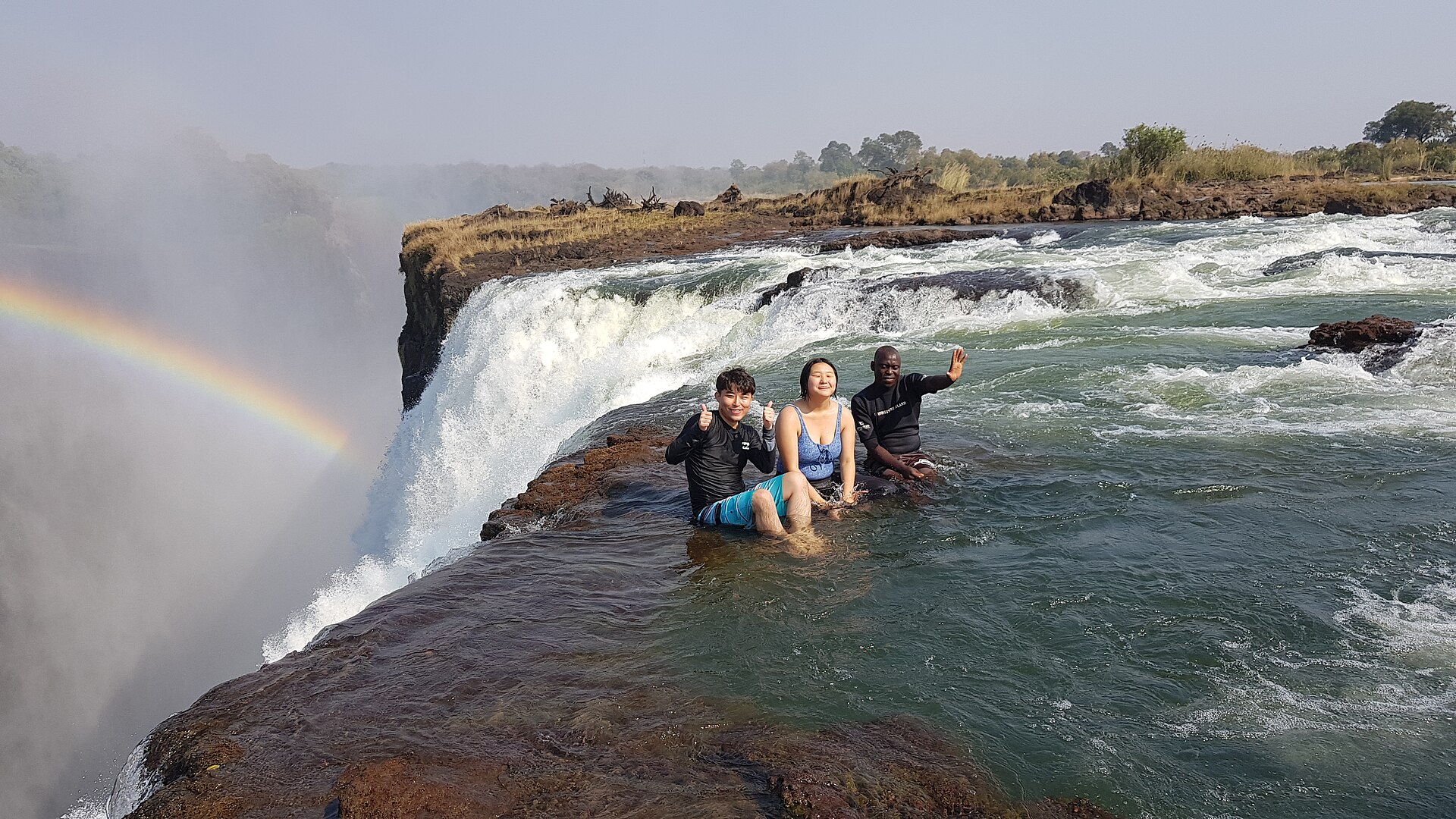
The area offers bungee jumping, white water rafting, abseiling and river boat cruises, and its rainforest receives constant spray, creating a unique ecosystem that is a botanist's dream and bird lovers' paradise. The park covers about 23.4 square kilometres and has a dense rainforest watered by spray from the falls; the area is mainly populated by baboons, warthogs and monkeys, with vegetation including ferns, palms, liana vines and mahogany. The park incorporates the Eastern Cataract of Victoria Falls, a section of lush rainforest sustained by the waterfall's life-giving spray where smaller antelope and warthog live.
10. Conservation Concerns
Concerns include the proposed damming of Batoka Gorge, whose lake could affect the gorges and reach into the Victoria Falls National Park, and the constant noise of helicopter flights over the gorge which could affect nesting raptors such as the Taita Falcon. 4
Zambia and Zimbabwe, with the Zambezi River Authority, committed to a geomorphological and geological baseline survey of the gorge environment, with follow-up surveys every two years to detect any changes possibly attributable to the proposed Batoka Gorge dam. 11Mosi-oa-Tunya / Victoria Falls World Heritage Property — State of Conservation Report, December 2025 · Zimbabwe Parks and Wildlife Management Authority / National Heritage Conservation Commission (Zambia) ↗ The state parties also report ongoing impact assessments with alternative scenarios designed to avoid adverse impacts of the Batoka Gorge Hydro Electric Scheme on the Outstanding Universal Value of the property. 11
11. Timeline: from the Batoka basalts to the joint management era
- c. 180 million years agoKaroo volcanism lays the Batoka basaltDuring the Jurassic, lava flows of Karoo age built the layered Batoka basalt that now forms the bedrock beneath the falls and the gorges below them.
- c. 3 million years agoHomo habilis stone artefactsStone artefacts of Homo habilis dating about three million years have been found near the falls in the property's banded basalt, Kalahari sandstone and chalcedony.
- c. 2 million years agoThe modern erosion phase beginsSince the uplifting of the Makgadikgadi Pan some two million years ago the Zambezi has been cutting through east-west fissures in the basalt plateau, forming a series of retreating falls.
- 1851Livingstone first hears of the fallsSebetwane, leader of the Makololo, met Livingstone in 1851 and asked him whether his country had 'smoke that sounds'; the explorer first heard of the great waterfall the same year.
- 16 November 1855Livingstone reaches the fallsDavid Livingstone became the first European to see the falls, naming them for Queen Victoria after landing on the island at the lip of the falls now called Livingstone Island.
- November 1857Missionary Travels publishedLivingstone published an account of his journey in Missionary Travels in South Africa, which earned him a considerable sum.
- 9 August 1860Livingstone returns and measures the fallsDuring his Zambezi expedition Livingstone revisited the falls and made an accurate measurement of their height by lowering a rope weighted with bullets over the precipice.
- 1898First buildings at the future town siteThe first storage and rest huts in the original village were built by Albert Giese on the south bank of the Zambezi.
- 11 April 1905Victoria Falls Bridge completedThe steel-arch bridge just below the falls, the brainchild of Cecil Rhodes, was completed after 14 months of construction, and the township of Victoria Falls grew up in connection with it.
- 1930Bridge adapted for road trafficThe bridge was altered to carry automobile traffic as well as trains.
- 1952Victoria Falls National Park formedVictoria Falls National Park was formed by combining the Victoria Falls Game Reserve in Zimbabwe and the Special Area in Zambia, with the Victoria Falls Trust made responsible for the area.
- 1972Mosi-oa-Tunya National Park foundedThe national park on the Zambian side, one of the country's smallest, was founded in 1972 and today protects white rhinos among other wildlife.
- 15 December 1989World Heritage inscriptionMosi-oa-Tunya / Victoria Falls was inscribed on the World Heritage List under criteria (vii) and (viii) as a transboundary property of Zambia and Zimbabwe.
- November 2007Joint Integrated Management Plan approvedZambia and Zimbabwe approved the first Joint Integrated Management Plan for the property, with joint ministerial, technical and site management committees.
- 30 June 2025Updated JIMP 2025–2030 submittedThe states parties jointly validated and submitted the updated Joint Integrated Management Plan 2025–2030 for review, a framework addressing tourism pressure, infrastructure, biodiversity and climate resilience.
References (21)
- 1Mosi-oa-Tunya / Victoria Falls — UNESCO World Heritage Centre WebView source
- 2Mosi-oa-Tunya / Victoria Falls — Geoheritage Site — International Union of Geological Sciences (IUGS) WebView source
- 3The Victoria Falls — Zambia Tourism Agency Web↩View source
- 4Zambezi – Victoria Falls National Parks Management Plan 2024–2034 — Zimbabwe Parks and Wildlife Management Authority 2024 Web↩View source
- 5Victoria Falls (waterfall, Zambia-Zimbabwe) — Encyclopaedia Britannica Web↩View source
- 6River Flows — Zambezi River Authority Web↩View source
- 7Victoria Falls, Zambezi River — Earth Observatory Image of the Day — NASA Earth Observatory WebView source
- 8Mosi-oa-Tunya / Victoria Falls — World Heritage Datasheet — UNEP-WCMC / IUCN Web↩View source
- 9Geography — Zambezi River Authority WebView source
- 10Mosi oa Tunya National Park — Zambia Tourism Agency WebView source
- 11Mosi-oa-Tunya / Victoria Falls World Heritage Property — State of Conservation Report, December 2025 — Zimbabwe Parks and Wildlife Management Authority / National Heritage Conservation Commission (Zambia) 2025 Web↩View source
- 12Mosi-oa-Tunya / Victoria Falls World Heritage Property — State of Conservation Report 2024 — Zambia and Zimbabwe (States Parties), via UNESCO World Heritage Centre 2024 WebView source
- 13Livingstone Sees the Victoria Falls (Research Starter) — EBSCO Information Services (Mark C. Herman) Web↩View source
- 14The Smoke That Thunders — David Livingstone Birthplace Museum Web↩View source
- 15Missionary Travels and Researches in South Africa (David Livingstone, 1857) — Project Gutenberg 1857 Web↩View source
- 16Cape to Cairo railway and the Victoria Falls Bridge — Institution of Civil Engineers (ICE) WebView source
- 17Victoria Falls Bridge — International Historic Civil Engineering Landmark — American Society of Civil Engineers (ASCE) WebView source
- 18Victoria Falls — Zimbabwe Tourism Authority WebView source
- 19Victoria Falls National Park — Zimbabwe Parks and Wildlife Management Authority WebView source
- 20Victoria Falls (township, Zimbabwe) — Encyclopaedia Britannica WebView source
- 21Construction of the Victoria Falls Bridge and the railway line are completed — South African History Online (SAHO) WebView source