Mount Fuji
Japan's highest mountain and most sacred volcano: its geology, its UNESCO World Heritage landscape of shrines and pilgrimage routes, and the rules that govern climbing it today.
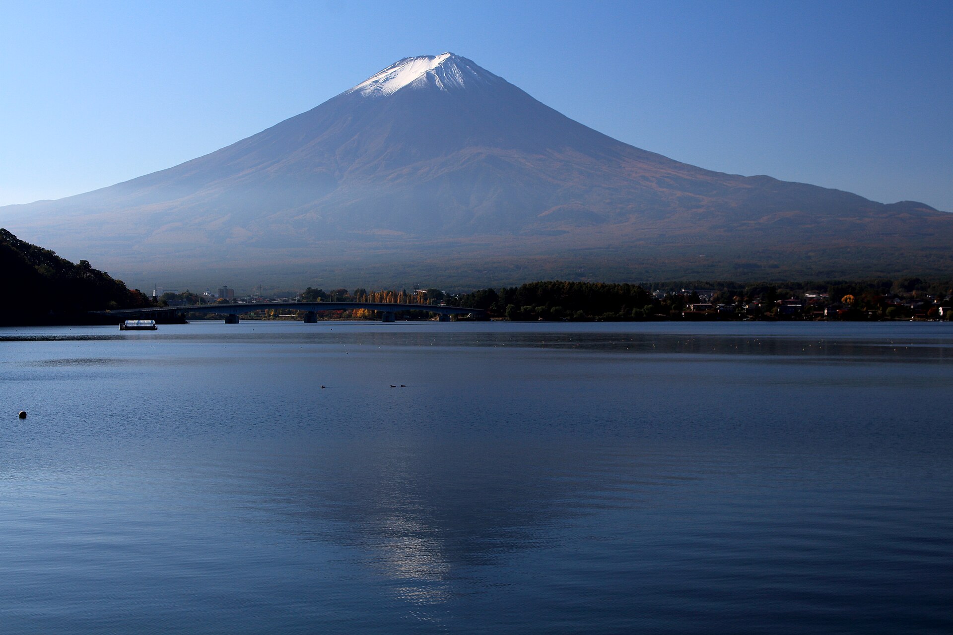
Mount Fuji (Fujisan) is a 3,776-metre stratovolcano in Yamanashi and Shizuoka prefectures, about 100 km west of Tokyo, and the highest mountain in Japan. It has erupted more than 15 times since 781 but has been dormant since the Hōei eruption of December 1707, which dropped ash on Edo. Revered in Shinto and Buddhist practice and celebrated by Hokusai and Hiroshige, it was inscribed in 2013 as the UNESCO World Heritage site Fujisan, sacred place and source of artistic inspiration, made up of 25 component sites. Climbing is now regulated: the Yoshida Trail season runs from 1 July to 10 September with a 4,000-yen hiking fee, a 4,000-climber daily cap and a gate closed from 2 PM to 3 AM.
In this article
- 1Overview
- 2Geography and Setting
- 3Geology and Volcanic History
- 4Cultural and Religious Significance
- 5Mount Fuji in Art
- 6World Heritage and Protected Status
- 7Climbing and Access
- 8Hazards and Risk Management
- 9Key Dates
- 10Timeline: from the first eruptions to the 2026 climbing season
- 11Frequently asked questions
- 12Knowledge graph
Overview
Mount Fuji is the highest mountain in Japan, rising to 3,776 m (12,388 ft) and known for its graceful conical form. It lies in Yamanashi and Shizuoka prefectures of central Honshu, about 100 km west of Tokyo. The mountain is a composite stratovolcano of the Izu Volcanic Arc.
1. Geography and Setting
Mount Fuji stands in the Yamanashi and Shizuoka prefectures of central Honshu, with the Smithsonian Global Volcanism Program recording its coordinates at 35.361 degrees north and 138.728 degrees east. Its southern slopes reach down to Suruga Bay, and the mountain's base has a circumference of about 78 miles (125 km). At the top, the summit crater measures about 1,600 feet (500 m) wide and 820 feet (250 m) deep.
The Fuji Five Lakes lie arrayed around the northern side of the mountain — Kawaguchiko, Saiko, Yamanakako, Shojiko and Motosuko — and serve as prime destinations for water sports, cycling and hiking. The Oshino-Hakkai springs are fed by Mount Fuji snow water filtered through underground lava over about twenty years. Diamond Fuji, the spectacle of the sun shining on the summit at sunset, can be observed from Lake Yamanaka for about four and a half months from autumn to winter.
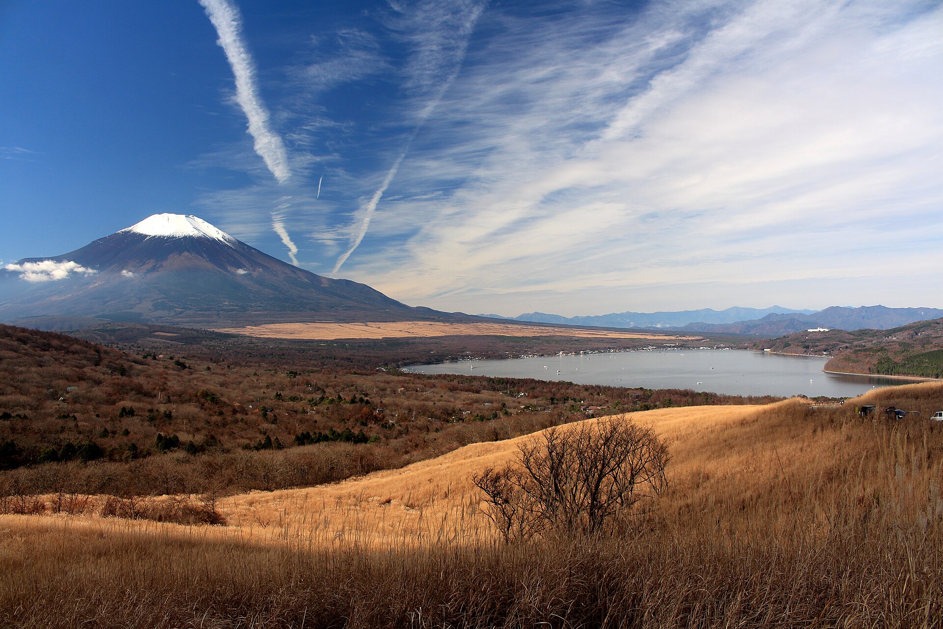
At the summit conditions are alpine, with average temperatures from about minus 19 degrees Celsius in winter to roughly 6.8 degrees Celsius in summer. It may be steamy and hot when a climb begins, but the summit of Fuji can be rainy, windy and below freezing even in summer, and the incline and loose volcanic rock make injuries more likely on the descent.
2. Geology and Volcanic History
Mount Fuji is a composite stratovolcano whose steep, conical profile results from numerous layers of lava and debris from explosive eruptions, including ash, cinders and volcanic bombs, that build up over time. It is considered active and has erupted more than 15 times since 781 CE.
The most recent major eruption took place in December 1707 and its ash darkened the midday sky as far as Edo, now Tokyo, and buried temples and dwellings near the mountain. The Plinian Hoei eruption of AD 1707 was the most recent eruption at Fuji, occurring on the southeastern flank 49 days after a magnitude 8 to 9 earthquake along the Nankai trough.
Climbers must undertake the ascent knowing that Mount Fuji is an active volcano and that there is a possibility of eruption.
3. Cultural and Religious Significance
Climbing Mount Fuji was once viewed as a religious pilgrimage to honour the spirit of one of the most beautiful and iconic peaks on the planet. The Yoshida-Guchi climbing trail officially starts at Kita-Guchi Hongu Fuji Sengen Shrine, and the traditional trail from the base to the 5th station is open and free to climb year-round.
The prefectural government decided to control climbers by setting up a gate at the entrance of the trail, making part of the trail and the descent road a prefectural facility. These measures include providing information and education on environmental care and safe climbing, maintaining public and mountain lodge toilets and regulating private cars at the starting points of mountain trails.
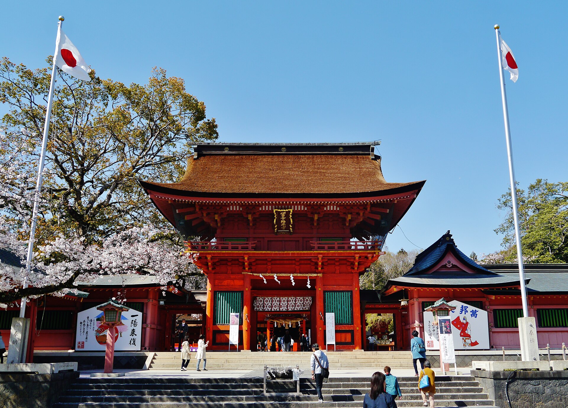
Within the Fuji-Hakone-Izu National Park are three Japanese Geoparks: Hakone, Izu Peninsula and Izu Oshima Island.
4. Mount Fuji in Art
Mount Fuji's place in Japanese art reaches back to the eleventh century, and by the nineteenth century the mountain had become an internationally recognized emblem of Japan through the medium of woodblock printing. That circulation of images carried Japanese aesthetics into Western art and shaped its later development.
The high point of the Japanese landscape print is generally identified with Katsushika Hokusai's Thirty-Six Views of Mount Fuji, issued between 1826 and 1833, the set of views by which the mountain is best known. Hokusai was born in Edo in October 1760 and died in the same city on 10 May 1849, at the age of eighty-eight.
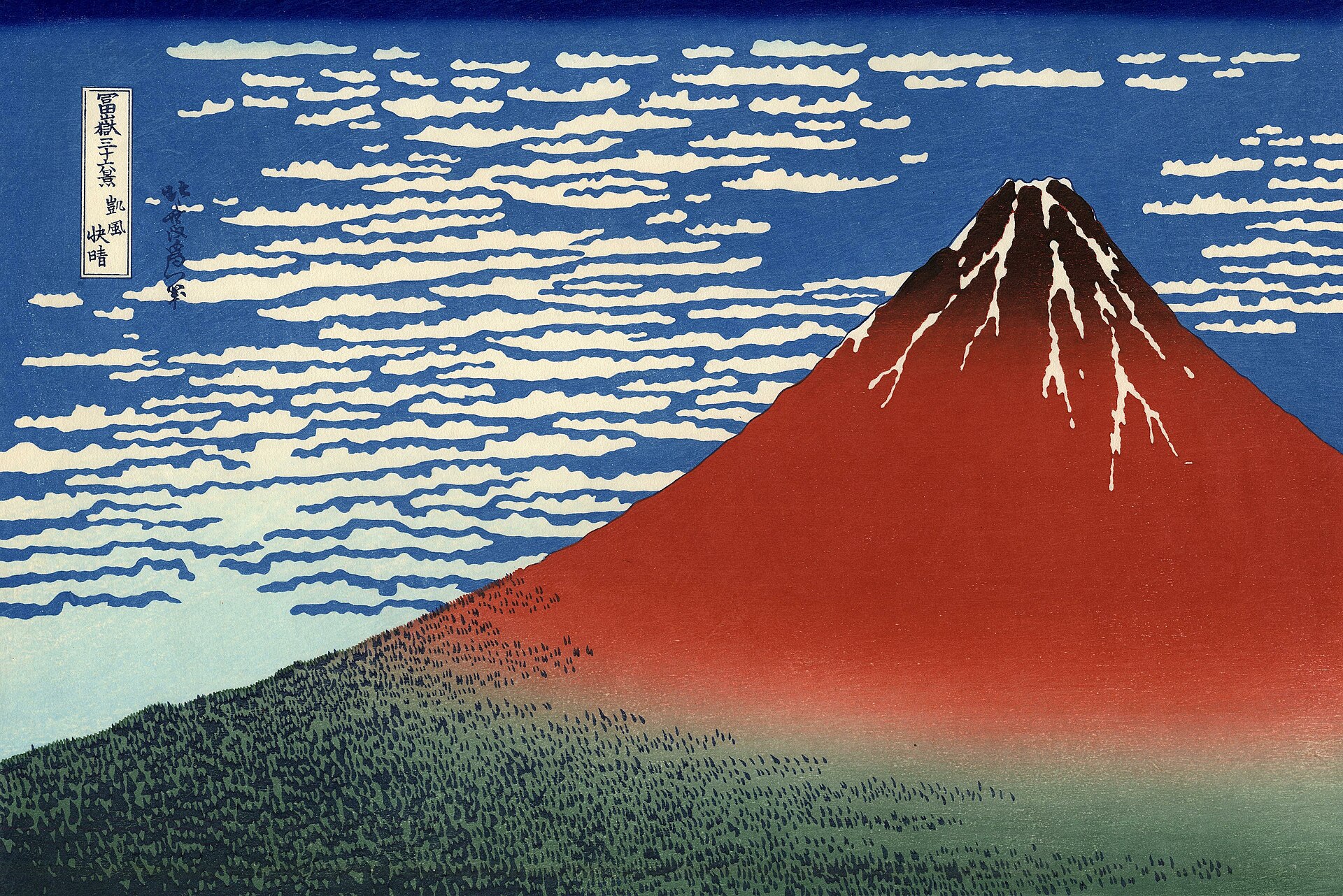

Within that series stands the Great Wave, a woodblock print in ink and colour on paper dated to about 1830 to 1832 and measuring 25.7 by 37.9 centimetres. In the composition the mountain is reduced to a small triangular mound set inside the hollow of the cresting wave. The print is said to have inspired Debussy's La Mer and Rilke's Der Berg.
5. World Heritage and Protected Status
On the upper 1,500-metre tier of the 3,776-metre mountain, pilgrim routes and crater shrines were inscribed together with sites around the base, including Sengen-jinja shrines, Oshi lodging houses, lava tree moulds, lakes, springs and waterfalls revered as sacred.
The Ministry of the Environment, the Shizuoka and Yamanashi prefectures, related municipalities and mountain lodges work together on environmental measures for the Mount Fuji area of Fuji-Hakone-Izu National Park. The mountain's cultural standing was formally acknowledged when the property was inscribed on the World Heritage list in 2013 under criteria (iii) and (vi), with a property area of 20,702.1 hectares and a buffer zone of 49,627.7 hectares.
6. Climbing and Access
Four main trails lead up the mountain — Yoshida, Subashiri, Gotemba and Fujinomiya — and all of them begin at the fifth station. The official climbing season runs from 1 July to 10 September on the Yoshida trail, when the mountain huts are open and all services are available at the Subaru Line 5th Station. Climbing during the off-season, from 11 September to 30 June, above the 5th station is strictly prohibited.
The climb from the fifth station to the summit covers roughly 6 km with 1,500 m of elevation gain, and most climbers take about 5 to 7 hours to ascend and about 3 to 4 hours to descend.
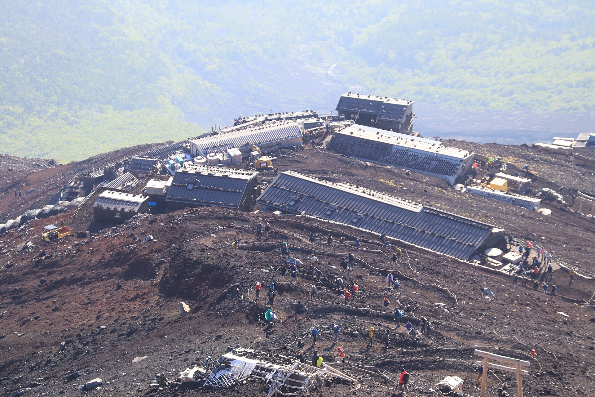
A hiking fee of 4,000 yen per person per climb applies on the Yoshida Trail, and it is also charged to climbers using the descending trail from another gate. Mountain huts typically cost around 15,000 to 20,000 yen per person in the 2026 season. A daily cap of 4,000 climbers from the fifth station applies, with the Fuji-Subaru Line fifth station gate closed once the limit is reached, and the gate is closed daily from 2 PM to 3 AM, with only climbers holding a mountain hut reservation and having paid the entrance fee permitted after closure. Since 2014 Yamanashi Prefecture has asked climbers above the fifth station for a cooperation fee of 1,000 yen, and it decided to add a toll fee of 2,000 yen for the trail. Climbers are asked not to attempt overnight climbs without staying in mountain huts, avoiding so-called bullet climbs.
About 300,000 mountaineers visit during the summer, with up to 10,000 people climbing each day. Fujiyoshida City describes Mount Fuji as the most ascended peak in the world, climbed by people of all ages and abilities from around the world. Visitors to the fifth station reached 5.06 million in 2019, more than double the figure recorded in 2013 when Fuji was registered as a World Heritage site.
7. Hazards and Risk Management
Fuji is an active basaltic volcano near the Tokyo metropolitan area, and future eruptions could have serious nationwide impacts. An eruption similar in scale to the Hoei event would cause great impacts today, especially through volcanic ashfall across the nation and the nearby Tokyo metropolitan area about 100 km to the east of the volcano. Scientists have compiled the 17 most prominent steepest-descent paths for lava flows on Fuji, and each path has its own evacuation route.
8. Key Dates
-
2000–2001Deep low-frequency earthquake swarmA deep low-frequency earthquake swarm occurred under Fuji.2Fujisan (Volcano Number 283030) · Smithsonian Institution, Global Volcanism Program ↗
-
11 March 2011Tohoku megathrust and aftershockThe 2000–2001 swarm was followed by the Tohoku megathrust, and an aftershock of magnitude 5.9 was centred below the volcano.2
-
1780–1820Steam observed at the summitNo further eruptions have occurred at Mount Fuji since 1707, while steam was observed at the summit between 1780 and 1820; the volcano is still considered active.7Mount Fuji, Japan · NASA Earth Observatory ↗
9. Timeline: from the first eruptions to the 2026 climbing season
- 286 BCE (tradition)Traditional date of Fuji's formationAccording to tradition the volcano was formed in 286 BCE by an earthquake, though geological study shows a much longer history of eruptions.
- 713 CEFirst written record of the nameThe name appears as Fuji no Yama in the Hitachi no kuni fudoki, an early Japanese government record and the mountain's first known written mention.
- 864-866 CEJogan eruption and the Aokigahara lava flowThe Jogan eruption on the lower northwestern flank was the largest at Fuji in the last 5,600 years and produced the Aokigahara lava flow.
- 12th centuryMount Fuji becomes a centre of ascetic BuddhismFujisan became a centre of training for ascetic Buddhism that included Shinto elements, and a temple was established near the summit.
- 1603-1867 (Edo period)The Fuji-ko pilgrimage movementDuring the Tokugawa period the Fuji-ko religious movement promoted pilgrimage to the summit, and organizations were established to support pilgrims with routes, huts and shrines.
- December 1707The Hoei eruption, Fuji's most recentThe eruption of December 1707 opened Hoei Crater on the southeastern flank, 49 days after a magnitude-8.4 earthquake, and its ash darkened the midday sky as far away as Edo (Tokyo).
- 1826-1833Hokusai's Thirty-six Views of Mount FujiKatsushika Hokusai published the woodblock print series Thirty-six Views of Mount Fuji, which helped make the mountain an internationally recognized icon.
- 1868Women allowed to climb the mountainWomen had been barred from climbing Mount Fuji; the prohibition ended with the Meiji Restoration, after which the climb opened to all pilgrims and visitors.
- 1936Fuji-Hakone-Izu National Park designatedMount Fuji became the major feature of the newly designated Fuji-Hakone-Izu National Park, which now stretches across four prefectures.
- 2000-2001Deep low-frequency earthquake swarmDeep low-frequency earthquakes beneath Fuji Volcano prompted the Japanese government to found the Review Committee of Volcanic Hazard Mitigation of Fuji Volcano.
- 2004First eruption hazard mapThe first edition of the Fuji Volcano hazard map was published in 2004, based on the findings available at that time.
- June 2013UNESCO World Heritage inscriptionFujisan, sacred place and source of artistic inspiration was inscribed on the UNESCO World Heritage List as a serial cultural property of 25 component sites.
- 2014Conservation cooperation fee introducedYamanashi Prefecture began asking climbers above the fifth station for a voluntary conservation cooperation fee of 1,000 yen.
- March 2021Hazard map revisedShizuoka and Yamanashi prefectures updated the Fuji Volcano hazard map in March 2021, drawing on a revised geological map of the volcano.
- 2026 seasonRegulated climbing season and 4,000-yen feeFor the 2026 season the Yoshida Trail ran from 1 July to 10 September, with a 4,000-yen hiking fee, a 4,000-climber daily cap and a gate closed from 2 PM to 3 AM.
10. Frequently asked questions
How old is Mount Fuji, and what built it?
The age of Fuji is disputed, but it seems to have formed during the past 2.6 million years, with the first eruptions and peaks probably occurring sometime after 700,000 years ago 1Mount Fuji | Height, History, Map, Elevation, & Facts · Encyclopaedia Britannica ↗. It is actually comprised of several overlapping volcanoes that began erupting in the Pleistocene Epoch, about 1.8 million to 10,000 years ago, and the currently active edifice is known as Younger Fuji 7.
What drives the volcano's activity?
Geologists note that the subduction of the Pacific Plate beneath the Philippine Plate at the Nankai Trough, which runs along Japan's southern coast, likely drives Mount Fuji's volcanic activity 1. The Geological Survey of Japan notes that Mount Fuji is not only the highest mountain in Japan but also one of the largest active volcanoes in the country 16Bulletin of the Geological Survey of Japan Vol.71 No.6 (2020) — cover photo: The Hoei crater of Fuji Volcano · Geological Survey of Japan (AIST) ↗.
How often does Fuji erupt, and how does that compare with other volcanoes?
Mount Fuji has erupted about 200 times in the last 5,600 years, more than 10 times the number of eruptions of a normal volcano 11Fureai 81: Changing Mt. Fuji, a World Treasure to bequeath to the future · Yamanashi Prefecture ↗. Geologists report that large eruptions at Fuji occur about every 500 years 1.
What was the largest eruption in recent geological time?
The Jogan eruption of AD 864 to 866 was the largest at Fuji in the last 5,600 years; it occurred on the lower northwestern flank and produced the Aokigahara lava flow 8Temporal variations of magma composition, eruption style and rate at Fuji Volcano, Japan · Earth, Planets and Space (Springer) ↗. At the northwestern foot of Mount Fuji stretches the Aokigahara-Jukai Forest, which spans about 30 square kilometres over a lava flow produced by volcanic activity about 1,200 years ago; the same activity formed the Fuji Five Lakes 5In the Foothills of Mount Fuji (Highlighting Japan, January 2018) · Public Relations Office, Government of Japan (Cabinet Office) ↗.
Is the volcano monitored, and how many people live within reach of an eruption?
Mount Fuji has been dormant since an eruption in 1707 and its last signs of volcanic activity occurred in the 1960s; because of concern about the damage an eruption would cause, it is monitored 24 hours a day 1. At Mount Fuji, in addition to tourists, approximately 560,000 residents live within its evacuation zones 15Volcano Watch — Mount Fuji workshop focused on how to manage tourism on active volcanoes · U.S. Geological Survey, Hawaiian Volcano Observatory ↗.
Where does the name "Fuji" come from, and how far back is the mountain recorded?
The name first appears as Fuji no Yama in the Hitachi no kuni fudoki of 713 CE, an early government record, and one theory derives it from an Ainu term meaning fire 1. Mount Fuji has long been considered sacred and has been the focus of religious devotion, particularly in the Shinto tradition, in which it is associated with the goddess Konohanasakuya-hime 1.
References (16)
- 1Mount Fuji | Height, History, Map, Elevation, & Facts — Encyclopaedia Britannica Web↩View source
- 2Fujisan (Volcano Number 283030) — Smithsonian Institution, Global Volcanism Program Web↩View source
- 3Fujisan, sacred place and source of artistic inspiration — UNESCO World Heritage Centre WebView source
- 4Mt. Fuji (Shizuoka) — Japan National Tourism Organization (JNTO) WebView source
- 5In the Foothills of Mount Fuji (Highlighting Japan, January 2018) — Public Relations Office, Government of Japan (Cabinet Office) 2018 Web↩View source
- 6Mt. Fuji — Japan National Tourism Organization (JNTO) WebView source
- 7Mount Fuji, Japan — NASA Earth Observatory Web↩View source
- 8Temporal variations of magma composition, eruption style and rate at Fuji Volcano, Japan — Earth, Planets and Space (Springer) Journal↩View source
- 9Announcement from Yamanashi Prefecture — Mt. Fuji Yoshida Trail — Yamanashi Prefecture (Official Website for Mt. Fuji Climbing) WebView source
- 10Climbing Fuji FAQ (Yamanashi Side, Yoshida-Guchi Trail) — Fujiyoshida City Office WebView source
- 11Fureai 81: Changing Mt. Fuji, a World Treasure to bequeath to the future — Yamanashi Prefecture Web↩View source
- 12Fuji-Hakone-Izu National Park — Ministry of the Environment, Japan WebView source
- 13Hokusai | Japanese Artist, Ukiyo-e Prints & Biography — Encyclopaedia Britannica WebView source
- 14Under the Wave off Kanagawa (The Great Wave), from the series Thirty-six Views of Mount Fuji — The Metropolitan Museum of Art WebView source
- 15Volcano Watch — Mount Fuji workshop focused on how to manage tourism on active volcanoes — U.S. Geological Survey, Hawaiian Volcano Observatory Web↩View source
- 16Bulletin of the Geological Survey of Japan Vol.71 No.6 (2020) — cover photo: The Hoei crater of Fuji Volcano — Geological Survey of Japan (AIST) 2020 Web↩View source