Mount Kilimanjaro
The highest mountain in Africa — a free-standing volcanic massif whose three peaks, five vegetation zones and shrinking summit glaciers have made it one of the world's most distinctive natural landmarks.
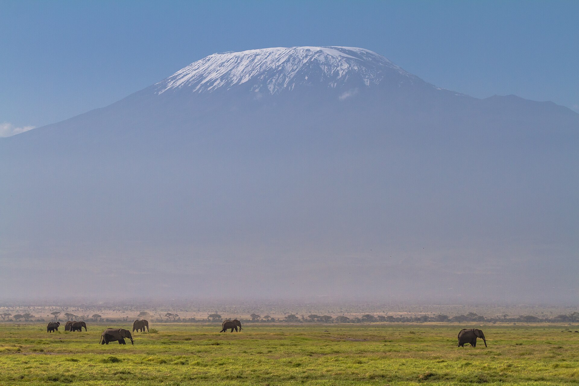
Mount Kilimanjaro is a volcanic massif in northeastern Tanzania whose central cone, Kibo, rises to 19,340 feet (5,895 metres), the highest point in Africa. The massif consists of three volcanoes — Kibo, Mawenzi and Shira — and its summit ice fields have retreated by roughly 85 percent since the early twentieth century, with the remaining ice projected to disappear by 2040. Kilimanjaro National Park, established in 1973 and inscribed as a UNESCO World Heritage site in 1987, draws tens of thousands of climbers each year, who ascend through five climate zones from bushland and rainforest to an arctic summit.
In this article
- 1Overview
- 2Topography and Volcanic Structure
- 3Name and Early Knowledge
- 4First Ascent and Climbing History
- 5National Park and World Heritage Status
- 6Vegetation Zones and Wildlife
- 7Glaciers and Ice Retreat
- 8Climbing Routes and Practicalities
- 9Tourism, Fees and Cultural Significance
- 10Key Facts
- 11Timeline: from the first sighting in 1848 to the projected ice-free summit
- 12Frequently asked questions
- 13Knowledge graph
Overview
Mount Kilimanjaro is a volcanic massif in northeastern Tanzania, near the border with Kenya and about 140 miles (225 km) south of Nairobi. Its central cone, Kibo, rises to 19,340 feet (5,895 metres) and is the highest point in Africa. The massif extends roughly 50 miles (80 km) east to west and consists of three principal extinct volcanoes: Kibo in the centre, Mawensi to the east, and Shira to the west.
1. Topography and Volcanic Structure
Kilimanjaro's mass is built from three distinct cones. Shira, the oldest, collapsed to form a plateau and stands at an altitude of 3,962 m on the broad WNW shoulder of the complex, its activity beginning during the Pliocene. Mawenzi, an extensively dissected Pleistocene peak with a sharp top, rises on the ESE flank. The central edifice is Kibo, whose summit crater and flank cones represent the most recent phase of volcanism at the mountain.
The age of Kilimanjaro's youngest volcanic material is 165,000 plus or minus 5,000 years before present. K-Ar dating placed the most recent volcanism, including formation of the present summit crater and flank cones, around 150-200 ka.
2. Name and Early Knowledge
The name Kilimanjaro is said to combine the Swahili word Kilima, meaning mountain, with the KiChagga word Njaro, loosely translated as whiteness, giving the name White Mountain. The mountain is sacred to the local Chagga people, who revere it as a source of life and fertility.
3. First Ascent and Climbing History
-
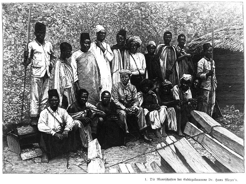
1888 and 1889Hans Meyer's expeditionsAt the time of Hans Meyer's expeditions in 1888 and 1889 the summit of Kibo was completely enveloped by an ice cap whose outlet glaciers cascaded in an unbroken arc across the western and southern slopes.6Satellite Image Atlas of Glaciers of the World — Glaciers of the Middle East and Africa (Professional Paper 1386-G) · U.S. Geological Survey ↗
-
1889First ascent of the Kibo summitThe Kibo summit was first reached in 1889 by the German geographer Hans Meyer and the Austrian mountaineer Ludwig Purtscheller.1Kilimanjaro | Height, Map, Country, & Facts · Encyclopaedia Britannica ↗
-
4 January 2006Rockfall at the Western BreachA rockfall on 4 January 2006 at the Western Breach took three climbers' lives and injured five others, prompting improvements to the route to minimize rockfall risk.3Kilimanjaro — Volcano Profile · Smithsonian Institution, Global Volcanism Program ↗

4. National Park and World Heritage Status
Kilimanjaro National Park was established in 1973. In 1987 the property was inscribed as a World Heritage Site by UNESCO under criterion (vii). The park is connected to Amboseli National Park, but corridors to Arusha National Park and Tsavo National Park have been encroached, impacting on wildlife migration.
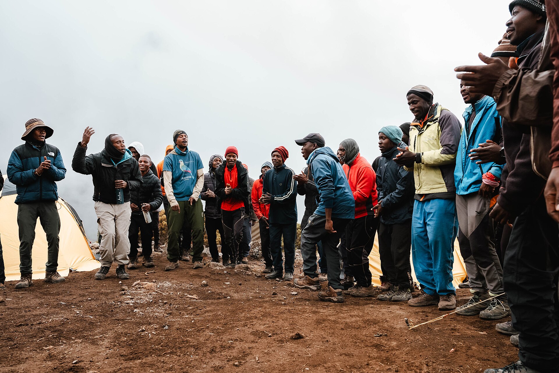
Within the park, single-use plastic is banned, weigh-ins ensure that porters are not overloaded, and rubbish is also weighed to deter littering.
5. Vegetation Zones and Wildlife
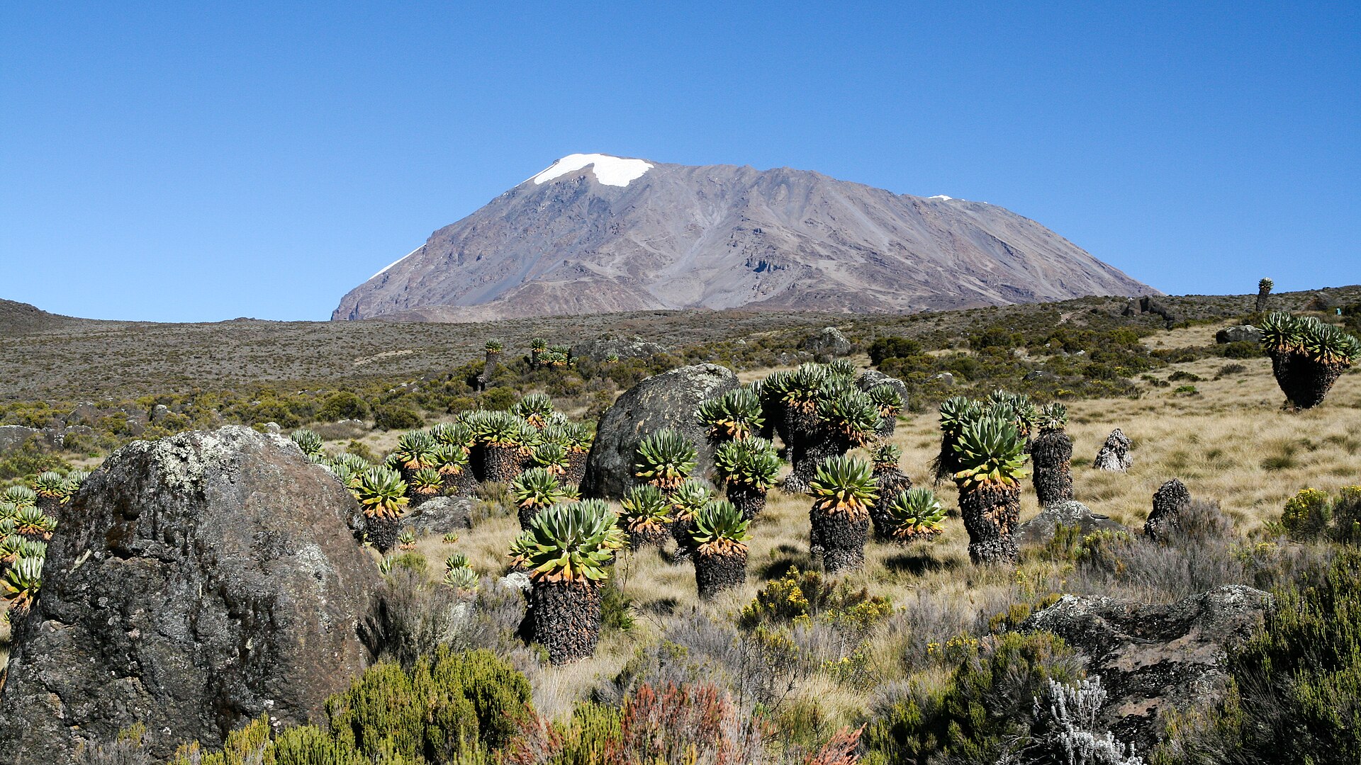
The mountain is climbed through five main vegetation zones, from lowest to highest: the lower slopes, the montane forest, the heath and moorland, the alpine desert, and the summit. The montane forests are lush cloud forest, with orchids and hidden streams, while the moorland and alpine desert zones are dotted with giant lobelias and senecios. Above 4,000 m a surreal alpine desert supports little life other than a few hardy mosses and lichen, before the last vegetation gives way to ice and snow. The trek likewise ascends through five corresponding climate zones, from bushland and rainforest to an icy arctic landscape at the top.
The forests of the southern slopes and the surrounding areas are home to elephants, buffalo, and eland, while smaller mammals include black and white colobus monkeys, blue monkeys, bushbuck, and duikers. The whole mountain, including the montane forest belt, is very rich in species, in particular mammals, many of them endangered. Below the national park boundary at the 2,700 m contour, cultivated footslopes give way to lush montane forest inhabited by elusive leopard and the endangered Abbot's duiker.
6. Glaciers and Ice Retreat
The present glacier ice on Kilimanjaro represents isolated remnants of a more extensive ice cap on Kibo, from which outlet glaciers extended hundreds of meters farther downslope in the late 1800s. Rising air temperatures due to global warming could be contributing to the ice loss, but an increasingly dry regional atmosphere starves the mountain of the fresh snow needed to sustain the ice fields.
Glacier area stood at 20.0 km2 in 1880 according to the USGS Earthshots record, and had fallen to 11.40 km2 by 1912. By 2011 the glacier area was 1.76 km2, a loss of about 85% since 1912.
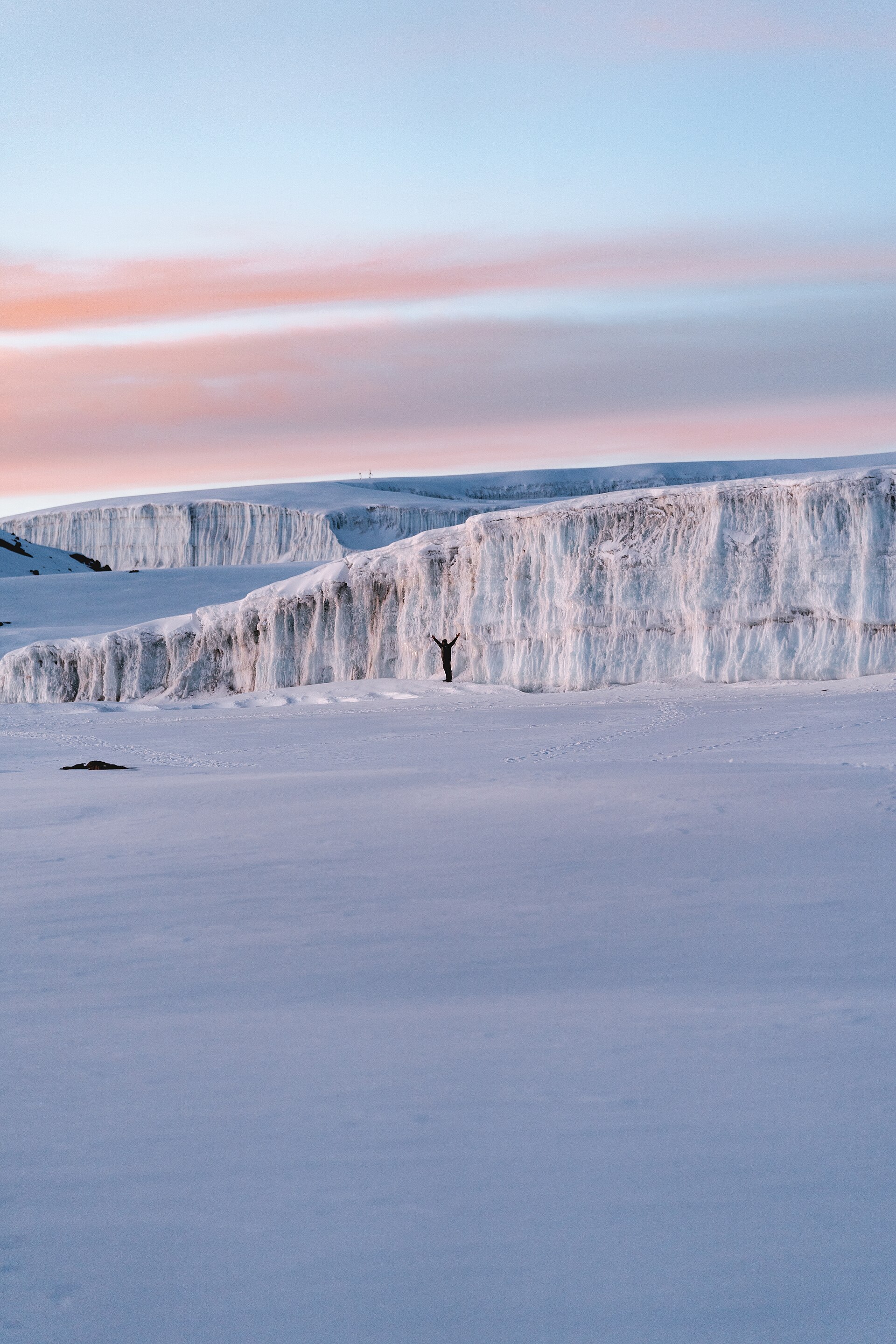
Linear extrapolation of the retreat implies the ice cover on the western slopes of Kilimanjaro will be gone before 2020, while the remaining ice bodies on the plateau and southern slopes will most likely disappear by 2040 in the study's extrapolation.
7. Climbing Routes and Practicalities
The park offers six usual trekking routes to the summit plus other more-demanding mountaineering routes, day or overnight hikes on the Shira plateau, nature trails on the lower reaches and trout fishing. The Marangu route is the busiest and the only route with huts, reachable from Moshi with one of the shortest climbs, while the longer Machame enables slower acclimatisation and the even longer Lemosho is quieter and has the best views.
Altitude sickness is the main risk on Kilimanjaro and the leading cause of death on the mountain, with symptoms above 2,500 metres ranging from headaches and nausea to potentially fatal pulmonary or cerebral oedemas.
8. Tourism, Fees and Cultural Significance
Kilimanjaro is Africa's highest mountain at 19,340ft, one of the Seven Summits and the world's highest standalone mountain, attracting more than 30,000 climbers annually. International adult entry fees for Kilimanjaro National Park are listed at $70 for adults and $20 for children, with East African residents paying TZS 20,000 per person.
9. Key Facts
| Attribute | Value |
|---|---|
| Location | Northeastern Tanzania, near the Kenya border, about 140 miles (225 km) south of Nairobi |
| Highest peak | Kibo (Uhuru Peak), 19,340 feet (5,895 metres) |
| Second-highest peak | Mawensi, 16,893 feet (5,149 metres) |
| Third peak | Shira ridge, 13,000 feet (3,962 metres) |
| Massif extent | Approximately 50 miles (80 km) east to west |
| Kibo caldera | 1.2 miles (2 km) across and about 980 feet (300 metres) deep |
| First ascent of Kibo summit | 1889, by Hans Meyer and Ludwig Purtscheller |
| World Heritage property area | 75,575 ha |
| Park size (TANAPA) | 1,712 square kilometres |
| Official climbing routes | Seven, with link-up combinations |
| Annual climbers | More than 30,000 |
| Youngest dated volcanic material | 165,000 ± 5,000 years before present |
The snow-clad dome of Kibo contains a caldera on its southern side, with an inner cone that displays residual volcanic activity1. The park was opened for tourism in 1977 and was named a Natural Wonder of Africa in 2013 by the awards programme4About Kilimanjaro National Park · Tanzania National Parks (TANAPA) ↗.
10. Timeline: from the first sighting in 1848 to the projected ice-free summit
- 1848Kilimanjaro sighted by European missionariesJohannes Rebmann and Johann Ludwig Krapf reached the mountain, though the news of snow-capped peaks so close to the Equator was not believed for more than a decade.
- 1889First ascent of the Kibo summitHans Meyer and Ludwig Purtscheller became the first people known to reach the highest peak of Kilimanjaro.
- 1912First thorough survey of the summit iceThe ice cap that crowned the mountain when first thoroughly surveyed in 1912 covered 11.40 km2, a figure later used to measure the century of retreat.
- 1930Southern and eastern slopes protectedA 2,286 square kilometre area in the southern and eastern Kilimanjaro region was designated, a forerunner of the later national park.
- 1973Kilimanjaro National Park establishedEstablished in 1973, the park initially comprised the whole of the mountain above the tree line and six forest corridors stretching down through the montane forest belt.
- 1977Kilimanjaro National Park opened for tourismThe park was officially opened for visitors four years after its establishment.
- 1987UNESCO World Heritage inscriptionKilimanjaro National Park was designated a UNESCO World Heritage site under criterion (vii) for its superlative natural phenomenon.
- 2005Park extended to include montane forestFollowing a 2005 extension, the National Park took in the whole of the natural montane forest that had been under Kilimanjaro Forest Reserve.
- 4 January 2006Fatal rockfall at the Western BreachA rockfall on Kibo's southwest face killed three climbers and injured five others, prompting safety improvements on the ascent route.
- 2011Ice cover measured at 1.76 km2Re-analysis of maps and satellite imagery put the remaining glacier extent at 1.76 km2, about 85 percent below its 1912 extent.
- 2012Northern ice field splits in twoThe northern ice field, which had been developing a hole since the 1970s, completely divided into two during a research expedition.
- 2013Named a Natural Wonder of AfricaThe park added the Natural Wonder of Africa recognition to its World Heritage status.
- projected 2040Projection of an ice-free KilimanjaroExtrapolation of the measured retreat and the IPCC assessment project that the remaining ice bodies on the plateau and southern slopes will most likely disappear by 2040.
11. Frequently asked questions
How did Kilimanjaro first become known to Europeans?
The Kilimanjaro formations became known to Europeans when they were reached in 1848 by the German missionaries Johannes Rebmann and Johann Ludwig Krapf, although the news of snow-capped mountains so close to the Equator was not believed for more than a decade.1
How large is the caldera at Kibo's summit?
How long has ice persisted on Kilimanjaro, and why?
Despite its location in the tropics, the dry and cold air at the top of Kilimanjaro has sustained large quantities of ice for more than 10,000 years.10Kilimanjaro's Shrinking Ice Fields · NASA Earth Observatory ↗ Studies of ice core samples show that Kilimanjaro's ice has persisted through multiple warm spells, droughts, and periods of abrupt climate change.10
What is the main mechanism by which the summit ice is being lost?
An energy balance study concluded that mass loss from the upper horizontal surfaces of the ice fields has been dominated by sublimation, although there is physical evidence of melting as well.13Glacier loss on Kilimanjaro continues unabated · Proceedings of the National Academy of Sciences ↗ Retreat of the tabular plateau glaciers is controlled primarily by solar radiation-induced ablation on the vertical cliffs that characterize them.12A century of ice retreat on Kilimanjaro: the mapping reloaded · The Cryosphere (Copernicus Publications) ↗
How many routes lead to the summit, and what do climbers need to know about altitude?
There is a network of seven official routes up Kilimanjaro, with some link-up combinations, varying in length, steepness, popularity and scenic variety.5Everything you need to know about climbing Mount Kilimanjaro · National Geographic Traveller (UK) ↗ An ascent of Kilimanjaro places the body at an altitude of 19,341 feet, where oxygen content is approximately 58% less than that of sea level.14Climbing Kilimanjaro · National Geographic ↗
When is the best time to climb, and how do temperatures vary?
The best times to climb Mount Kilimanjaro are the dry seasons, between January and March and from June to October, which offer the best chances of clear skies and dry conditions.5 At the base of Kilimanjaro temperatures can reach up to 30C, while at the summit they can drop to as low as -20C at night, with the temperature dropping by around 6C for every 1,000 metres of altitude gain.5
References (15)
- 1Kilimanjaro | Height, Map, Country, & Facts — Encyclopaedia Britannica Web↩View source
- 2Kilimanjaro National Park — The Roof of Africa — Tanzania National Parks (TANAPA) WebView source
- 3Kilimanjaro — Volcano Profile — Smithsonian Institution, Global Volcanism Program Web↩View source
- 4About Kilimanjaro National Park — Tanzania National Parks (TANAPA) Web↩View source
- 5Everything you need to know about climbing Mount Kilimanjaro — National Geographic Traveller (UK) Web↩View source
- 6Satellite Image Atlas of Glaciers of the World — Glaciers of the Middle East and Africa (Professional Paper 1386-G) — U.S. Geological Survey Web↩View source
- 7Kilimanjaro National Park — UNESCO World Heritage Centre WebView source
- 8Attractions | Kilimanjaro National Park — Tanzania National Parks (TANAPA) WebView source
- 9Mount Kilimanjaro National Park — Tanzania Tourist Board (tanzaniatourism.go.tz) WebView source
- 10Kilimanjaro's Shrinking Ice Fields — NASA Earth Observatory Web↩View source
- 11The Glaciers of Kilimanjaro (Earthshots) — U.S. Geological Survey, EROS Center WebView source
- 12A century of ice retreat on Kilimanjaro: the mapping reloaded — The Cryosphere (Copernicus Publications) 2013 Web↩View source
- 13Glacier loss on Kilimanjaro continues unabated — Proceedings of the National Academy of Sciences Journal↩View source
- 14Climbing Kilimanjaro — National Geographic Web↩View source
- 15Climate Change 2022: Impacts, Adaptation and Vulnerability — Chapter 9: Africa — Intergovernmental Panel on Climate Change 2022 WebView source