Nile River
The world's longest river, whose annual flood built ancient Egypt and whose control now pits eleven African states against one another.
The Nile flows northward for about 4,132 miles (6,650 kilometres) from the East African lakes to the Mediterranean, draining a basin of some 3,349,000 square kilometres across eleven countries. Its annual inundation made ancient Egypt possible: farmers planted as the flood receded, and the river served as the country's highway, calendar and measure of the year. The Aswan High Dam, completed in 1970, ended the flood and created Lake Nasser, while Ethiopia's Grand Ethiopian Renaissance Dam on the Blue Nile has reopened the old quarrel over who owns the river's water.
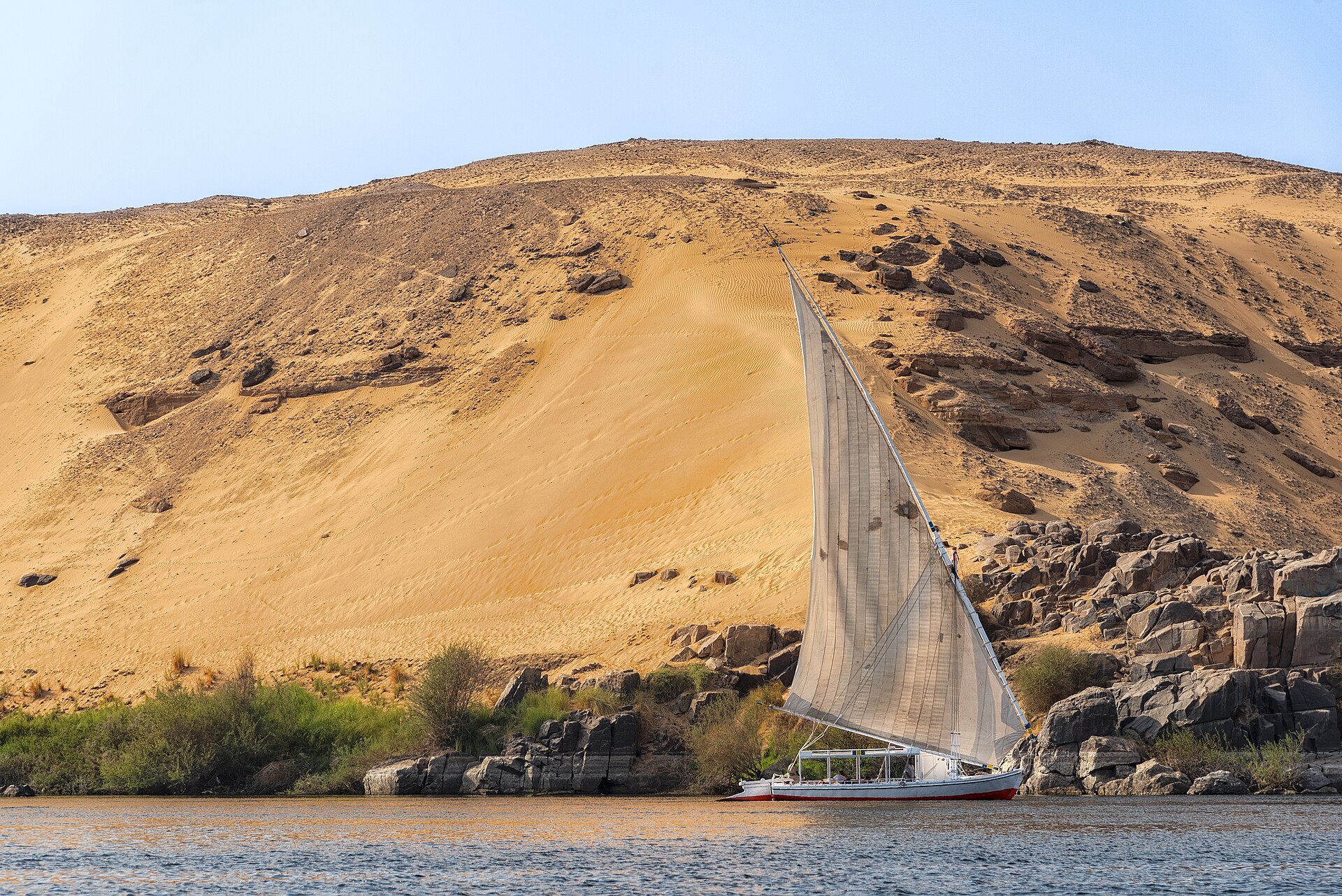
In this article
- 1Overview
- 2Course and Tributaries
- 3Drainage Basin and Riparian Countries
- 4The Nile in Ancient Egypt
- 5The Search for the Source
- 6The Aswan High Dam and the Taming of the Flood
- 7Water Allocation and Agriculture
- 8The Grand Ethiopian Renaissance Dam and Downstream Tensions
- 9Ecology and Heritage
- 10Flooding and Food Insecurity in Sudan
- 11Key Measurements
- 12Timeline: from the first settlements to the Grand Ethiopian Renaissance Dam
- 13Frequently asked questions
- 14Knowledge graph
Overview
The Nile is the longest river in the world, rising south of the Equator and flowing northward for about 4,132 miles (6,650 kilometres) to the Mediterranean Sea. The river's importance to life and culture along its course earned it the nickname the father of African rivers.
1. Course and Tributaries
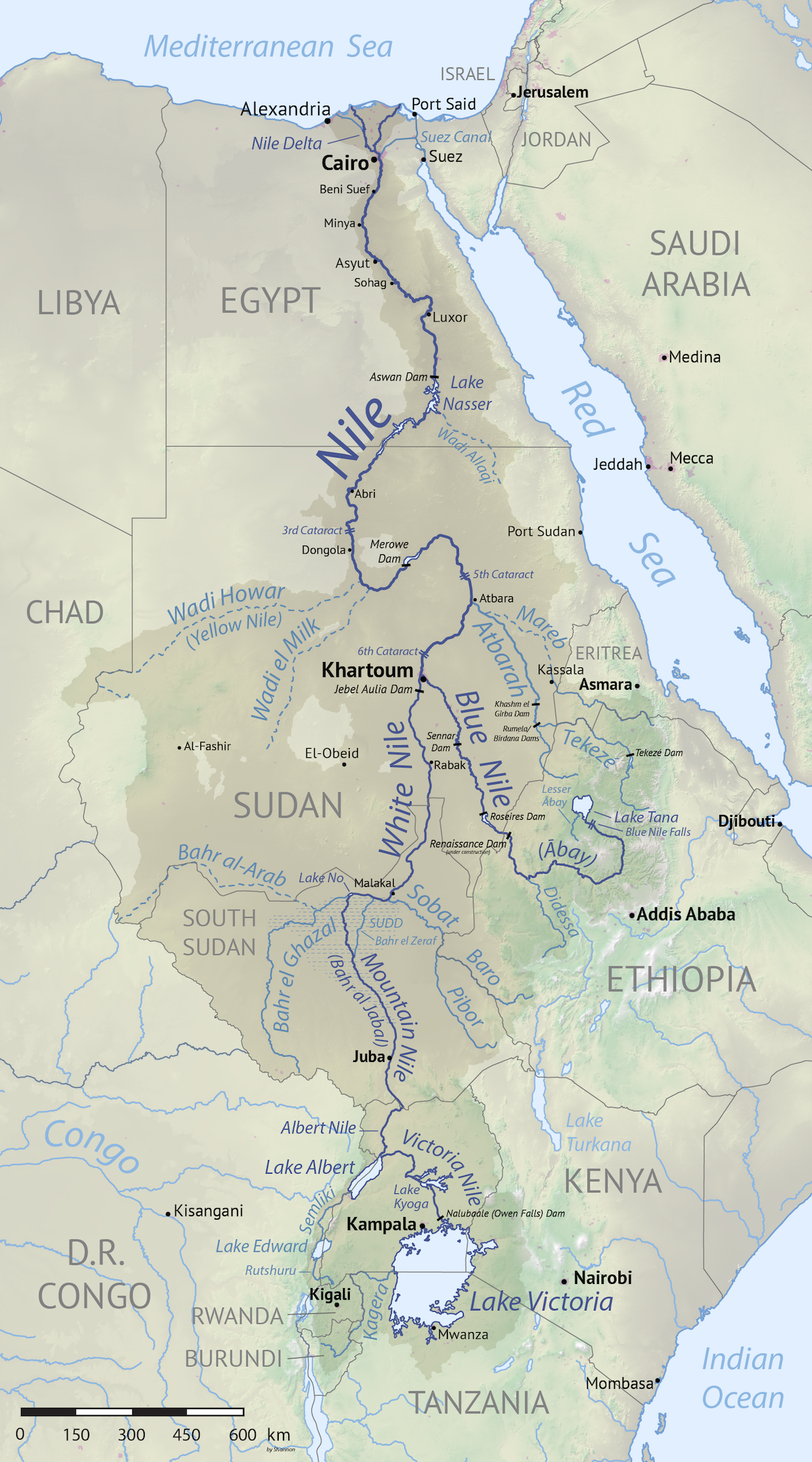
The Blue Nile rises at Lake Tana and joins the White Nile at Khartoum, and together with the Atbara and the Sobat it contributes between 70 and 90 percent of the Nile's total low and peak flows. Lake Victoria covers approximately 67,000 square kilometres and, together with other lakes downstream, regulates the White Nile. The Atbara and the Blue Nile, which together represent 80 percent of total Nile discharge, carry over 90 percent of the sediment load.
Ethiopia built the Grand Ethiopian Renaissance Dam on the Blue Nile, the tributary that supplies most of the water reaching the Nile, creating conflict with Egypt and Sudan downstream.
Dams such as the Aswan Dam tame the river and supply hydroelectric power, but silt that once enriched the delta now builds up behind the dam, and the delta is shrinking through erosion. The Aswan Low Dam, completed in 1902 and raised twice, in 1912 and 1933, stands 6 km downstream of the High Dam and was once one of the largest dams in the world, pierced by 180 sluices.
2. Drainage Basin and Riparian Countries
The drainage basin of the Nile covers 1,293,000 square miles (3,349,000 square kilometres), about one-tenth of the African continent. It extends across parts of Tanzania, Burundi, Rwanda, the Democratic Republic of the Congo, Kenya, Uganda, South Sudan, Ethiopia and Sudan, together with the cultivated part of Egypt.
Monsoon rains pour into the Ethiopian Highlands each year and flow down to the Blue Nile and White Nile, whose floodwaters can swamp communities as the rivers wind through Sudan and South Sudan. Abundant summer rainfall in Sudan and South Sudan from 2019 raised Lake Nasser's level, and record-breaking floods in Sudan in 2020 produced the highest level ever recorded there.
3. The Nile in Ancient Egypt
The modern name of the river derives from the Greek Nelios, meaning river valley, while the ancient Egyptians called it Ar or Aur, meaning Black, after the dark sediment it carried; the same word gave the land its oldest name, Kem or Kemi. There was no ancient Egyptian name for the river itself — it was simply the river. The Egyptians divided their world into Kemet, the black land of the Nile Valley, and Deshret, the red land of the desert.
The annual inundation covered the valley and delta in August and September, and the flood began in June at Aswan. The Egyptian calendar was adjusted to the Nile: New Year fell in mid July when the river began to rise, the star Sirius anchored the 365-day calendar, and the river defined three seasons — Flood (Akhet), Growth (Peret) and Harvest (Shemu). The flood was considered perfect when the waters rose fourteen or sixteen cubits at Memphis. A Nilometer tracked the rise and fall of the river in the flood season, letting Egyptians predict which crops would succeed.
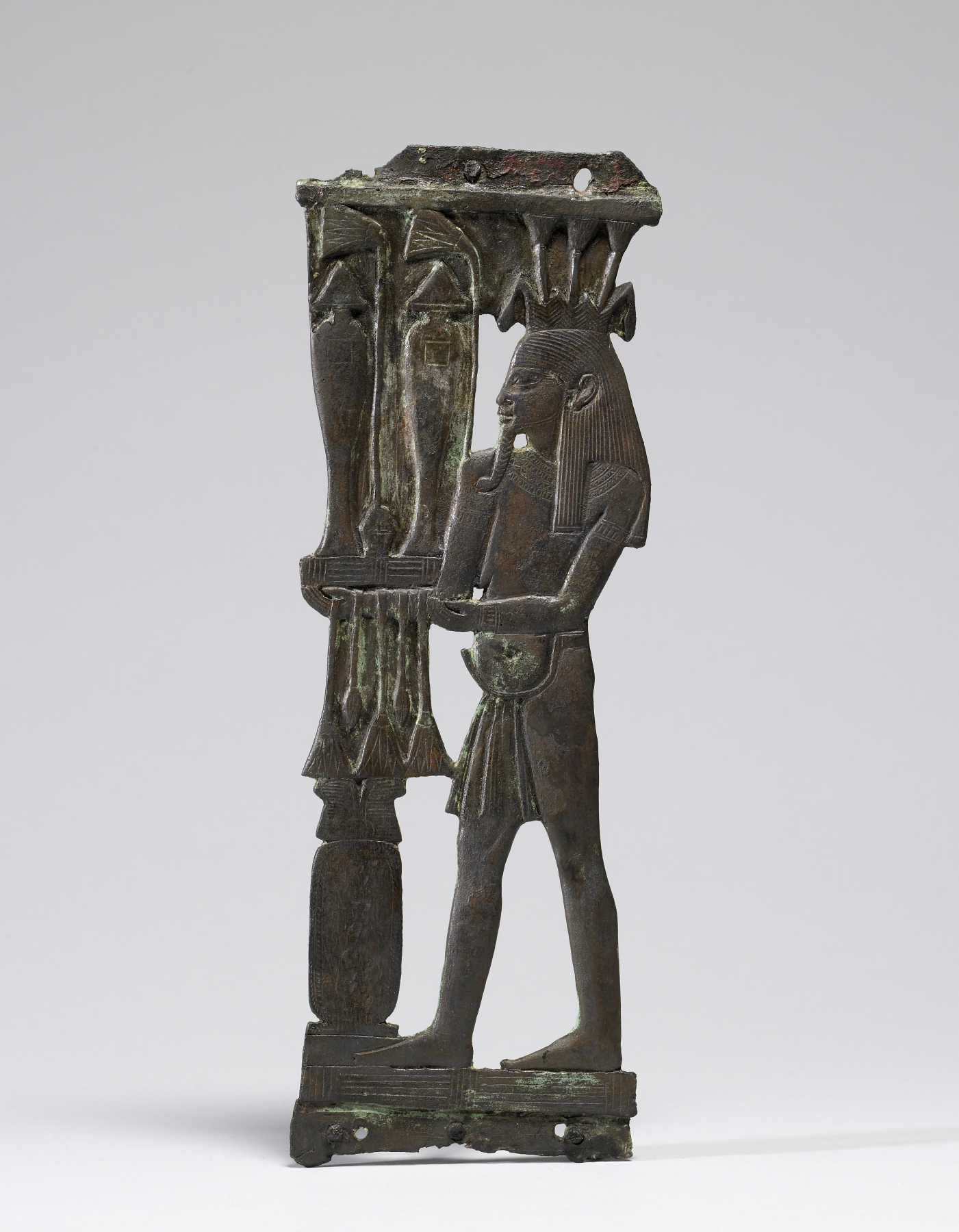

The bringer of fertility was the inundation itself, Hapy, who became a god; the river was called the Father of Life and the Mother of All Men and was considered a manifestation of the god Hapi, while the god Khnum was originally lord of the source of the Nile. The Milky Way was considered a celestial mirror of the Nile, and the gods were believed to cause the annual floods. Boat travel on the Nile was a major unifying factor, and in Egyptian thought death was expressed as coming to land on the other side and crossing to the next world.
Permanent settlements rose along the Nile beginning around 6000 BCE, and by about 3150 BCE the valley and delta formed the world's first recognisable nation state. Egyptian farmers were among the first to practise agriculture on a large scale and developed basin irrigation, building earthen banks and channels to trap floodwater in basins; by the Middle Kingdom basin irrigation was well established, and the only area of major irrigation work before Graeco-Roman times was the Faiyum. The annual inundation was relatively reliable and the floodplain and Delta very fertile, making Egyptian agriculture the most secure and productive in the Near East, with food stored against scarcity. Crops were planted after the inundation, and irrigation of small plots was later aided by artificial water-lifting devices from 1500 BC. The principal crops were cereals — emmer wheat for bread and barley for beer — along with flax for rope and linen and papyrus for writing material. When flood waters receded farmers found a layer of fertile sludge on their land, and basins preserved the water for later seasons; the Ramessid rulers exported food and Egypt became the granary of Rome and Constantinople.
The Nile played an important role in the building of monuments such as the Great Pyramid, whose limestone blocks were transported by boat according to an ancient papyrus diary. The stretch of the Nile from Aswan to the Sudanese border is an archaeological haven, and Aswan, north of the first cataract, was the border town of ancient Egypt.
4. The Search for the Source
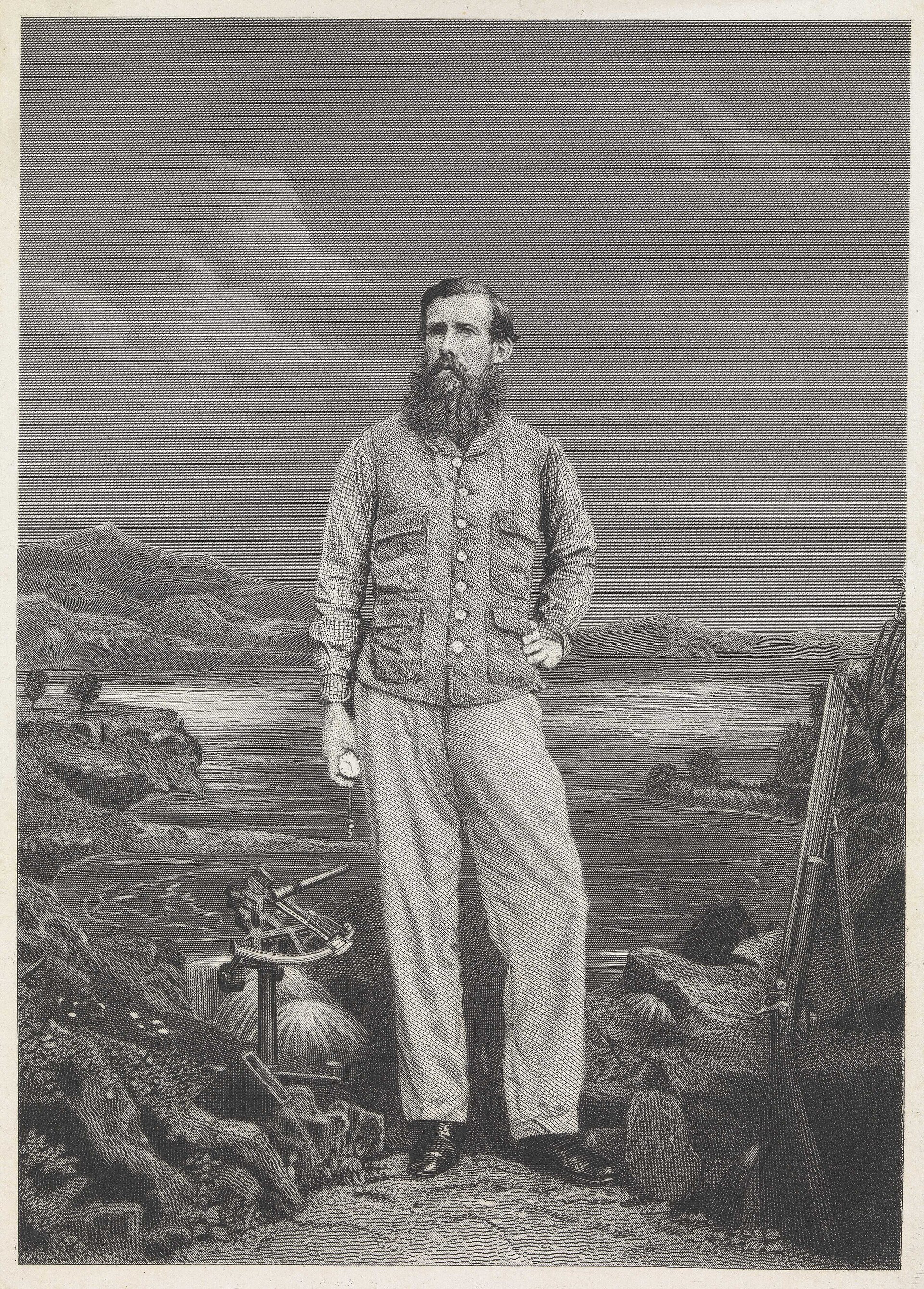
The search for the source of the Nile was one of the last great geographical mysteries of 19th-century European exploration, pursued by men like Livingstone, Burton, Speke and Stanley. The ancient Egyptians knew the Nile as far upstream as today's Khartoum, some 1,700 miles from the river's mouth, and in 150 CE the Greek geographer Ptolemy placed its origin in the Mountains of the Moon.
Stanley's expedition and Verney Lovett Cameron's separate expedition of 1875 together confirmed that the Lualaba was the Congo River, and that Lake Victoria rather than Lake Tanganyika was the true source of the Nile.

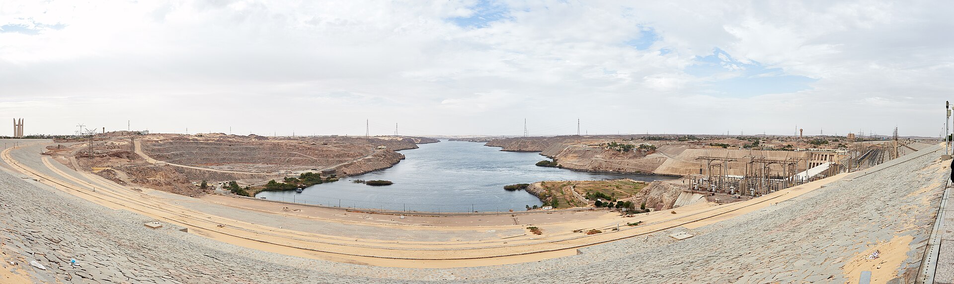
5. The Aswan High Dam and the Taming of the Flood
In the 1950s Gamal Abdel Nasser envisioned a new dam across the Nile, and after the United States and Britain cancelled their financial backing in July 1956 he nationalised the Suez Canal to pay for the project. Soviet loans and Suez Canal tolls allowed work on the Aswan High Dam to begin in 1960; some 57 million cubic yards of earth and rock went into a dam with a mass sixteen times that of the Great Pyramid.
Because so much of the flood silt is now trapped in the reservoirs, the fertility of Egypt's riverside land has declined, and about one million tons of artificial fertilizer are an inadequate substitute for the 40 million tons of silt once deposited yearly.
6. Water Allocation and Agriculture
The 1959 Nile Waters Agreement rested on the average flow of the Nile at Aswan during the 1900-1959 period, measured at 84 km3/yr; once estimated losses of 10 km3/yr were subtracted, the net usable flow of 74 km3/yr was divided between Sudan and Egypt. Egyptian agriculture covers 3.3 million hectares in the Nile Valley and Delta and relies almost exclusively on irrigation, with water reaching the fields through seven barrages and 31,200 km of main canals.
Today 95 percent of Egyptians live within a few miles of the Nile, and canals bring its water to farms and cities.
7. The Grand Ethiopian Renaissance Dam and Downstream Tensions
The dam on the Blue Nile near the border with Sudan was expected to be about 5,840 feet long and 475 feet high. Filling of its reservoir began in July 2020.
The need for cooperation led to the formation of the Nile Basin Initiative in 1999 and brought the eleven basin countries together. In 2010 four nations entered a water-sharing agreement.
8. Ecology and Heritage
The Nubian Monuments are a serial World Heritage property of ten component parts covering 374.48 hectares, from Abu Simbel to Philae. The temples of the first five component parts were moved during the UNESCO International Campaign from 1960 to 1980 to save them from flooding by the Nile and Lake Nasser. The Great Temple at Abu Simbel was carved out of an escarpment of solid rock, and its design allows the rays of the sun to penetrate to the innermost chamber twice annually on the equinoxes. Philae above the first cataract was the great Ptolemaic sanctuary of the goddess Isis, and it remained the final bastion of ancient Egyptian religion, with the cult's rites persisting until the 9th century CE.
9. Flooding and Food Insecurity in Sudan
According to the UN Office for the Coordination of Humanitarian Affairs, more than 94,000 people in White Nile State were affected by flooding. Floods in Sudan often contribute to regional food insecurity by killing livestock and damaging crops, and White Nile State was classified as facing crisis levels of food insecurity during the 2021 season.
10. Key Measurements
| Feature | Value | Source |
|---|---|---|
| Length | about 4,132 miles / 6,650 kilometres | britannica-nile |
| Drainage basin | 1,293,000 square miles / 3,349,000 square kilometres, about one-tenth of the African continent | britannica-nile |
| Most distant source | the Kagera River in Burundi | britannica-nile |
| Principal streams | the Blue Nile, the Atbara and the White Nile | britannica-nile |
| Aswan High Dam height | 111 metres / 364 feet | britannica-aswan-high-dam |
| Aswan High Dam crest length | 3,830 metres / 12,562 feet | britannica-aswan-high-dam |
| Lake Nasser capacity | 169 billion cubic metres / 5.97 trillion cubic feet | britannica-lake-nasser |
| Lake Nasser size | 480 kilometres / 300 miles long and 16 kilometres / 10 miles wide | britannica-lake-nasser |
| Grand Ethiopian Renaissance Dam dimensions | about 5,840 feet long and 475 feet high | britannica-gerd |
| Egypt's Nile allocation | about 55.5 billion cubic metres / 1.96 trillion cubic feet a year under the treaty with Sudan | britannica-nile-allocation |
| Sudan's Nile allocation | 18.5 km3/yr under the 1959 Nile Waters Agreement | fao-egypt-aquastat |
| Average Nile flow at Aswan, 1900-1959 | 84 km3/yr | fao-egypt-aquastat |
| Share of Nile flow from the Ethiopian tributaries | between 70-90% of total low and peak flows | britannica-nile |
| Egypt's water drawn from the Nile | 90 percent | britannica-nile |
| Egyptians living near the Nile | 95 percent of Egyptians live within a few miles of the Nile | britannica-nile |
11. Timeline: from the first settlements to the Grand Ethiopian Renaissance Dam
- c. 6000 BCEFirst permanent settlements on the NilePermanent settlements gradually rose along the banks of the river, marking the beginning of Egyptian civilization and culture.
- c. 3100 BCEThe Nile Valley becomes a single stateBy 3100 BC the Nile Valley and Delta had coalesced into a single entity that was the world's first large nation state.
- c. 2560 BCEGreat Pyramid of Giza constructedThe Great Pyramid of Giza is constructed by Pharaoh Khufu, the largest of the monuments raised on the Nile floodplain.
- 520 BCEDarius links the Nile and the Red SeaDarius of Persia links the Nile and the Red Sea by a canal, an early attempt to join the river to the eastern trade routes.
- 61 CENero's expedition up the NileThe Roman emperor Nero sent two centurions to Meroe and beyond; they followed the White Nile as far as the Sudd marshes.
- c. 150 CEPtolemy places the source in the Mountains of the MoonThe Greek geographer Ptolemy, living in Roman Egypt, wrote that the river originated in the Mountains of the Moon deep in the African interior.
- 1862Speke finds the Ripon FallsJohn Hanning Speke, accompanied by James Grant, returned to Lake Victoria and discovered the cascade he christened Ripon Falls, which he took as the Nile's outlet.
- 1902The Aswan Low Dam is completedThe first dam at Aswan was completed, providing irrigation during droughts but unable to hold back the annual Nile flood.
- July 1956Nasser nationalises the Suez CanalAfter the United States and Britain cancelled financing for the High Dam, Nasser nationalised the Suez Canal to fund the project, precipitating the Suez Crisis.
- 9 January 1960Construction of the Aswan High Dam beginsWork began on the Aswan High Dam, replacing the Aswan Low Dam and eventually creating Lake Nasser.
- 21 July 1970Aswan High Dam completedAfter eleven years of construction the dam across the Nile was completed, ending the cycle of flood and drought in the region.
- 1979Nubian Monuments inscribed by UNESCOThe Nubian Monuments from Abu Simbel to Philae, saved from the rising waters of Lake Nasser, were inscribed on the World Heritage List.
- 1999Nile Basin Initiative foundedThe need for cooperation between the riparian states led to the formation of the Nile Basin Initiative, bringing all eleven basin countries together.
- July 2020Filling of the GERD reservoir beginsFilling of the Grand Ethiopian Renaissance Dam reservoir, planned for the rainy season across several years, began in July 2020.
- 2022GERD begins generating electricityThe Grand Ethiopian Renaissance Dam, now Africa's largest dam, began producing electricity, over the objections of Egypt and Sudan downstream.
12. Frequently asked questions
How long is the Nile, and where does its most distant source lie?
How much water does Egypt draw from the Nile, and how many Egyptians depend on it?
What is the Aswan High Dam's power plant, and how much electricity does it produce?
The Aswan High Dam's power plant has 12 giant Soviet-built turbines producing as much as 10 billion kilowatt-hours annually8Aswan High Dam completed (July 21, 1970) · HISTORY (A&E Television Networks) ↗.
How large is Lake Nasser, and how much water can it hold?
What happened to the people and temples displaced by the reservoir?
Creating the reservoir forced the costly relocation of the temple complex of Abu Simbel, and 90,000 Egyptian peasants and Sudanese Nubian nomads had to be moved4.
What wildlife does the Nile basin support?
The habitats of the basin support hippopotamus, monitor lizard and Nile crocodile, and the delta is a vital winter stopover for millions of migrating birds3.
References (16)
- 1Nile River — Encyclopaedia Britannica Web↩View source
- 2Water and Agriculture in the Nile Basin — Food and Agriculture Organization of the United Nations (FAO) WebView source
- 3Nile River — National Geographic Society Web↩View source
- 4Aswan High Dam — Encyclopaedia Britannica Web↩View source
- 5Two Decades of Change at Toshka Lakes — NASA Earth Observatory WebView source
- 6The Search for the Source of the Nile: Solving Geography's Last Great Riddle — World History Encyclopedia WebView source
- 7What is the Longest River in the World? — HISTORY (A&E Television Networks) WebView source
- 8Aswan High Dam completed (July 21, 1970) — HISTORY (A&E Television Networks) 1970 Web↩View source
- 9Irrigation in Africa in figures — AQUASTAT Survey: Egypt country profile — Food and Agriculture Organization of the United Nations (FAO) WebView source
- 10Grand Ethiopian Renaissance Dam — Encyclopaedia Britannica WebView source
- 11Floods Along the White Nile — NASA Earth Observatory WebView source
- 12Fueled by the Nile — NASA Earth Observatory Web↩View source
- 13Nile — World History Encyclopedia WebView source
- 14The Story of the Nile — BBC History WebView source
- 15Nile — Livius.org (Jona Lendering) WebView source
- 16Nubian Monuments from Abu Simbel to Philae — UNESCO World Heritage Centre WebView source