Egypt
The geography, people and history of Egypt — from the Nile valley and its deserts through the pharaonic, Islamic and modern eras to the republic of today.
Egypt (official name Arab Republic of Egypt) is a country of about 1,002,000 km² in the northeastern corner of Africa, with a population of some 107.9 million concentrated almost entirely along the Nile valley and delta. Its recorded history spans the pharaonic civilization, the Fatimid and Mamluk eras, Ottoman and British rule, and the modern republic declared in 1953; Cairo, its capital, anchors a culture that counts 7 UNESCO World Heritage sites, and the Suez Canal links the Mediterranean to the Red Sea.
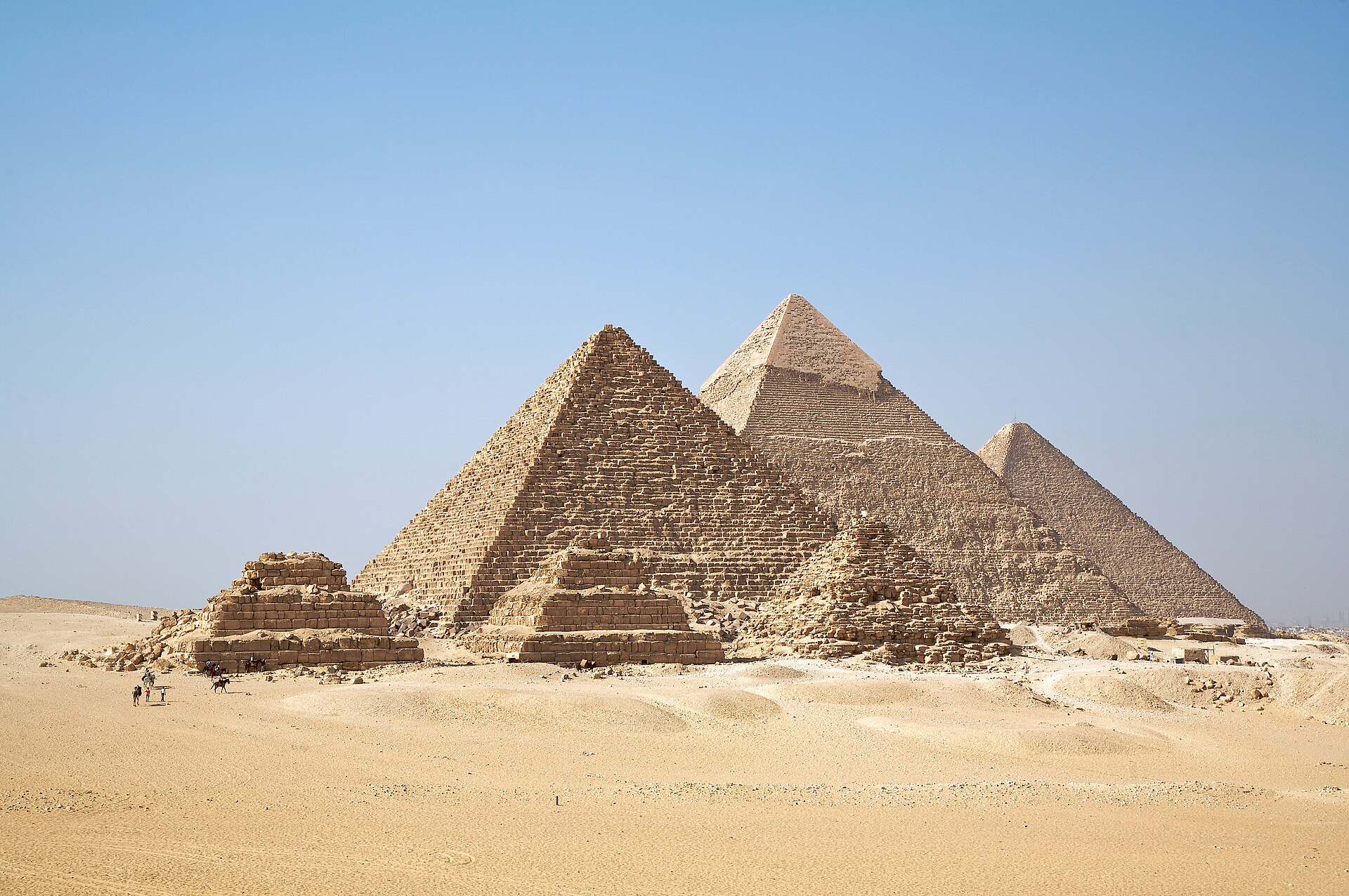
In this article
- 1Land and Physical Setting
- 2Borders and Coastline
- 3Climate and Water
- 4Population and Settlement
- 5Government and Administration
- 6Historical Outline
- 7The Suez Canal
- 8World Heritage
- 9Culture and Intangible Heritage
- 10Economy and Development
- 11Timeline: from the unification of Egypt to the Suez Canal's modern expansion
- 12Frequently asked questions
- 13Knowledge graph
Land and Physical Setting
Egypt covers a total area of about 1,002,000 km2, of which only about 78,990 km2 — some 7.8 percent — is inhabited. The country stretches about 1,080 km from north to south and about 1,100 km at its maximum extent from east to west. It lies between latitudes 22 and 32 degrees north of the equator and between longitudes 24 and 37 degrees east of the Greenwich line.
The Egyptian terrain consists of a vast desert plateau interrupted by the Nile Valley and Delta, which together occupy about 4 percent of the total country area. Egypt is located in the northeastern corner of Africa, and its heartland, the Nile River valley and delta, was the home of one of the principal civilizations of the ancient Middle East.
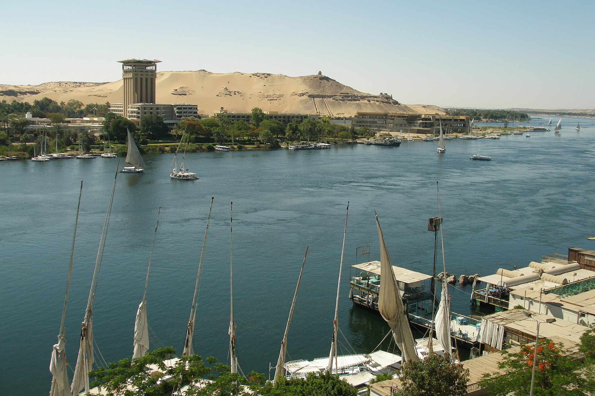
The Western Desert covers about 680,650 km2, or 68 percent of Egypt's area, and includes the Siwa Oasis and the Qattara Depression. The Eastern Desert covers about 225,000 km2, or 28 percent of the national territory, and is rich in natural resources including gold, coal and oil. The Sinai Peninsula covers about 61,000 km2, or about 6 percent of Egypt's area, and is shaped like a triangle between the Mediterranean and the gulfs of Aqaba and Suez.
Mount Kātrīnā, also known as Mount Catherine, is the highest point of Egypt, reaching 8,668 feet (2,642 meters) in the Sinai Peninsula.
1. Borders and Coastline
Its territory is bounded on the west by Libya and on the south by Sudan, while its eastern frontier runs against the Gaza Strip and Israel. 2Country profile – Egypt (AQUASTAT) · Food and Agriculture Organization of the United Nations (FAO) ↗
The western boundary with Libya extends 1,115 km, and the southern boundary with Sudan runs 1,280 km. To the east, Egypt adjoins the Gaza Strip and Israel. 2 1Basic Information · Egypt State Information Service (SIS) ↗
Egypt's seaboard is divided between two bodies of water. The Mediterranean Sea washes 995 km of the northern coast, while the Red Sea accounts for 1,941 km of coastline to the east. 1
| Direction | Neighbouring country or body of water | Length in km |
|---|---|---|
| North | Mediterranean Sea | 995 |
| East | Red Sea | 1,941 |
| East | Gaza Strip and Israel | — |
| West | Libya | 1,115 |
| South | Sudan | 1,280 |
2. Climate and Water
Egypt lies in the dry arid region, with the northern region forming the exception to that rule. The country has only two prominent seasons: a hot summer running from May to October and a mild winter running from November to April.
Summer temperatures are extremely high, reaching 38°C to 43°C, with extremes of 49°C recorded in the southern and western deserts. Rainfall across the country is very low, irregular and unpredictable. It ranges from a maximum of about 200 mm in the northern coastal region to nearly zero in the south, with an annual average of 51 mm.
The River Nile is the main source of water for Egypt, carrying an annual allocated flow of 55.5 km3 under the Nile Waters Agreement signed in 1959 between Egypt and Sudan. The river extends about 1,532 km from Egypt's southern border to the Mediterranean Sea. North of Cairo it splits into the Damietta and Rashid branches.
The Nile Basin Initiative is an intergovernmental partnership of 10 Nile Basin countries: Burundi, DR Congo, Egypt, Ethiopia, Kenya, Rwanda, South Sudan, The Sudan, Tanzania and Uganda. Eritrea participates in the initiative as an observer. The partnership promotes sustainable management and development of the shared Nile Basin water resources.
3. Population and Settlement
Egypt's population stood at 107,904,841 according to the population clock of 25 July 2025.
In the Nile Valley and Delta, population density reaches more than 1,165 inhabitants per km2. In the desert, by contrast, density falls to about 1.2 people per square kilometre.
The capital is Cairo, one of the world's largest urban agglomerations. Manufacturing and trade have increasingly outstripped agriculture as the largest sectors of the national economy.
4. Government and Administration
Its form of government is a multiparty republic with two legislative houses. The lower chamber, the House of Representatives, comprises 596 seats, while the upper chamber, the Senate, holds 300.
The official language of the state is Arabic.
5. Historical Outline
Egypt's recorded past begins with political unification. Around 3000 BCE the kingdoms of Upper and Lower Egypt united, beginning the successive dynasties that developed great cultural traditions, writing and the pyramids. The Old Kingdom, about 2649 to 2130 BCE, was an incredibly dynamic period of Egyptian history. The capital of the Old Kingdom of Egypt has some extraordinary funerary monuments, including rock tombs, ornate mastabas, temples and pyramids.
Arab Muslim armies conquered Egypt between 639 and 642 CE, after which an Arabic vernacular gradually replaced the Egyptian language as the common means of spoken discourse. In 642 the Arab conquest brought Egypt into the Islamic world, and in 969 Cairo was established as capital.
In 1517 the Ottoman Empire defeated the Mamluks and established control over Egypt that lasted until 1798 when Napoleon I led a French army in a short occupation of the country. The United Kingdom occupied Egypt in 1882 and continued to exert a strong influence on the country until after the Second World War. Egypt gained independence in 1922 when Fuad I became king, although British influence remained significant.
In 1952 a military coup installed a revolutionary regime in Egypt that promoted a combination of socialism and Pan-Arab nationalism. In June 1953 the coup leader Muhammad Najib became president as Egypt was declared a republic.
In June 1967 an Israeli pre-emptive attack defeated Egypt, Jordan and Syria, leaving Israel in control of Sinai up to the Suez Canal. In 1979 Egypt became the first of the Arab states to make peace with the Jewish state, after leading them in a series of wars against Israel. In October 1981 President Sadat was assassinated by Islamist extremists and was succeeded by Vice-President Hosni Mubarak.
6. The Suez Canal
The cutting of the Suez Canal consumed almost ten years of work carried out by Egyptian labor. The waters of the two seas met on 18 August 1869, bringing to an end that decade of toil and creating an invaluable artery for world navigation. Navigation through the canal began for the first time on 17 November 1869. The inauguration ceremony held that day was a legendary affair that drew six thousand guests.
By 2015 the overall length of the canal stood at 193.30 km, of which bypasses accounted for 113.3 km. A planned phase completed by the Suez Canal Authority in January 2010 raised the canal's permissible draft to 66 ft. That increase allowed the waterway to accommodate 100 percent of container ships, 92.7 percent of the bulk carrier fleet and 61.2 percent of the tanker fleet.
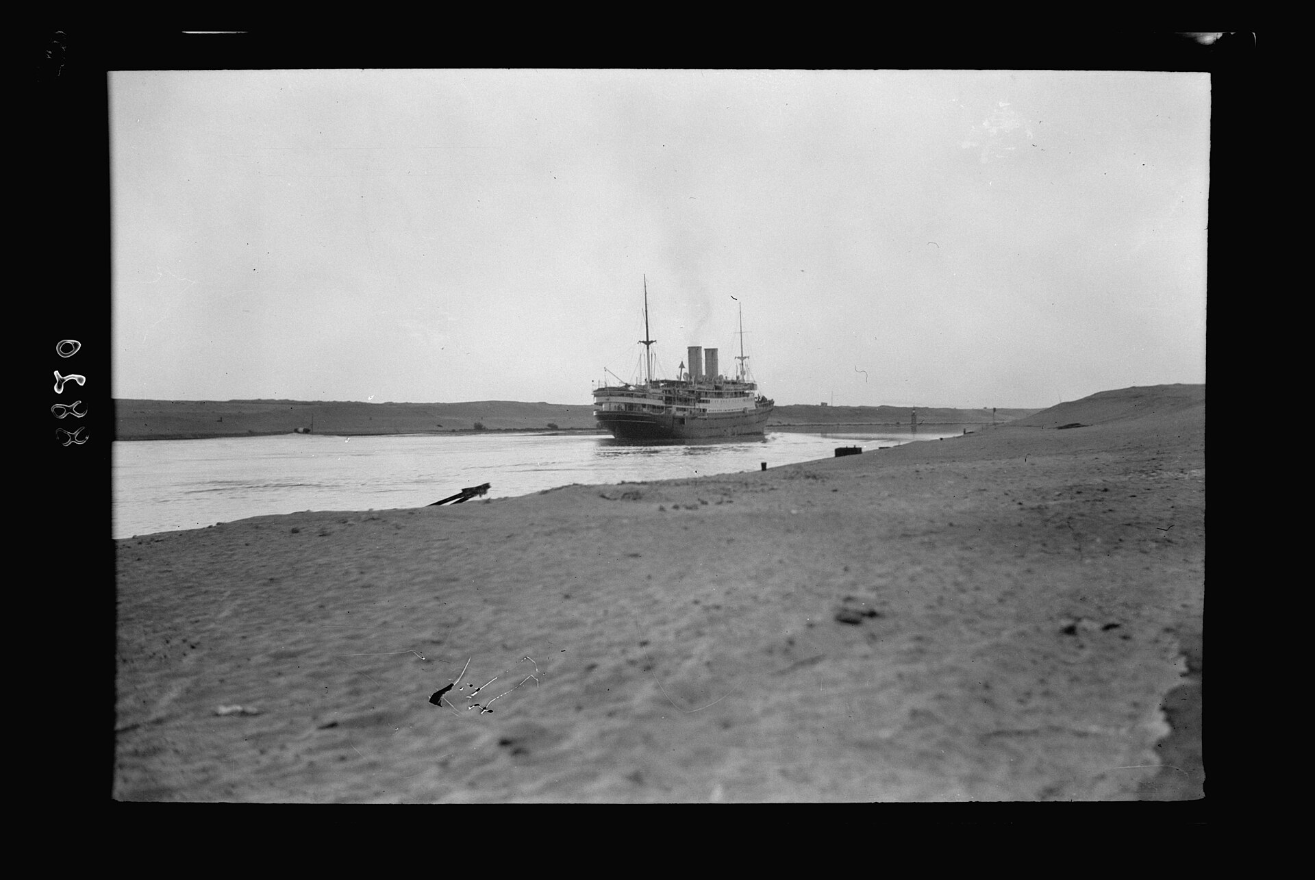

In a historic speech delivered in Alexandria on 6 July 1956, President Gamal Abdel Nasser declared the nationalization of the Suez Canal. It reopened for international navigation in June 1975.
7. World Heritage
Egypt holds seven inscribed World Heritage sites, of which six are cultural and one is natural. A further thirty-four sites stand on the country's tentative list.
The six cultural properties are Abu Mena, Ancient Thebes with its Necropolis, Historic Cairo, Memphis and its Necropolis, the Nubian Monuments from Abu Simbel to Philae, and the Saint Catherine Area.
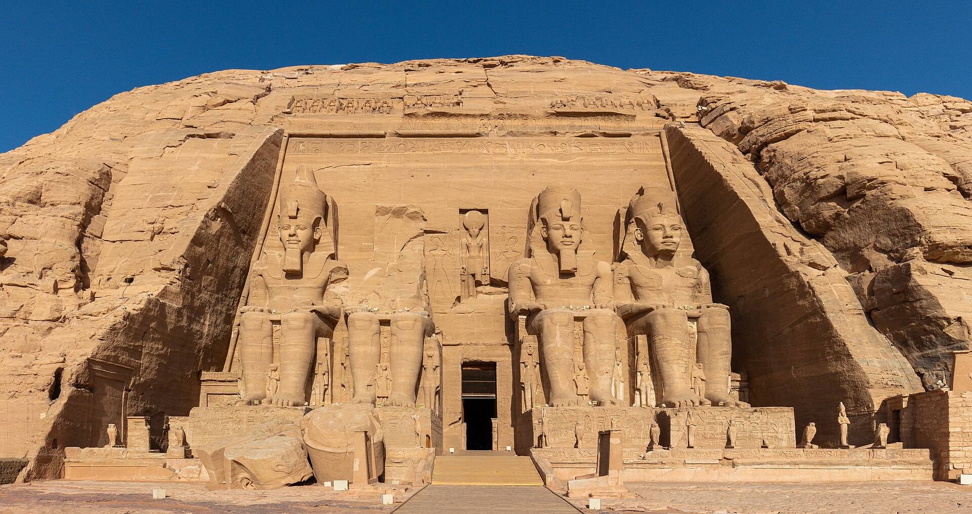
Memphis, whose fame comes from its being the first capital of Ancient Egypt, lies in the center of the floodplain on the western side of the Nile. More than thirty-eight pyramids stand at Memphis and its necropolis, including the three pyramids of Giza, of which the Great Pyramid of Khufu is the only surviving wonder of the ancient world. The limestone step pyramid of Djoser is the oldest pyramid to be constructed. The site preserves more than nine thousand rock-cut tombs as well as ornate mastabas, temples and pyramids.
The Nubian Monuments from Abu Simbel to Philae contain the Temples of Ramses II at Abu Simbel and the Sanctuary of Isis at Philae. These monuments were saved from the rising waters of the Nile by the International Campaign that UNESCO launched between 1960 and 1980 to save the temples. Philae, above the first cataract, was the great Ptolemaic sanctuary of the goddess Isis and the final bastion of ancient Egyptian religion.
Tucked away amid the modern urban area of Cairo lies one of the world's oldest Islamic cities, with its famous mosques, madrasas, hammams and fountains. Historic Cairo developed further in the Ayyubid and Mamluk eras, when the Fatimid plan was enlarged outside the walls into a cohesive urban fabric. The building of a new Cairo in the 19th century allowed Historic Cairo to remain largely intact.
The Saint Catherine Area stands at the foot of Mount Horeb, known and revered by Muslims as Jebel Musa, and is sacred to Christianity, Islam and Judaism. It was inscribed on the World Heritage List in 2002 and covers 60,100 hectares in South Sinai. The monastery of Saint Catherine, founded in the 6th century, is the oldest Christian monastery still in use for its initial function.
Egypt's only natural World Heritage property is Wadi Al-Hitan (Whale Valley), on the World Heritage List since 2005 and the country's sole natural site.
8. Culture and Intangible Heritage
Egypt's presence on the Representative List of the Intangible Cultural Heritage of Humanity is anchored in practices of everyday life as much as in performance. Koshary, the daily life dish, is inscribed together with the practices associated with it. Henna likewise appears on the list, cited for its rituals and its aesthetic and social practices.
Other traditions are recorded in categories that signal vulnerability or distinctiveness. Handmade weaving in Upper Egypt (Sa'eed) and traditional hand puppetry are inscribed on the List of Intangible Cultural Heritage in Need of Urgent Safeguarding. The Al-Sirah Al-Hilaliyyah epic and the Tahteeb stick game are among Egypt's entries on the UNESCO intangible cultural heritage lists.
The Bibliotheca Alexandrina concentrates the country's modern library and museum culture in a single institution. Its main library is joined by six specialized libraries, among them the Taha Hussein Library for the visually impaired and the Children's Library. The institution also houses four major museums: the Sadat Museum, the Antiquities Museum, the Manuscripts Museum and the History of Science Museum. Its Manuscripts Center pursues the depths of Arab and Islamic manuscript heritage through indexing, verification and study.
9. Economy and Development
Its currency is the Egyptian pound, divided into 100 piasters.
Real GDP grew 5.3 percent in the first half of FY26, covering July to December 2025, up from 3.9 percent a year earlier. Central government debt declined to 82.5 percent of GDP at end-FY25 from 90.1 percent at end-FY24. The primary surplus reached 3.5 percent of GDP in FY25, even as interest payments remained high at 10.6 percent of GDP.
As of end-February 2026, official foreign reserves and other foreign currency assets reached US$67.5 billion. The Central Bank of Egypt publishes daily CBE exchange rates in EGP, including buying and selling rates for the US dollar and the euro. For the fourth quarter of 2026 the Central Bank targets inflation of 7.0 percent, plus or minus 2 percentage points, on average.
More than 700,000 subsidies have been delivered to low-income households across Egypt. As of December 2025, 4.66 million households had benefited from the Takaful and Karama cash transfer programme. Through the World Bank's Inclusive Housing Finance Program, more than 693,000 low-income households have been enabled to access formal, affordable housing.
10. Timeline: from the unification of Egypt to the Suez Canal's modern expansion
- c. 3000 BCEUpper and Lower Egypt uniteAround 3000 BCE the kingdoms of Upper and Lower Egypt united, and the successive dynasties that followed developed writing and built the pyramids around 2500 BC.
- c. 2649–2130 BCEThe Old KingdomThe Old Kingdom opened an incredibly dynamic period of Egyptian history; Dynasty 3 built the Step Pyramid at Saqqara, Egypt's first pyramid, and Dynasty 4 raised the Great Pyramid of Khufu at Giza.
- 969 CECairo founded by the FatimidsAfter the Fatimid conquest of Egypt in 969 the dynasty founded the city of Cairo and established it as their new capital in 973.
- 1250–1517Mamluk sultanateThe Mamluk sultanate emerged from the weakening of the Ayyubid realm in Egypt and Syria, creating the greatest Islamic empire of the later Middle Ages around its capital Cairo.
- 1517Ottoman conquestIn 1517 the Ottoman Empire defeated the Mamluks and established control over Egypt; its rule lasted until the French invasion of 1798.
- 1805Muhammad Ali's dynastyThe Ottoman Albanian commander Muhammad Ali established a dynasty that reigned until 1953, although Egypt remained nominally part of the Ottoman Empire.
- 17 November 1869Suez Canal openedTen years of digging with Egyptian labour ended on 18 August 1869 when the waters of the two seas met, and the canal was inaugurated on 17 November 1869.
- 1882British occupationBritish troops defeated the Egyptian army and took control of the country; Egypt formally became a British protectorate in 1914.
- 1922Independence restoredFuad I became king and Egypt gained independence, although British influence remained significant until the 1950s.
- July 1952The Free Officers' coupA coup by the Free Officers' Movement forced King Farouk to abdicate in favour of his infant son Ahmed Fuad II.
- June 1953Egypt declared a republicThe coup leader Muhammad Najib became president as Egypt was declared a republic, ending the era of the monarchy.
- July 1956Nationalisation of the Suez CanalPresident Nasser nationalised the Suez Canal to fund the Aswan High Dam after Britain and the United States withdrew financing.
- 1958–1961United Arab RepublicEgypt and Syria formed the brief United Arab Republic, a unitary state that lasted from 1958 to 1961.
- June 1975Suez Canal reopenedThe Suez Canal was reopened for international navigation in June 1975 after its closure following the 1967 war.
- 2015Canal reaches its modern dimensionsBy 2015 the canal's overall length reached 193.30 km with bypasses totalling 113.3 km, allowing transit of vessels up to 440 thousand tons.
11. Frequently asked questions
What is the official name of Egypt, and what is its capital?
The country's official name is the Arab Republic of Egypt, rendered in Arabic as Jumhūriyyat Miṣr al-ʿArabiyyah 3Egypt | History, Map, Flag, Population, & Facts · Encyclopaedia Britannica ↗. Its capital is Cairo 1, a city founded in 969 AD by the Fatimid leader Jawhar Al-Sequilli on the order of the caliph Al-Mo'iz lideenellah 1.
How large is Egypt, and how many people live there?
What countries and seas border Egypt?
How is Egypt governed?
How many World Heritage sites does Egypt have?
References (20)
- 1Basic Information — Egypt State Information Service (SIS) Web↩View source
- 2Country profile – Egypt (AQUASTAT) — Food and Agriculture Organization of the United Nations (FAO) Web↩View source
- 3Egypt | History, Map, Flag, Population, & Facts — Encyclopaedia Britannica Web↩View source
- 4Mount Kātrīnā | Egypt, Map, & Facts — Encyclopaedia Britannica WebView source
- 5Homepage | Nile Basin Initiative — Nile Basin Initiative WebView source
- 6Egypt profile - Timeline — BBC News WebView source
- 7Egypt in the Old Kingdom (ca. 2649–2130 B.C.) — The Metropolitan Museum of Art WebView source
- 8Memphis and its Necropolis – the Pyramid Fields from Giza to Dahshur — UNESCO World Heritage Centre WebView source
- 9SCA — Canal Characteristics — Suez Canal Authority WebView source
- 10SCA — Canal History — Suez Canal Authority WebView source
- 11Egypt — UNESCO World Heritage Convention — UNESCO World Heritage Centre Web↩View source
- 12Nubian Monuments from Abu Simbel to Philae — UNESCO World Heritage Centre WebView source
- 13Historic Cairo — UNESCO World Heritage Centre WebView source
- 14Saint Catherine Area — UNESCO World Heritage Centre WebView source
- 15Egypt — UNESCO Intangible Cultural Heritage — UNESCO Intangible Cultural Heritage WebView source
- 16Home — Bibliotheca Alexandrina — Bibliotheca Alexandrina WebView source
- 17Egypt | World Bank Group — World Bank Group WebView source
- 18Home — Central Bank of Egypt — Central Bank of Egypt WebView source
- 19The Art of the Fatimid Period (909–1171) — The Metropolitan Museum of Art WebView source
- 20The Art of the Mamluk Period (1250–1517) — The Metropolitan Museum of Art 1517 WebView source