Monsoon
The monsoon in the global climate system: the seasonal reversal of the prevailing winds, the land-sea heating contrast and the ITCZ that drive it, the Indian summer monsoon and its onset, breaks and withdrawal, the world's other monsoon systems, the cycles of drought and flood, and how the rains are measured, forecast and changed by a warming climate.
A monsoon is a seasonal reversal of a region's prevailing winds, together with the wet and dry seasons it brings, and it arises mainly from the different rates at which land and ocean heat and cool through the year. The Indian summer monsoon is the largest of the world's monsoon systems: its southwest winds deliver roughly three-quarters of India's annual rainfall between June and September, and its onset, advance, active and break spells and withdrawal are tracked by the India Meteorological Department against long period averages and fixed onset criteria revised in 2016. Monsoon systems also dominate the climate of East and Southeast Asia, Australia, West Africa, and North and South America. Because the rains support rain-fed agriculture, water supply and hydropower, the year-to-year variability of the monsoon, linked to the El Nino-Southern Oscillation and the Indian Ocean Dipole, has consequences for food prices, economic growth and hazard risk.
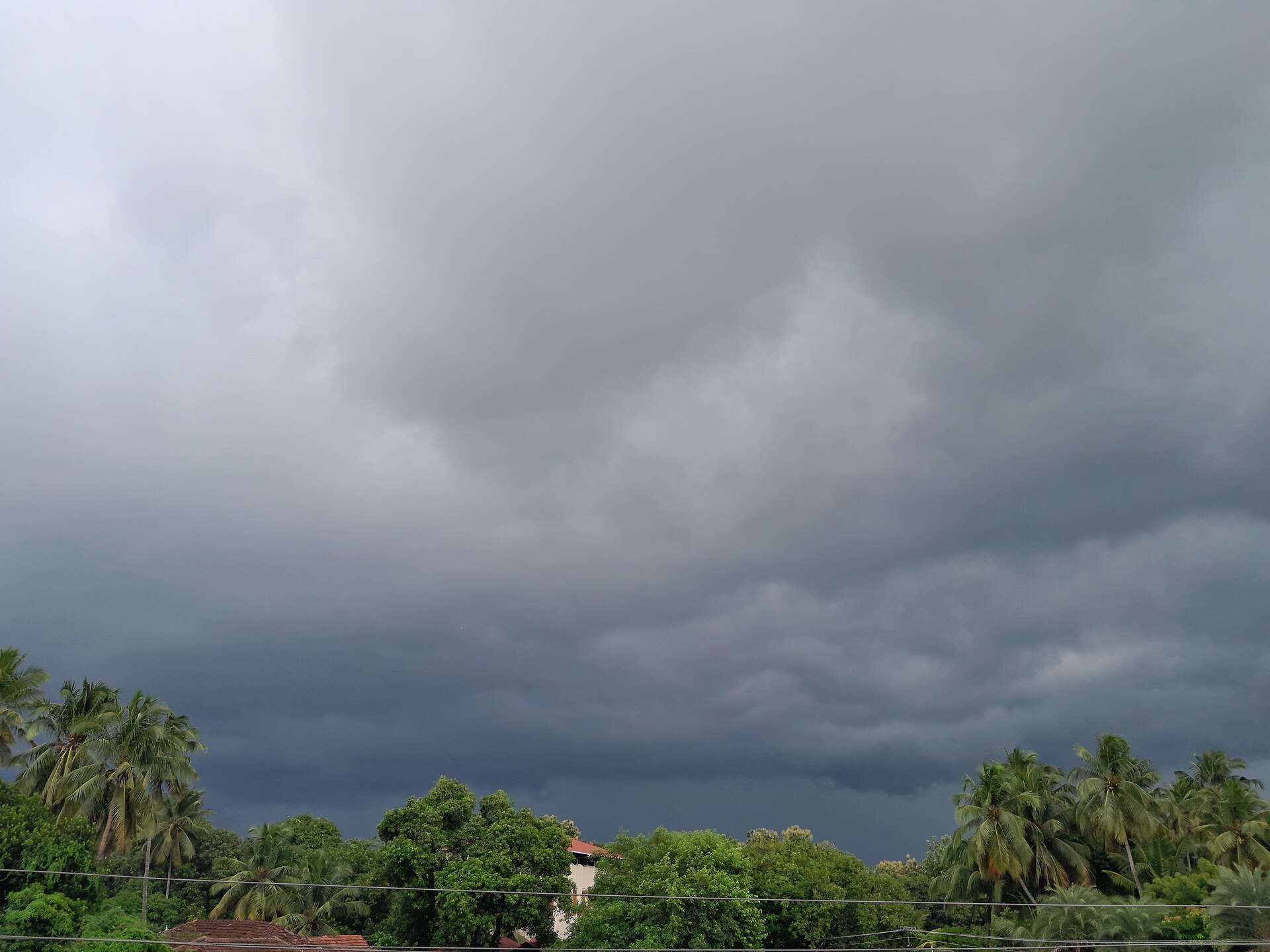
In this article
- 1Overview
- 2Physical Mechanism
- 3The Intertropical Convergence Zone and the Global Monsoon
- 4Regional Monsoon Systems
- 5The South Asian Monsoon
- 6Onset, Withdrawal and Rainfall Classification
- 7Interannual Variability and Forecasting
- 8Recent Seasons
- 9The North American Monsoon
- 10Agriculture, Water and Economy
- 11Key Figures
- 12Timeline
- 13Frequently Asked Questions
- 14Timeline: from the Cherrapunji records to the 2026 outlook
- 15Knowledge graph
Overview
A monsoon is a major wind system that seasonally reverses its direction, blowing for approximately six months from the northeast and six months from the southwest. More broadly, monsoons are seasonal changes in the direction of the prevailing, or strongest, winds of a region, and they cause wet and dry seasons throughout much of the tropics. The most prominent monsoons occur in South Asia, Africa, Australia, and the Pacific coast of Central America, while the Gulf Coast of the United States and central Europe experience only monsoonal tendencies rather than true monsoons.
1. Physical Mechanism
The primary cause of monsoons lies in different warming trends over land and sea, so monsoon winds typically travel from sea to land in summer and from land to sea in winter. Monsoons always blow from cold to warm regions, and the summer and winter monsoons together determine the climate for most of India and Southeast Asia. The basic cause of the Asian monsoon is that the Eurasian landmass and the Indian Ocean warm and cool at different rates through the seasons: in summer the land surface gets hotter than the ocean, hot air above the land rises, and moist ocean air flows in to replace it, while in winter air over the land becomes colder and denser, warmer air over the ocean rises, and cold air from the north blows in to replace it. Land heats up faster than water, so as the sun intensifies over the Indian subcontinent between March and May the land becomes much hotter than the surrounding seas, and this contrast makes warm air rise and creates a low-pressure zone that draws in cooler, moisture-laden air from the Indian Ocean. A lack of snow allows the land surface to heat up more in summer, and the resulting widening temperature contrast between land and ocean strengthens the monsoon.
The heat source for the Indian summer monsoon resides over the Plateau of Tibet and the eastern foothills of the Himalayas, while for the Australian summer monsoon the heat source lies over the Maritime Continent and the heat sink over Siberia. The Tibetan High is a warm anticyclone located over the Tibetan Plateau in the middle and upper troposphere during the monsoon period, marked at the 300 hPa level with its centre near 30 N, 90 E, and in July its outflow concentrates into an easterly jet stream centred near the latitude of Chennai at 150 hPa.
2. The Intertropical Convergence Zone and the Global Monsoon
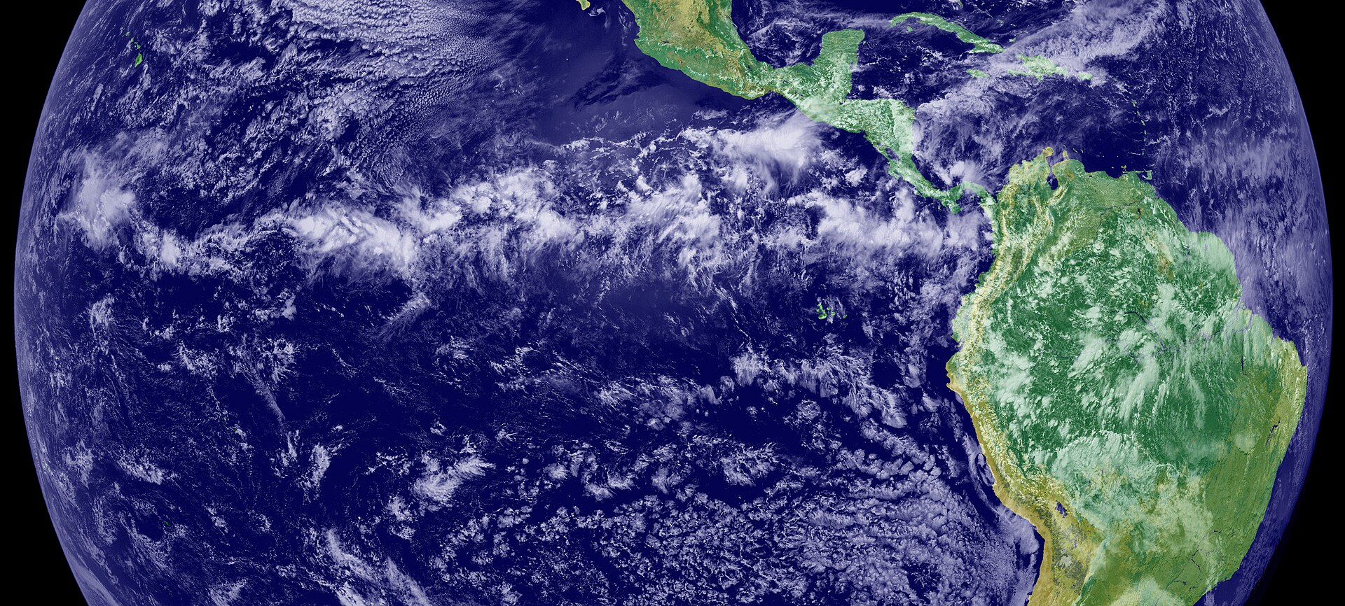
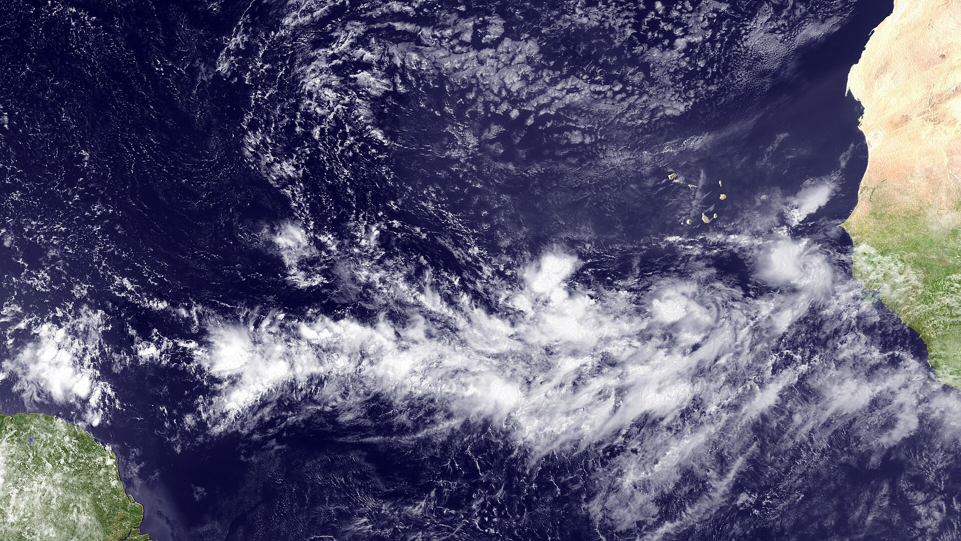
The Inter-Tropical Convergence Zone appears as a band of clouds consisting of showers and occasional thunderstorms that encircles the globe near the equator and may extend for many hundreds of miles. It forms because the northeast trade winds from the Northern Hemisphere converge with the southeast winds from the Southern Hemisphere, forcing air up into the atmosphere.
In AR6 the global monsoon is defined as the area where the annual range of precipitation (local summer minus local winter) exceeds 2.5 mm per day. The global monsoon represents the leading empirical orthogonal function (EOF) mode of the annual variations of precipitation and circulation in the global tropics and subtropics, a forced response of the coupled climate system to the annual cycle of solar insolation. Variability of the global monsoon represents, to a large extent, changes in the Intertropical Convergence Zone and the associated Hadley circulation.
3. Regional Monsoon Systems
The regional monsoon systems recognised in AR6 comprise the South and South East Asian, East Asian, West African, North American, South American and Australian–Maritime Continent monsoons. The definition of regional monsoons was slightly modified in AR6, because some continental areas identified by the global precipitation metric have a seasonality not necessarily of monsoon origin, and the qualification of regions such as South Africa, Central America and equatorial South America as monsoons remains a subject of discussion. The East Asian winter monsoon weakened significantly in the mid-1980s, a change linked to atmospheric quasi-stationary planetary waves and external forcings, and it was observed to recover from that weak epoch in the mid-2000s.
The South American Monsoon System has well-defined wet seasons from October to March and dry seasons from June to August despite the lack of a seasonal reversal in wind direction. The Working Group on American Monsoons works with the CLIVAR/GEWEX Monsoons Panel on the American Monsoon system, comprising the South American, Central American and North American monsoons, while the Asian-Australian Monsoon Working Group addresses the South Asian, East Asian and Australian monsoons. Both groups pursue three key aims: promoting engagement among research, operational prediction and stakeholders; providing authoritative information on process understanding, model fidelity and forecast skill; and identifying key research priorities.
4. The South Asian Monsoon
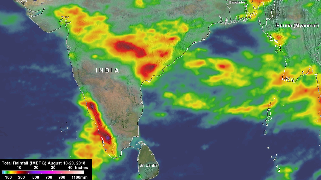
The South Asian monsoon is the most prominent of the world's monsoon systems, and its influence is felt across India and the surrounding water bodies. Its defining mechanism is a seasonal reversal of winds: the northeast winds of the cooler months give way to southwest winds during the warmest months, which deliver large amounts of rain in June and July. In Southwest Asia this cycle dominates the climate, with summer winds blowing from ocean to land and bringing heavy rain to India, Pakistan, Bangladesh and Myanmar, while in winter the flow reverses and blows from land to sea. During the boreal summer, Southern Hemisphere winds cross the equator and bring abundant monsoon rains over South, Southeast and East Asia, a region home to nearly 60% of the world's population, where agriculture is the main source of subsistence.
The advance of the system follows a seasonal progression. By May the southwest monsoon is well established over Sri Lanka; it typically begins over southwestern India around late May or early June and advances north-westward to reach the northernmost regions by mid-July. The Himalayas act as a natural barrier that halts its advance and causes intense rainfall in the northeastern foothills, where Mawsynram receives nearly 12 metres of rain annually. In the winter monsoon, the surface flow is deflected by the Coriolis force into a northeasterly flow, producing an October to December rainy season for the extreme southeast of the Deccan, including the Madras coast, and for eastern Sri Lanka. Midlatitude upper air flowing along the south face of the Himalayas can bring drought to northern districts and dry spells known as breaks of the monsoon, while waves of low pressure appear in the body of monsoonal air mainly in July and August, with fully developed depressions appearing once or twice per month.
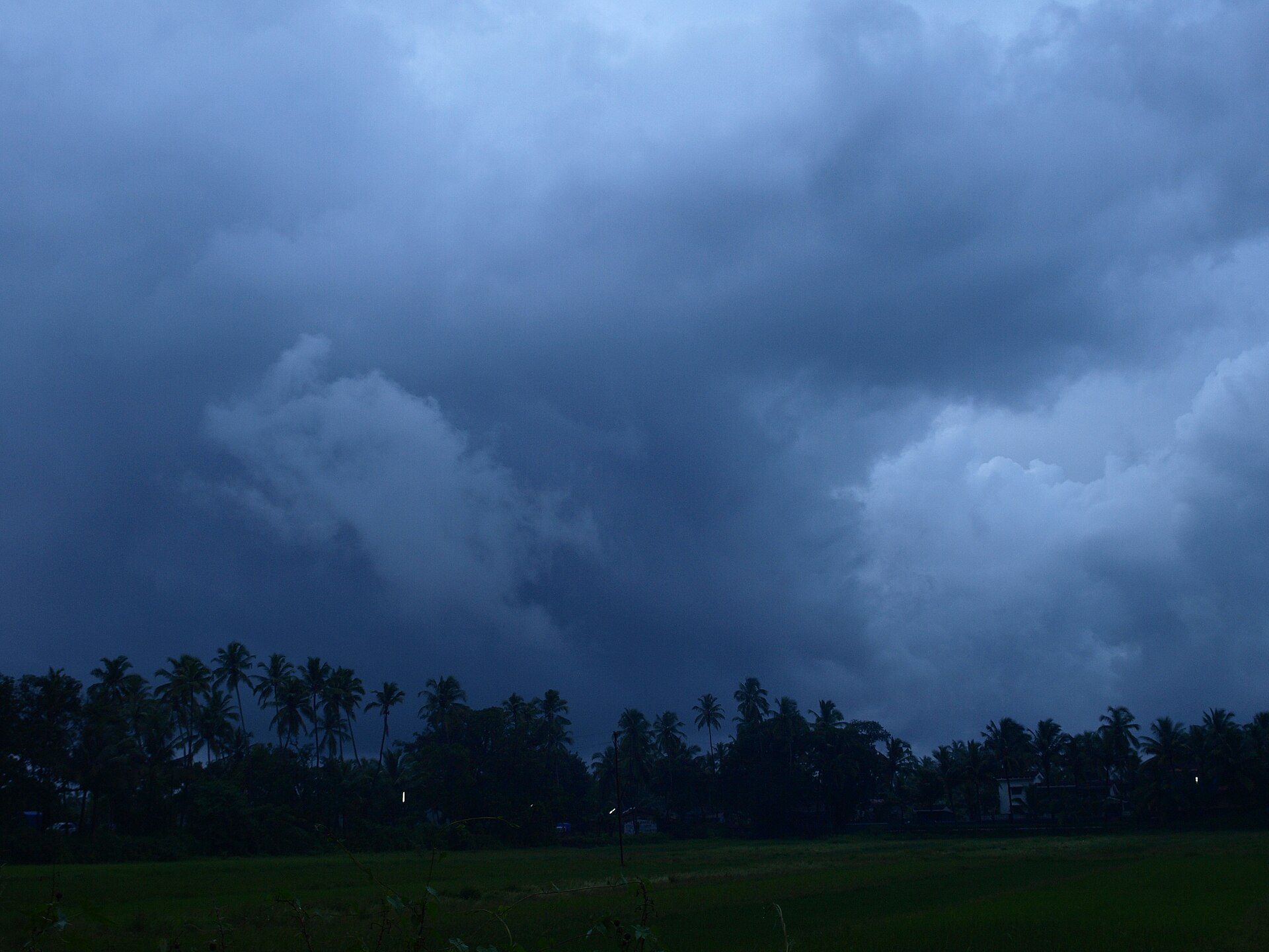
The seasonal reversal has dramatic effects on the Arabian Sea, which is landlocked to the north and isolated from large-scale ocean circulation; summer southwest winds push surface waters toward Asia, and cold water wells up along the coast of Somalia and the Arabian Peninsula. The monsoon climate produces high annual rainfall totals, exceeding 1.5 m (5 ft) in many places. The southwest monsoon accounts for 75 to 90 per cent of annual rainfall in most parts of South Asia, making it the lifeblood of national economies, agricultural production and food security.
5. Onset, Withdrawal and Rainfall Classification
The southwest monsoon normally sets in over Kerala around 1 June and advances northwards, usually in surges; the northern limit of monsoon is the northernmost limit up to which it has advanced on any given day. IMD declares the onset of the monsoon over Kerala when 60 per cent of the 14 listed stations report rainfall of 2.5 mm or more for two consecutive days, with the onset dated on the second day provided the wind field and outgoing longwave radiation criteria are also met. The wind field criterion requires the depth of westerlies to be maintained up to 600 hPa in the box from the equator to 10 N between 55 E and 80 E, with zonal wind speed over 5-10 N, 70-80 E of the order of 15 to 20 knots at 925 hPa. The third criterion is that INSAT-derived outgoing longwave radiation should be below 200 wm-2 in the box confined by 5-10 N and 70-75 E.
The criteria IMD uses for declaring withdrawal of the monsoon from the extreme north-western parts of the country were adopted in 2006 and are considered only after 1 September. They cover cessation of rainfall over the area for 5 continuous days, establishment of an anticyclone in the lower troposphere and considerable reduction in moisture content as seen in satellite water vapour imageries.
The long period average is the rainfall recorded over a region for an interval such as a month or season, averaged over a long period like 30 or 50 years; the all-India south-west monsoon long period average based on 1961-2010 stands at 880.6 mm. Against this average, rainfall is classified as large excess at 60 per cent or more, excess at 20 to 59 per cent, normal between -19 and +19 per cent, deficient at -59 to -20 per cent and large deficient at -99 to -60 per cent.
6. Interannual Variability and Forecasting
The dominant driver of year-to-year variations in the Asian-Australian monsoon is the El Nino Southern Oscillation, in which El Nino warming and La Nina cooling occur in the central and eastern equatorial Pacific, with El Nino normally suppressing monsoon rainfall and La Nina enhancing it.
IMD releases seasonal or long-range forecasts for the southwest monsoon in two stages: a first forecast in mid-April giving an overall estimate of the rain the country is expected to receive, and a second at the end of June that updates it and adds expected July rainfall and likely regional rainfall patterns. Over the four years from 2021 to 2024 IMD maintained 100 per cent accuracy in forecasting the all-India southwest monsoon rainfall, with each year's forecast falling within the accepted margin of error of plus or minus 5 per cent of the long period average.
7. Recent Seasons
In 2021 the southwest monsoon current arrived over the south Andaman Sea and Nicobar Islands on 21 May, set in over Kerala on 3 June four days later than normal, covered the entire country on 13 July, and withdrew from the entire country on 25 October. North-west India and central India received normal rainfall at 96 and 104 per cent of the long period average, the south peninsula received above normal rainfall at 111 per cent while east and north-east India received below normal rainfall at 88 per cent, and 20 of the 36 meteorological subdivisions covering 58 per cent of the country's area recorded normal seasonal rainfall.
Rainfall is likely to be below normal during the June to September 2026 southwest monsoon season across much of South Asia, with the strongest signal over central regions.
8. The North American Monsoon
The North American Monsoon is a seasonal change in the atmospheric circulation that occurs as the summer sun heats the continental land mass. It is a summer shift in wind patterns caused by intense solar heating, reversing the flow from dry land areas to moist ocean areas. During much of the year the prevailing wind over northwestern Mexico, Arizona and New Mexico is westerly and dry. Low-level moisture is transported primarily from the Gulf of California and eastern Pacific, and Sierra Madre Occidental forests add further moisture once they green up from the first monsoon rains. The monsoon happens once a year in the middle of summer, when warm, moist air from the Gulf of California and from the Gulf of Mexico meet over the Sierra Madre Occidental mountains in central Mexico.
The core of the North American Monsoon is located in northwestern Mexico and extends into the southwestern United States across much of Arizona and New Mexico. The circulation pattern typically develops in late May or early June over southwest Mexico and arrives in mid to late June over northwest Mexico and early July over the southwest United States. The monsoon season in northern Arizona officially runs from 15 June through 30 September, but monsoonal moisture typically does not reach the region until the first week of July.
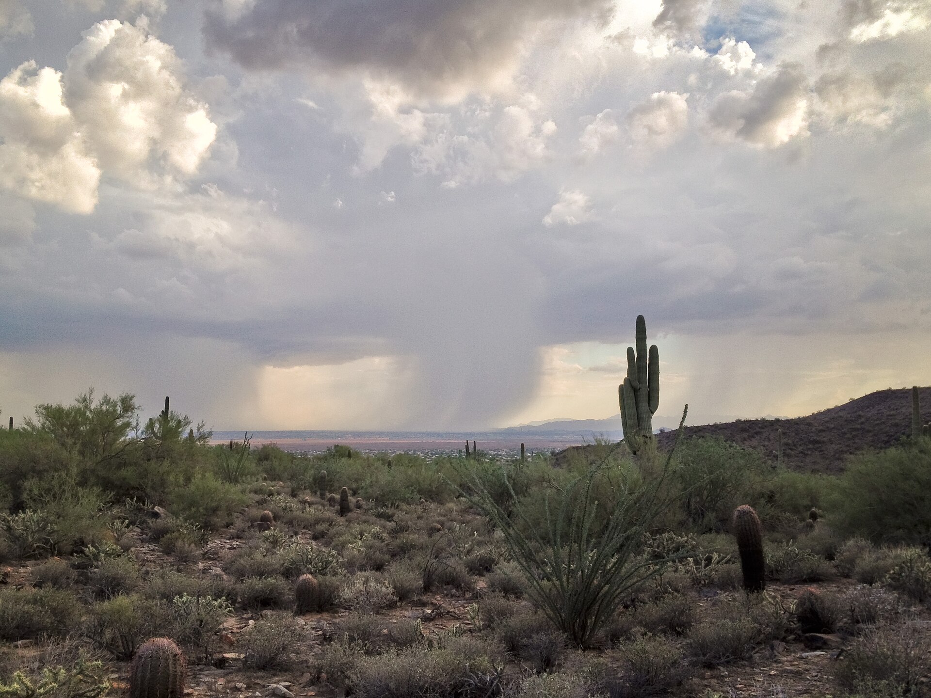
Rainfall from the North American Monsoon supplies northwestern Mexico with upwards of 75 per cent of its average annual precipitation and Arizona and New Mexico with more than 50 per cent during July through September. 40 to 50 per cent of northern Arizona's annual precipitation falls during the monsoon season, refilling reservoirs and supporting farmers and ranchers. As monsoon moisture increases and upper-level focusing mechanisms strengthen, flash flooding becomes the main concern. Flash flooding is the biggest threat in northern Arizona, most flood fatalities happen in vehicles, and 12 inches of water can sweep a car off the roadway. Lightning poses a serious threat to outdoor activities and no outside location is safe when thunderstorms are near, while safe locations include a substantial building or an enclosed metal-topped automobile.
Wetter-than-average North American monsoons are slightly more common during La Nina years, while drier-than-average monsoons are slightly more common during El Nino years. Monsoon conditions, though less intense than the Asian monsoon, also occur in northern Australia, parts of Africa and the Americas.
9. Agriculture, Water and Economy
Nearly 64 per cent of Indians depend on agriculture, which mainly relies on the southwest monsoon, and with only about 55 per cent of the net sown area irrigated the rest of the farmland depends on rain-fed systems and is vulnerable to changes in rainfall.
A lackluster monsoon can seriously impact food prices and India's overall economic growth. In one poor monsoon year, sugar, legume and potato prices rose and many estimated that India's gross domestic product growth rate could drop by a full percentage point.
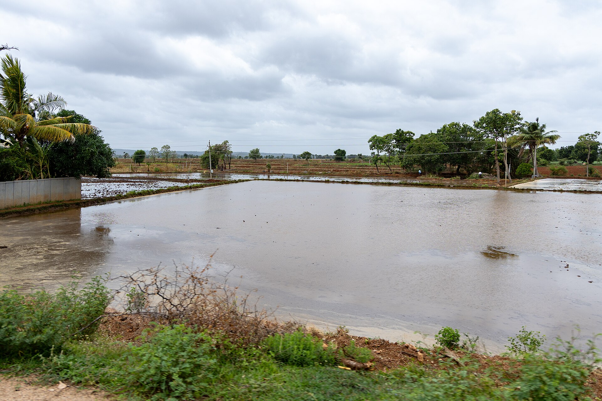
In the low-lying deepwater areas of western Bangladesh and eastern India, farmers have adopted sequences using appropriately selected Boro rice cultivars that take advantage of slowly receding post-monsoon water, with persistent shallow groundwater accessible for late-season supplementary watering.
10. Key Figures
The season's performance is tracked against the long period average, and in 2024 the June to September season recorded 934.8 mm of rainfall for the country, or 108 per cent of the 868.6 mm long period average based on the 1971-2020 average 10Monsoon (Press Note) · Press Information Bureau, Government of India ↗.
11. Timeline
-
21 May 2021Arrival over the south Andaman Sea and Nicobar IslandsThe southwest monsoon current arrived over the south Andaman Sea and Nicobar Islands. 11Monsoon Report 2021 (IMD Met. Monograph MoES/IMD/SYNOPTIC MET/01(2022)26) · India Meteorological Department, Pune ↗
-
3 June 2021Onset over KeralaThe monsoon set in over Kerala, four days later than normal. 11
-
13 July 2021Coverage of the entire countryThe monsoon covered the entire country. 11
-
25 October 2021Withdrawal from the entire countryThe monsoon withdrew from the entire country. 11
-
2026Seasonal outlookRainfall is likely to be below normal during the June to September southwest monsoon season across much of South Asia, with the strongest signal over central regions. 12South Asia is expected to receive below average monsoon rainfall · World Meteorological Organization ↗
12. Frequently Asked Questions
What share of annual precipitation does the North American Monsoon provide?
It supplies northwestern Mexico with upwards of 75 percent of its average annual precipitation, and Arizona and New Mexico with more than 50 percent during July through September. 13The North American Monsoon · NOAA Climate.gov ↗
What is the long period average?
It is the rainfall recorded over a particular region for an interval such as a month or season, averaged over a long period like 30 or 50 years. The current long period average of all-India south-west monsoon rainfall, based on 1961-2010, is 880.6 mm. 5Frequently Asked Questions (FAQs) on Monsoon · India Meteorological Department, Ministry of Earth Sciences ↗
What does the outlook indicate for the June to September 2026 southwest monsoon season?
Rainfall is likely to be below normal across much of South Asia, with the strongest signal over central regions. 12
How many monsoon depressions usually form in a season?
How much of India's farmland is rain-fed, and how large is the average farm?
Does El Niño always mean a weak Indian monsoon?
El Niño generally suppresses Indian monsoon rainfall, whereas La Niña generally increases it 17ENSO and the Indian Monsoon: not as straightforward as you'd think · NOAA Climate.gov ↗. But the strongest El Niño of the twentieth century produced above-average monsoon rain and no drought in India, while one of the driest Indian monsoons featured only a weak to moderate El Niño 17.
Why is forecasting the Indian monsoon considered so difficult?
Forecasting the Indian summer monsoon is one of the oldest challenges in climate science; droughts in India during the eighteenth and nineteenth centuries triggered some of the first inquiries into monsoon failures, and the vagaries of the southwest monsoon over India remain one of the big puzzles of climate science 15. Concern that climate change could increase extreme weather patterns has added to interest in finding more ways to plan ahead for the monsoon 15.
How does the monsoon shape rice cropping in South Asia?
In almost all rice-based cropping sequences, the timing of the initial post-dry-season rice crop is constrained within the monsoonal rainfall period, and in deepwater systems it is limited to the months immediately before or after the monsoon 16Rice and water: regional situations, trends and projections · Food and Agriculture Organization of the United Nations (FAO) ↗. Farms that lack supplemental water usually have their options restricted to a single rice crop or two-phase sequences, whereas three-crop and multi-year sequences are more likely to be adopted on irrigated land or by favourably rainfed lowland farms 16.
13. Timeline: from the Cherrapunji records to the 2026 outlook
- July 1861Record July rainfall at CherrapunjiCherrapunji in Meghalaya recorded more than 9,000 mm (354 inches) of rain in July 1861, among the heaviest monthly totals ever measured.
- 1875India Meteorological Department establishedThe India Meteorological Department was established in 1875 and now delivers weather and climate services across disaster management, agriculture, aviation and public safety.
- monsoon season of 1899Cherrapunji seasonal recordThe monsoon season of 1899 brought Cherrapunji 16,305 mm (642 inches) of rain, the highest seasonal total recorded there.
- early 1900sGilbert Walker and the groundwork for ENSOSir Gilbert Walker, director of the India Meteorological Department in the early 1900s, laid the groundwork for uncovering the El Nino-Southern Oscillation while searching for the causes of monsoon failures.
- July 191524-hour rainfall record at CherrapunjiCherrapunji recorded 897 mm (35 inches) of rain in 24 hours in July 1915, one of the extreme daily totals that make the monsoon the heaviest seasonal rainfall system on Earth.
- mid-1980sEast Asian winter monsoon weakensAt the inter-decadal scale the East Asian winter monsoon weakened significantly in the mid-1980s, a change attributed to atmospheric quasi-stationary planetary waves and external forcings.
- 1997-1998Strongest El Nino of the century, above-average monsoonThe strongest El Nino in the twentieth century, in 1997-1998, produced a monsoon season with above-average rainfall rather than a drought, showing that El Nino alone does not determine the Indian monsoon.
- 2002Driest Indian monsoon with a weak El NinoOne of the driest Indian monsoons, in 2002, featured only a weak to moderate El Nino, the opposite pairing to the record El Nino year five years earlier.
- mid-2000sEast Asian winter monsoon recoversIn the mid-2000s the East Asian winter monsoon was observed to recover from the weak period that had begun around 1985.
- 2006IMD adopts withdrawal criteriaThe India Meteorological Department adopted in 2006 its current operational criteria for declaring the withdrawal of the monsoon from the extreme north-western parts of the country.
- 2016New onset criteria for KeralaIMD adopted in 2016 a new criteria for declaring monsoon onset over Kerala, based on rainfall at 14 stations along with wind field and outgoing longwave radiation over the south-east Arabian Sea.
- 21 May to 25 October 2021The 2021 monsoon seasonIn 2021 the southwest monsoon reached the Andaman Sea in the last week of May, set in over Kerala on 3 June against a normal date of 1 June, covered the whole country by 13 July and withdrew from the entire country on 25 October.
- June to September 2024Above-normal 2024 monsoonIndia recorded 934.8 mm of rainfall during the 2024 southwest monsoon season, which is 108 per cent of the long period average of 868.6 mm based on the 1971-2020 average.
- 2025Asian-Australian Monsoon Working Group refreshedThe Asian-Australian Monsoon Working Group was refreshed in 2025 with 17 members drawn from the international research community.
- 30 April 2026WMO outlook for the 2026 monsoonA WMO seasonal forecast issued on 30 April 2026 indicated that rainfall was likely to be below normal during the June-September 2026 southwest monsoon season across much of South Asia.
References (20)
- 1Monsoon — Encyclopaedia Britannica ArchiveView source
- 2Monsoon (Encyclopedic Entry) — National Geographic Society, Education ArchiveView source
- 3Winds Connect Snow to Sea — NASA Earth Observatory WebView source
- 4Met Office explains: What are monsoons? — Met Office (United Kingdom) 2025 WebView source
- 5Frequently Asked Questions (FAQs) on Monsoon — India Meteorological Department, Ministry of Earth Sciences Web↩View source
- 6Inter-Tropical Convergence Zone — NOAA National Weather Service (JetStream) WebView source
- 7Annex V: Monsoons — IPCC AR6 Working Group I — Intergovernmental Panel on Climate Change WebView source
- 8Onset & Advance of Monsoon — India Meteorological Department, Ministry of Earth Sciences WebView source
- 9Regional Working Group on Asian-Australian Monsoons — International Monsoons Project Office, Indian Institute of Tropical Meteorology (CLIVAR/GEWEX) WebView source
- 10Monsoon (Press Note) — Press Information Bureau, Government of India Book↩View source
- 11Monsoon Report 2021 (IMD Met. Monograph MoES/IMD/SYNOPTIC MET/01(2022)26) — India Meteorological Department, Pune 2021 Book↩View source
- 12South Asia is expected to receive below average monsoon rainfall — World Meteorological Organization Web↩View source
- 13The North American Monsoon — NOAA Climate.gov Web↩View source
- 14Monsoon Information Page — NOAA National Weather Service, Tucson WebView source
- 15Living with an Uncertain Monsoon — NOAA Climate.gov Web↩View source
- 16Rice and water: regional situations, trends and projections — Food and Agriculture Organization of the United Nations (FAO) Web↩View source
- 17ENSO and the Indian Monsoon: not as straightforward as you'd think — NOAA Climate.gov Web↩View source
- 18Northern Arizona Monsoon Season — NOAA National Weather Service, Flagstaff WebView source
- 19Monsoons — Met Office (United Kingdom) WebView source
- 20Indian monsoon — Encyclopaedia Britannica ArchiveView source