Mangrove
How salt-tolerant trees and shrubs build forests in the intertidal zone of tropical coasts: aerial roots, salt glands and floating seedlings, the extent and value of the world's mangroves, the animals that depend on them, and the global effort to stop their loss.
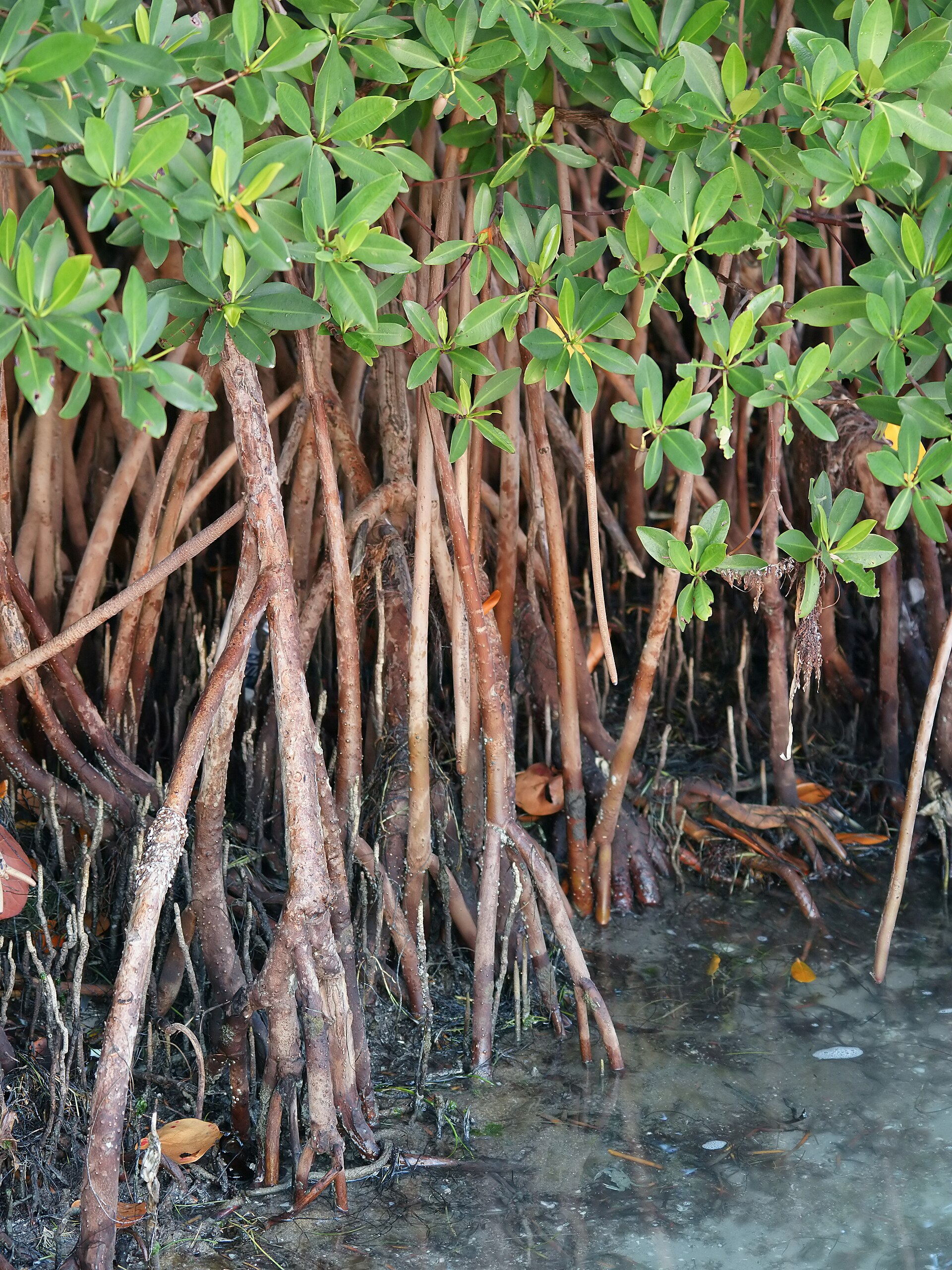
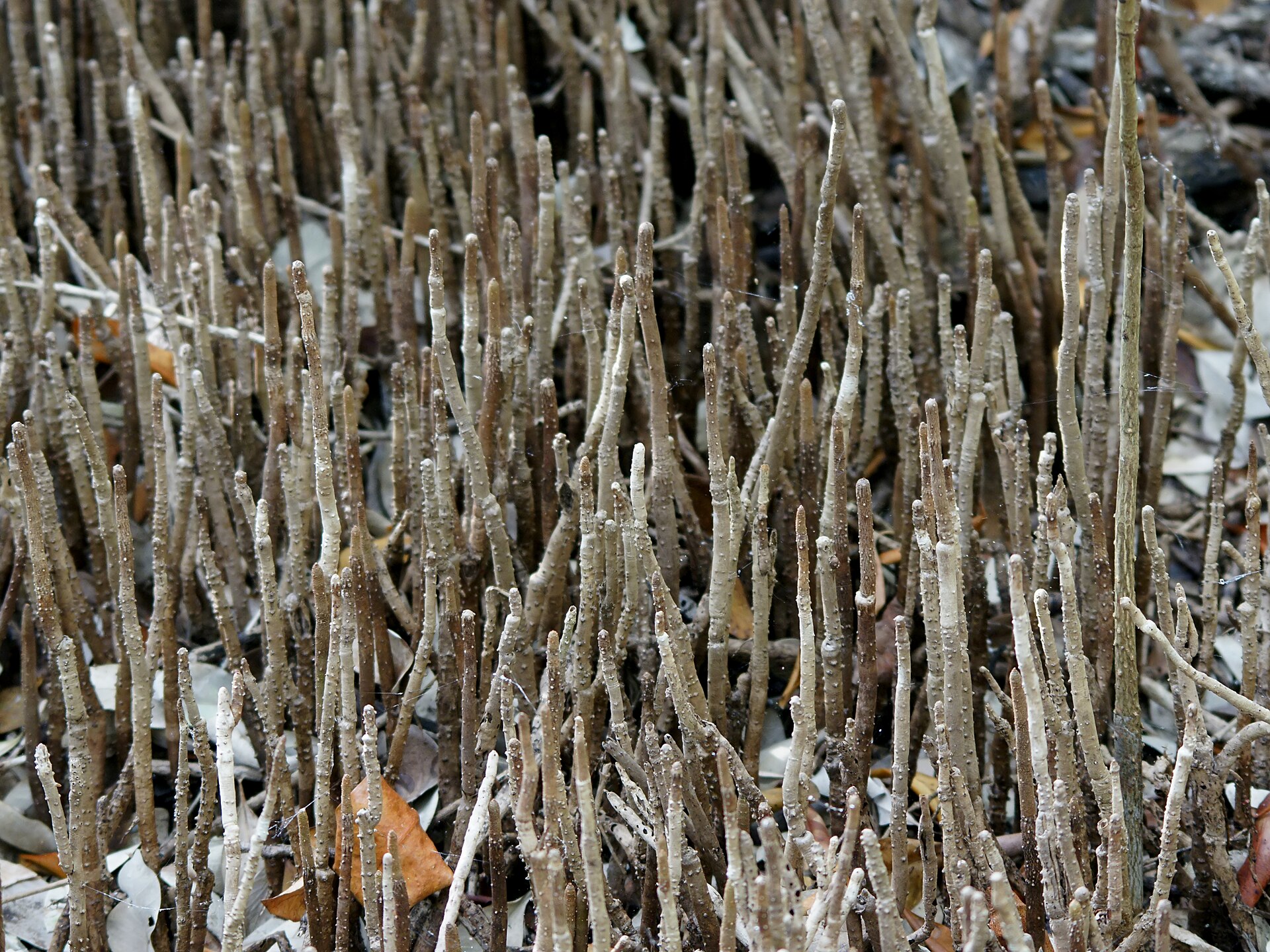
Mangroves are salt-tolerant trees and shrubs that grow in the intertidal zone along tropical and subtropical coasts, where they form the mangrove forest, or mangal. Aerial roots that breathe through lenticels, salt exclusion at the roots and salt secretion through leaves, and buoyant seedlings let them survive waterlogged and saline mud. They cover about 150 thousand km2, store almost 11 billion tonnes of carbon and protect 15.4 million people a year from coastal disasters, while serving as nurseries for fish and crustaceans. More than half of the world's mangrove ecosystems are at risk of collapse, mainly because of conversion to aquaculture and agriculture, and the IUCN Red List of Ecosystems, Global Mangrove Watch, the Global Mangrove Alliance and the Mangrove Breakthrough now track and target their recovery.
In this article
Overview
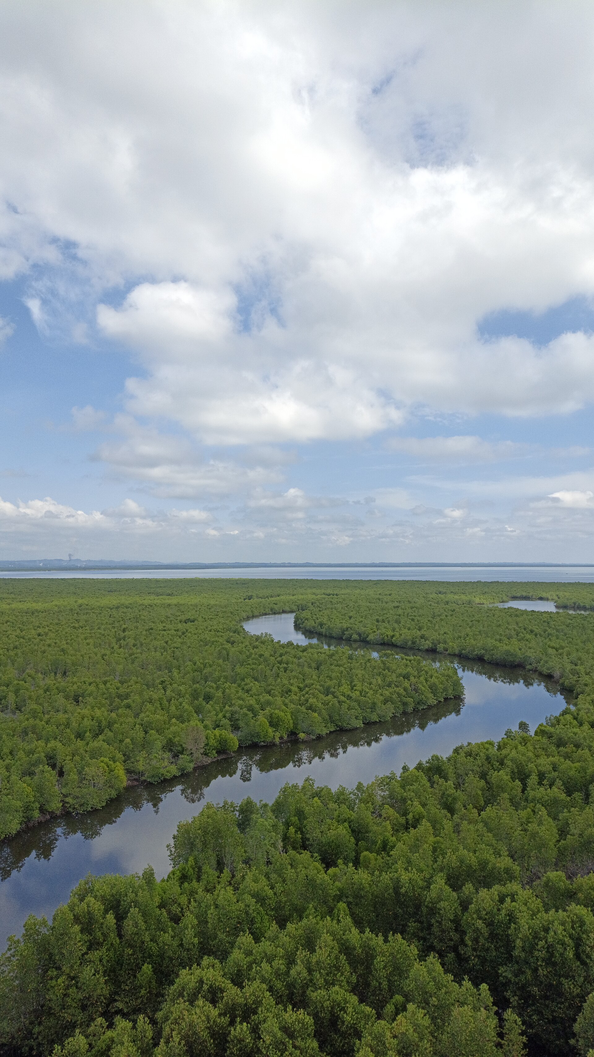
Mangroves are salt-tolerant evergreen tree- or shrub-dominated ecosystems found in intertidal environments at the land-sea interface along tropical and subtropical coastlines, shallow-water lagoons, estuaries, rivers and deltas. They are a group of trees and shrubs that live in the coastal intertidal zone.
The world's mangrove ecosystems cover about 150 thousand km2 along mainly tropical, sub-tropical and some warm temperate coasts of the world.
1. Distribution and Extent
Mangrove forests are confined to tropical and subtropical latitudes near the equator, since the trees cannot withstand freezing temperatures.
Estimates of global extent vary with the method used. The Food and Agriculture Organization of the United Nations put worldwide mangrove cover at an estimated 14.8 million hectares. Satellite maps, which show the location and relative density of mangroves, indicate cover of an estimated 137,760 square kilometers of Earth's surface. Based on global mangrove maps released by the Global Mangrove Watch, an estimated 147,359 km2 of mangrove forest cover existed globally in 2020. A 2022 report brought Global Mangrove Watch data coverage from 2016 up to 2020 and shows that 147,000 km2 of mangroves remain worldwide, an area about the size of Bangladesh.
The distribution is uneven across regions. By continental breakdown, about 42 percent of mangroves lie in Asia, 21 percent in Africa, 15 percent in North and Central America, 12 percent in Australia and the islands of Oceania, and 11 percent in South America. The Global Mangrove Watch figures place 51 per cent of cover in the Asia-Pacific, 29 per cent in the Americas and 20 per cent in Africa. Southeast Asia alone has almost 50,000 km2 of mangrove cover, about one-third of all mangroves across the world.
Mapping efforts continue to refine these figures. Giri and colleagues found 12.3 percent less area covered by mangroves than previously estimated by the United Nations Food and Agriculture Organization, and the current extent is probably half of what once existed. The Global Mangrove Watch confirmed a six-fold improvement in its ability to map mangroves, adding six new territories to its database.
2. Form and Adaptations
Mangroves are salt-tolerant coastal trees that sequester carbon, filter water, act as buffers from storms and provide habitat for wildlife. Their most conspicuous structural feature is a dense tangle of prop roots that make the trees appear to be standing on stilts above the water.
Florida's three native species are the red mangrove (Rhizophora mangle), the black mangrove (Avicennia germinans) and the white mangrove (Laguncularia racemosa), each with unique adaptations to salinity and hydrology and thriving along distinct zones of the intertidal gradient. Black mangroves are effective at stabilizing shorelines and offer storm protection for habitats affected by climate change at the water's edge. Along with many other shoreline plant species, mangroves provide ecosystem services and do their part to prevent erosion.
At the poleward marsh-mangrove ecotone, mangrove abundance and coverage is winter temperature-sensitive, oscillating in response to extreme winter temperatures, and future winter climate change is expected to facilitate poleward mangrove range expansion at the expense of salt marshes in Texas, Louisiana and parts of Florida. In many areas of the Gulf coast, the types of emergent vegetation in some estuarine habitats are starting to shift from salt marsh to black mangrove due to climate change.
3. Ecosystem Services
Mangroves shield coastlines from the force of the sea. Globally, they protect 15.4 million people and USD 65 billion worth of property each year from coastal disasters. Their forests stabilize the coastline, reducing erosion from storm surges, currents, waves and tides. They have also been found to be an effective defense against tsunamis, reducing wave heights between 5 and 35 per cent.
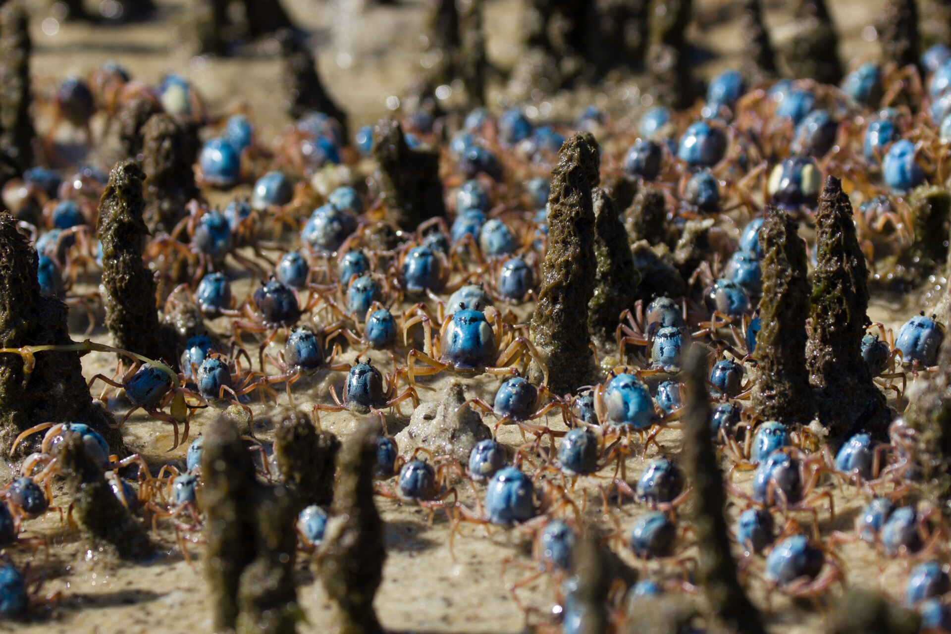
Mangroves underpin coastal fisheries. Global mangroves support 126 million fishing days per year, providing a key source of food for human populations living near coasts and beyond. Penaeid shrimp, commonly referred to as pink, white and brown shrimp in the Gulf of Mexico, make up one of the most economically valuable fisheries in the United States, with USD 371 million in landings revenue in 2019, 45 percent of the Gulf of Mexico total. When young, shrimp use estuarine habitats like salt marsh, seagrass beds and oyster reefs as nursery areas that provide juvenile shrimp with food and protection from predators before they return to the fishery in the ocean.
The value of mangrove-derived ecosystem services has been estimated at between US$33,000 and US$57,000 per hectare per year, including timber, fuelwood and construction materials, fisheries, medicinal compounds, water quality maintenance, coastal protection and ecotourism. These ecosystems provide essential ecosystem goods and services that contribute significantly to the livelihoods, well-being and security of coastal communities.
Mangrove ecosystems are an important indicator of biodiversity health and are critical for climate mitigation and adaptation. Of the more than 1,500 species that depend on mangroves for their survival, 15 per cent are threatened with extinction.
4. Carbon Storage and Blue Carbon
Mangroves are among the most carbon-dense ecosystems on Earth. Globally they store almost 11 billion tons of carbon, nearly three times the amount held by tropical forests of the same size. The global average carbon stock of mangroves is around 1,000 tonnes of carbon per hectare, a figure that includes soil carbon.
A blue carbon assessment conducted at five mangrove sites across West Papua Province in Indonesia — a region supporting 10% of the world's mangrove area — found that total carbon stocks of undisturbed mangroves ranged between 182 and 2,730 Mg C/ha, with a mean and standard deviation of 1,087 ± 584 Mg C/ha. Among carbon pools, 89% of total carbon stocks were stored in the soil, while 10% was stored in biomass and 1% in dead wood.
Disturbance can strip these stores rapidly: aquaculture conversion removed 60% of the soil carbon stock and 85% of the live biomass carbon stock relative to reference sites. Recovery is possible, however — mangroves left to regenerate for more than 25 years reached the same level of biomass carbon as undisturbed forests, with annual accumulation rates of 3.6 ± 1.1 Mg C per hectare per year. The study concludes that hydrogeomorphic setting controls natural dynamics of blue carbon stocks, while long-term land-use changes affect carbon loss and gain substantially.
Globally, marine mangroves held 67% of the total mangrove soil organic carbon, reaching 3025 +/- 345 Tg C, while 1502 +/- 154 Tg C was stored in estuarine mangrove sediments. Estuarine mangroves accumulated more soil organic carbon than marine mangroves, at 282 +/- 8.1 and 250 +/- 5.0 Mg C per hectare respectively, mainly because of additional terrestrial organic carbon inputs. Mangrove sediments hold approximately 70% of the whole ecosystem's carbon storage, a share that varies geographically with coastal environmental settings.
High methane evasion rates have the potential to partially offset blue carbon burial rates in mangrove sediments on average by 20%, with a sensitivity analysis offset range of 18 to 22%, using the 20-year global warming potential. Water-atmosphere methane flux rates in the three studied mangrove creeks ranged from 96.5 to 1049.8 μmol m-2 day-1 and were 64%, 91%, and 40% higher in the wet season compared to the dry season. A literature review showed that methane fluxes from exposed mangrove sediments are highly variable, ranging from 0 to 2127.2 μmol m-2 day-1 and generally larger than emissions from mangrove creek waters.
The significance of these stocks becomes clear against the wider coastal context: vegetated coastal habitats cover less than 2% of the coastal ocean but have carbon burial rates 40 times higher than tropical rainforests and account for more than half of the carbon burial in marine sediments. Accurate quantification of organic carbon fractions in mangrove sediments is essential for allocating carbon credits under certification standards such as the Verified Carbon Standard.
5. Loss, Threats and Risk
More than half of all mangrove ecosystems are at risk of collapse, according to the first global mangrove assessment for the IUCN Red List of Ecosystems. Nearly 20% (19.6%) of the assessed mangroves are at high risk, classed as either Endangered or Critically Endangered. The study classified the world's mangrove ecosystems into 36 different regions called provinces and assessed the threats and risk of collapse in each region. This work has been led by IUCN with the active involvement of more than 250 experts based in 44 countries, coming from various research institutions.
Mangroves are threatened by deforestation, development, pollution and dam construction, while the risk to these ecosystems is increasing due to sea-level rise and severe storms associated with climate change. Up to 43% of the mangrove losses that occurred between 2000 and 2020 are attributed to conversion to aquaculture, oil palm plantations and rice cultivation. An estimated 62% of global losses between 2000 and 2016 resulted from land-use change, primarily through conversion to aquaculture and agriculture, and up to 80% of these human-driven losses occurred within six Southeast Asian nations.
A net 5,245 km2 of mangrove forest, equivalent to 3.4 per cent of cover, has been lost over the 24 years since 1996, while average losses over the last decade have fallen to 0.04% per year and there have been considerable gains in river mouths and deltas. The latest satellite imagery indicates the global loss has stabilised. Global mangrove loss rates declined by 73% since 2000 while conversion of mangroves to aquaculture, agriculture, and settlement decreased globally. The world lost 3,363 km2 (2.1%) of mangrove between 2000 and 2016, an average annual rate of 0.13%. Gains in mangrove area have also become increasingly prevalent in some regions, helping to offset losses.
Scientists have used satellite imaging to map the extent of mangroves worldwide and to show that tropical mangrove forests are being lost across Southeastern Asia, particularly in Indonesia and Myanmar. Outside of Asia, tidal wetlands in Africa had the highest ratio of loss to gain, a loss associated with severe mangrove degradation that is most intense in Nigeria, Mozambique, and Guinea-Bissau. Mangroves showed the highest ratio of loss to gain, with an estimated net decrease of 3,700 square kilometers (1,400 square miles). The researchers reported that their data suggest a net loss of tidal wetlands on deltas globally, though gains of 2,100 square kilometers (810 square miles) alongside losses of 2,300 square kilometers (890 square miles) indicate the considerable dynamism of these systems.
Under business as usual the models used for the assessment predict that 25% of the global mangrove area will be submerged in the next 50 years. Without significant changes by 2050 climate change and sea level rise will result in the loss of 1.8 billion tonnes of carbon stored in mangroves, 17% of the current total, valued at a minimum of $13 billion.
Mangroves face growing threats from development, pollution and mismanagement, and improper trimming practices can harm their health and resilience, especially along developed coastlines. Trimming mangroves excessively or incorrectly can stress the trees and leave them vulnerable to damage. The 1996 Mangrove Trimming and Preservation Act (MTPA) is listed among the key terms of Florida's mangrove guidance, along with mangroves, pruning and environmental law.
6. Conservation, Restoration and Research
The legal protection of mangrove forests remains far from complete: only 6.9 percent of mangrove forests are protected by law.
Restoration carries substantial promise. The Global Mangrove Alliance has set a goal of restoring half of the 8,183 km2 of restorable area by 2030. Meeting that goal could result in an additional 25 billion commercial marine fish and shellfish and benefit 4.1 million small-scale fishers.
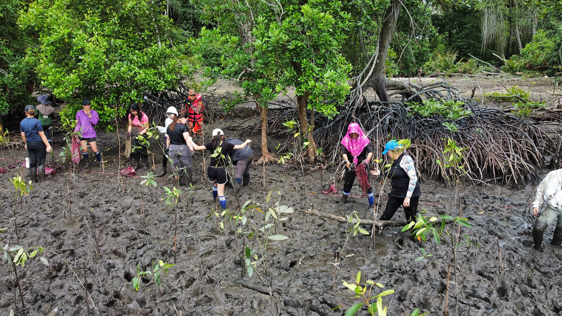
In 2018 Conservation International, IUCN, The Nature Conservancy, Wetlands International and the World Wildlife Fund formed the Global Mangrove Alliance. The alliance now has more than 100 members and 14 national chapters, representing technical experts, civil society organizations, governments, local communities, businesses, funding agencies and foundations. It is a coordinated, multidisciplinary approach to mangrove conservation and restoration at a scale that matters. Its stated targets are to halt loss, restore half and double protection, with a call to act now for coordinated global impact.
A global campaign launched in late 2022 to restore and protect mangrove ecosystems, the Mangrove Breakthrough, has gained support from 50 governments. Its goal is to mobilise USD 4 billion to ensure the future of 15 million hectares of mangroves.
Hydrologic restoration is one of several approaches to rehabilitate mangroves on a large-scale. USGS evaluates how solely restoring tidal hydrologic flows affects the recovery of mangroves in Florida.
USGS and NPS partners are working together to analyze and synthesize long-term SET-MH measurements to improve understanding of coastal wetland soil elevation change and ecological responses to sea-level rise. USGS researchers will utilize long-term soil elevation change data to help advance understanding of soil elevation dynamics and ecological transformations within coastal wetlands of the Greater Everglades. WARC researchers are comparing tree and root growth, soil CO2 flux and surface elevation change between fertilized and unfertilized mangrove forests to assess the potential impact of increased nutrient loading and to help rate mangrove stand vulnerability.
Using digital image classification techniques, the research team compiled and analyzed more than 1,000 scenes from the Landsat series of satellites. Using a Random Forest-based analysis of over one million Landsat images, the study produced the first 30 m resolution global maps of the drivers of mangrove loss covering 2000 to 2016 and capturing both human-driven and natural stressors.
The UN Decade of Ocean Science for Sustainable Development (2021-2030), led by UNESCO's Intergovernmental Oceanographic Commission, aims to support efforts to reverse the cycle of decline in ocean health and to gather ocean stakeholders behind a common framework ensuring that ocean science can fully support countries in creating improved conditions for sustainable development of the ocean. In eastern Ghana, the UN Ocean Decade-endorsed MANCOGA project aims to develop a robust and participatory Nature-based Solution that uses mangroves to address coastal flooding, erosion, pollution and biodiversity loss to strengthen community resilience.
7. Notable Mangrove Forests
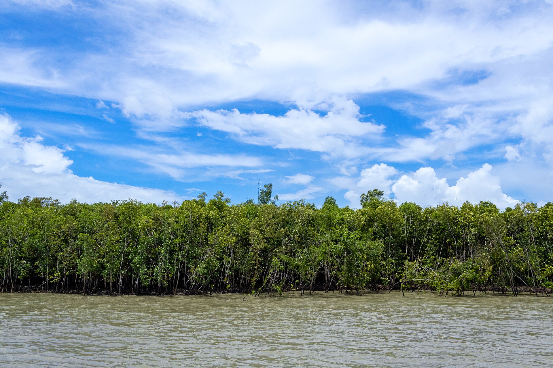
The Sundarbans mangrove forest stands among the largest such forests in the world, covering 140,000 hectares on the delta of the Ganges, Brahmaputra and Meghna rivers on the Bay of Bengal. The property was inscribed on the World Heritage List in 1997 under natural criteria (ix) and (x), with an inscribed property area of 139,500 ha. Its fauna is notably wide-ranging, encompassing 260 bird species alongside the Bengal tiger and other threatened species such as the estuarine crocodile and the Indian python. Criterion (ix) recognizes the property as a significant example of on-going ecological processes, among them delta formation, tidal influence and the colonization of newly formed deltaic islands by associated mangrove communities. Storms, cyclones and tidal surges up to 7.5 m high pose a potential threat to the property's values, with possible increased frequency as a result of climate change.
8. Key Dates
-
2007FAO Forestry Paper 153 publishedThe world's mangroves 1980-2005 was published in Rome by the Food and Agriculture Organization of the United Nations.21The world's mangroves 1980-2005 (FAO Forestry Paper 153) · Food and Agriculture Organization of the United Nations (FAO) ↗
-
26 JulyWorld Mangrove DayObserved annually on 26 July.12An Inside Look at the Beauty and Benefits of Mangroves · UNESCO ↗
9. Timeline: from the Sundarbans inscription to the 2024 Red List assessment
- 1987India's Sundarbans inscribedIndia's Sundarbans World Heritage site was inscribed in 1987 and lies adjacent to the Bangladesh Sundarbans across the border.
- 1996Global mangrove change baselineThe 1996 baseline used to measure global mangrove change shows a net loss of 5,245 km2, or 3.4 per cent of cover, over the following 24 years.
- 7 December 1997The Sundarbans joins the World Heritage ListBangladesh's Sundarbans was inscribed on the World Heritage List in 1997 under natural criteria (ix) and (x), with an inscribed property of 139,500 hectares.
- 2007FAO publishes the mangrove assessment 1980-2005The FAO published The world's mangroves 1980-2005 as Forestry Paper 153 in Rome in 2007, assessing mangrove resources and trends over a quarter of a century.
- 17 April 2016Mangrove Migration NetworkUSGS established the Mangrove Migration Network to study the winter temperature-sensitive marsh-mangrove ecotone, where poleward mangrove expansion is expected at the expense of salt marshes in Texas, Louisiana and parts of Florida.
- 2018Global Mangrove Alliance formedIn 2018 Conservation International, IUCN, The Nature Conservancy, Wetlands International and the World Wildlife Fund formed the Global Mangrove Alliance.
- 2018Methane offset quantified for mangrove sedimentsA study collected in 2018 found that methane emissions can partially offset blue carbon burial in mangrove sediments by about 20 per cent.
- 2020Global Mangrove Watch extended to 2020Data updates to Global Mangrove Watch brought coverage from 2016 up to 2020, showing 147,000 km2 of mangroves remaining worldwide.
- May 2020Papua blue carbon assessment publishedThe West Papua blue carbon assessment was published in May 2020, reporting total carbon stocks of undisturbed mangroves and the effect of aquaculture conversion on soil carbon.
- 23 July 2021Nutrient loading and mangrove stressWARC researchers began comparing fertilized and unfertilized mangrove forests to assess the impact of increased nutrient loading and to help rate mangrove stand vulnerability.
- 21 September 2022State of the World's Mangroves 2022The Global Mangrove Alliance launched The State of the World's Mangroves 2022, compiled with the help of over 100 mangrove science, finance and policy experts.
- late 2022Mangrove Breakthrough campaignThe Mangrove Breakthrough, a global campaign launched in late 2022, gained support from 50 governments with a goal of mobilising USD 4 billion to ensure the future of 15 million hectares of mangroves.
- 26 July 2023World Mangrove Day in focusUNESCO marked the International Day for the Conservation of the Mangrove Ecosystem on 26 July 2023 with an inside look at the benefits mangroves provide to people and nature.
- 22 May 2024First global Red List assessment of mangrovesIUCN published the first global mangrove assessment for the Red List of Ecosystems in May 2024, finding that more than half of the world's mangrove ecosystems are at risk of collapse.
- October 2024Global assessment of mangrove soil carbon sourcesA global-scale stable isotope assessment distinguished autochthonous from allochthonous organic carbon in mangrove sediments, a distinction required for the proper allocation of blue carbon credits.
- 12 November 2024Synthesizing surface elevation dataUSGS and National Park Service partners began synthesizing long-term SET-MH measurements to advance understanding of sea-level-rise impacts on mangrove forests and salt marshes.
References (21)
- 1Mangroves — Food and Agriculture Organization of the United Nations (FAO) WebView source
- 2What is a mangrove forest? — NOAA National Ocean Service WebView source
- 3Red List of Mangrove Ecosystems — International Union for Conservation of Nature (IUCN) WebView source
- 4Mapping Mangroves by Satellite — NASA Earth Observatory WebView source
- 5Mangrove forests — United Nations Environment Programme (UNEP) WebView source
- 6Mangroves for Climate Action: Global Mangrove Alliance launches new State of World Mangrove Report — International Union for Conservation of Nature (IUCN) WebView source
- 7New 'State of the World's Mangroves' report underscores critical links to biodiversity, climate, and communities — International Union for Conservation of Nature (IUCN) WebView source
- 8Mangrove Trimming Regulations (FA271) — University of Florida IFAS Extension (EDIS) WebView source
- 9"Climate Change at the Water's Edge": Understanding Impacts of Black Mangroves on Juvenile Shrimp — NOAA Fisheries (National Oceanic and Atmospheric Administration) WebView source
- 10Mangroves: Saltwater Forests — University of Florida IFAS Extension (Blogs.IFAS) 2022 WebView source
- 11Mangroves — U.S. Geological Survey (USGS) WebView source
- 12An Inside Look at the Beauty and Benefits of Mangroves — UNESCO Web↩View source
- 13Mangrove blue carbon stocks and dynamics are controlled by hydrogeomorphic settings and land-use change — Global Change Biology (PubMed Central) WebView source
- 14A global assessment of mangrove soil organic carbon sources and implications for blue carbon credit — Nature Communications (PubMed Central) WebView source
- 15Methane emissions partially offset "blue carbon" burial in mangroves — Science Advances (PubMed Central) WebView source
- 16More than half of all mangrove ecosystems at risk of collapse by 2050, first global assessment finds — International Union for Conservation of Nature (IUCN) WebView source
- 17Global declines in human-driven mangrove loss — Global Change Biology (PubMed Central) WebView source
- 18Mapping Missing Mangroves — NASA Earth Observatory WebView source
- 19The Mangrove Alliance — Global Mangrove Alliance WebView source
- 20The Sundarbans — UNESCO World Heritage Centre WebView source
- 21The world's mangroves 1980-2005 (FAO Forestry Paper 153) — Food and Agriculture Organization of the United Nations (FAO) 1980 Web↩View source