Lothal
The Indus dockyard that traded with Mesopotamia.
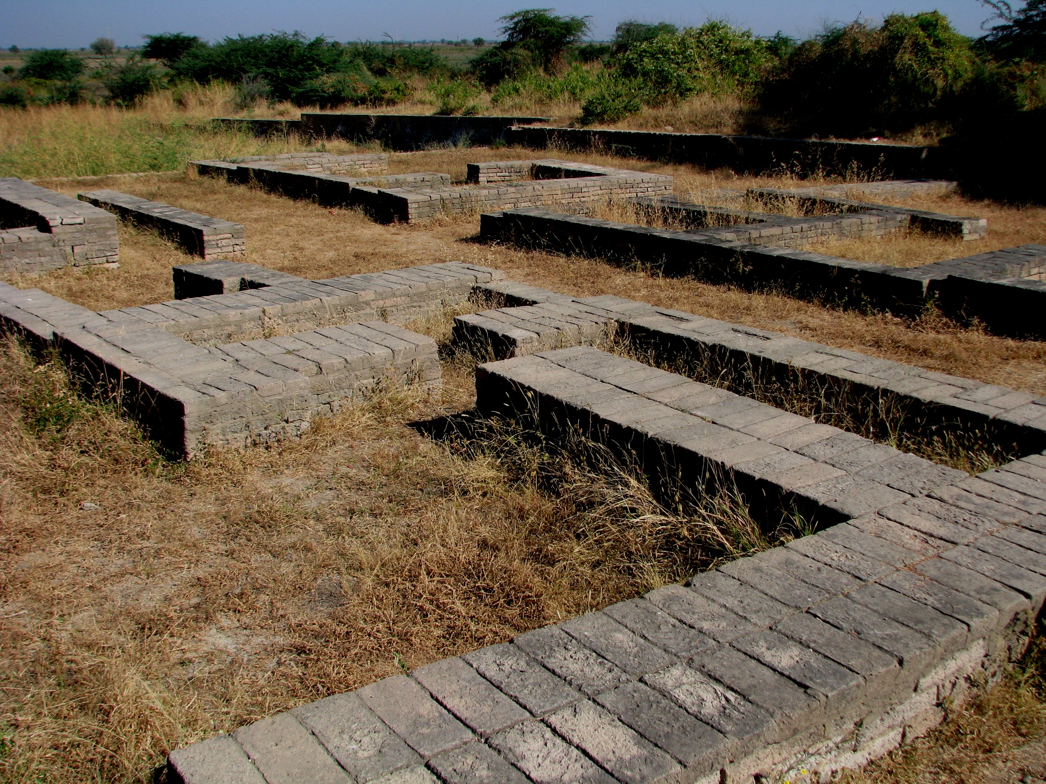
Overview
Lothal was one of the southernmost sites of the ancient Indus Valley Civilisation, situated in the Bhal region of the Indian state of Gujarat1Lothal — wiki · Wikipedia ↗. The settlement lies near the village of Saragwala in the Dholka Taluka of Ahmedabad district2Lothal — sec1 · Wikipedia ↗. In Gujarati the name Lothal, a combination of Loth and (s) thal, means "the mound of the dead"3Lothal — sec2 · Wikipedia ↗.
The Archaeological Survey of India, the official Indian government agency for the preservation of ancient monuments, discovered Lothal in 19542. Villagers in the surrounding countryside had long known of the presence of an ancient town and human remains3. Excavation work at the site commenced on 13 February 1955 and continued until 19 May 19602.
Harappans were drawn to Lothal by its sheltered harbour, its rich cotton and rice-growing environment and its bead-making industry4Lothal — sec3 · Wikipedia ↗. Groups based around Lothal and from Sindh took the opportunity to expand their settlement and create a planned township on the lines of the greater cities of the Indus valley5Lothal — sec4 · Wikipedia ↗. A silted creek connecting modern Bholad with Lothal and Saragwala preserves the ancient flow channel of a river or creek3.
In ancient times Lothal was an important trade centre, its trade in beads, gems and valuable ornaments reaching the far corners of West Asia and Africa2. Metalware, gold and jewellery and tastefully decorated ornaments attest to the culture and prosperity of the people of Lothal6Lothal — sec5 · Wikipedia ↗. The uniform organisation of the town and its institutions makes it evident that the Harappans were a very disciplined people6.
Lothal contributes one of three measurement scales that are integrated and linear, the others having been found at Harappa and Mohenjodaro7Lothal — sec8 · Wikipedia ↗. An ivory scale from Lothal bears the smallest-known decimal divisions in Indus civilisation7. A thick ring-like shell object found with four slits each in two margins served as a compass to measure angles on plane surfaces such as housing alignments, roads or land surveys7.
While the wider debate over the end of the Indus Civilisation continues, archaeological evidence gathered by the ASI appears to point to natural catastrophes, specifically floods and storms, as the source of Lothal's downfall8Lothal — sec6 · Wikipedia ↗. The flood affected the entire region of Saurashtra, Sindh and south Gujarat and the upper reaches of the Indus and Sutlej, where scores of villages and townships were washed away8.
When British India was partitioned in 1947 most Indus sites, including Mohenjo-daro and Harappa, became part of Pakistan3. A National Maritime Heritage Complex is under construction near Lothal in Ahmedabad district, intended to present the maritime heritage of India9Lothal — complex · Reference ↗. The Government of Gujarat allocated land, built road, water supply and electricity lines and contributed ₹150 crore (US$16 million) for internal infrastructure9.
Lothal lies 670 kilometers (420 miles) from Mohenjo-daro, which is in Sindh3. Its planners engaged themselves to protect the area from consistent floods5. Archaeological evidence shows that the site continued to be inhabited after its urban phase, albeit by a much smaller population devoid of urban influences10Lothal — sec7 · Wikipedia ↗. The few people who returned to Lothal could not reconstruct and repair their city, but surprisingly continued to stay and preserved religious traditions, living in poorly built houses and reed huts10.
1. Discovery and Excavation
Excavation work at Lothal commenced on 13 February 1955 and continued until 19 May 19602. The site lies 670 kilometers (420 miles) from Mohenjo-daro, which is in Sindh3.
According to the ASI, Lothal may have had one of the world's earliest known dock, which connected the city to an ancient course of the Sabarmati River on the trade route2. The National Institute of Oceanography in Goa discovered foraminifera (marine microfossils) and salt, gypsum crystals in the rectangular structure clearly indicating that sea water once filled the structure and it was definitely a dockyard2.
However, this interpretation has been challenged by other archaeologists, who argue Khufu's Red Sea harbour at Wadi al-Jarf (Egypt) is older, dating its construction to between 2580 and 2550 BCE and that Lothal was a comparatively small town, and that the "dock" was primarily an irrigation tank2. Speculation suggests that owing to the comparatively small dimensions of the main city (7 hectares (17 acres)), Lothal was not a large settlement at all, and its "dock" was perhaps an irrigation tank3.
All the construction were made of fire dried bricks, lime and sand mortar and not by sun-dried bricks as bricks are still intact after 4,000 years and still bonded together with each other with the mortar bond5. Lothal planners engaged themselves to protect the area from consistent floods5. For their renowned draining system, Lothal engineers provided corbelled roofs, and an apron of kiln-fired bricks over the brick face of the platform where the sewerage entered the cesspool7.
Archaeological evidence shows that the site continued to be inhabited, albeit by a much smaller population devoid of urban influences10. The few people who returned to Lothal could not reconstruct and repair their city, but surprisingly continued to stay and preserved religious traditions, living in poorly built houses and reed huts10. In Lothal, Harappan ceramic works of bowls, dishes and jars were mass-produced10.
Lothal was a major trade centre, importing en masse raw materials like copper, chert and semi-precious stones from Mohenjo-daro and Harappa, and mass distributing to inner villages and towns6. One of the evidence of trade in Lothal is the discovery of typical Persian gulf seals, a circular button seal6. The Lothal craftsmen took care to ensure durability and accuracy of stone weights by blunting edges before polishing7. The sum total of ten graduations from Lothal is approximate to the angula in the Arthashastra7.
The Archaeological Survey of India (ASI), the official Indian government agency for the preservation of ancient monuments, discovered Lothal in 19542.
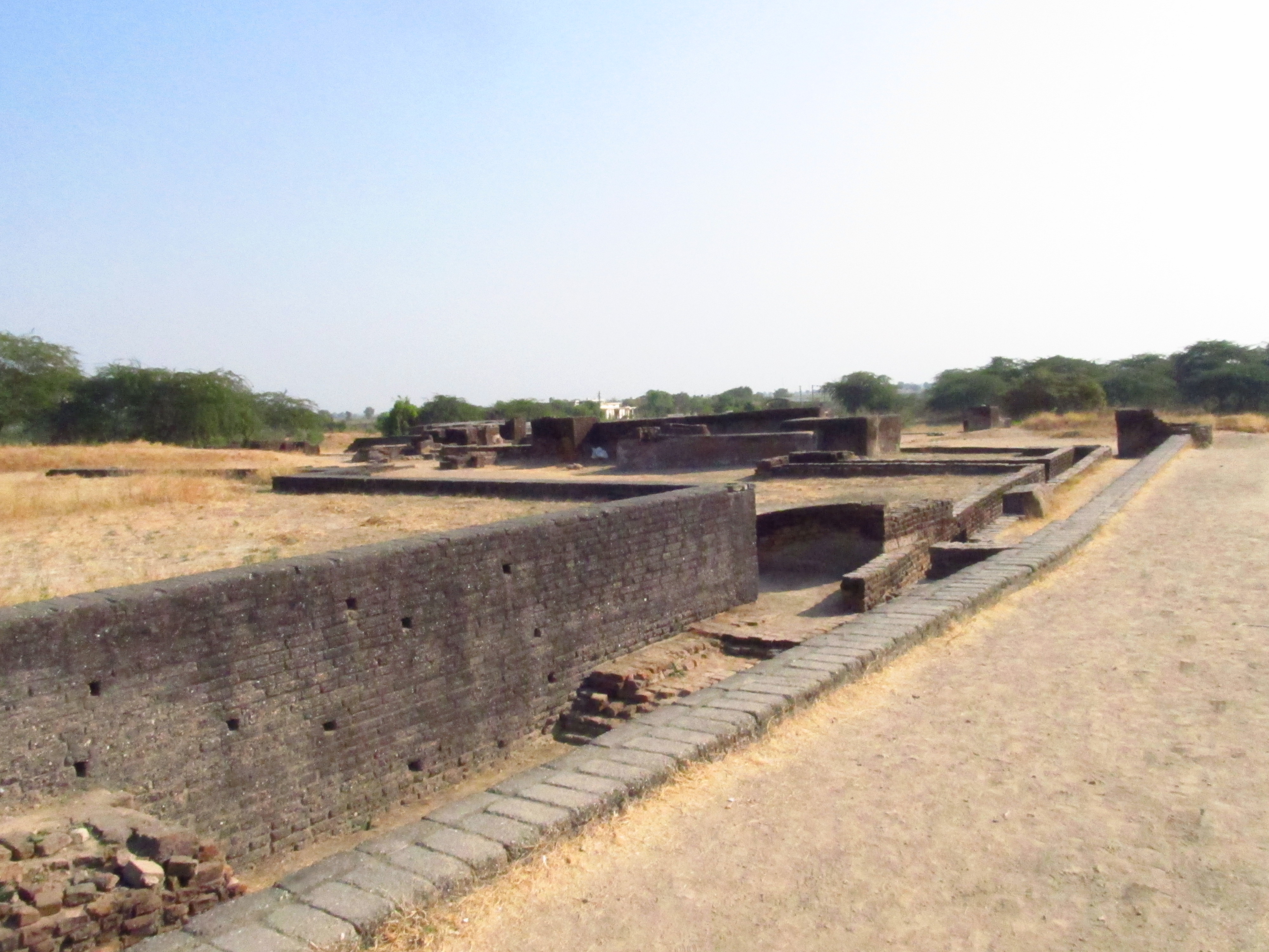
2. Location and Setting
Lothal lay at a considerable remove from the great cities of the Indus heartland; the distance to Mohenjo-daro in Sindh is given as 670 kilometers (420 miles) 3. The site is tied to the wider riverine network of the region, for the ASI and other contemporary archaeologists assert that the city was a part of a major river system on the trade route of the ancient peoples from Sindh to Saurashtra in Gujarat 3.
The watercourse that once served the settlement survives only in traces. A silted creek connecting modern Bholad with Lothal and Saragwala is taken to represent the ancient flow channel of a river or creek 3.
The political geography of the region was redrawn after the partition of British India in 1947, when most Indus sites including Mohenjo-daro and Harappa became part of Pakistan 3. Against this background the Harappans based around Lothal and those from Sindh expanded their settlement into a planned township laid out on the lines of greater Indus cities 3.
The material culture of the inhabitants matched that of the civilization at large: most of their equipment — metal tools, weights, measures, seals, earthenware and ornaments — was of the uniform standard and quality found across the Indus civilization 6. Continuity of measurement outlasted other conventions, for though Indus seals went out of use the system of weights with an 8.573 gram (0.3024 oz avoirdupois ) unit was retained 10.
Lothal belongs among the southernmost settlements of the ancient Indus Valley Civilisation and lies in the Bhal region of Gujarat 1. What drew the Harappans there was a combination of advantages: a sheltered harbour, an environment suited to cotton and rice, and a bead-making industry 4. The Archaeological Survey of India, the government agency charged with preserving ancient monuments, is credited with the site's discovery in 1954 2. Excavation began on 13 February 1955 and ran until 19 May 1960 2.
The town's institutions and its uniform layout point to a highly disciplined population 6. Its planners set themselves the task of defending the area against recurrent floods 5. Among the objects recovered is a thick ring-like shell with four slits cut into each of two margins, understood as a compass for measuring angles on plane surfaces such as housing alignments, roads or land surveys 7. Lothal also contributes one of three integrated and linear measurement scales known from the civilization, the others coming from Harappa and Mohenjodaro 7. Metalware, gold, jewellery and finely decorated ornaments testify to the culture and prosperity of the inhabitants 6.
Occupation did not end with the urban phase. Archaeological evidence shows the site remained inhabited by a far smaller population untouched by urban influences 10. The few who returned could neither rebuild nor repair the city, yet they stayed on, keeping their religious traditions while living in poorly built houses and reed huts 10. Debate over the end of the Indus Civilisation continues, but the evidence assembled by the ASI points to natural catastrophes, specifically floods and storms, as the cause of Lothal's downfall 8. The flooding is described as covering the whole of Saurashtra, Sindh and south Gujarat and reaching the upper Indus and Sutlej, where numerous villages and townships were swept away 8.
A National Maritime Heritage Complex is under construction near Lothal in Ahmedabad district, intended to present India's maritime heritage 9. It is being built beside what was an ancient maritime port city of the Indus Valley Civilisation 9.
3. The Dock and Maritime Trade
Lothal may have possessed one of the world's earliest known docks, a structure that would have linked the city to an ancient course of the Sabarmati River along a maritime trade route.2 Investigators from the National Institute of Oceanography in Goa reported finding foraminifera, salt and gypsum crystals within the rectangular structure, evidence taken to indicate that sea water once filled it.2
This reading has not gone unchallenged. Other archaeologists contend that Khufu's Red Sea harbour at Wadi al-Jarf in Egypt is older, dating its construction to between 2580 and 2550 BCE.1 The same critics hold that Lothal was a comparatively small town and that the "dock" served primarily as an irrigation tank.1
Against such objections stands the position of the ASI and contemporary archaeologists, who maintain that the city formed part of a major river system lying on the trade route from Sindh to Saurashtra.2
Lothal functioned as a major trade centre, importing raw materials such as copper, chert and semi-precious stones in bulk from Mohenjo-daro and Harappa and distributing them onward to inner villages and towns.6
Lothal's standing as an important trade centre in ancient times rested on goods that travelled far: its beads, gems and valuable ornaments reached the far corners of West Asia and Africa.2 Among the evidence of this trade is the discovery of typical Persian Gulf seals, including a circular button seal.6
The case for a small settlement is sometimes framed in terms of scale, with speculation that the comparatively small dimensions of the main city — 7 hectares (17 acres) — mean Lothal was not a large settlement at all and that its "dock" was perhaps an irrigation tank.3
The site's maritime identity is being carried forward in the present: the National Maritime Heritage Complex, a tourism complex under construction near Lothal in the Ahmedabad district of Gujarat, India, is intended to present the maritime heritage of India.9 It is being built near Lothal, described as an ancient maritime port city of the Indus Valley Civilisation.9
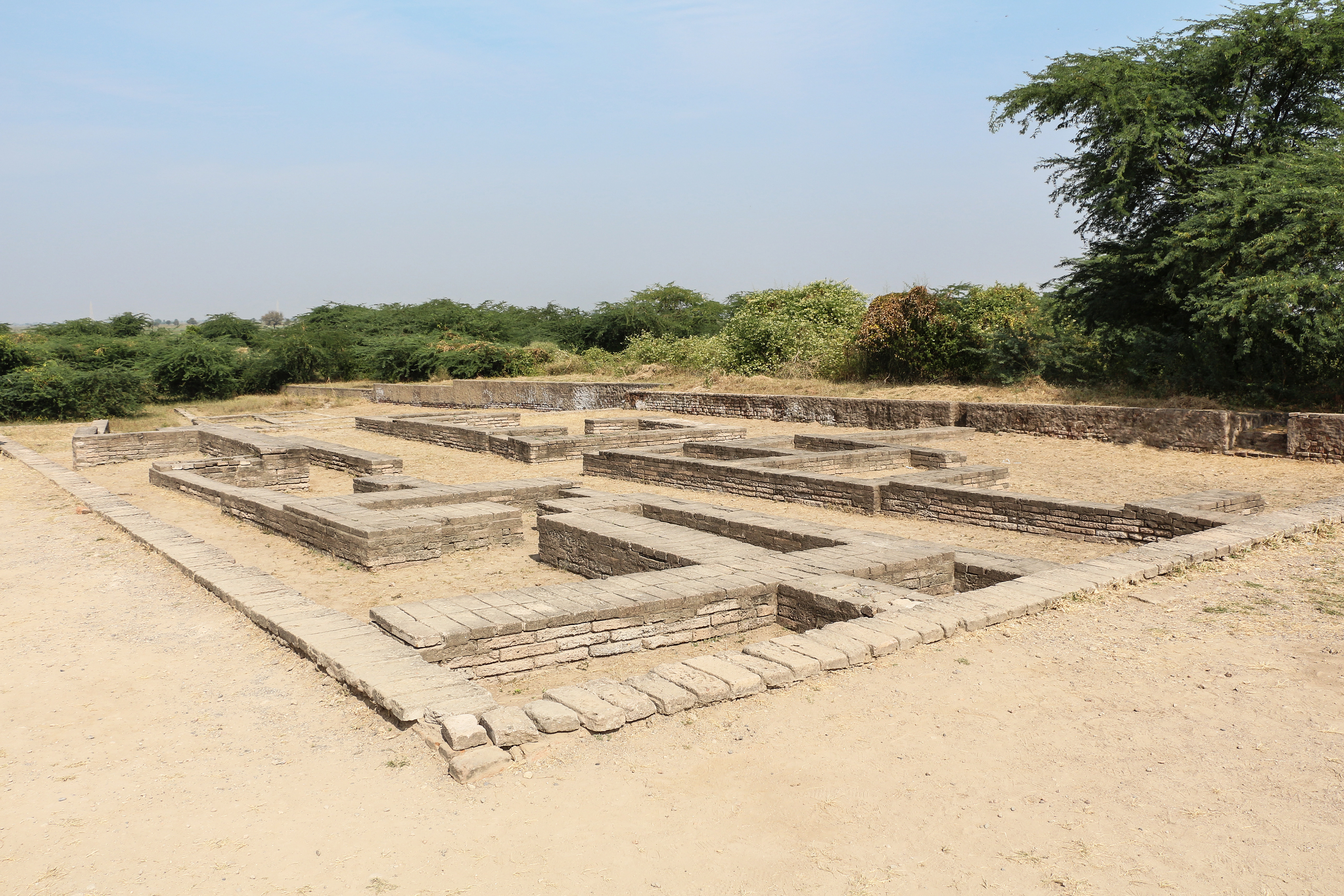
4. Town Planning and Architecture
The builders of Lothal worked in fire-dried bricks rather than sun-dried ones, binding them with lime and sand mortar5. The choice has proved durable: after 4,000 years the bricks remain intact and still hold together through the mortar bond4. The same account of fired construction and lime-and-sand mortar applies across the town's building work5.
Brick-making at the site was handled with care, and the thickness of the bricks received deliberate attention from those who produced them4.
The town's engineers gave particular thought to drainage7. For the draining system they provided corbelled roofs7. Where the sewerage entered the cesspool they laid an apron of kiln-fired bricks over the brick face of the platform7.
The planners of Lothal also sought to protect the area from the consistent floods that threatened it4. The uniform organization of the town and of its institutions is read as the mark of a disciplined people5.
The town was not raised in isolation. Harappans settled around Lothal, together with others from Sindh, took the opening to enlarge their settlement and to lay out a planned township on the pattern of the greater cities of the Indus valley5. The same account of that planned expansion is given for the settlement's growth4.
The discipline visible in the town's layout and institutions is taken by its interpreters as evidence that the Harappans were a highly ordered people6. The same reading of the uniform organization of the town and its institutions is repeated in the site's urban description4.
Not every claim about the site is settled. Some archaeologists hold that Khufu's Red Sea harbour at Wadi al-Jarf in Egypt is older, placing its construction between 2580 and 2550 BCE, that Lothal was a comparatively small town, and that the feature called a dock was primarily an irrigation tank2. The challenge to the dock interpretation is stated in the same terms elsewhere in the record1.
The floods that shaped the region's history were not confined to Lothal. They struck the whole of Saurashtra, Sindh and south Gujarat, and reached the upper courses of the Indus and the Sutlej, where scores of villages and townships were washed away8.
Long before excavation, the presence of an ancient town and of human remains was already known to people in the villages neighbouring Lothal3.
5. Craft, Measurement and Daily Life
The equipment recovered from the site reflects a community whose everyday goods were made to a shared standard rather than to local habit. Metal tools, weights, measures, seals, earthenware and ornaments were of the uniform standard and quality found across the Indus civilization 6. The same uniformity in these classes of equipment is attested again in the settlement's material record 4.
Measurement at Lothal was both a practical craft and a matter of precision. A thick ring-like shell object, cut with four slits in each of two margins, served as a compass for measuring angles on plane surfaces such as housing alignments, roads or land surveys 7.
Lothal preserves one of three integrated and linear measurement scales known from the Indus civilization, the others being those of Harappa and Mohenjodaro 7. The stone weights of the settlement were finished with deliberate care: craftsmen blunted the edges before polishing so that the pieces would hold their accuracy and resist wear 7.
The town's uniform organization and the ordering of its institutions are read by excavators as evidence of a disciplined population 6. Its prosperity is further attested by metalware, gold and jewellery, and tastefully decorated ornaments 6. The Harappans were drawn to the place by its sheltered harbour, its cotton and rice-growing environment and its bead-making industry 4, and settlers based around Lothal and arriving from Sindh took the opportunity to expand the settlement and lay out a planned township on the lines of the greater cities of the Indus valley 5. The planners set themselves to protect the area from consistent floods 5.
Occupation did not end with the urban phase. Archaeological evidence shows that the site continued to be inhabited, though by a much smaller population devoid of urban influences 10. Those few who returned could not reconstruct or repair the city, yet they stayed on, living in poorly built houses and reed huts while preserving religious traditions 10. Archaeological evidence gathered by the ASI appears to point to natural catastrophes, specifically floods and storms, as the source of Lothal's downfall, even as the wider debate over the end of the Indus civilization continues 8. The flood affected the entire region of Saurashtra, Sindh and south Gujarat and the upper reaches of the Indus and Sutlej, where scores of villages and townships were washed away 8.
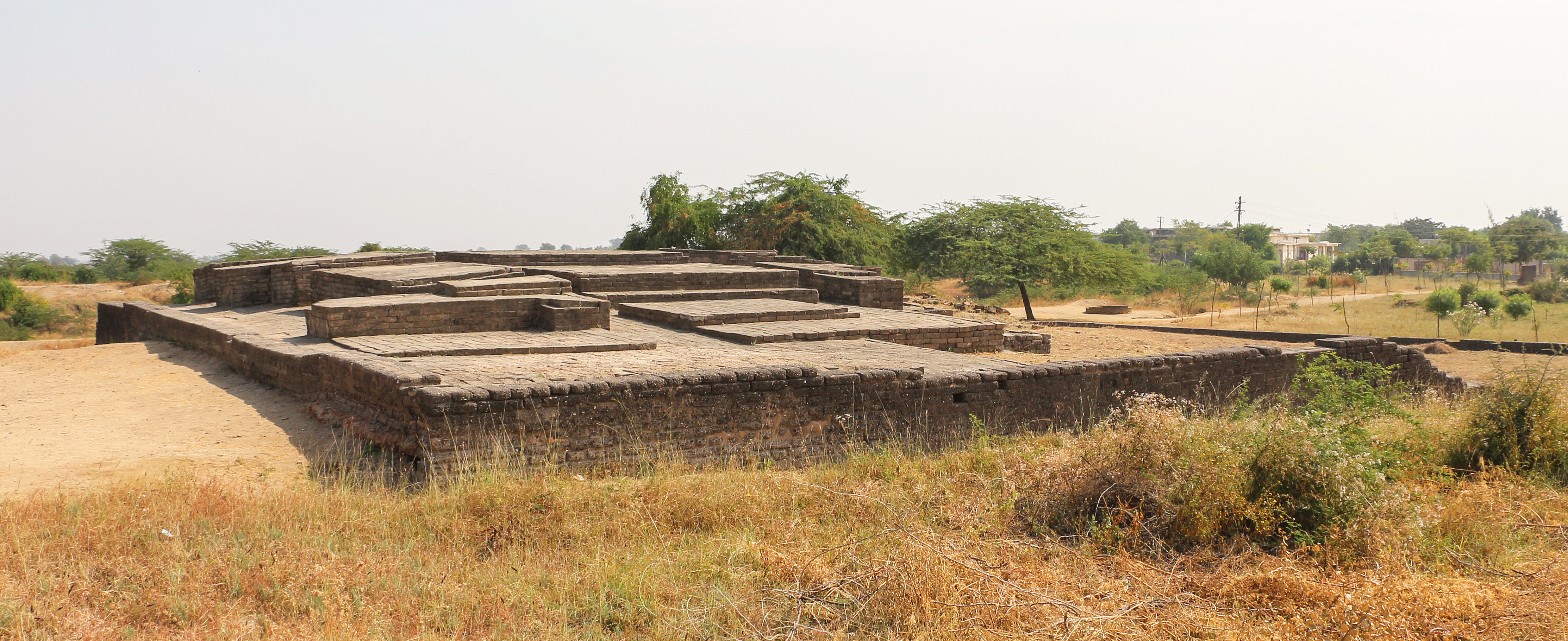
6. Later Harappan Culture and Decline
Archaeological evidence shows that Lothal continued to be inhabited after its urban phase, though by a much smaller population devoid of urban influences 10. The few people who returned to the site could not reconstruct and repair their city, yet surprisingly continued to stay, living in poorly built houses and reed huts 10. They preserved religious traditions even as the material fabric of urban life fell away 10.
While the wider debate over the end of Indus Civilisation continues, archaeological evidence gathered by the ASI appears to point to natural catastrophes, specifically floods and storms, as the source of Lothal's downfall 8.
The attraction of the site lay in its sheltered harbour, in a rich cotton and rice-growing environment and in a bead-making industry 4. Harappans based around Lothal and from Sindh took this opportunity to expand their settlement and create a planned township on the lines of greater cities in the Indus valley 5.
The uniform organization of the town and its institutions make it evident that the Harappans were very disciplined people 6. Metalware, gold and jewellery and tastefully decorated ornaments attest to the culture and prosperity of the people of Lothal 6.
In Lothal Harappan ceramic works of bowls, dishes and jars were mass-produced 10.
7. National Maritime Heritage Complex
The National Maritime Heritage Complex (NMHC) is a tourism complex under construction near Lothal in Ahmedabad district of Gujarat, India, intended to present the maritime heritage of India 9. Beyond its exhibition role, the complex is planned to recreate Dholavira and Lothal as they were in ancient times 9. The Government of Gujarat has supported the project by allocating land and by building road, water supply and electricity lines 9. The state government also contributed ₹150 crore (US$16 million) toward internal infrastructure 9.
The complex takes its setting from Lothal itself, an ancient maritime port city of the Indus Valley Civilisation 9. Lothal was one of the southernmost sites of that civilisation, situated in the Bhal region of Gujarat 1. The Archaeological Survey of India, the official Indian government agency for the preservation of ancient monuments, discovered the site in 1954 2. Excavation work at Lothal commenced on 13 February 1955 and continued until 19 May 1960 2.
The identification of Lothal as a dockyard rests on evidence recovered by the National Institute of Oceanography in Goa, which discovered foraminifera, marine microfossils, together with salt and gypsum crystals in the rectangular structure, indicating that sea water once filled it 2. The Harappans were drawn to the location by its sheltered harbour, its rich cotton and rice-growing environment and its bead-making industry 4. Metalware, gold and jewellery and tastefully decorated ornaments attest to the culture and prosperity of the people of Lothal 6.
Lothal stands 670 kilometers (420 miles) from Mohenjo-daro, which is in Sindh 3. When British India was partitioned in 1947 most Indus sites, including Mohenjo-daro and Harappa, became part of Pakistan 3. Harappans based around Lothal and from Sindh took the opportunity to expand their settlement and create a planned township on the lines of greater cities in the Indus valley 5. The planners engaged themselves to protect the area from consistent floods 5, and the uniform organization of the town and its institutions makes it evident that the Harappans were very disciplined people 6.
Among the site's technical remains, a thick ring-like shell object found with four slits each in two margins served as a compass to measure angles on plane surfaces such as housing alignments, roads or land surveys 7. Lothal contributes one of three measurement scales that are integrated and linear, the others found in Harappa and Mohenjodaro 7.
While the wider debate over the end of the Indus Civilisation continues, archaeological evidence gathered by the ASI appears to point to natural catastrophes, specifically floods and storms, as the source of Lothal's downfall 8. The flood affected the entire region of Saurashtra, Sindh and south Gujarat, and affected the upper reaches of the Indus and Sutlej, where scores of villages and townships were washed away 8. Archaeological evidence shows that the site continued to be inhabited, albeit by a much smaller population devoid of urban influences 10. The few people who returned to Lothal could not reconstruct and repair their city, but surprisingly continued to stay and preserved religious traditions, living in poorly built houses and reed huts 10.
8. Key dates
- 2550 BCEHowever, this interpretation has been challenged by other archaeologistsHowever, this interpretation has been challenged by other archaeologists , who argue Khufu 's Red Sea harbour at Wadi al-Jarf is older, dating its construction to between 2580 and 2550 BCE and that Lothal was a comparatively small town, and that the "dock" was primarily
- 1947Archaeology Layout of Lothal Extent and major sites of the Indus ValleyArchaeology Layout of Lothal Extent and major sites of the Indus Valley Civilisation When British India was partitioned in 1947, most Indus sites, including Mohenjo-daro and Harappa , became part of Pakistan .
- 1954Discovery The Archaeological Survey of India , the official Indian governmDiscovery The Archaeological Survey of India , the official Indian government agency for the preservation of ancient monuments, discovered Lothal in 1954.
- 1955Excavation work at Lothal commenced on 13 February 1955 and continued untiExcavation work at Lothal commenced on 13 February 1955 and continued until 19 May 1960.
- 1985== Excavation == The site, located in Sukkur District on the right== Excavation == The site, located in Sukkur District on the right bank of the Indus River was first discovered in 1985 by Prof Qasid Mallah and his team from Khairpur University.
9. Frequently asked questions
What does the name Lothal mean?
In Gujarati the name Lothal, a combination of Loth and (s) thal, means "the mound of the dead" 3.
How far is Lothal from Mohenjo-daro?
Lothal stands 670 kilometers (420 miles) from Mohenjo-daro, which is in Sindh 3.
What did the oceanographers find in the rectangular structure at Lothal?
The National Institute of Oceanography in Goa discovered foraminifera (marine microfossils) and salt, gypsum crystals in the rectangular structure, clearly indicating that sea water once filled the structure and it was definitely a dockyard 1.
What became of the system of weights after Indus seals fell out of use?
Though Indus seals went out of use, the system of weights with an 8.573 gram (0.3024 oz avoirdupois ) unit was retained 10.
How large was the main city at Lothal thought to be?
Speculation suggests that owing to the comparatively small dimensions of the main city (7 hectares (17 acres)), Lothal was not a large settlement at all, and its "dock" was perhaps an irrigation tank 3.
What did the craftsmen at Lothal do to make their stone weights durable and accurate?
The Lothal craftsmen took care to ensure durability and accuracy of stone weights by blunting edges before polishing 7.
References (11)
- 1Lothal — wiki — Wikipedia Web↩View source
- 2Lothal — sec1 — Wikipedia Web↩View source
- 3Lothal — sec2 — Wikipedia Web↩View source
- 4Lothal — sec3 — Wikipedia Web↩View source
- 5Lothal — sec4 — Wikipedia Web↩View source
- 6Lothal — sec5 — Wikipedia Web↩View source
- 7Lothal — sec8 — Wikipedia Web↩View source
- 8Lothal — sec6 — Wikipedia Web↩View source
- 9Lothal — complex — Reference Web↩View source
- 10Lothal — sec7 — Wikipedia Web↩View source
- 11Lothal — daro — Reference WebView source