Indus Valley Civilization
The Bronze Age Harappan civilization of the Indus valley — its planned cities of Harappa and Mohenjo-daro and their drainage, its seals and still-undeciphered script, standardized weights, trade with Mesopotamia, agriculture, river and climate decline debates, and its UNESCO-listed ruins.
The Indus Valley (Harappan) civilization was the earliest known urban culture of the Indian subcontinent, flourishing in the Indus river plain of present-day Pakistan and northwestern India with nuclear dates of about 2600–1900 BCE and more than a thousand towns and villages. Its cities, best known at Harappa and Mohenjo-daro, are celebrated for grid planning, elaborate drains and standardized bricks, weights and seals bearing a script that remains undeciphered. Long-distance trade linked it with Mesopotamia under the name Meluhha, while studies of the Ghaggar-Hakra river system and weakening monsoons frame a drawn-out, regionally varied decline after about 3900 years ago.
In this article
- 1Overview
- 2Discovery and Early Excavations
- 3Urban Planning and Architecture
- 4Major Cities and Sites
- 5Writing and Seals
- 6Economy and Agriculture
- 7Trade and External Contacts
- 8Decline and Climate
- 9UNESCO World Heritage Sites
- 10Timeline: from Neolithic Mehrgarh to the UNESCO listings
- 11Frequently asked questions
- 12Knowledge graph
Overview
The Indus Valley Civilization is the earliest known urban culture of the Indian subcontinent and one of the world's three earliest civilizations, alongside Mesopotamia and ancient Egypt. Its modern name derives from its location in the valley of the Indus River, in what is now Pakistan and northwestern India. Of the world's three earliest civilizations, it was the most extensive.
1. Discovery and Early Excavations
The civilization was first identified in 1921 at Harappa in the Punjab region and then in 1922 at Mohenjo-daro near the Indus River in the Sindh region, both sites lying in present-day Pakistan. The institutional groundwork for such work had been laid earlier, when Sir Alexander Cunningham, a British engineer with a passion for ancient history, founded the Archaeological Survey of India in 1861 CE, an organization dedicated to maintaining a professional standard of excavation and preservation of historic sites. Excavations at Mohenjo-daro began in the 1924-1925 season under John Marshall, and the similarities of the two sites were recognized; the Indus Valley Civilization had been discovered.
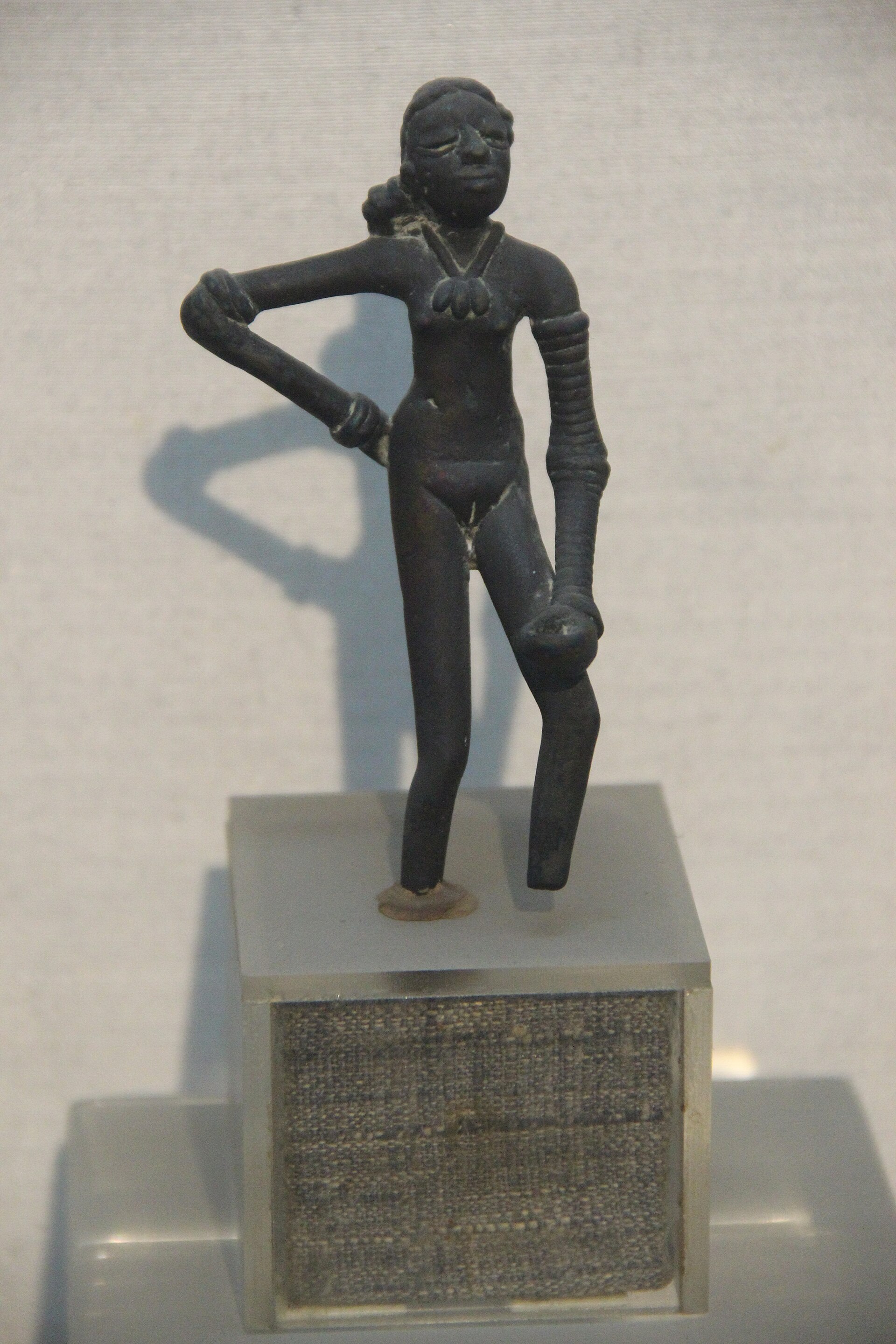
Marshall's official report covers excavations at Mohenjo-daro carried out by the Government of India in five winter seasons spanning 1922 to 1927 and published as an official account of the work. In that report Marshall gives R. Banerji the credit of having discovered, if not Mohenjo-daro itself, at any rate its high antiquity, and names Vats and Dikshit as his successors in the task of excavation. The discovery of Moenjodaro in 1922 revealed evidence of the customs, art, religion and administrative abilities of its inhabitants.
Later research turned to the setting and the fate of the city. The Penn Museum initiated a program of excavations and environmental studies centering around Mohenjo-daro, about 180 air miles north of Karachi, with environmental and geomorphological studies conducted by the professional hydrologist Robert L. Preliminary studies by Raikes suggested that a great natural disaster, a series of vast floods, could have been a major factor in the collapse of the Indus civilization, and fresh field evidence was sought to test the idea. Since 1986 the joint Pakistani American Harappa Archaeological Research Project has carried out the first major excavations at Harappa since before independence in 1946 and shown the site to have been far larger than once thought, perhaps supporting a population of 50,000 at certain periods.
2. Urban Planning and Architecture
The cities of the Indus civilization were laid out in a grid-like pattern oriented on a north-south axis, each comprising a citadel mound complex of public buildings raised about 12 meters above the floodplain and a lower town that appears to have been mostly residential. Its ruins were built entirely of unbaked brick in the 3rd millennium BCE, and the acropolis on high embankments, the ramparts and the lower town laid out according to strict rules provide evidence of an early system of town planning. The settlement grew to monumental proportions through the build up of occupation debris and the construction of massive mud brick platforms. A standardized brick with a ratio of 4:2:1 appears to have been common across several cities, generally laid using alternating rows of bricks laid lengthways and sideways, referred to today as an English bond.
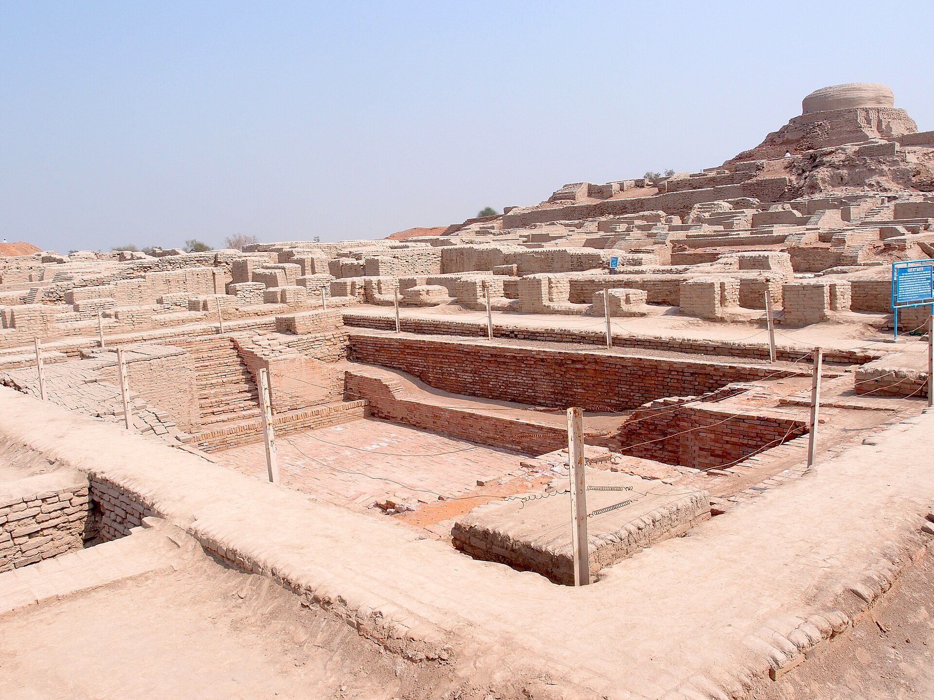
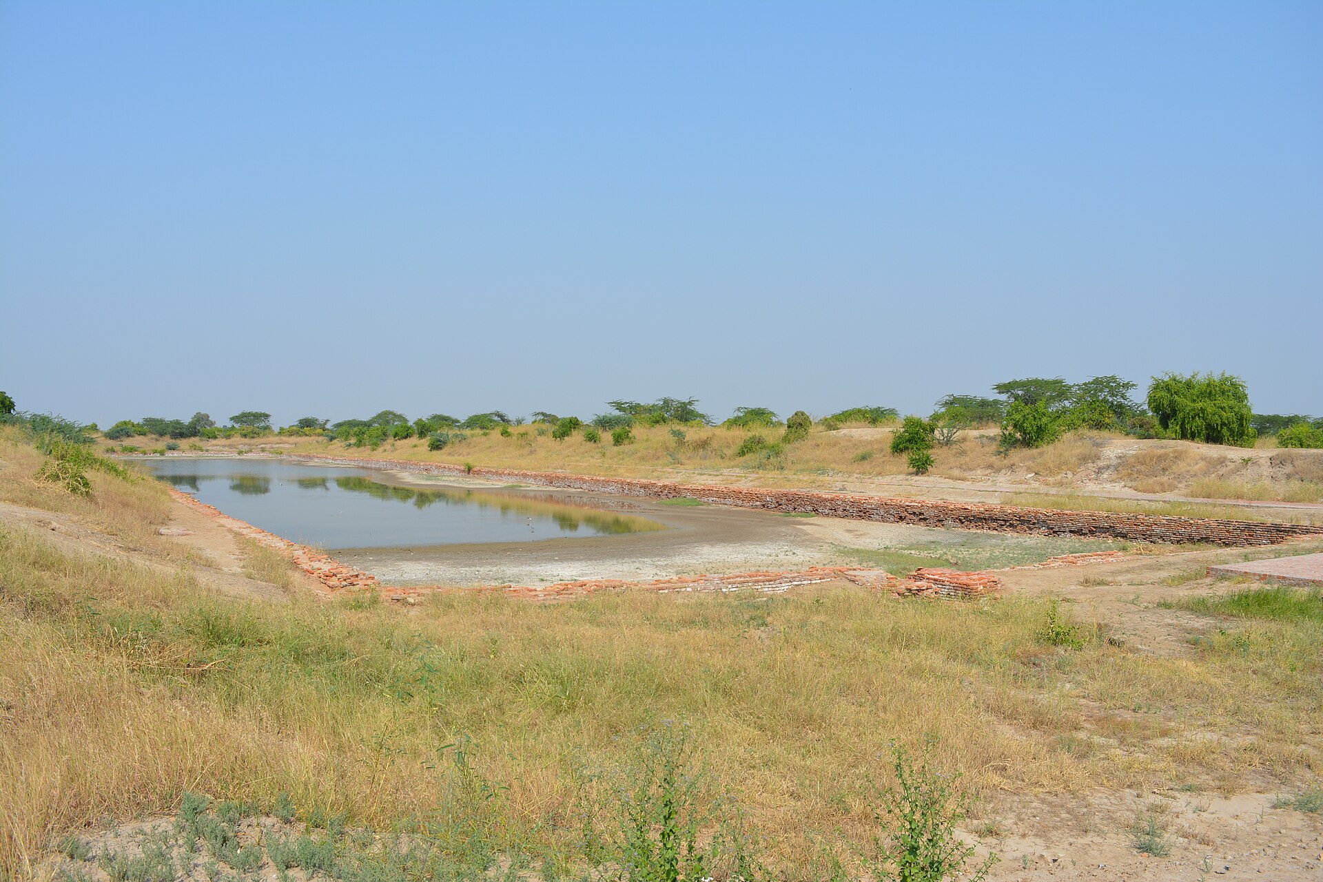
One of the more significant features of Harappan cities was their sophisticated water supply and waste extraction systems; in Mohenjo-daro water was supplied from some 700 wells to both public and private facilities. The well planned city had public baths, a college of priests, an elaborate drainage system, wells, soak pits for sewage and a large granary. Marshall saw in the Great Bath of Mohenjo-daro and in its roomy houses with ubiquitous wells, bathrooms and elaborate drainage evidence that ordinary townspeople enjoyed a degree of comfort and luxury unexampled in other parts of the then civilized world.
A monumental solid mud-brick embankment lines the edge of the Mohenjo-daro mound, and it appears that the walls and platforms were intended to artificially raise the level of the city as protection against floods rather than as a purely defensive structure against military attack. Mohenjo-daro comprises two sectors: a citadel area in the west where a Buddhist stupa was later built, and to the east a lower city whose buildings are laid out along streets intersecting each other at right angles in a highly orderly form of city planning that incorporated systems of sanitation and drainage. A large number of stone weights found in Mohenjodaro, Harappa and other sites in Sind and south Baluchistan indicate a definite system used uniformly throughout the Indus region; most are carefully cut cubes of banded grey chert.
3. Major Cities and Sites
The urban network of the civilization was anchored by a small group of large settlements, among them Harappa, Mohenjo-daro, Ganweriwala, Dholavira, Rakhigarhi and Kalibangan 10Fluvial landscapes of the Harappan civilization (PNAS 109:E1688–E1694, 2012) · PubMed Central, U.S. National Library of Medicine ↗. The civilization as a whole consisted of two large cities, Harappa and Mohenjo-daro, together with more than 100 towns and villages, often of relatively small size 1Indus civilization · Encyclopaedia Britannica ↗. Its cities were well planned, with wide streets, public and private wells, drains, bathing platforms and reservoirs 6A Brief Introduction to the Ancient Indus Civilization · Harappa.com ↗.
Mohenjo-daro is by far the largest of the Indus cities, extending over 250 hectares, and is one of the best-preserved urban centers of the Indus Civilization, comparable only to Dholavira in Kutch, India 8Mohenjo Daro: An Ancient Indus Valley Metropolis (Jonathan Mark Kenoyer) · Harappa.com ↗. It is situated on a Pleistocene ridge that sits like an island in the flood plain of the Indus River in the semi-arid region of Sindh province, Pakistan 8.
The ancient city of Dholavira, the southern centre of the Harappan Civilization, sits on the arid island of Khadir in Gujarat and was occupied between about 3000 and 1500 BCE, comprising a fortified city and a cemetery 11Dholavira: a Harappan City · UNESCO World Heritage Centre ↗. It is the sixth largest of more than 1,000 Harappan sites discovered so far and was occupied for over 1,500 years, witnessing the entire trajectory of the rise and fall of the civilization and its achievements in urban planning, water management, art, manufacturing and trade 11. Unlike other Harappan towns normally located near rivers and perennial water sources, Dholavira's location on the island of Khadir was strategic for harnessing mineral and raw material sources and facilitating internal and external trade with the Magan and Mesopotamian regions 11. The site is inscribed on the World Heritage List as Dholavira: a Harappan City, inscribed in 2021 under criteria (iii)(iv), with a property of 103 ha 11.
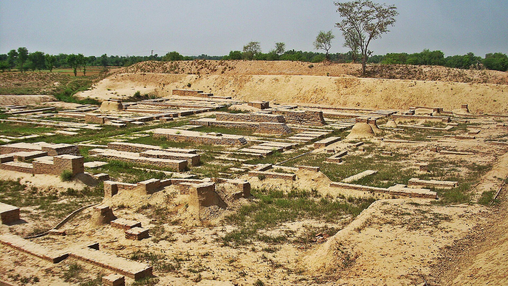
The vast mounded remains of the ancient city of Harappa, one of the largest sites of the Indus Valley civilization, have been known by scholars for more than one hundred years, and the site was occupied almost continuously for more than five thousand years 12The Ancient City of Harappa (Jonathan Mark Kenoyer) · Harappa.com ↗. The large agglomeration of mature Harappan sites including the urban Ganweriwala occurs on the lowermost Ghaggar-Hakra interfluve in modern Cholistan 10. Rakhigarhi and Kalibangan stand among the major urban sites of the civilization 10.
| Site | Region/Location | Key Facts |
|---|---|---|
| Harappa | Punjab, present-day Pakistan | Occupied almost continuously for more than five thousand years 12; population estimate 23,500–35,000 1; possibly 50,000 at certain periods 6 |
| Mohenjo-daro | Sindh, present-day Pakistan | Largest Indus city, extending over 250 hectares 8; population estimate 35,000–41,250 1 or around 40,000 or more 7Life in Ancient Cities · National Geographic Education ↗ |
| Ganweriwala | Cholistan | Large agglomeration of mature Harappan sites 10 |
| Dholavira | Khadir island, Gujarat | Occupied between about 3000 and 1500 BCE 11; sixth largest of more than 1,000 Harappan sites 11; UNESCO World Heritage site since 2021 11 |
| Rakhigarhi | Northwestern India | Major urban site 10 |
| Kalibangan | Northwestern India | Major urban site 10 |
4. Writing and Seals
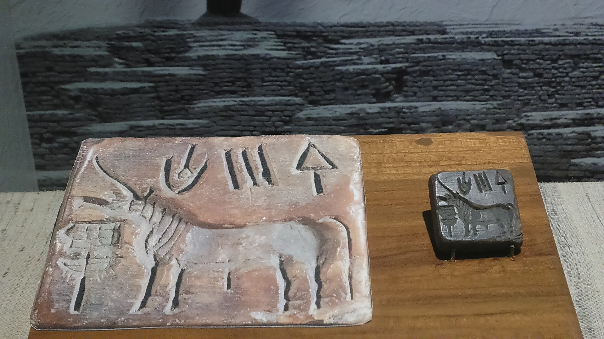
The writing of the Indus civilization, commonly called the Indus or Harappan script, ran from right to left and comprised more than 500 signs, and it remains undeciphered. The surviving evidence is modest in scale: roughly 4,000 inscriptions are known, averaging about five signs each, and no bilingual artefact comparable to the Rosetta Stone has been found to unlock them. Analysis has shown that 67 signs account for 80 percent of the writing, and the most frequently used sign resembles a jar with two handles. The underlying language has long resisted reading; recent analyses suggest it is not Indo-European and, if it belongs to any modern family, appears to be Dravidian.
The seals that carry much of this writing were cut from steatite, and the great majority display a humpless “unicorn” or a bull. Such seals served to identify merchandise. The unicorn motif is not reported from any other contemporaneous civilization and appears unique to the Indus region. It persisted across the greater Indus region for more than 700 years before vanishing along with the Indus script and other diagnostic elements of Indus ideology and bureaucracy around 1900 BCE.
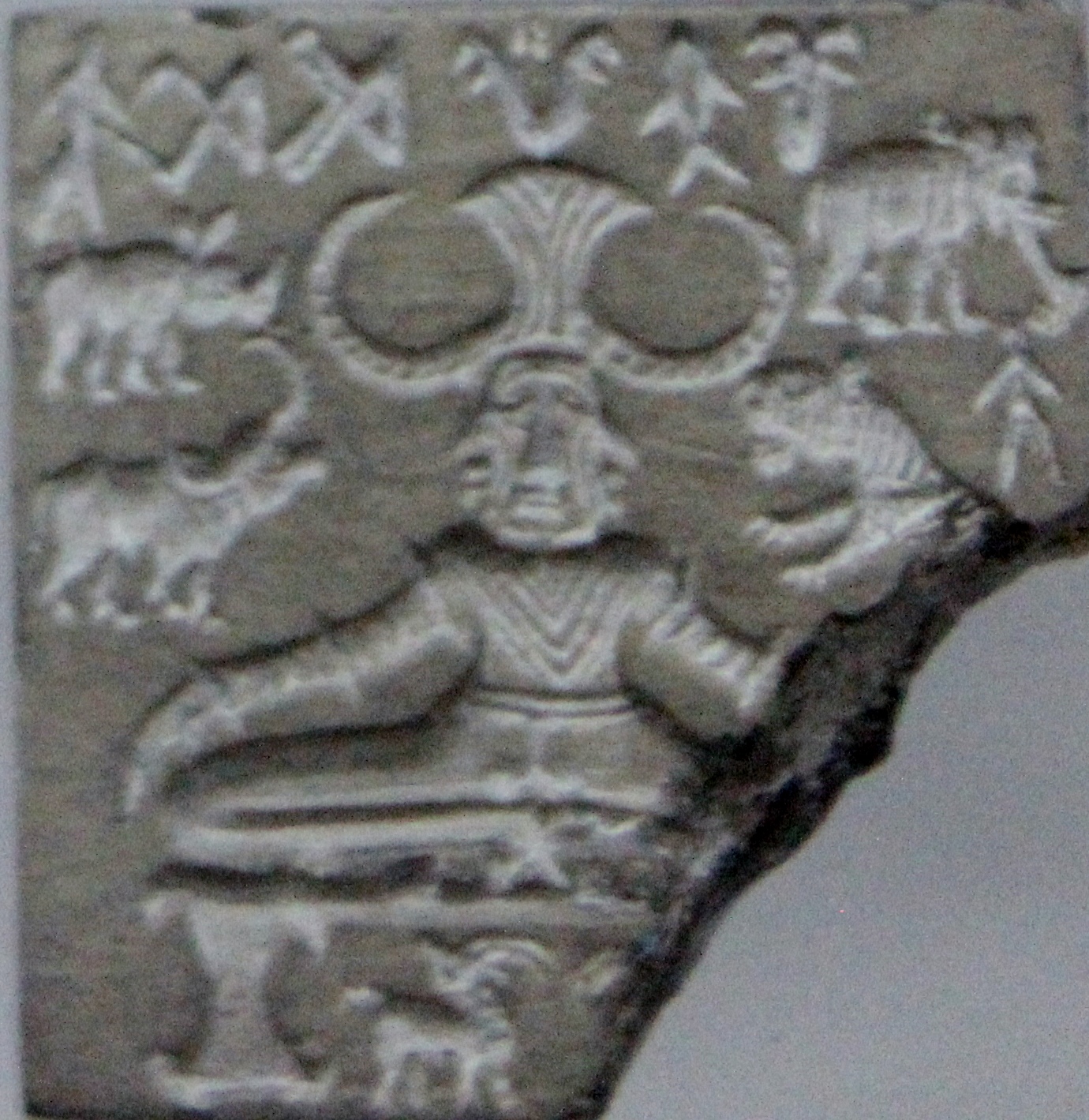
Decipherment remains an open challenge, and the government of Tamil Nadu has announced a cash prize of $1 million for individuals or organizations who decipher the Indus script to the satisfaction of archaeological experts. In one recent study, K. Sivananthan digitized 15,000 graffiti-marked pot shards from 140 archaeological sites in Tamil Nadu and compared them against 4,000 examples of the Indus Valley script, finding that nearly 60 percent of the signs matched and 90 percent shared parallels. The authors emphasized that their approach was morphological rather than linguistic, and noted that the script is especially perplexing because it tends to occur in short inscriptions, usually around five symbols long.
5. Economy and Agriculture
Its principal crops were wheat and six-row barley, alongside field peas, mustard and sesame, and the civilization has yielded some of the earliest traces of cotton. Domesticated animals included dogs, cats, humped and shorthorn cattle and domestic fowl, with pigs, camels and buffalo possibly among them as well. Crop choices were not fixed: barley was the dominant crop during the Early Harappan phase, wheat predominated in the Harappan phase, and barley took over again in the Late Harappan.
Research on Indus agriculture has identified both monocultures, one crop likely grown to serve the needs of larger urban populations at Harappa, Rakigarhi and Mohenjo-daro, and intercropping, duo-cultures and flexible crop selection in Gujarat and elsewhere in response to local conditions. Sites such as Khirsara underwent dramatic transitions from a ninety per cent barley monoculture in Early Harappan times to predominantly kharif crops, including pearl millet, rice and sorghum, by the Late Harappan phase. Of the 250,000 seeds so far analysed from Harappa, eighty per cent are cereal grains.
Exchange and provisioning rested on a standardized system of weights. Cubical weights from Harappa conform to the standard Harappan binary weight system used in all of the settlements, the smallest weight in the series being 0.856 grams and the most common approximately 13.7 grams. All the weights are graded accurately in a system unique among ancient civilizations, with lower denominations following a binary doubling series of one, two, four, eight, sixteen and thirty-two, and larger weights continuing on up to 12,800 at the top of the series. These weights were found in recent excavations at Harappa and may have been used for controlling trade and possibly for collecting taxes.
6. Trade and External Contacts
Trade with Mesopotamia is attested by Indus seals found at Ur and other Mesopotamian cities, and the discovery of a Persian Gulf type of seal at Lothal provides convincing indication of sea trade with other civilizations. Exports included ivory, lapis lazuli and carnelian beads, while imports included silver, tin, woollen textiles and grains. Mesopotamian trade documents, lists of goods and official inscriptions mentioning Meluhha, the ancient Akkadian name for the Indus region, supplement the Harappan seals and archaeological finds, with literary references dating from about 2350-1794 BCE. Ancient Mesopotamian texts speak of trading with at least two seafaring civilizations, Magan and Meluhha, in the neighborhood of South Asia in the third millennium BCE, conducted with real financial sophistication in amounts that could involve tons of copper.
During the later 3rd millennium the trade relationship was a direct one: ships from Meluhha, the Indus, docked in Mesopotamian ports, some Meluhhans settled in Sumer, and a seal belongs to a Mesopotamian whose job was to act as an interpreter of the Meluhhan language. In the beginning of the Mature Harappan period, around 2400 BCE, the Harappans sailed all the way to Mesopotamia, but soon thereafter the Dilmun culture of the Gulf seems to have become a mediator of this sea trade. Dilmun operated as a middleman between Mesopotamia and the Indus in some of this trade, and in the early 2nd millennium BC both Harappan and Mesopotamian ships sailed only to Bahrain, which acted as an entrepot between them.
Some Indus Valley seals have been found in Mesopotamia, evidence that trade with remote areas was an important aspect of the Harappan economy, and the civilization was part of a trading network that included Afghanistan, Iran and Oman. The exchange and communication systems that connected distant parts of the Indus Civilization and beyond had roots beginning in the early Neolithic period, connecting the site to multiple source areas ranging from 120 km to more than 700 km away.
7. Decline and Climate
Deurbanization after about 3,900 years ago was characterized by increasingly regional artefact styles and trading networks and by the disappearance of the distinctive Harappan script, a protracted and regionally varied process often loosely called collapse. Urbanism had flourished in the western Indo-Gangetic Plain for about 600 years, but since about 3,900 years ago the total settled area and settlement sizes declined, many sites were abandoned and there was a significant shift of site numbers and density towards the east. The decline probably occurred in several stages over a century or more, with the period between about 2000 and 1750 BCE a reasonable estimation; after that date the cities and many distinctively urban traits, including the use of writing and of seals, disappear.
Climate records indicate that the region went through four periods of intense drought between 4,400 and 3,400 years ago, when average annual rainfall decreased between 10 and 20 percent and the average annual temperature increased by roughly 0.9 degrees Fahrenheit. Between roughly 2425 and 1400 B.C.E. the region suffered a series of droughts that each lasted more than 85 years; one, which peaked around 1733 B.C.E., lasted about 164 years. Lead author Hiren Solanki said the most surprising finding is that the Harappan decline was driven not by a single catastrophic event but by repeated, long and intensifying river droughts lasting centuries. The authors propose that a coordinated climate reorganization may have helped trigger the metamorphosis of the urban Harappan civilization into a rural society through push-pull migration from flood-deficient river valleys to the Himalayan piedmont plains with augmented winter rains.
-
between 4,400 and 3,400 years agoFour intense droughtsThe region went through four periods of intense drought between 4,400 and 3,400 years ago, when average annual rainfall decreased between 10 and 20 percent and the average annual temperature increased by roughly 0.9 degrees Fahrenheit 21Why Did This Advanced Ancient Civilization Collapse? New Research Suggests Climate Change Played a Role (Sarah Kuta) · Smithsonian Magazine ↗.
-
roughly 2425–1400 BCESeries of long droughtsBetween roughly 2425 and 1400 B.C.E. the region suffered a series of droughts that each lasted more than 85 years; one, which peaked around 1733 B.C.E., lasted about 164 years 21.
-
after about 3,900 years agoDeurbanization beginsDeurbanization after about 3,900 years ago was characterized by increasingly regional artefact styles and trading networks and by the disappearance of the distinctive Harappan script, a protracted and regionally varied process often loosely called collapse 10.
-
about 2000–1750 BCECities and urban traits disappearThe decline probably occurred in several stages over a century or more, with the period between about 2000 and 1750 BCE a reasonable estimation; after that date the cities and many distinctively urban traits, including the use of writing and of seals, disappear 13Indus civilization: Craft, technology, and artifacts — Language, scripts, weights, and measures; Trade and external contacts; Decline · Encyclopaedia Britannica ↗.
8. UNESCO World Heritage Sites
| Site | Inscription Year | Criteria | Property Size |
|---|---|---|---|
| Moenjodaro | 1980 | (ii)(iii) | 240 ha |
| Dholavira | 2021 | (iii)(iv) | 103 ha |
9. Timeline: from Neolithic Mehrgarh to the UNESCO listings
- c. 7000–5500 BCENeolithic MehrgarhThe Neolithic period in the Indus region is best exemplified by sites like Mehrgarh, showing agricultural development, domestication of plants and animals, and production of tools and ceramics.
- c. 3300 BCERavi phase at HarappaThe Early Harappan Ravi Phase at Harappa dates to about 3300 BCE, with new facts and examples of writing discovered by excavations in India and Pakistan.
- c. 2600–1900 BCEMature urban civilizationThe Indus Valley / Harappan civilization flourishes: an integrated urban culture with advanced grid-pattern urban planning and extensive trade with cultures to the west.
- c. 2600 BCEEarliest unicorn motif on sealsThe earliest representation of a unicorn appears on seals and sealings from the northern Indus region, a motif unique to the Indus among contemporaneous civilizations.
- c. 2350–1794 BCEMeluhhan trade documentedLiterary references to Meluhhan trade date from the Akkadian, Ur III and Isin-Larsa periods, and during the Akkadian Period Meluhhan vessels sailed directly to Mesopotamian ports.
- c. 2000–1750 BCEStages of declineThe decline probably occurred in several stages over a century or more, a reasonable estimation being the period between about 2000 and 1750 BCE.
- c. 3900 years ago (c. 1900 BCE)Deurbanization beginsAfter about 3,900 years ago settlement sizes declined, many sites were abandoned and the distinctive Harappan script disappeared in a protracted, regionally varied process.
- 1829 CECharles Masson reaches HarappaIn following various leads, Charles Masson wound up excavating ancient sites on his own; one of these sites was Harappa, which he found in 1829 CE and wrongly attributed to Alexander the Great.
- 1861 CEArchaeological Survey of India foundedSir Alexander Cunningham, a British engineer with a passion for ancient history, founded the Archaeological Survey of India, dedicated to professional excavation and preservation of historic sites.
- 1921 CEHarappa identifiedThe civilization was first identified in 1921 at Harappa in the Punjab region, followed in 1922 by Mohenjo-daro near the Indus River in Sindh.
- 1922 CEMohenjo-daro discoveredThe discovery of Moenjodaro in 1922 revealed evidence of the customs, art, religion and administrative abilities of its inhabitants, including public baths, an elaborate drainage system and a large granary.
- 1931 CEMarshall's official reportJohn Marshall's official account of the excavations at Mohenjo-daro, carried out by the Government of India in five winter seasons between 1922 and 1927, is published.
- 1965 CEPenn Museum flood studiesThe Penn Museum's program of excavations and environmental studies at Mohenjo-daro tested whether a series of vast floods could have been a major factor in the civilization's collapse.
- 1980 CEMoenjodaro inscribed by UNESCOThe Archaeological Ruins at Moenjodaro, the best preserved urban settlement in South Asia dating back to the beginning of the 3rd millennium BC, are inscribed as a UNESCO World Heritage site.
- 2021 CEDholavira inscribed by UNESCODholavira, the southern centre of the Harappan Civilization on the island of Khadir in Gujarat and the sixth largest of more than 1,000 Harappan sites discovered so far, is inscribed as a UNESCO World Heritage site.
- 16 January 2025Million-dollar script prizeThe chief minister of Tamil Nadu announces a $1 million prize for anyone who can decipher the Indus script, as experts continue to use computer science to tackle the script's patterns.
10. Frequently asked questions
What is the Indus Valley Civilization also called, and when did it flourish?
Where was it located and how large was it?
Which were its major cities?
What was the Indus script like, and has it been deciphered?
The Indus (Harappan) script was written right to left, had more than 500 signs, and remains undeciphered 13. Decipherment faces two challenges: a relatively small number of inscriptions, about 4,000 of them almost all on small objects such as seals and tablets, and the brevity of each inscription averaging about five signs, with no long texts 14A million-dollar challenge to crack the script of early Indians (Soutik Biswas) · BBC News ↗.
What crops and animals sustained the civilization?
References (23)
- 1Indus civilization — Encyclopaedia Britannica Web↩View source
- 2Indus Valley Civilization (Joshua J. Mark) — World History Encyclopedia Web↩View source
- 3Mohenjo-daro and the Indus Civilization: official account of archaeological excavations 1922–1927 (Vol. I, ed. John Marshall) — Internet Archive (Arthur Probsthain, London, 1931) 1922 ArchiveView source
- 4Archaeological Ruins at Moenjodaro — UNESCO World Heritage Centre WebView source
- 5Civilization and Floods in the Indus Valley (Expedition Magazine 7:4, 1965, George F. Dales) — Penn Museum, University of Pennsylvania 1965 WebView source
- 6A Brief Introduction to the Ancient Indus Civilization — Harappa.com Web↩View source
- 7Life in Ancient Cities — National Geographic Education Web↩View source
- 8Mohenjo Daro: An Ancient Indus Valley Metropolis (Jonathan Mark Kenoyer) — Harappa.com Web↩View source
- 9Weights (Indus at the National Museum of Pakistan, Karachi) — Harappa.com WebView source
- 10Fluvial landscapes of the Harappan civilization (PNAS 109:E1688–E1694, 2012) — PubMed Central, U.S. National Library of Medicine 2012 Web↩View source
- 11Dholavira: a Harappan City — UNESCO World Heritage Centre 1645 Web↩View source
- 12The Ancient City of Harappa (Jonathan Mark Kenoyer) — Harappa.com Web↩View source
- 13Indus civilization: Craft, technology, and artifacts — Language, scripts, weights, and measures; Trade and external contacts; Decline — Encyclopaedia Britannica Web↩View source
- 14A million-dollar challenge to crack the script of early Indians (Soutik Biswas) — BBC News Web↩View source
- 15Unicorn Sealings and Seals (excerpt from Jonathan Mark Kenoyer) — Harappa.com WebView source
- 16Officials Are Offering $1 Million to Anyone Who Can Decode This Ancient Script (Eli Wizevich) — Smithsonian Magazine WebView source
- 17Different strategies in Indus agriculture: the goals and outcomes of farming choices (summary of Bates & Choi) — Harappa.com WebView source
- 18Weights, Harappa (Around the Indus in 90 Slides) — Harappa.com / Harappa Archaeological Research Project WebView source
- 19Was the trade relationship between the Harappans and the Mesopotamians a direct one? (answers by Jane McIntosh, Richard Meadow, Asko Parpola, Rita Wright, Shereen Ratnagar) — Harappa.com WebView source
- 20Regional Interaction in the Prehistoric Indus Valley (Randall Law) — Harappa.com WebView source
- 21Why Did This Advanced Ancient Civilization Collapse? New Research Suggests Climate Change Played a Role (Sarah Kuta) — Smithsonian Magazine Web↩View source
- 22Neoglacial climate anomalies and the Harappan metamorphosis (Climate of the Past 14:1669–1686, 2018) — European Geosciences Union (Copernicus Publications) 1669 WebView source
- 23South Asia, 8000–2000 B.C. (Heilbrunn Timeline of Art History) — The Metropolitan Museum of Art 2000 WebView source