Amazon River
The greatest river of South America — its course from the Peruvian Andes to the Atlantic, its basin and flood cycle, its wildlife and peoples, and the long search for its true source.
The Amazon is the largest drainage system on Earth, carrying about one-fifth of all the water that runs off the land and draining a basin of some 7 million square km across Brazil, Peru, Colombia, Ecuador, Bolivia, and Venezuela. Its annual flood pulse, tidal bore, and sediment plume sustain the richest riverine ecosystem on the planet, with about 2,500 recorded fish species and floodplain forests that flood for months each year. Its source and length have been argued over since the 1600s: a 2007 satellite-based expedition concluded that Apacheta Creek on Mount Mismi is the true source, making the river possibly the longest in the world.
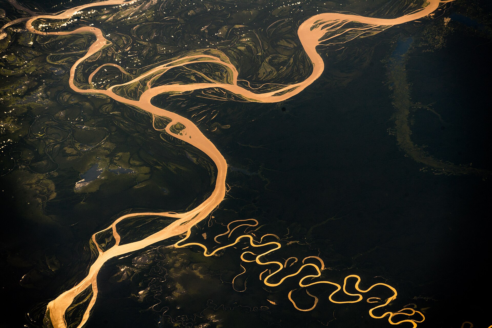
In this article
- 1Overview
- 2Course and Length
- 3The Source Controversy
- 4Basin and Drainage
- 5Discharge and Hydrology
- 6Sediment and the Absence of a Delta
- 7Climate and Global Influence
- 8Flora and the Rainforest
- 9Animal Life
- 10Peoples of the Basin
- 11Exploration and Historical Timeline
- 12Deforestation, Conservation, and Threats
- 13Key Measurements at a Glance
- 14Timeline: from Orellana's descent to satellite measurements
- 15Frequently asked questions
- 16Knowledge graph
Overview
The Amazon is the greatest river of South America and the largest drainage system in the world, in terms of both the volume of its flow and the area of its basin. Its westernmost source lies high in the Andes within 100 miles (160 km) of the Pacific Ocean, while its mouth opens into the Atlantic on the northeastern coast of Brazil. It is the largest river basin on the planet, holding one million km2 of freshwater ecosystems.
1. Course and Length
Measured from its Ucayali-Apurímac headwaters, the Amazon runs at least 4,000 miles (6,400 km), a figure slightly shorter than the Nile on the same basis. A satellite-based measurement made in 2007 placed the river's length at about 4,345 miles (6,992 km), reckoned from Apacheta Creek to the mouth of Marajó Bay. The river travels through 6,280 kilometers of rainforest, crossing Peruvian highlands and Brazilian rainforests, and drains approximately 40 percent of the South American continent.
The Amazon reaches the Atlantic Ocean on the northeastern coast of Brazil by way of the southern channel and Marajó Bay. In choosing among three main outlets to the sea, the 2007 team used the southern channel and estuary because it gave the longest distance from source to ocean, lengthening the river by 219 miles (353 km). The same methods measured the Nile at about 4,258 miles (6,853 km), so the Amazon may come to be recognized as the world's longest river.
2. The Source Controversy
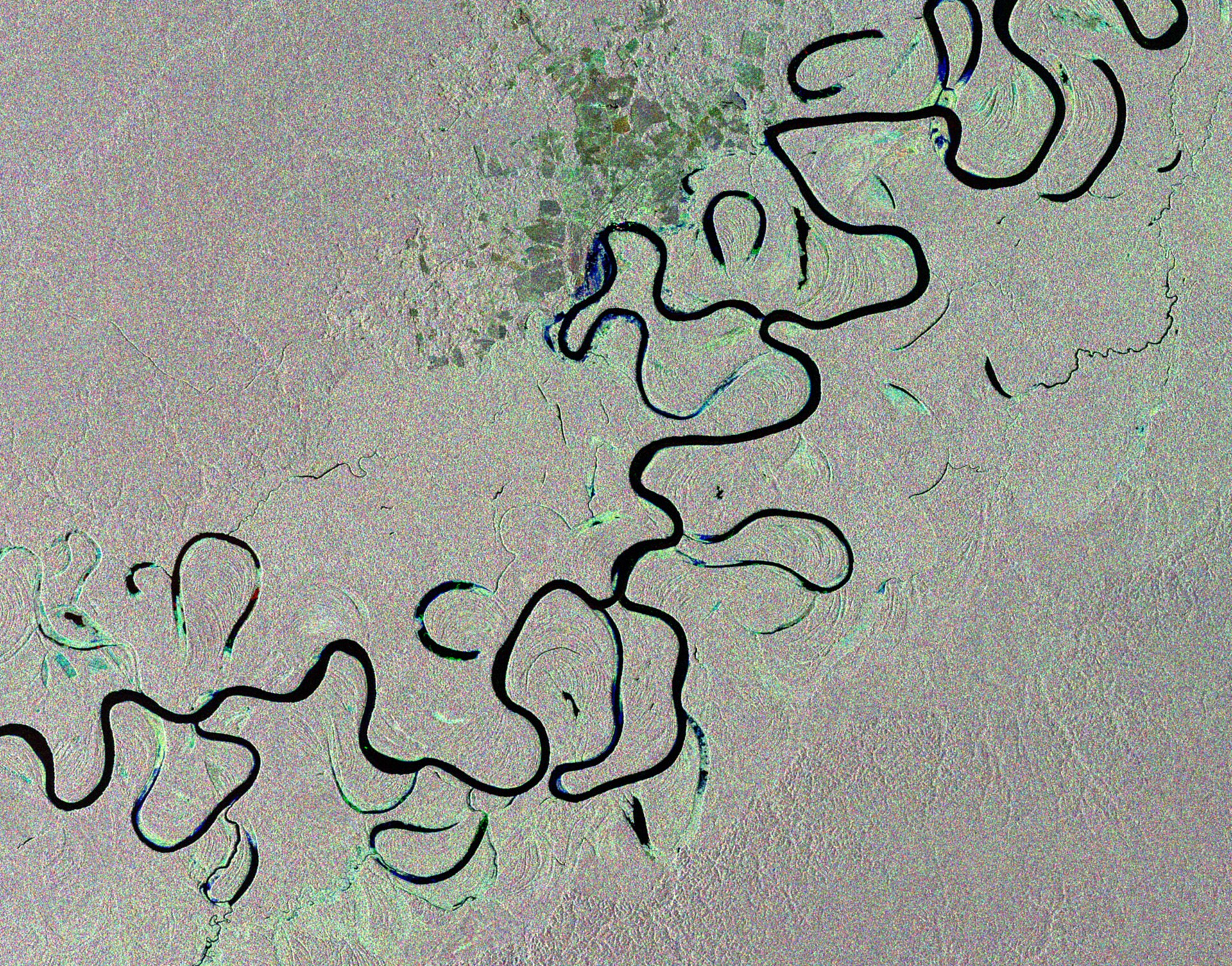
The internationally accepted definition of a river's source is the most distant point of its longest tributary that flows continuously. In 1971 a National Geographic expedition led by Loren McIntyre identified the snow-capped peak of Mismi as the ultimate source of the Amazon. The Mismi identification became widely accepted in the scientific community and remained so until the mid-1990s, although a Polish expedition in 1983 contended that nearby Apacheta Creek was the real source. The Mantaro River runs dry for about five months of the year, when the Tablachaca dam built in 1974 diverts its flow around its kink, leaving the loop devoid of water. A study published in the journal Area argues that the true source is the Mantaro River in southwestern Peru; if right, that would add 47 to 57 miles (75 to 92 kilometers) to the present measurement of about 4,000 miles (6,437 kilometers) by the U.S. Using six different methods of measurement, including GPS tracking data and satellite images, James Contos and his team determined that the Mantaro River is about 10 percent longer than the Apurímac River that has been regarded as the Amazon’s source since 1971 on the strength of a National Geographic expedition.
3. Basin and Drainage
The Amazon basin covers an area of about 2.7 million square miles (7 million square km), nearly twice that of the Congo basin, and forms the largest lowland in Latin America. Its territory takes in the greater part of Brazil and Peru, significant parts of Colombia, Ecuador, and Bolivia, and a small area of Venezuela. The river system spans eight countries and one overseas territory: Brazil, Bolivia, Peru, Ecuador, Colombia, Venezuela, Guyana, Suriname and French Guiana.
In Peruvian and Brazilian usage the name Amazon applies only to particular sections of the river rather than to the whole course. The upper main stream is known as the Marañón, the stretch running to the Brazilian border is called the Amazonas, and within Brazil the river is called the Solimões as far as its confluence with the Negro.
4. Discharge and Hydrology
The mean discharge of the Amazon at Óbidos has been computed at 5,500,000 cubic feet (157,000 cubic metres) per second, derived from the stage-discharge relation together with the river-stage record for 1928–46. The first measurements of the river's flow were made in July 1963 as a joint project of the University of Brazil, the Brazilian Navy, and the U.S. Three measurements were taken at the Óbidos narrows in 1963–64, at high, low, and medium stage. At the narrows, where the channel is constricted to little more than a mile wide, discharge was measured at 7,628,000 cubic feet (216,000 cubic metres) per second. The greatest known flood at Óbidos, that of June 1953, is computed to have been a flow of 12,500,000 cubic feet (350,000 cubic metres) per second.
The upper course of the river has two annual floods, one from rains in the Peruvian Andes between October and January and another from rains in the Ecuadoran Andes between March and July. Downstream these merge into a single rise that progresses as a gigantic wave from November to June. Flood levels reach 40 to 50 feet (12 to 15 metres) above low river. The maximum free width of the permanent bed is 8.5 miles (14 km) upstream from the mouth of the Xingu, but during great floods the river spreads in a band some 35 miles (55 km) wide or more. From November to June the rain drops as much as three metres of water, and some sections swell to nearly 480 kilometers across, submersing parts of the forest for up to six months.
The tide is normally felt as far upstream as Óbidos, 600 miles (970 km) from the mouth. The pororoca tidal bore occurs at times in the estuary before spring tides, advancing at 10 to 15 miles (16 to 24 km) per hour as a breaking wall of water 5 to 12 feet (1.5 to 4 metres) high. At Manaus the average daily temperature is in the upper 80s F (about 32 °C) in September and the mid-70s F (about 24 °C) in April, with humidity consistently high and often oppressive. In 2005 the Manaus region suffered a devastating drought that dried up parts of the river, made transportation difficult, depleted drinking supplies, and left millions of rotting fish in the riverbed.
5. Sediment and the Absence of a Delta
Every day, some 1.3 million tons of sediment pour from the mouth of the Amazon River into the Atlantic Ocean, and the abundance of sediment gives much of the main stem its milky brown color. Most of that sediment comes from three "whitewater" rivers of the western Amazon — the Marañón, the Ucayali, and the Mamoré — while clearwater rivers of the southern lowlands and blackwater rivers transport minimal amounts.
The muddy water is loaded with nutrients such as nitrogen and phosphorous and with organic matter that make whitewater rivers and the várzea floodplain forests particularly rich in plant and animal species, notably fish.
6. Climate and Global Influence
The Amazon's hydrology has far-reaching impacts on regional and global climate: the basin provides moisture to the southern parts of South America and, as a large source of heat in the tropics, significantly impacts global atmospheric circulation. Water vapor released from the Amazon creates vast "flying rivers" in the atmosphere that influence rainfall and agricultural production in central and southern South America, and the rainforest stores billions of tons of carbon of global importance.
Satellite observations show increased precipitation, discharge, and flooded area in the northern part of the basin, raising flood risks, while the southern region trends toward reduced rainfall and discharge. River discharge from the Amazon basin represents about 20 percent of the total amount of global fresh water reaching the ocean each year. Amazon surface waters are a major source and sink of carbon dioxide and the largest natural geographic source of methane in the tropics.
7. Flora and the Rainforest
The Amazon Rainforest stretches from the Atlantic Ocean in the east to the tree line of the Andes in the west, widening from a 200-mile (320-km) front along the Atlantic to a belt 1,200 miles (1,900 km) wide at the Andean foothills, with Brazil holding approximately 60 percent of it. The river drains a rainforest that occupies 2,300,000 square miles (6,000,000 square km), comprising about 40 percent of Brazil's total area and bounded by the Guiana Highlands, the Andes, the Brazilian central plateau, and the Atlantic.
It is the world's richest and most-varied biological reservoir, containing several million species of insects, plants, birds, and other forms of life, many still unrecorded by science. The biome holds one in ten known species on Earth and constitutes the world's largest remaining tropical forest, containing 90-140 billion metric tons of carbon.
8. Animal Life
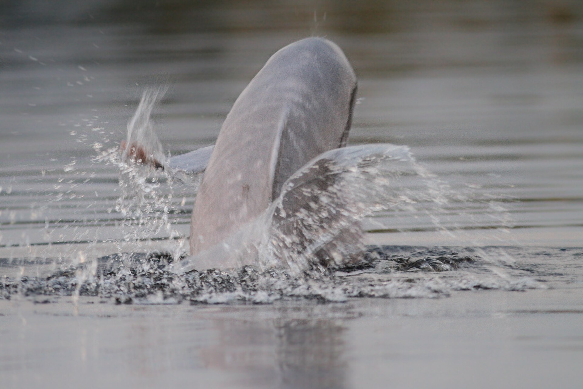
The Amazon river dolphin, also known as the pink river dolphin or boto, lives only in freshwater and is found throughout much of the Amazon and Orinoco river basins in Bolivia, Brazil, Colombia, Ecuador, Guyana, Peru, and Venezuela. The small flesh-eating piranha generally feeds on other fish but may attack any animal or human that enters the water, its razor-sharp teeth stripping a carcass of meat in a few minutes.
Mercury pollution from small-scale gold mining is one of the main threats to the Bolivian river dolphin, a subspecies of the Amazon river dolphin, reaching them through the food chain because they mainly eat catfish, bottom feeders greatly affected by metals in the water. The Amazon river dolphin, Inia geoffrensis, reaches up to 352 pounds and 9.2 feet, and although it is relatively abundant, with an estimated population in the tens of thousands, it is classified as vulnerable in certain areas due to dams and contamination of rivers and lakes.
9. Peoples of the Basin
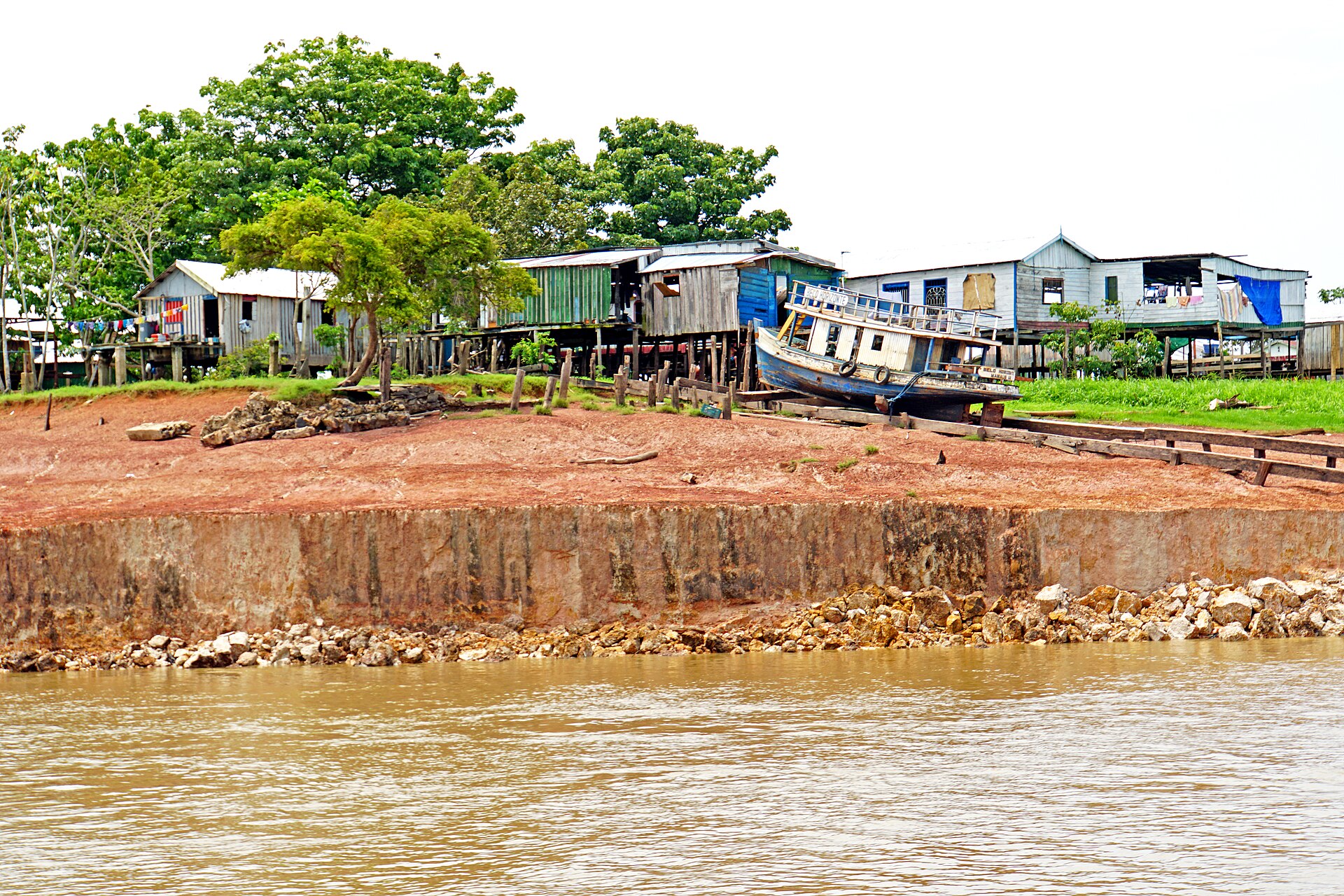
In the early 1990s the indigenous population of the Amazon basin numbered about 600,000 people; by the early 21st century it had dropped to fewer than 200,000 people, partly as a result of deforestation and commercial exploitation of their lands.
Amazonian Indians devised means of making the poisonous bitter cassava edible, perfected the use of quinine against malaria, collected the sap of the rubber tree, and invented the blowgun and the hammock. Large numbers of Indians were taken into slavery, especially during organized raids known as bandeiras from the 16th to the 18th century, and many others succumbed to European diseases such as influenza, measles, and smallpox.
10. Exploration and Historical Timeline
-
Early 1540sOrellana descends the AmazonFrancisco de Orellana descended the main course of the Amazon from the Ecuadoran and Peruvian Andes to the Atlantic.12Amazon River — Ecological concerns; Study and exploration · Encyclopaedia Britannica ↗
-
Nearly a century laterTeixeira’s journey from Belém to QuitoPedro Teixeira traveled from Belém, Brazil, to Quito, Ecuador, and the region increasingly became known through Portuguese explorations.12
-
1743La Condamine’s raft journeyThe French naturalist Charles-Marie de La Condamine made a raft trip down the Amazon, recording geographic and ethnographic observations of the basin.12
-
Outset of the 19th centuryHumboldt confirms the Casiquiare connectionThe German explorer Alexander von Humboldt confirmed the connection between the Amazon and Orinoco systems through the Casiquiare River.12
-
1848 — 1859Bates collects on the AmazonThe English naturalist H. W. Bates spent eleven years along the Amazon collecting thousands of species, and his 1863 book The Naturalist on the River Amazons remains a classic account of the river.12
-
1913 — 1914Roosevelt and Rondon expeditionAn expedition headed by former U.S. president Theodore Roosevelt and Brazilian Colonel Cândido Rondon explored a tributary of the Madeira River and recorded its natural history.12
-
1971Mismi named the sourceA National Geographic Society expedition points to snow-capped Mount Mismi in southern Peru.4Amazon River — Physical features (The length of the Amazon; Landforms and drainage patterns) · Encyclopaedia Britannica ↗
-
1974Tablachaca dam builtThe dam begins diverting the Mantaro River around its kink, leaving the loop dry for part of the year.5Where Does the Amazon River Begin? · National Geographic (Jane J. Lee) ↗
-
1992Earth Summit in RioThe United Nations Conference on Environment and Development in Rio de Janeiro underscored international concern over deforestation.12
-
2005Drought at ManausA severe drought afflicts the Manaus region and the lower river.13Amazon River — Hydrology (History; Climate) · Encyclopaedia Britannica ↗
-
2014Mantaro claim publishedA journal study proposes the Mantaro River in southwestern Peru as the Amazon’s source.5
11. Deforestation, Conservation, and Threats
Between 1970 and 2016 Brazilian Amazon forest cover declined from some 1,583,000 square miles to about 1,283,000 square miles, though conservation between 2008 and 2016 slowed forest loss to roughly 0.1 — 0.2 percent per year.
In 2007 Ecuador proposed forgoing development of heavy oil deposits beneath the Yasuní rainforest if donors contributed half the deposits' value, but in 2013 it abandoned the plan after only $6.5 million had been raised by the end of 2012 and drilling soon resumed.
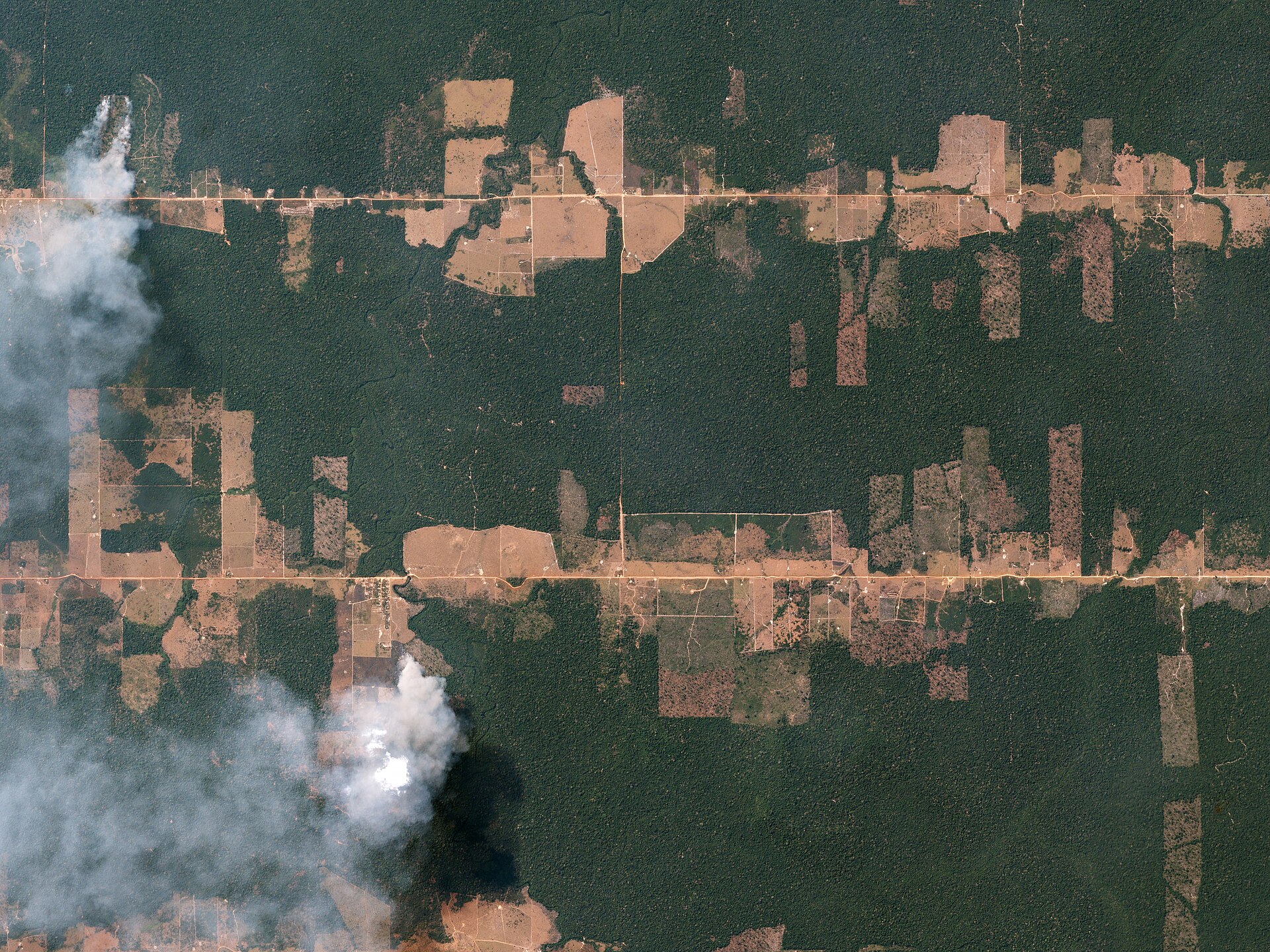
In Brazil, through the Amazon Region Protected Areas program, WWF supported a network of parks covering 154 million acres of forest — over 50% larger than the US National Park System — and between 2008 and 2020 those protected areas prevented 1,000 square miles of deforestation. The Amazon Cooperation Treaty signed in Brasília in 1978 pledged the basin countries to coordinated development of the region on sound ecological principles, and in 1995 they created the Amazon Cooperation Treaty Organization.
12. Key Measurements at a Glance
The Amazon basin contains about 38 percent of the world’s river water, the most of any hydrologic region evaluated 14Global Accounting of Earth's Rivers · NASA Earth Observatory ↗. It discharges the most water to the ocean of any region — 6,789 cubic kilometers (1,629 cubic miles) per year — which is 18 percent of the global river discharge to the ocean, which averaged 37,411 cubic kilometers (8,975 cubic miles) per year over the 1980 — 2009 study period 14.
13. Timeline: from Orellana's descent to satellite measurements
- 1541 — 1542Orellana descends the riverFrancisco de Orellana sailed the main course of the Amazon from the Ecuadoran and Peruvian Andes to the Atlantic, the first European descent of the river.
- c. 1637 — 1639Teixeira travels upriver to QuitoNearly a century after Orellana, Pedro Teixeira went from Belém, Brazil, to Quito, Ecuador, and the region became increasingly known through Portuguese explorations.
- 1743La Condamine's raft journeyThe French naturalist Charles-Marie de La Condamine made a raft trip down the Amazon, recording geographic and ethnographic observations of the basin.
- 1848 — 1859Bates collects on the AmazonThe English naturalist H. W. Bates spent eleven years along the Amazon collecting thousands of species; his book The Naturalist on the River Amazons (1863) remains a classic.
- 1913 — 1914Roosevelt and Rondon expeditionAn expedition headed by former U.S. president Theodore Roosevelt and Brazilian Colonel Cândido Rondon explored a tributary of the Madeira and made natural-history collections and observations.
- June 1953Greatest known flood at ÓbidosThe June 1953 flood at Óbidos is computed to have been a flow of 12,500,000 cubic feet (350,000 cubic metres) per second.
- July 1963First flow measurementsThe first measurements of the flow of the Amazon River were made as a joint project of the University of Brazil, the Brazilian Navy, and the U.S. Geological Survey; at Óbidos the discharge was 7,640,000 cubic feet per second.
- 1971Mismi pinpointed as the sourceA National Geographic Society expedition identified Carruhasanta Creek, running off Mount Mismi in southern Peru, as the source of the Amazon — a conclusion widely accepted until the mid-1990s.
- 1974Tablachaca dam builtThe Tablachaca dam began diverting the Mantaro River's flow around its kink, leaving the loop dry for about five months of the year and complicating claims about the river's most distant source.
- 1978Amazon Cooperation TreatyRepresentatives of all the basin's countries signed the Amazon Cooperation Treaty in Brasília, pledging coordinated development of the region on sound ecological principles.
- 1992Earth Summit in RioInternational concern over deforestation was underscored by the United Nations Conference on Environment and Development held in Rio de Janeiro.
- 1995Amazon Cooperation Treaty OrganizationThe basin countries created the Amazon Cooperation Treaty Organization to strengthen and better implement the treaty goals.
- 2005Devastating drought at ManausThe Manaus region experienced a drought that caused parts of the river to dry up, made transport difficult, depleted drinking supplies, and left millions of rotting fish on the riverbed.
- 2007Apacheta Creek named the true sourceAn expedition including members of Brazil's National Institute for Space Research found Apacheta Creek to be 6 miles (10 km) longer than Carruhasanta and measured the river at about 4,345 miles (6,992 km).
- 2014Mantaro claim publishedA study in the journal Area argued that the Mantaro River is the Amazon's true source, a claim that would add 47 to 57 miles (75 to 92 kilometers) to the river's measured length.
14. Frequently asked questions
How many fish species live in the Amazon system?
About 2,500 species have been recorded in the Amazon system, with many more unidentified 11Amazon River — Animal life (People; Early settlement patterns) · Encyclopaedia Britannica ↗. Most Amazon fish are migratory, moving in great schools at spawning time, and fish represent a critical source of protein in the diet of the riverine caboclo population 11.
How many people live in the Amazon basin?
Is the Amazon close to an ecological tipping point?
According to many notable scientists the Amazon is close to a tipping point past which it will no longer be able to support itself, and deforestation should not exceed 20 — 25 percent; it is already at approximately 17 percent 2. Dams disrupt river connectivity, block the range of many aquatic species including migratory fish and river dolphins, and interfere with subsistence and commercial fisheries 2.
References (15)
- 1Amazon River | Facts, History, Location, Length, Animals, & Map — Encyclopaedia Britannica WebView source
- 2For a Living Amazon! — WWF (panda.org) Web↩View source
- 3River Seasons — NASA Earthdata (Laura Cheshire) WebView source
- 4Amazon River — Physical features (The length of the Amazon; Landforms and drainage patterns) — Encyclopaedia Britannica Web↩View source
- 5Where Does the Amazon River Begin? — National Geographic (Jane J. Lee) Web↩View source
- 6Reconnaissance investigations of the discharge and water quality of the Amazon River (Circular 552) — U.S. Geological Survey (R. E. Oltman) WebView source
- 7Mud from the Andes Carried by the Amazon — NASA Earth Observatory WebView source
- 8Amazon Water Cycle Observed from Space — Eos, American Geophysical Union (Fassoni-Andrade et al.) WebView source
- 9Amazon Rainforest | Plants, Animals, Climate, & Deforestation — Encyclopaedia Britannica WebView source
- 10Amazon River Dolphins | Species — World Wildlife Fund (WWF) WebView source
- 11Amazon River — Animal life (People; Early settlement patterns) — Encyclopaedia Britannica Web↩View source
- 12Amazon River — Ecological concerns; Study and exploration — Encyclopaedia Britannica Web↩View source
- 13Amazon River — Hydrology (History; Climate) — Encyclopaedia Britannica Web↩View source
- 14Global Accounting of Earth's Rivers — NASA Earth Observatory Web↩View source
- 15Amazon River Investigations: Reconnaissance Measurements of July 1963 (Circular 486) — U.S. Geological Survey 1963 WebView source