Ice Age
The Pleistocene ice ages — the continental ice sheets that covered a third of the land, the orbital cycles that paced them, and their effects on sea level, landscapes, megafauna and human migration.
Ice ages are the long glacial phases of Earth's recent geological past in which great continental ice sheets grew across North America and Eurasia and global sea level fell by more than 400 feet. The Pleistocene Epoch, beginning about 2.6 million years ago, was marked by repeated glacial-interglacial cycles paced by the Milankovitch orbital variations of eccentricity, obliquity and precession, with glacial cycles lengthening to about 100,000 years after 800,000 years ago. The Last Glacial Maximum about 20,000 years ago left the Laurentide and Cordilleran ice sheets over North America, exposed the Bering land bridge that people crossed into the Americas, and was followed by the deglaciation that ended the Pleistocene and ushered in the Holocene interglacial.
In this article
- 1Overview
- 2The Pleistocene Epoch
- 3Extent of Glaciation
- 4The Last Glacial Maximum
- 5Causes: Milankovitch Cycles
- 6Milutin Milankovitch
- 7Beringia and the Land Bridge
- 8Human and Animal Life
- 9Megafaunal Extinction
- 10Present-Day Ice Sheets
- 11Legacy in the Landscape
- 12Study of Ice Ages
- 13Timeline: from the Pleistocene glaciation to the last mammoths
- 14Frequently asked questions
- 15Knowledge graph
Overview
An ice age is a time when large ice sheets exist; intervals without such sheets are called interglacial periods. The most recent glacial period occurred between about 120,000 and 11,500 years ago, and since then Earth has been in an interglacial period called the Holocene.
These glacial–interglacial cycles have waxed and waned throughout the Quaternary Period, the past 2.6 million years. Since the middle Quaternary they have had a frequency of about 100,000 years.
1. The Pleistocene Epoch
The Pleistocene Epoch spans the interval from 2.6 million to 11,700 years ago, a period during which a succession of glacial and interglacial climatic cycles occurred. It was an epoch defined by that alternation of glacial and interglacial phases rather than by a single unbroken cold.
Beginning roughly 2.6 million years ago, global climate entered a cooling phase, and as snow in northern latitudes compacted into ice several kilometers thick, it flowed as glaciers southward across the North American continent.
Pleistocene biotas were extremely close to modern ones, with many genera and even species of Pleistocene conifers, mosses, flowering plants, insects, mollusks, birds and mammals surviving to this day.
The Pleistocene also saw the evolution and expansion of our own species, Homo sapiens, and by the close of the Pleistocene humans had spread through most of the world.
2. Extent of Glaciation
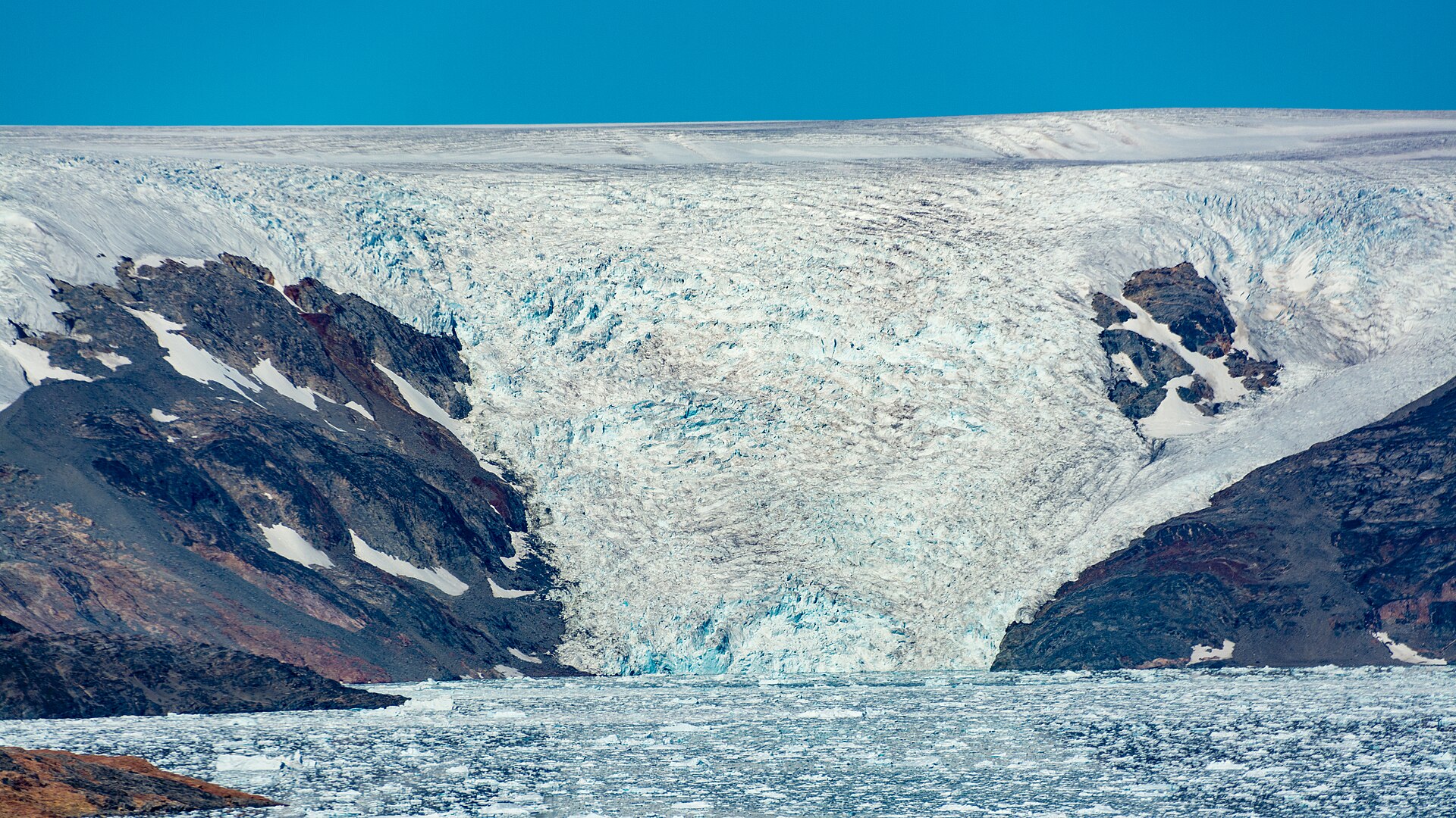
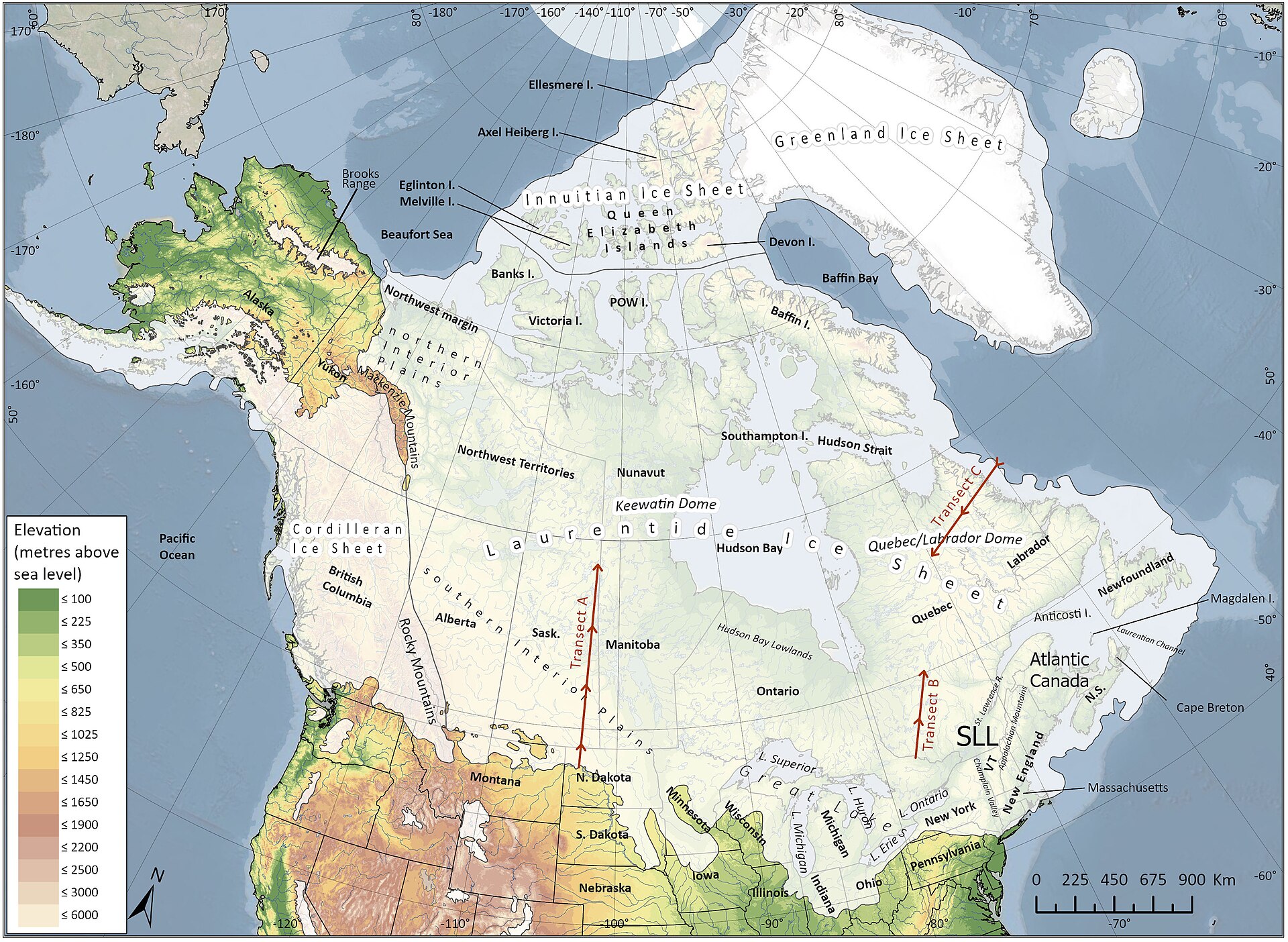
During the Pleistocene, mountain glaciers formed on all continents, while the icecaps of Antarctica and Greenland stood more extensive and thicker than they are today, and vast glaciers spread across northern North America and Eurasia. The glaciers of the Great Ice Age were so extensive that almost a third of the present land surface of the Earth was intermittently covered by ice. The last major ice sheet to spread across the north-central United States reached its maximum extent about 20,000 years ago and lingered in Canada until about 6,000 years ago.
3. The Last Glacial Maximum
The Last Glacial Maximum occurred about 20,000 years ago, during the last phase of the Pleistocene.
At that time, global sea level stood more than 400 feet lower than it does today. Glaciers covered approximately 8% of Earth's surface and 25% of its land area, and 33% of Alaska.
Ice sheets up to two miles thick covered large parts of North America, Europe and Asia, locking up much of the earth's water.
The glaciers began to retreat about 15,000 years ago. Sea level rose to its current height about 8,000 years ago and has fluctuated since.
4. Causes: Milankovitch Cycles
Milutin Milankovitch proposed that the collective effects of changes in Earth's position relative to the Sun drive long-term climate and set in motion the beginning and end of glaciation periods. His career in science followed an early period as a construction company's chief engineer, after which he accepted a faculty position in applied mathematics at the University of Belgrade in 1909 and held the post for the rest of his life.
The hypothesis rests on three orbital movements. Eccentricity varies on a cycle of about 100,000 years; obliquity, or axial tilt, varies between 22.1 and 24.5 degrees; and axial precession spans about 25,771.5 years.
The mechanism works through the seasons. As obliquity decreases, milder seasons with warmer winters and cooler summers allow snow and ice at high latitudes to build into large ice sheets, and the increasing ice cover reflects more solar energy, promoting further cooling.
Milankovitch calculated that ice ages occur approximately every 41,000 years, a figure confirmed for the interval between one and three million years ago. About 800,000 years ago the cycle lengthened to 100,000 years, matching Earth's eccentricity cycle.
Fluctuations in sunlight alone are not enough to bring about full-blown ice ages and interglacials; they trigger feedback loops that amplify the original warming or cooling.
5. Milutin Milankovitch
Milutin Milankovitch was born in 1879 in the rural village of Dalj, then part of the Austro-Hungarian Empire and today in Croatia, and graduated from the Vienna Institute of Technology in 1904 with a doctorate in technical sciences.
He built a comprehensive mathematical model that calculated latitudinal differences in insolation and the corresponding surface temperature for 600,000 years prior to the year 1800, and he then attempted to correlate those changes with the growth and retreat of ice ages.

For about 50 years Milankovitch's theory was largely ignored, until a 1976 study published in the journal Science examined deep-sea sediment cores and found that the theory did in fact correspond to periods of climate change.
6. Beringia and the Land Bridge
Beringia is the name given to the unglaciated region that extended from the Yukon Territory in Canada west across to eastern Siberia. Because so much of the planet's water was locked up in glaciers, sea level was much lower, and Alaska and Siberia were connected by the Bering Land Bridge.
During the cold, dry glacial periods, the emergence of the land bridge allowed plant and animal ranges to shift and mobile species to migrate between the continents.
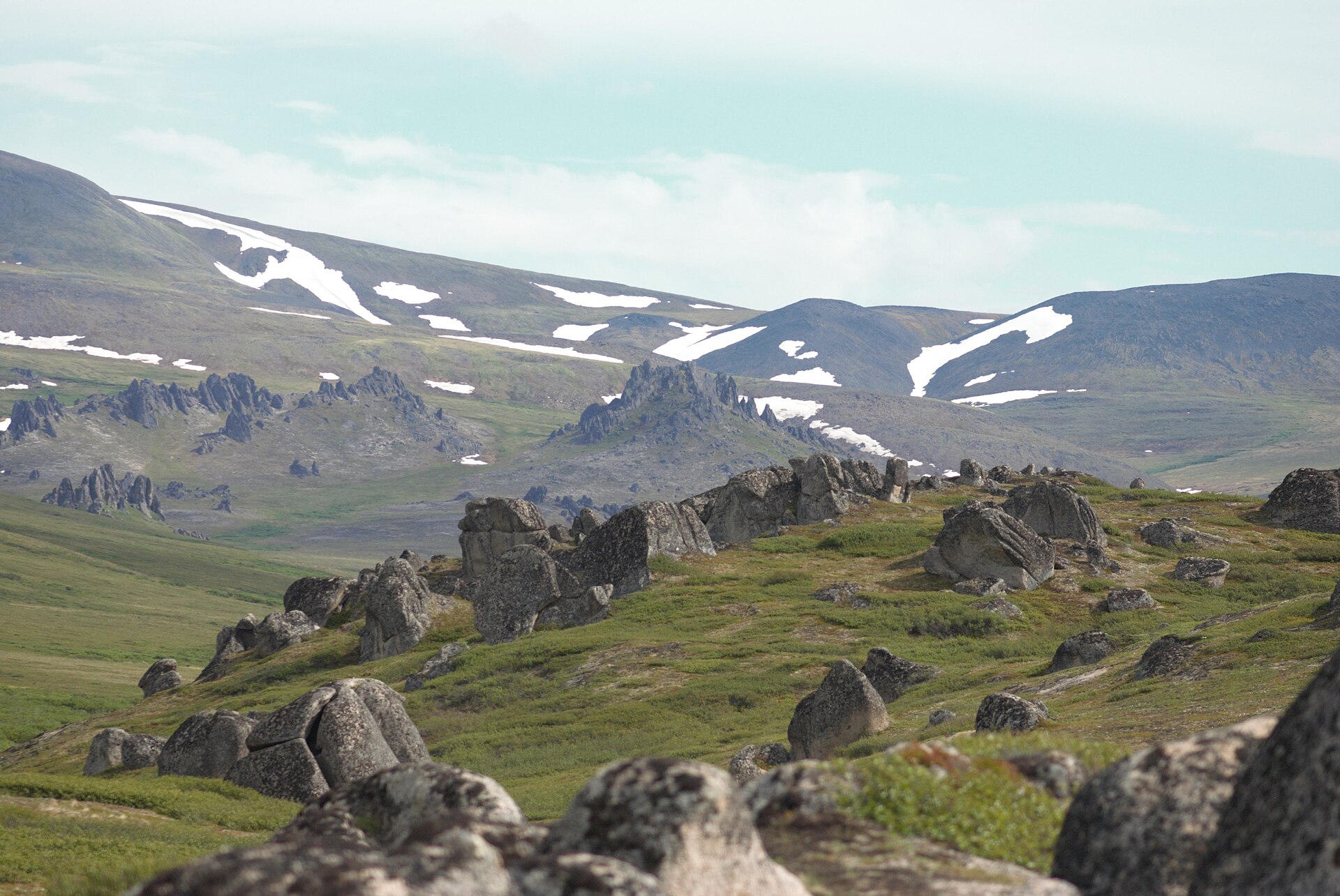
As the climate began warming about 18,000 years ago, the Beringia region became more moist and the sea level rose, submerging the land bridge and causing shrub tundra vegetation to expand. The first flooding of the land bridge happened around 10,000 years ago.
7. Human and Animal Life
At the peak of the last ice age, 20,000 years ago, when most of northern North America was covered by massive glaciers, much of Alaska was ice-free and home to a diverse assortment of large mammals.
The Paleoarctic were the very first humans to set foot in North America, moving from eastern Siberia about 1,000 miles across the Bering Land Bridge during the final millennia of the Earth's last Ice Age.
Most of interior Alaska, south of the Brooks Range and north of the Alaska Range, was a non-glaciated grassland refuge habitat for a number of plant and animal species during the maximum Pleistocene glaciation. This ice-free corridor also provided one route for humans to move into North America.
8. Megafaunal Extinction
Distinctive large mammals characterized Pleistocene habitats in North America, Asia, and Europe, among them mammoths and their cousins the mastodons, longhorned bison, saber-toothed cats, and giant ground sloths. Around the end of the Pleistocene, all these creatures went extinct.
The loss was not confined to a handful of species. Hundreds of large mammal species disappeared during the transition from the last glaciation to the present interglacial period, a span running from around 50,000 to 5,000 years ago.
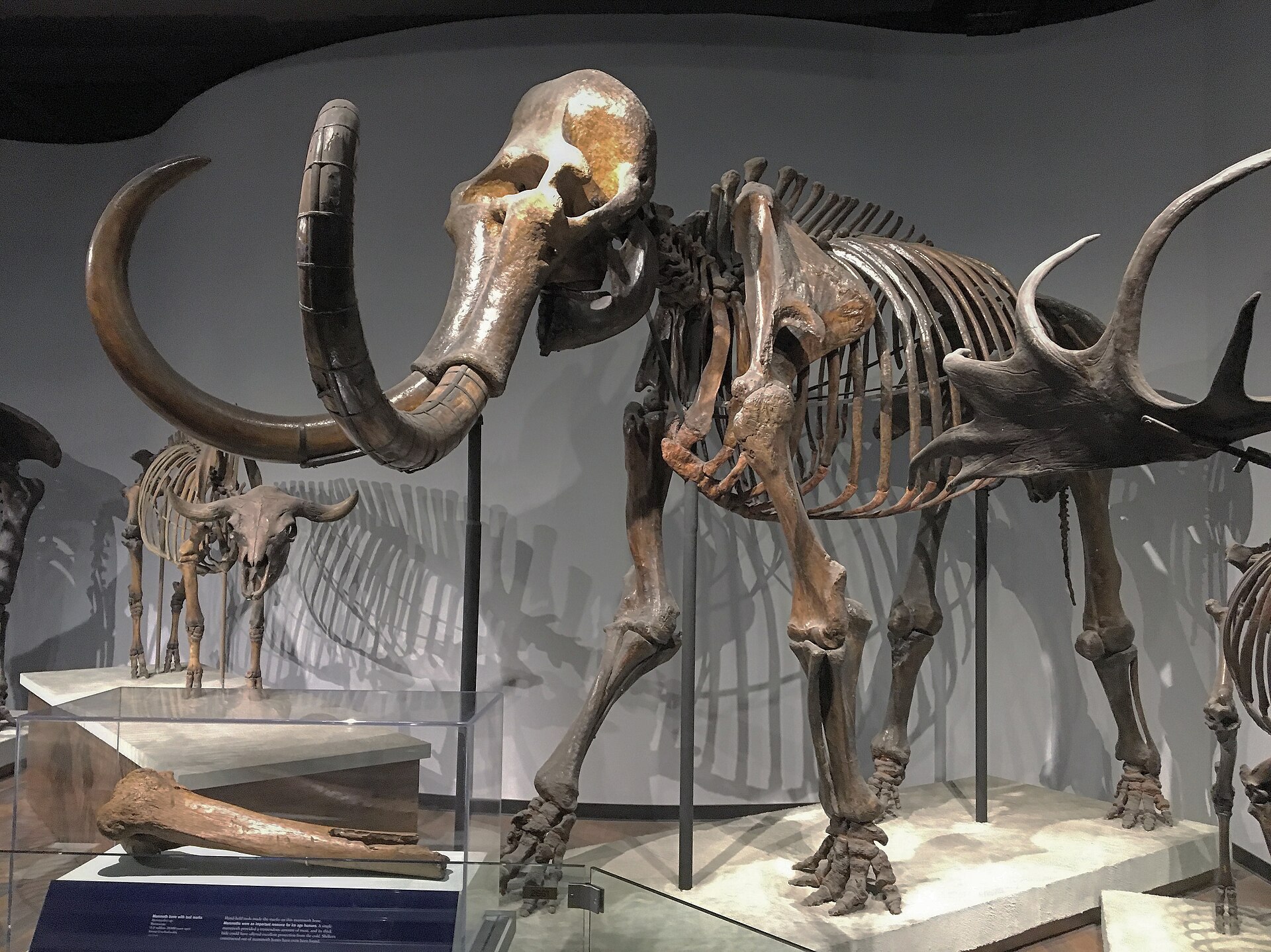
The woolly mammoth illustrates the scale of that history. Woolly mammoths roamed parts of Earth's northern hemisphere for at least half a million years, and were still in their heyday 20,000 years ago. By 4,000 years ago they were gone.
9. Present-Day Ice Sheets
Two great ice masses, the Antarctic and Greenland ice sheets, stand out in the world today and may be similar in many respects to the large Pleistocene ice sheets.
Parts of the Antarctic continent have had continuous glacier cover for perhaps as long as 20 million years, while valley glaciers of the Antarctic Peninsula and glaciers of the Transantarctic Mountains may date from the early Pleistocene.
For Greenland, ice cores and related data suggest that all of southern Greenland and most of northern Greenland were ice-free during the last interglacial period, approximately 125,000 years ago.
10. Legacy in the Landscape
Where ice once gathered in mountain ranges, the land still carries its signature. Falls drop at the outlets of cirques, the bowl-shaped depressions in the headwaters of drainage areas formed by the accumulation of ice and its erosive action on the underlying bedrock.
Ice age glaciation shaped mountaintops into amphitheatre-like cirques, arête ridges, and majestic peaks such as the Matterhorn and Grossglockner.
Not all ice in the landscape is ancient. Temperate glaciers in Alaska are generally much younger than the great Pleistocene ice, and many formed as recently as the start of the Little Ice Age, approximately 700 years ago.
11. Study of Ice Ages
The concept of an ice age was enlarged and popularized by the Swiss geologist Louis Agassiz, whose arrival in the United States in 1846 marks the beginning of the study of this period of Earth history in North America.
A chronology developed from European river terraces suggested that the Pleistocene consisted of four or five major glacial stages separated by interglacial stages with climates generally similar to those of today.
The World Data Service for Paleoclimatology maintains archives of ice core data from polar and low-latitude mountain glaciers and ice caps throughout the world.
12. Timeline: from the Pleistocene glaciation to the last mammoths
- About 2.6 million years agoQuaternary glaciation beginsGlobal climate enters the cooling phase known as the Pleistocene Epoch, and ice several kilometers thick flows southward as glaciers across North America.
- About 125,000 years agoLast interglacialIce cores and related data suggest that all of southern Greenland and most of northern Greenland were ice-free during the last interglacial period.
- Between about 120,000 and 11,500 years agoThe most recent glacial periodThe most recent glacial period runs from about 120,000 to 11,500 years ago, after which Earth enters the Holocene interglacial.
- About 20,000 years agoLast Glacial MaximumIce sheets reach their greatest extent: close to a third of the land surface is intermittently under ice, sea level stands more than 400 feet lower than today, and only about 8% of Earth's surface is glaciated.
- About 18,000 years agoWarming beginsAs the climate begins warming, the Beringia region becomes more moist and the sea level rises.
- Beginning about 15,000 years agoGlaciers retreatContinental glaciers retreat and sea level begins to rise, reaching its current height roughly 8,000 years ago.
- About 14,000 years agoFirst Americans in interior AlaskaThe first definitive archaeological evidence for human presence in interior Alaska and the Yukon dates from about 14,000 years ago during the deglaciation.
- About 11,700 years agoPleistocene endsThe Pleistocene gives way to the Holocene; most Pleistocene ice age glaciers melt away during the warm period.
- About 10,000 years agoBering land bridge floodsRising sea level first floods the Bering land bridge; by now the large ice sheets have retreated.
- About 8,000 years agoModern sea levelSea level reaches its current height and has fluctuated ever since.
- About 6,000 years agoLast ice sheet meltsThe remnant of the last major ice sheet lingers in Canada until about 6,000 years ago, when it finally melts.
- About 4,000 years agoLast mammoths die outThe last woolly mammoths, isolated populations off the coasts of Siberia and Alaska, are gone by about 4,000 years ago.
- About 700 years agoLittle Ice Age beginsMany temperate glaciers in Alaska formed as recently as the start of the Little Ice Age.
- 1976Milankovitch theory validatedA study published in the journal Science examines deep-sea sediment cores and finds that Milankovitch's orbital theory corresponds to periods of climate change.
13. Frequently asked questions
When did glaciation first begin?
Glaciation began roughly 2.6 million years ago.4Quaternary sediment thickness and bedrock topography of the glaciated United States east of the Rocky Mountains · U.S. Geological Survey ↗
What were the two great ice sheets of North America?
East of the Rocky Mountains, the ice coalesced into continental glaciers called the Laurentide Ice Sheet, which at times blanketed much of the north-central and northeastern United States.4 West of it, glaciers formed in the mountains of western Canada and the United States and coalesced into the Cordilleran ice sheet, a relatively smaller ice mass that extended into the northernmost areas of western Montana, Idaho, and Washington.4
How thick is the Antarctic ice sheet today?
Its mean thickness is 2.16 km, and the maximum known thickness is 4,776 m in Terre Adelie.20Ice sheets · Australian Antarctic Program (Australian Antarctic Division) ↗
What is the obliquity cycle?
The obliquity cycle spans about 41,000 years.10Milankovitch (Orbital) Cycles and Their Role in Earth's Climate · NASA Science ↗
When did the Bering land bridge first flood?
The first flooding of the land bridge happened around 10,000 years ago.9Beringia: About · U.S. National Park Service ↗
How old is the earliest definitive archaeology in interior Alaska and the Yukon?
It dates to about 14,000 years ago.9
References (21)
- 1Glacial-Interglacial Cycles — NOAA National Centers for Environmental Information 2021 WebView source
- 2Glaciation — Encyclopaedia Britannica WebView source
- 3Pleistocene Epoch — Encyclopaedia Britannica WebView source
- 4Quaternary sediment thickness and bedrock topography of the glaciated United States east of the Rocky Mountains — U.S. Geological Survey Web↩View source
- 5The Pleistocene Epoch — University of California Museum of Paleontology WebView source
- 6The Great Ice Age — U.S. Geological Survey WebView source
- 7Are today's glaciers leftovers from the Pleistocene ice age? — U.S. Geological Survey WebView source
- 8How does present glacier extent and sea level compare to the extent of glaciers and global sea level during the Last Glacial Maximum (LGM)? — U.S. Geological Survey WebView source
- 9Beringia: About — U.S. National Park Service Web↩View source
- 10Milankovitch (Orbital) Cycles and Their Role in Earth's Climate — NASA Science Web↩View source
- 11Milutin Milankovitch — NASA Science (Earth Observatory) WebView source
- 12Hasn't Earth warmed and cooled naturally throughout history? — NOAA Climate.gov WebView source
- 13Pleistocene Megafauna in Beringia (Alaska Park Science) — U.S. National Park Service WebView source
- 14The Paleoarctic Tradition — U.S. National Park Service (Bering Land Bridge National Preserve) WebView source
- 15Was all of Alaska covered by glaciers during the Pleistocene Ice Age? — U.S. Geological Survey WebView source
- 16Extinction of large mammals in the Late Quaternary Ice Age — Natural History Museum, London WebView source
- 17The last of the mammoths — Natural History Museum (London) WebView source
- 18Ice sheet — Encyclopaedia Britannica WebView source
- 19Ice Core — NOAA National Centers for Environmental Information WebView source
- 20Ice sheets — Australian Antarctic Program (Australian Antarctic Division) Web↩View source
- 21Geology of Glacier National Park — U.S. Geological Survey WebView source