Dead Sea
The lowest place on Earth — its extreme salinity, rift-valley geology, shrinking shore, sinkholes and the industries and health resorts built on its shores.
The Dead Sea is a landlocked hypersaline lake between Israel, Jordan and the West Bank whose surface, at roughly 430 metres below sea level, is the lowest on Earth. Fed almost entirely by the Jordan River, it has no outlet, so decades of upstream diversion and mineral extraction have made it shrink, exposing hundreds of sinkholes along its shores. The same salt that makes bathers float supports a major potash and bromine industry, a centuries-old health-tourism tradition and an archaeological record that includes Qumran and Masada.
In this article
- 1Overview
- 2Geography and Setting
- 3Physical Dimensions
- 4Geological Origins
- 5Water Level History
- 6Salinity and Water Chemistry
- 7Decline and Its Causes
- 8Sinkholes and Subsidence
- 9Mineral Extraction and Industry
- 10Dead Sea Scrolls and Qumran
- 11Masada
- 12Historical and Classical Accounts
- 13Health, Wellness and Tourism
- 14Conservation and Regional Cooperation
- 15Timeline: from the Qumran community to the shrinking sea
- 16Frequently asked questions
- 17Knowledge graph
Overview
The Dead Sea is an endorheic hypersaline lake whose primary inflow is the Jordan River and which has no outflow. Its water surface is the lowest natural land or water surface on Earth, standing more than 400 metres below sea level.
1. Geography and Setting
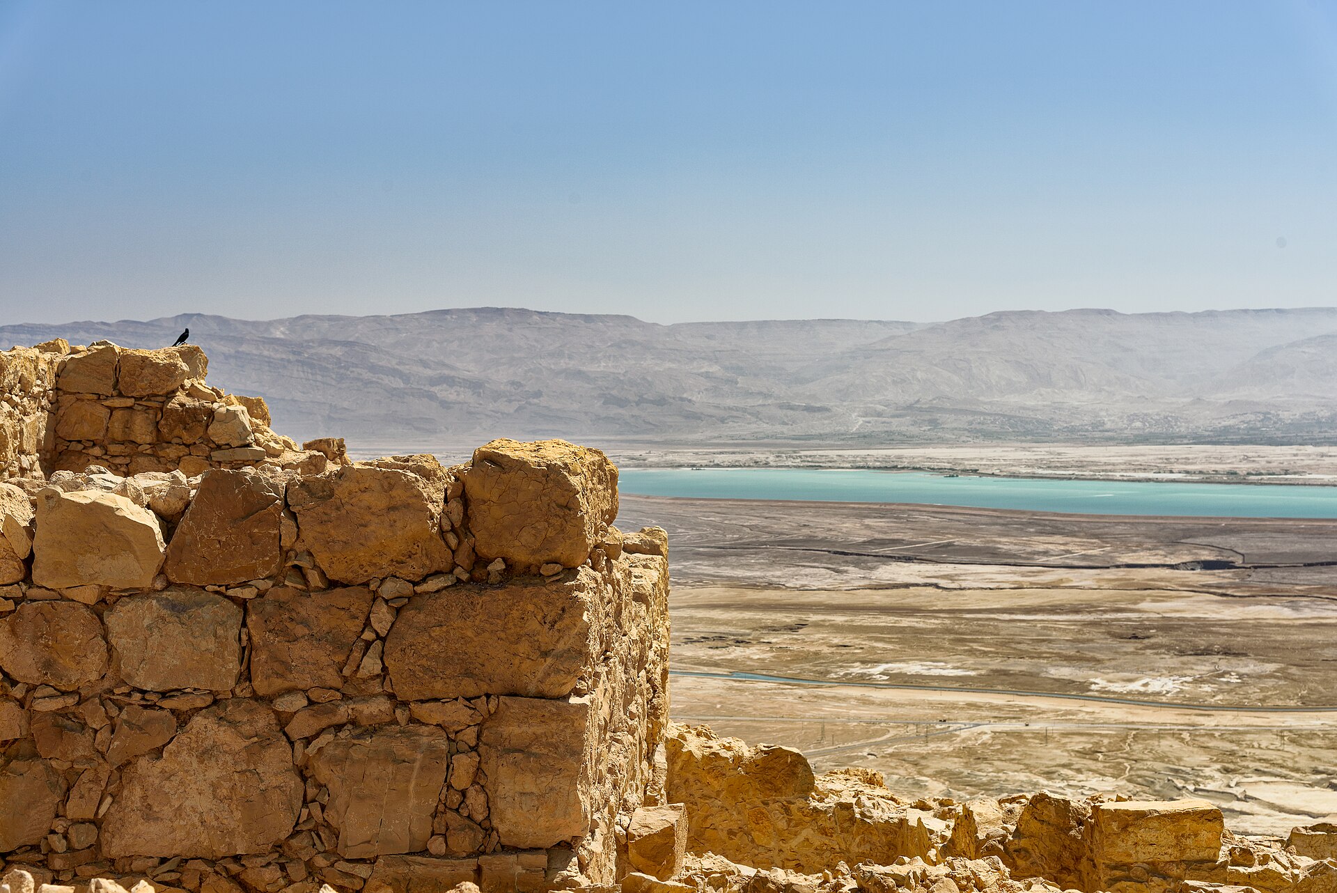
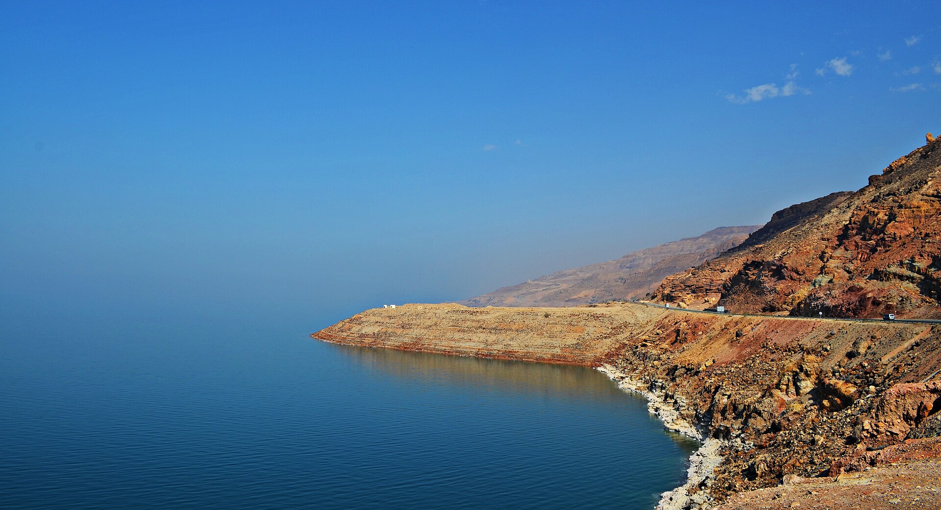
The Dead Sea is a landlocked salt lake lying between Israel and Jordan in southwestern Asia, with its eastern shore belonging to Jordan. The southern half of its western shore belongs to Israel, while the northern half lies within the Palestinian West Bank and has been under Israeli occupation since the 1967 Arab-Israeli war. Its catchment area covers 41,650 sq km (16,080 sq mi).
The peninsula of Al-Lisan divided the lake on its eastern side into two unequal basins, the northern basin holding about three-fourths of the total surface area and reaching a depth of 400 metres. The northern and southern basins were once connected by a strait, which is now dry.
2. Physical Dimensions
| Measurement | Value | Source note |
|---|---|---|
| Lake type | Endorheic hypersaline lake | — |
| Primary inflow | Jordan River | — |
| Surface elevation, 2025 | 439.78 m below sea level | — |
| Surface elevation, mid-2010s | About 430 m / 1,410 ft below sea level | — |
| Historic length | About 80 km / 50 mi before the level began dropping | — |
| Maximum width | 18 km / 11 mi before the level began dropping | — |
| Maximum depth | 298 m / 978 ft | 1Dead Sea · Wikipedia ↗ |
| Average depth | 188.4 m / 618 ft | 1 |
| Water volume | 114 cubic km / 27 cu mi | 1 |
| Surface area | 605 sq km / 234 sq mi in 2016, down from 1,050 sq km in 1930 | — |
| Deepest point elevation | 728 m / 2,388 ft below sea level | — |
| Catchment area | 41,650 sq km / 16,080 sq mi | — |
It has 330 sunny days a year and a 75-kilometre stretch of beaches lined with hotels and spa facilities 4The Dead Sea · Israel Ministry of Tourism (israel.travel) ↗. Industrial solar evaporation ponds of the Dead Sea Works and the Arab Potash Company are responsible for 30 to 40 percent of the depletion of Dead Sea waters 5Dead Sea · EcoPeace Middle East ↗.
3. Geological Origins
The Dead Sea occupies part of a graben, a downfaulted block of Earth's crust, between transform faults along a tectonic plate boundary running from the Red Sea spreading centre to the Taurus Mountains of southern Turkey. During the Miocene Epoch, as the Arabian Plate collided with the Eurasian Plate, fractures formed that allowed the Dead Sea graben to drop.
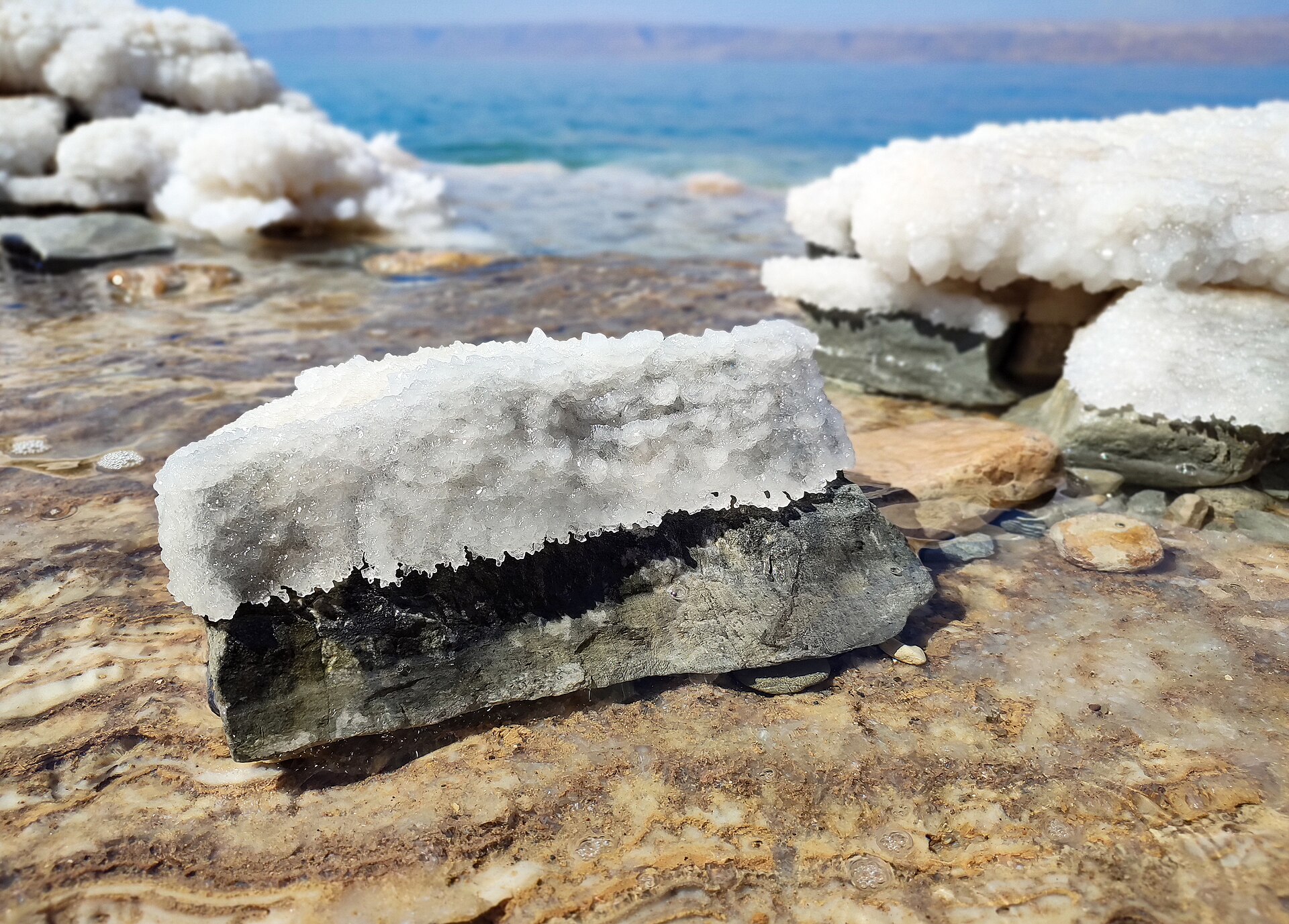
During the Pleistocene Epoch the lake rose about 200 metres above its modern level and formed a vast inland sea stretching some 320 kilometres. The salt layer coating the Dead Sea bottom has been growing about 10 centimetres thicker every year.
4. Water Level History
-
1896Highest recorded levelThe Dead Sea rose to its highest recorded level of 389 metres below sea level.3Dead Sea | History, Location, Salt, Map, Minerals, & Facts · Encyclopaedia Britannica ↗
-
After 1935Recession and stabilisationThe Dead Sea receded again after 1935, then stabilised near 400 metres below sea level for several decades.3
-
1964National Water Carrier completedThe National Water Carrier scheme, completed in 1964, diverts incoming Jordan River water to the north, and the Dead Sea has been rapidly shrinking since the 1960s.1
-
1967West Bank shore occupiedThe northern half of the Dead Sea's western shore lies within the Palestinian West Bank and has been under Israeli occupation since the 1967 Arab-Israeli war.3
-
1974–1979Decline of 62 centimetres per yearThe Dead Sea dropped 62 centimetres per year between 1974 and 1979.6Rates of Decline · U.S. Geological Survey, EROS Center (Earthshots) ↗
-
1981–1990Decline of 79 centimetres per yearThe drop reached 79 centimetres per year between 1981 and 1990.6
-
1994–2001Decline of 100 centimetres per yearThe decline reached 100 centimetres per year over 1994 to 2001, and the rate kept increasing.6
5. Salinity and Water Chemistry
The Dead Sea is more than eight times as saline as the ocean, with a salinity of about 34 percent compared with 3.5 percent for the Mediterranean Sea. Because it has no outlets it is one of the saltiest bodies of water on the planet. Its water is rich in chloride salts of magnesium, sodium, potassium and bromine.
Average annual rainfall of about 50 mm means that upstream water uses have a bigger impact on the lake's level than rain does. The Dead Sea has been described as absolutely devoid of life, yet giant craters spewing fresh water and brimming with bacteria have been found at its otherwise barren bottom. A first diving expedition to these springs took place in 2010, and bacterial communities live near thin plumes of fresh water from undersea springs whose presence had long been suspected from peculiar ripples on the surface.
6. Decline and Its Causes
The Jordan River once brought 1.3 billion cubic metres of fresh water every year into the Dead Sea; now it brings only about 100 million cubic metres, most of it containing agricultural runoff and sewage.
Two main factors contributed to the decline in the Dead Sea level: extensive extraction of minerals from Dead Sea water by Jordanian and Israeli industries, and elevated evaporation rates accompanied by the diversion of substantial quantities of freshwater. The primary cause of the Dead Sea's disappearance is the diversion of fresh water, half by Israel and half by Syria and Jordan, from the Lower Jordan River and its tributaries.
7. Sinkholes and Subsidence
Sinkholes appeared especially in the southwestern part of the Dead Sea region as groundwater rose and dissolved large subterranean caverns in the overlying salt layer until the surface finally collapsed. Subsidence at the Dead Sea occurs at rates of millimetres to centimetres per month on different spatial scales, and hazardous local sinkhole phenomena have disastrous effects on infrastructure, industry, tourism and agriculture.
The Ghor Al-Haditha region in the southern Dead Sea has been severely affected by saltwater intrusion, widespread sinkhole formation and topographic changes largely driven by declining Dead Sea water levels.
8. Mineral Extraction and Industry
A concession was granted by the British Mandatory government in 1929 to the newly formed Palestine Potash Company, founded by the engineer Moses Novomeysky, who had sought the charter for over ten years. The Dead Sea was one of the world's first health resorts and has supplied products ranging from asphalt for Egyptian mummification to potash for fertilisers. The Dead Sea Works was founded in 1952 as a state-owned enterprise based on the remnants of the Palestine Potash Company. It was privatized in 1995 and is now owned by Israel Chemicals, producing potash and other minerals from Dead Sea brine.
ICL Dead Sea runs nine production plants with 1,500 employees working around the clock, 365 days a year. A concession deed codified by the Dead Sea Concession Law of 1961 applies to approximately 652 square kilometres within the Dead Sea and its environs, about 3 percent of the territory of Israel. Infrastructure mapped in the Dead Sea concession area includes 63 evaporation and collection ponds and 55 conduits for transporting brine and Dead Sea water.
9. Dead Sea Scrolls and Qumran
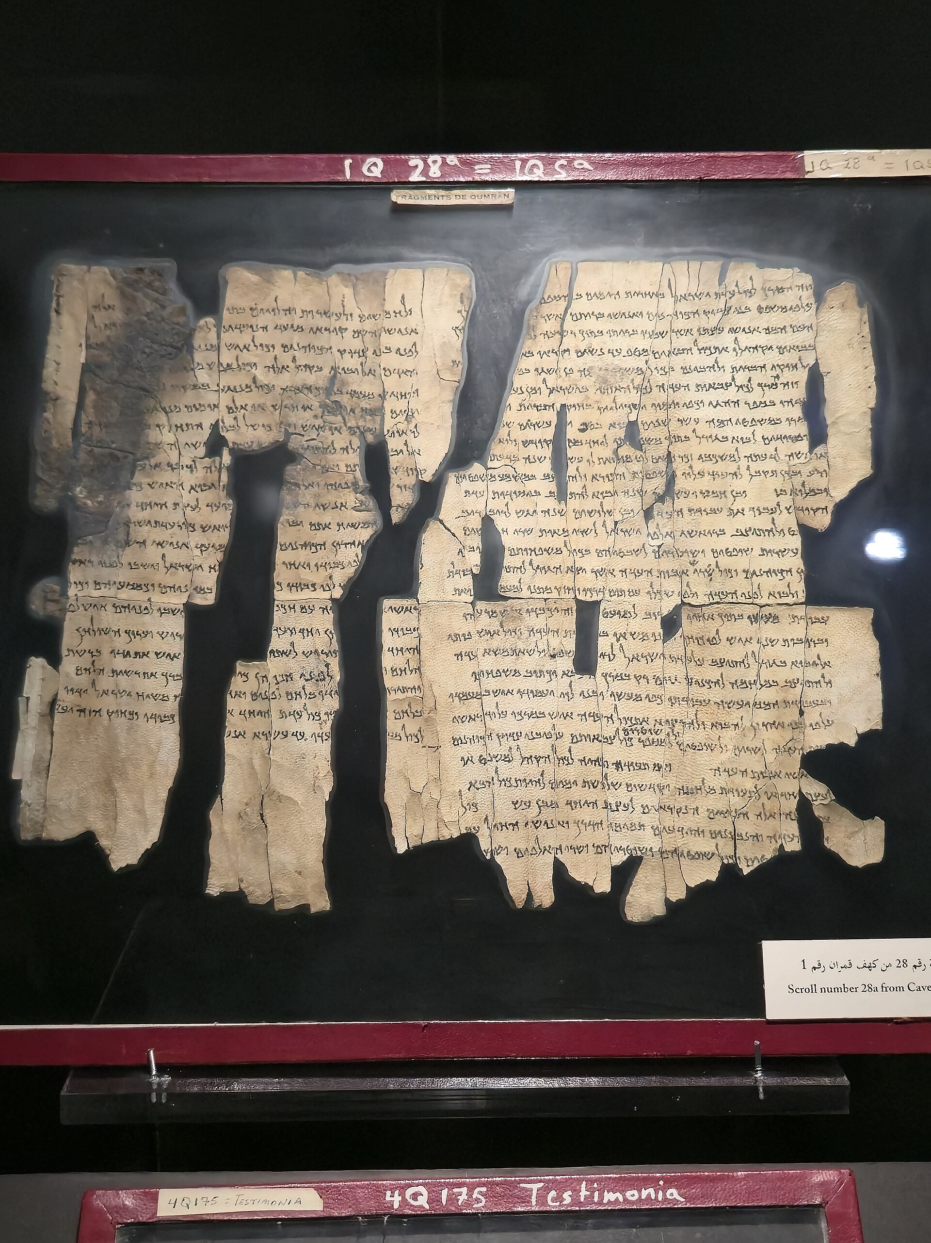
The Dead Sea Scrolls come from various sites and date from the 3rd century BCE to the 2nd century CE, and the term usually refers to manuscripts found in 11 caves near the ruins of Qumran. The first of them came to light by accident: in late 1946 or 1947 three Bedouin wandering along the northwest shore of the Dead Sea stumbled across a cave containing ten jars, only two of which were not empty.
The scrolls are the product of a community of Essenes who lived in the nearby ruins of Qumran, and they were composed between the 3rd century BCE and the 1st century CE. The relevant period of occupation of Qumran runs from about 100 to about 68 BCE.
10. Masada
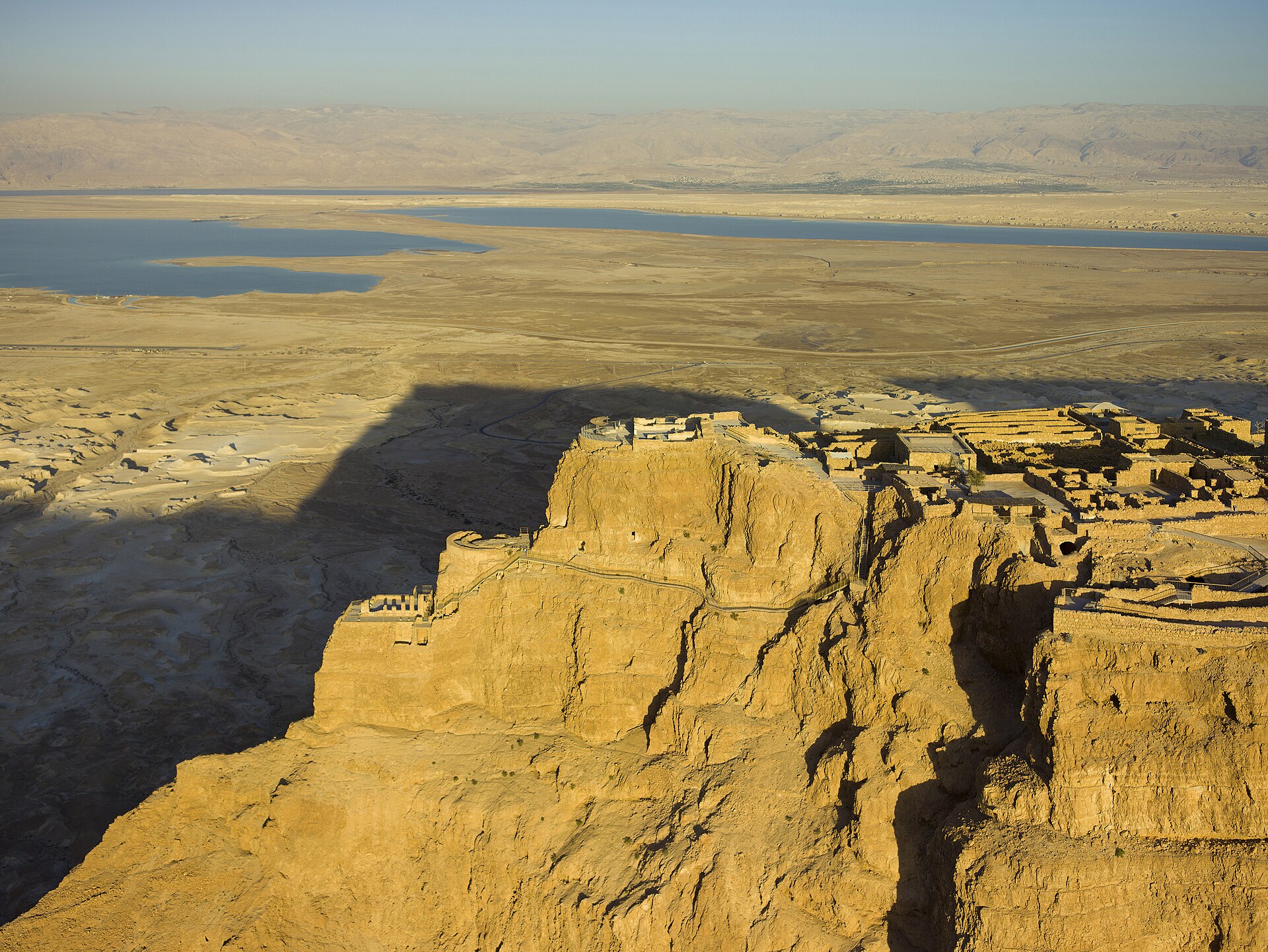
South of Ein Gedi lies Masada, a national landmark on top of a massive mountain that can be hiked or reached by cable car.
Herod the Great renovated Masada between 37 and 31 BCE with barracks, an armory, two palaces, Roman baths, a synagogue and a casement wall surrounding the structure. Josephus described the decision to commit mass suicide at Masada by 960 men, women and children, although he was not an eyewitness and modern debate continues over the historical basis of his story. The last stand of Jewish patriots against the Roman army ended in 73 AD, and the camps, fortifications and attack ramp that encircle Masada are the most complete Roman siege works surviving.
11. Historical and Classical Accounts
Josephus records that the lake Asphaltitis casts up black clods of bitumen in many parts, which swim at the top of the water and resemble headless bulls in shape and size.17Josephus: Of the War, Book IV (The Jewish War, trans. William Whiston) · LacusCurtius, penelope.uchicago.edu ↗ He gives the lake's length as five hundred and eighty furlongs and its breadth as one hundred and fifty, with the country of Sodom bordering upon it.17 He also notes that the country around the lake was of old a happy land for its fruits and cities, although in his day it was all burnt up.17
Strabo describes water so heavy that anyone who walks in and goes no farther than up to his navel is immediately raised afloat.18Strabo's Geography — Book XVI Chapter 2 · LacusCurtius, penelope.uchicago.edu ↗ 18 According to him the lake is full of asphalt, which is blown to the surface at irregular intervals while bubbles rise as though the water were boiling.18
12. Health, Wellness and Tourism
The unique attenuation and spectrum of ultraviolet rays near the Dead Sea contribute to effective photoclimatherapy for psoriasis because reduced exposure to solar radiation allows longer periods of sunbathing. A 2003 study of 27 patients found that after four weeks of climatotherapy at the Dead Sea the overall Psoriasis Area and Severity Index score decreased by 81.5 percent, with complete clearance in 48 percent of the patients. A 2022 immunohistochemical study concluded that Dead Sea climatotherapy is highly effective in the short term and almost normalising all investigated biomarkers, but that at relapse biomarkers were upregulated to the baseline level.
13. Conservation and Regional Cooperation
EcoPeace Middle East argues that the Dead Sea basin must be registered as a UNESCO World Heritage site to promote regional cooperation among Israeli, Jordanian and Palestinian riparians.5 This is an advocacy position advanced by the organization, not an accomplished designation.
The region already contains a UNESCO world heritage site: Masada, which is also one of the most popular tourist destinations in Israel.15Masada · World History Encyclopedia ↗ The World Heritage Committee inscribed Masada on the World Heritage List under criteria (iii), (iv) and (vi) on 13 December 2001.16Masada · UNESCO World Heritage Centre ↗ In December 2013 Israel, Jordan and the Palestinian Authority signed an agreement for a 180 kilometre water pipeline linking the Red Sea with the Dead Sea.1 In March 2025 Israel's State Comptroller published a special report on the management and supervision of the Dead Sea concession, covering evaporation ponds, industrial waste and uncollected royalties.12Management and Supervision of the Dead Sea Concession — Environmental and Land Use Aspects (Special Report, March 2025) · State Comptroller of Israel ↗
14. Timeline: from the Qumran community to the shrinking sea
- c. 100-68 BCEEssene community at QumranThe site of Qumran was occupied by a community that most scholars identify as Essenes, and the Dead Sea Scrolls nearly all date from the 3rd to the 1st century BCE.
- 37-31 BCEHerod the Great fortifies MasadaHerod the Great rebuilt Masada with barracks, an armory, two palaces, Roman baths, a synagogue and a casement wall, possibly as a retreat in case of rebellion.
- 73 CEFall of MasadaThe last stand of Jewish patriots against the Roman army ended in 73 AD; the camps, fortifications and attack ramp that encircle Masada are the most complete Roman siege works surviving.
- 1896Highest recorded level of the Dead SeaThe lake rose to its highest recorded level, 389 metres below sea level, and then receded again after 1935.
- 1929Palestine Potash Company concessionA concession was granted by the British Mandatory government to the newly formed Palestine Potash Company, whose first plant was built on the north shore at Kalya.
- 1947Discovery of the Dead Sea ScrollsThe first manuscripts were accidentally found in 1947 by a shepherd boy in a cave at Khirbat Qumran on the northwestern shore of the Dead Sea.
- 1952Founding of the Dead Sea WorksThe Dead Sea Works was founded as a state-owned enterprise based on the remnants of the Palestine Potash Company.
- 1960sWater diversion beginsIsrael and Jordan began diverting much of the Jordan River's flow and increased commercial use of the lake's water, producing a precipitous drop in the Dead Sea's level.
- 1964National Water Carrier completedThe National Water Carrier scheme diverted incoming Jordan River water to the north, and the Dead Sea has shrunk rapidly since the 1960s.
- 1967West Bank shore occupiedThe northern half of the Dead Sea's western shore lies within the Palestinian West Bank and has been under Israeli occupation since the 1967 Arab-Israeli war.
- late 1980sFirst sinkhole at a Dead Sea tourist siteThe first sinkhole appeared in the late 1980s, forcing a Dead Sea tourist park to be abandoned and beginning decades of ground collapse along the shore.
- 1995Dead Sea Works privatizedThe Dead Sea Works was privatized and is now owned by Israel Chemicals, producing potash and other minerals from Dead Sea brine.
- 13 December 2001Masada inscribed by UNESCOThe World Heritage Committee inscribed Masada on the World Heritage List under criteria (iii), (iv) and (vi).
- December 2013Red Sea-Dead Sea pipeline agreementIsrael, Jordan and the Palestinian Authority signed an agreement for a 180 kilometre water pipeline linking the Red Sea with the Dead Sea.
- March 2025State Comptroller report on the Dead Sea concessionIsrael's State Comptroller published a special report on the management and supervision of the Dead Sea concession, covering evaporation ponds, industrial waste and uncollected royalties.
15. Frequently asked questions
How fast is the Dead Sea shrinking today?
How much of the Dead Sea has already dried up?
About 250 square kilometres of the surface of the Dead Sea has dried up since the enactment of the Dead Sea Concession Law 12. The drop in the lake level separated the northern and southern basins by a strip of dry land and left the southern basin subdivided into dozens of large evaporation pools 3.
Are there really sinkholes around the Dead Sea, and when did they start?
In the late 1980s the first sinkhole appeared at a Dead Sea tourist site, forcing the tourist park to be abandoned 20The Dead Sea is disappearing, leaving behind a landscape shattered by sinkholes · ABC News (Australia) ↗. Several hundred sinkholes have formed around the Dead Sea, some of them in areas popular with tourists 3.
What minerals does industry take from the Dead Sea?
ICL Dead Sea extracts minerals from the Dead Sea including potash, bromine, sodium chloride, magnesia, magnesium chloride and metal magnesium 11ICL Dead Sea | Israel · ICL Group ↗. Its extraction and production operation spans across 150 square kilometres in the southern basin of the Dead Sea 11, and in 2001 potash output from Dead Sea brine reached 1.77 million tons 1.
What did the Dead Sea Scrolls actually contain?
About 15,000 fragments, most of them tiny, represent the remains of 800 to 900 original manuscripts from the Dead Sea Scrolls 13Dead Sea Scrolls | Definition, Discovery, History, & Facts · Encyclopaedia Britannica ↗. Cave 4 sheltered approximately 400 manuscripts, generally in poor condition, and about 100 of the manuscripts are biblical texts covering the entire Hebrew Bible except Esther 13.
Why is the Dead Sea considered a health destination?
The atmospheric oxygen concentration at the Dead Sea is higher than in most other places on Earth, contributing to its health benefits 8Dead Sea · Jordan Tourism Board (Visit Jordan) ↗. The Dead Sea is known as the oldest natural spa in the world, and its high salt concentration allows visitors to float effortlessly on its waters 21The Dead Sea Natural Spa · Israel Ministry of Tourism (israel.travel) ↗.
References (21)
- 1Dead Sea — Wikipedia Web↩View source
- 2Dead Sea, Israel, Jordan, West Bank — U.S. Geological Survey, EROS Center (Earthshots) WebView source
- 3Dead Sea | History, Location, Salt, Map, Minerals, & Facts — Encyclopaedia Britannica Web↩View source
- 4The Dead Sea — Israel Ministry of Tourism (israel.travel) Web↩View source
- 5Dead Sea — EcoPeace Middle East Web↩View source
- 6Rates of Decline — U.S. Geological Survey, EROS Center (Earthshots) Web↩View source
- 7The Dead Sea — National Geographic Education Blog 2010 WebView source
- 8Dead Sea — Jordan Tourism Board (Visit Jordan) Web↩View source
- 9Transient electromagnetic imaging of saltwater intrusion at the shrinking Dead Sea — Scientific Reports (Nature Portfolio) JournalView source
- 10Delayed subsidence of the Dead Sea shore due to hydro-meteorological changes — Scientific Reports (Nature Portfolio) JournalView source
- 11ICL Dead Sea | Israel — ICL Group Web↩View source
- 12Management and Supervision of the Dead Sea Concession — Environmental and Land Use Aspects (Special Report, March 2025) — State Comptroller of Israel 2025 Web↩View source
- 13Dead Sea Scrolls | Definition, Discovery, History, & Facts — Encyclopaedia Britannica Web↩View source
- 14Dead Sea Scrolls — World History Encyclopedia WebView source
- 15Masada — World History Encyclopedia Web↩View source
- 16Masada — UNESCO World Heritage Centre Web↩View source
- 17Josephus: Of the War, Book IV (The Jewish War, trans. William Whiston) — LacusCurtius, penelope.uchicago.edu Book↩View source
- 18Strabo's Geography — Book XVI Chapter 2 — LacusCurtius, penelope.uchicago.edu Book↩View source
- 19Climatotherapy at the Dead Sea for psoriasis — PubMed abstracts (PMID 35196397; PMID 12963909) — PubMed, U.S. National Library of Medicine WebView source
- 20The Dead Sea is disappearing, leaving behind a landscape shattered by sinkholes — ABC News (Australia) 2021 Web↩View source
- 21The Dead Sea Natural Spa — Israel Ministry of Tourism (israel.travel) Web↩View source