Compass
The magnetic compass from Han-dynasty China to the World Magnetic Model — how a south-pointing needle became the instrument of oceanic navigation.
The magnetic compass was developed in China, where Han-dynasty diviners used lodestone spoons and Song-dynasty writers first described a magnetized needle that pointed south with a deviation. The floating-needle compass spread through the Arab world to Europe, where a pivoted needle and the compass rose made long ocean voyages possible and where sailors learned to correct for magnetic declination. Compasses remain standard navigational equipment, corrected by geomagnetic models such as the World Magnetic Model, while steel-hulled ships rely on the gyrocompass that Sperry and Anschütz-Kaempfe introduced in the early 20th century.
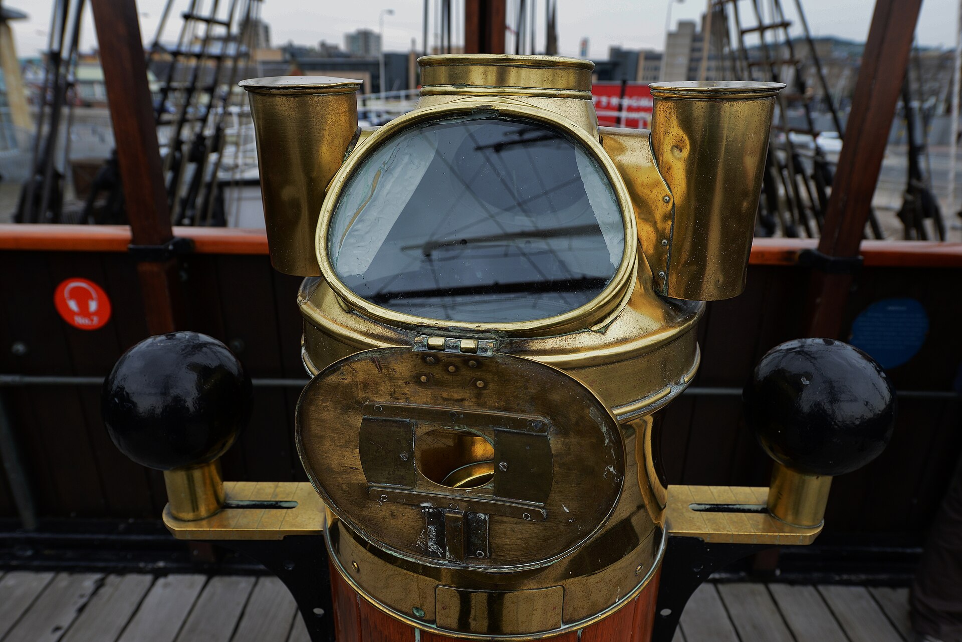
In this article
- 1Overview
- 2Origins in China
- 3Diffusion and Early European Records
- 4Declination, Dip, and the Magnetic Earth
- 5Magnetic Survey and the Poles
- 6The Gyrocompass
- 7Modern Field Models and Applications
- 8Compass in Navigation and Exploration
- 9Timeline of Key Developments
- 10Timeline: from the Han dynasty to the World Magnetic Model
- 11Knowledge graph
Overview
A compass is a direction-finding instrument. Its history runs from early Chinese observation of lodestone to the gyrocompass and to numerical field models maintained for navigation.
The account below follows that arc: the Chinese beginnings and the recognition of true north, the discovery of declination and of dip, the interpretation of the Earth itself as a magnet, the gyroscopic alternative to the magnetic needle, and the modern models that supply the corrections on which accurate bearing depends.
1. Origins in China
The first magnetic compasses were used in China during the Han dynasty, the second imperial dynasty, which ruled from 206 BC to 220 AD. The earliest compass form was a lodestone spoon used for divination, and later magnetized fish-shaped objects floated in a water-filled bowl. The first mention of a spoon made of lodestone and observed pointing in a cardinal direction appears in a Chinese work composed between 70 and 80 AD. In 1044 the Collection of the Most Important Military Techniques recorded that magnetized fish-shaped objects were placed in a water-filled bowl, enclosed by a box, and used to determine direction.
It was not until the time of Shen Kuo that the earliest magnetic compasses were used for navigation. Shen Kuo (1031-1095), Song dynasty scientist and official, provided the first description of the needle and true north. Remarkable studies of magnetism existed during the medieval period, in particular the work of Shen Kuo on the magnetic declination. Magnetic declination, sometimes called magnetic variation, is the angle between magnetic north and true north, and it depends on location and also changes over time.
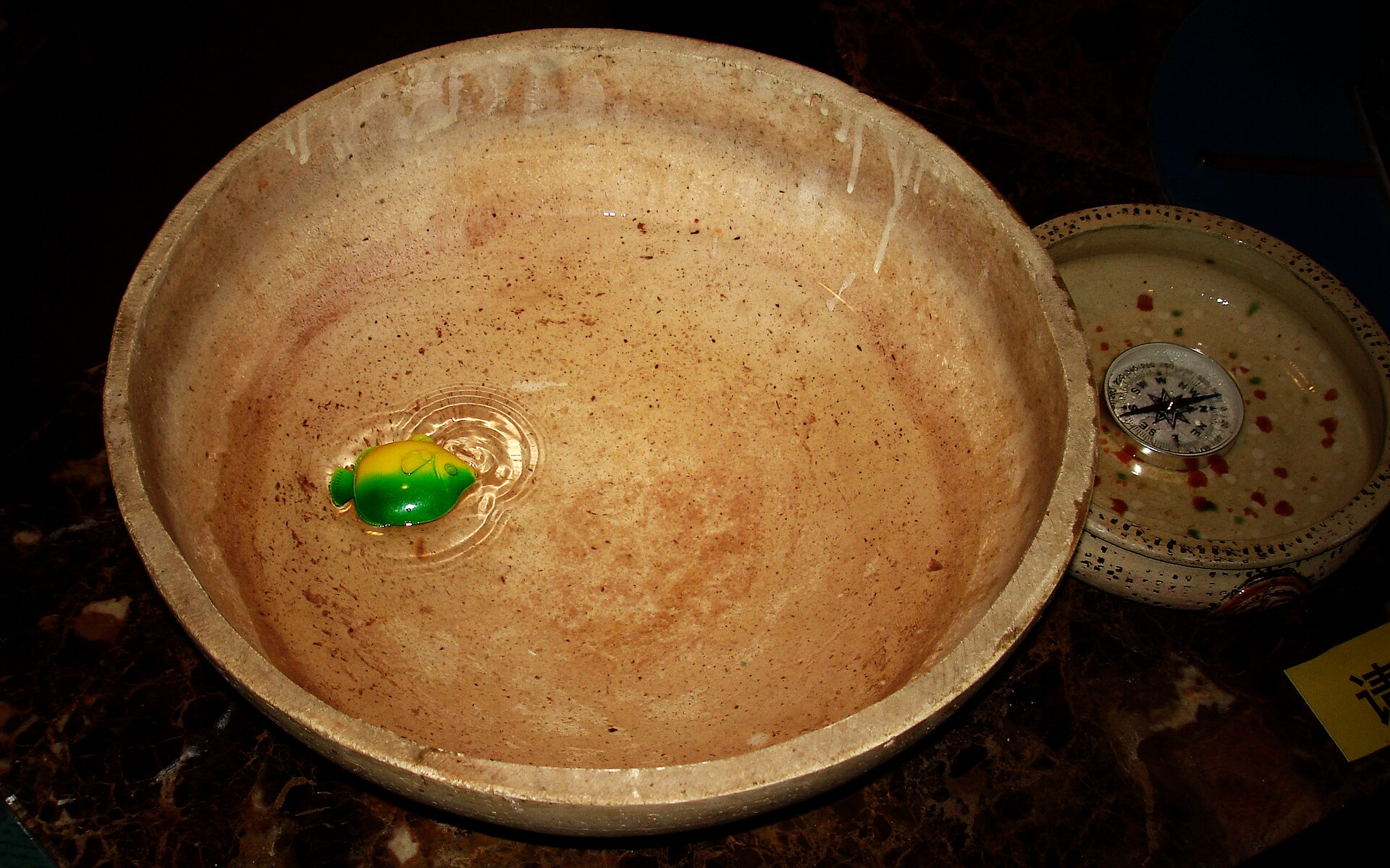
Around the year 1000 Chinese seafarers discovered that a lodestone floating on a boat prefers a south-north direction. The same preference was observed when a lodestone or an iron magnet was placed on a float in a bowl of water, where it always pointed south.
The magnetic declination in Beijing is about 6 degrees 50 minutes, and its value is negative.
2. Diffusion and Early European Records
The ancient Greeks knew about lodestones, strange minerals with the power to attract iron, some of which were found near the city of Magnesia in Asia Minor, which lent its name to all things magnetic. In 1187 Alexander Neckham described a pivoted compass, and in 1269 a letter by Petrus Peregrinus described the properties of magnets. The pivoted needle and the rose of the winds as a compass card both originated in the Mediterranean, and the earliest known compass card marked with the initials of the names of the winds is that ascribed to Jachobus Giraldis in the year 1426 and preserved in the Biblioteca Marciana in Venice.
3. Declination, Dip, and the Magnetic Earth
The compass needle does not seek out a single point on the globe; it aligns itself with the horizontal component of the magnetic field at the observer's own position, so the direction it indicates departs from true north by an angle known as magnetic declination, or variation. Columbus noted while sailing for America in 1492 that the declination changed in mid-ocean from easterly to westerly.
The needle's second departure from the horizontal — its tendency to slant downwards — was studied by Robert Norman of London, who in 1581 published his finding in a book, The Newe Attractive. Norman's work announced the phenomenon of magnetic dip and gave it a place beside declination in the study of terrestrial magnetism.
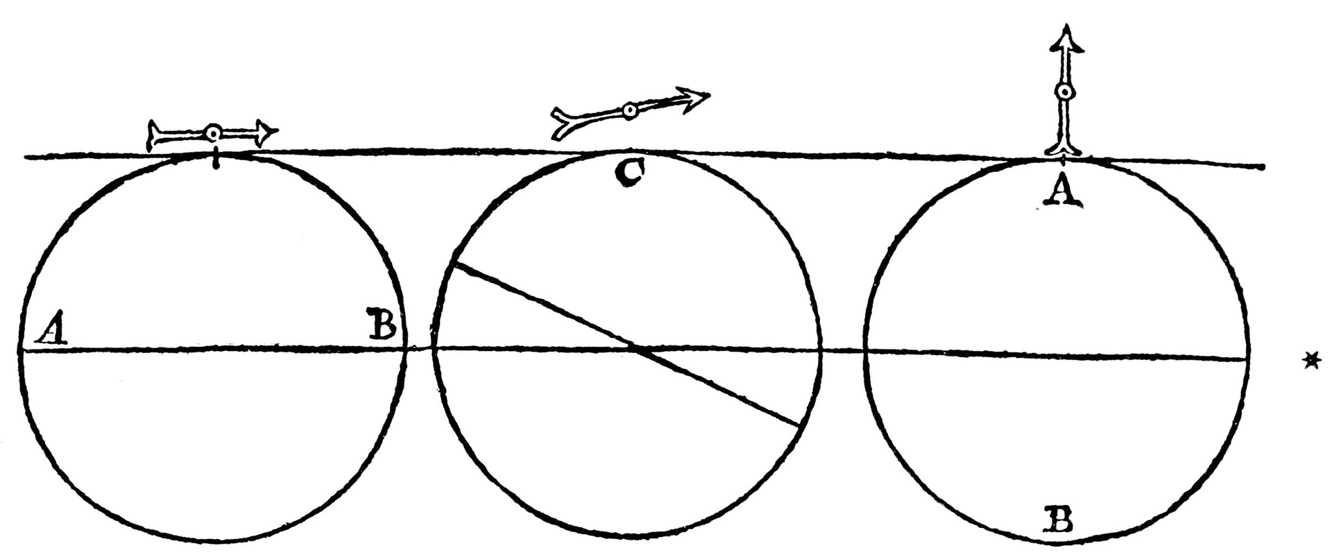
Gilbert's monumental work, the De Magnete, was published in 1600 and marks an era in magnetic science. In it the Earth itself was shown to act as a great magnet, an explanation that accounted at once for the needle's polar tendency and for its downward dip. The same treatise is often regarded as the foundation of electrical studies, and its author as the father of that field.
A NASA geospace physicist notes that if there were no magnetic field, we might have a very different atmosphere left, without life as we know it.
The first authoritative treatise on the variation of the compass was the tract by William Borough, comptroller to the Navy, who in 1580 found an eastward declination of 11 degrees 15 minutes at Limehouse. Robert Norman measured the dip for London at about 71 degrees 50 minutes. One letter written by Columbus in 1498 from Haiti claimed that the compass direction changed from east of true north to west of it, suggesting that the discrepancy might depend on location.
In 1601 Gilbert was appointed physician to Queen Elizabeth I, and upon her death in 1603 he was appointed physician to King James I, dying later that year in a plague epidemic.
Gilbert was the first to use the terms electric attraction, electric force and magnetic pole, and he is often considered the father of electrical studies.
4. Magnetic Survey and the Poles
Edmond Halley led the earliest global magnetic survey starting in 1699, using the 52-foot Paramore lent by the British Admiralty for more accurate charts of the Atlantic. Halley proposed Earth's interior consisted of concentric spherical shells, each magnetized differently and some rotating differently. From his survey the first magnetic map of the Atlantic was compiled with contour lines connecting points of equal declination, the first known use of contour lines, known for the next century as Halleyan lines.
In 1831 the Rosses and Sabine reached the northern magnetic pole, the same year Faraday discovered electrical induction. At the magnetic poles a dip needle stands vertical, horizontal intensity is zero, and a compass does not show direction.
Based on WMM2020 coefficients for epoch 2020.0 the geomagnetic north pole lies at 72.68 degrees west longitude and 80.65 degrees north latitude, and the geomagnetic south pole at 107.32 degrees east and 80.65 degrees south. The 2020 location of the north magnetic pole is 86.5 degrees north and 164.04 degrees east, while the south magnetic pole lies at 64.07 degrees south and 135.88 degrees east.
Careful observation of the tip of a long compass needle by the London clockmaker George Graham showed in 1722 that the direction of the magnetic force in London underwent a 24-hour cycle.
5. The Gyrocompass
The gyrocompass is immune to magnetic interference from ore deposits, steel structures or electric circuits, making it a prime navigational device in ships and submarines. Although the apparent effect of Earth's rotation on gyroscopes was first shown by Leon Foucault in 1852 while the ability to construct sufficiently accurate units did not exist until the first decade of the 20th century. In 1911 Elmer Sperry in the United States produced a gyrocompass easier to manufacture, patented in 1908 and adopted by the U.S. Navy in 1911, and playing a major role in World War I. Sperry founded the Sperry Gyroscope Company.
By 1890 Sperry had founded two companies, and in that year G.M. Hopkins invented the first electrically driven gyroscope; a gyroscope is a disk mounted on a base in such a way that the disk can spin freely on its X- and Y-axes. The electrically driven gyroscope, once a curiosity, became a reliable reference device in steel ships where a standard magnetic compass was unreliable.
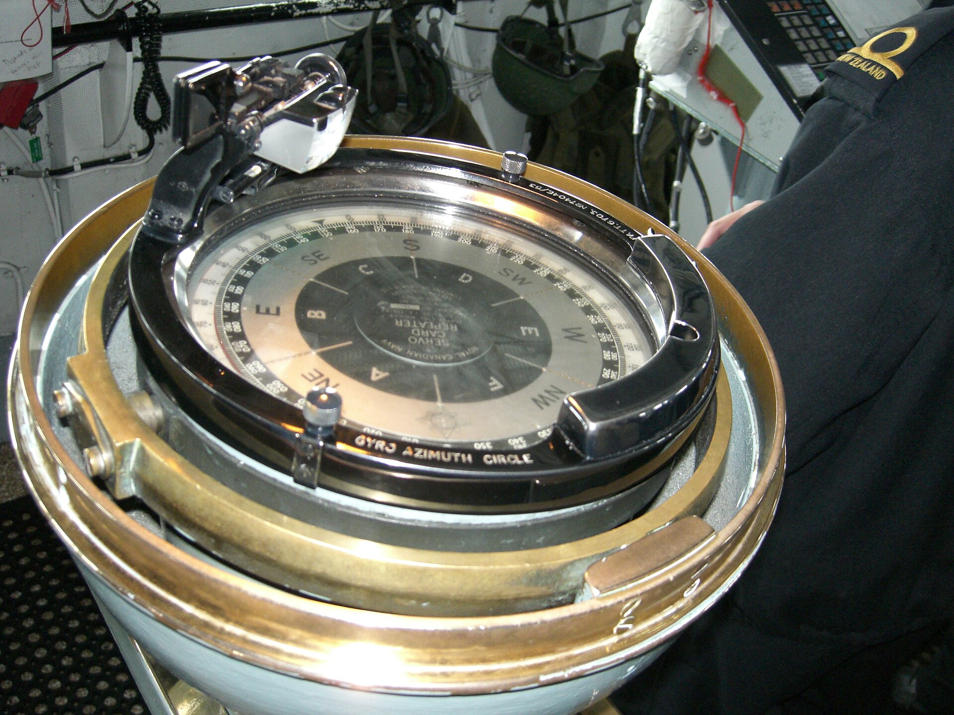
The gyrocompass is not suitable as an aircraft compass because speed of several hundred knots seriously affects its north-seeking properties.
6. Modern Field Models and Applications
The World Magnetic Model is the standard model for navigation, attitude and heading referencing systems that use the geomagnetic field, and for civilian navigation and heading systems. It is produced by the United States National Geospatial-Intelligence Agency and the United Kingdom Defence Geographic Centre, and is jointly developed by the National Centers for Environmental Information and the British Geological Survey. A new version of the model is issued every five years to address changes in Earth's magnetic field; the current version, WMM2025, was released on 17 December 2024 and will remain valid until late in 2029 for navigational use.
The British Geological Survey's geomagnetism science capability measures, records, models and interprets variations in the Earth's magnetic field, helping to develop scientific understanding of the solid Earth and its atmospheric and space environments.
7. Compass in Navigation and Exploration
The question of purposeful human settlement of the Pacific turns on the wayfinding skills of the Polynesian people, even though the prevailing European view held that any migration resulted from accidental storms or current drifts. The Lapita and their ancestors were skilled seafarers who memorised navigational instructions and passed their knowledge down through folklore, cultural heroes and simple oral stories. Indigenous navigators required deep knowledge of the movement of the stars through the night sky.
Between 1405 and 1433 CE Zheng He commanded huge fleets loaded with trade goods and high-value gifts to far-flung places such as Hormuz in the Persian Gulf and Mogadishu in East Africa.
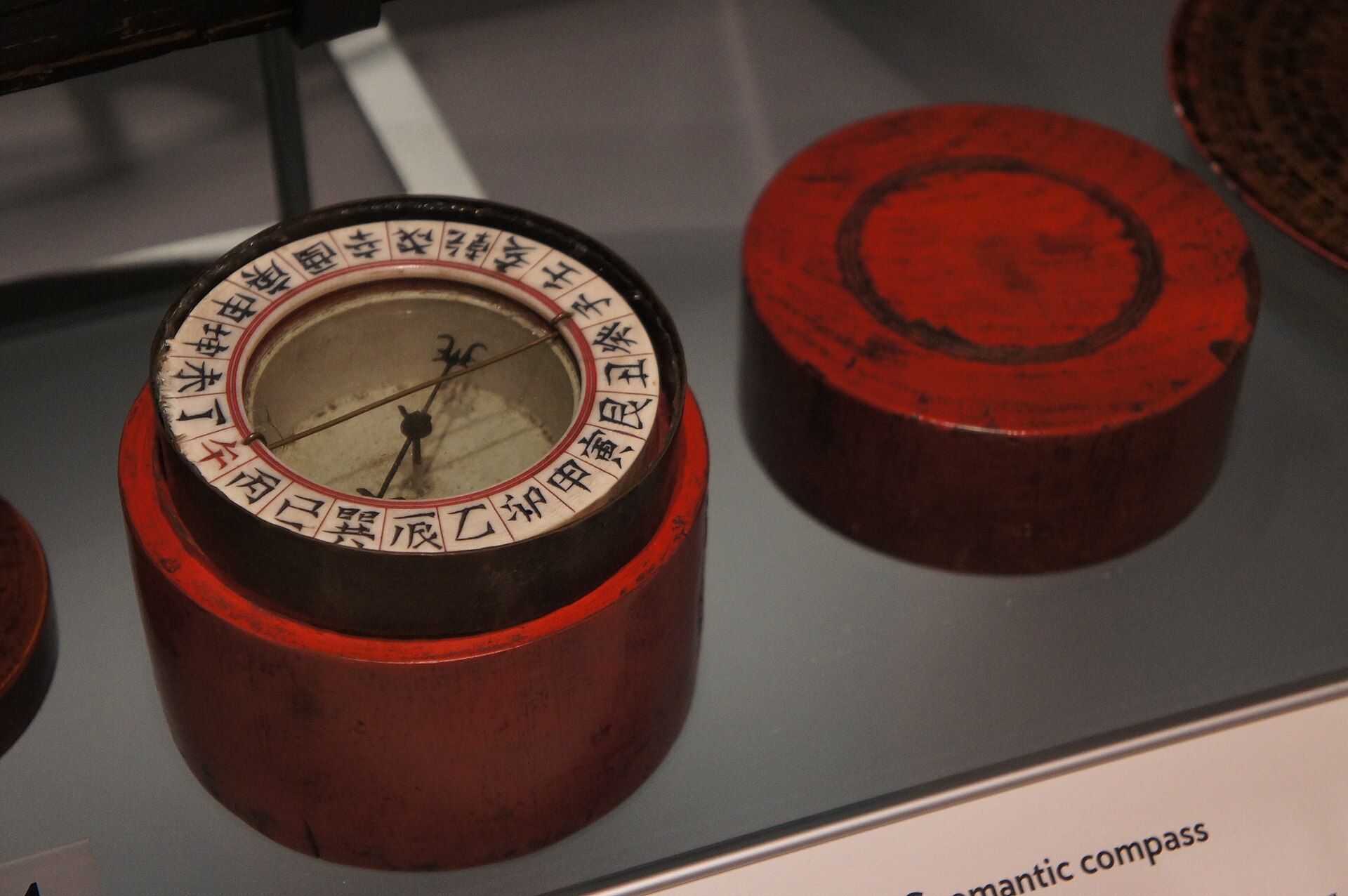
Zheng He's massive fleet of 317 ships had been under construction since 1403 CE and included 62 baochuan, then the largest ships in the world.
Many of Zheng He's vessels, built at the shipyards of Nanjing, were equipped with water-tight compartments, sternpost rudders, magnetic compasses and paper charts and maps.
8. Timeline of Key Developments
-
1044Magnetized fish in a water-filled bowlThe Collection of the Most Important Military Techniques recorded that magnetized fish-shaped objects were placed in a water-filled bowl, enclosed by a box, and used to determine direction. 4Magnetic Compasses and Chinese Architectures (Amelia Carolina Sparavigna, Politecnico di Torino) · arXiv (Cornell University) ↗
-
1600De MagneteWilliam Gilbert's De Magnete showed that Earth itself is a great magnet. 2A Millennium of Geomagnetism: Appendix, A Chronology of Geomagnetism (David P. Stern, Reviews of Geophysics 40(3), 2002) · NASA Goddard Space Flight Center / American Geophysical Union ↗
-
1634Secular variation of declinationHenry Gellibrand discovered the secular variation of declination. 2
-
1699First magnetic surveyEdmond Halley conducted the first magnetic survey. 2
-
1722Diurnal variation of declinationGeorge Graham discovered the diurnal variation of declination. 2
9. Timeline: from the Han dynasty to the World Magnetic Model
- 206 BC - 220 ADHan dynasty compassesThe first magnetic compasses were used in China during the Han dynasty, chiefly for divination and in the shape of a spoon.
- 70-80 ADFirst mention of the lodestone spoonA Chinese work composed between 70 and 80 AD mentions a spoon made of lodestone that came to rest pointing south.
- around 1000 CELodestone float points south-northChinese seafarers discovered that a lodestone floating on a boat prefers a south-north direction, and from this the magnetic compass developed.
- 1044 CEMagnetized fish in a water bowlThe Collection of the Most Important Military Techniques recorded magnetized fish-shaped objects placed in a water-filled bowl and used to determine direction.
- 1187First European pivoted compassAlexander Neckham described a pivoted compass, the earliest European reference to the instrument.
- 1269Peregrinus letter on magnetsA letter by Petrus Peregrinus described the properties of magnets and the pivoted needle.
- 1405-1433 CEZheng He's treasure fleetsBetween 1405 and 1433 CE Zheng He commanded fleets of 317 ships whose vessels carried magnetic compasses, paper charts and sternpost rudders.
- 1426Earliest known compass cardThe earliest known compass card marked with the initials of the names of the winds is ascribed to Jachobus Giraldis of Venice.
- 1492Columbus notes changing declinationSailing for America, Columbus noted that the declination changed in mid-ocean from easterly to westerly.
- 1581Magnetic dip announcedRobert Norman published The Newe Attractive, announcing the discovery of magnetic dip.
- 1600De Magnete publishedWilliam Gilbert's De Magnete showed that Earth itself is a great magnet.
- 1634Secular variation discoveredHenry Gellibrand showed that the magnetic declination observed near London had undergone a systematic shift.
- 1699-1701First magnetic survey and chartEdmond Halley carried out the first magnetic survey and compiled the first magnetic map of the Atlantic with lines of equal declination.
- 1908First seaworthy gyrocompassThe firm of Hermann Anschutz-Kaempfe in Germany produced the first seaworthy gyrocompass.
- 1911Sperry gyrocompass in serviceElmer Sperry produced an easier-to-manufacture gyrocompass, and the U.S. Navy adopted his unit in 1911.
- 17 December 2024WMM2025 releasedThe current World Magnetic Model, WMM2025, was released and will remain valid until late 2029.
References (15)
- 1Magnetic Declination — National Centers for Environmental Information (NOAA) WebView source
- 2A Millennium of Geomagnetism: Appendix, A Chronology of Geomagnetism (David P. Stern, Reviews of Geophysics 40(3), 2002) — NASA Goddard Space Flight Center / American Geophysical Union 2002 Web↩View source
- 3Gyrocompass | Navigational Instrument, Principles & History — Encyclopaedia Britannica WebView source
- 4Magnetic Compasses and Chinese Architectures (Amelia Carolina Sparavigna, Politecnico di Torino) — arXiv (Cornell University) 1709 Journal↩View source
- 5William Gilbert, and Terrestrial Magnetism in the Time of Queen Elizabeth: A Discourse (Silvanus P. Thompson) — Project Gutenberg WebView source
- 6William Gilbert | Biography & Facts — Encyclopaedia Britannica WebView source
- 7World Magnetic Model (WMM) — National Centers for Environmental Information (NOAA) WebView source
- 8The Great Magnet, the Earth: What was known before Gilbert about Magnets and the Compass Needle — NASA Goddard Space Flight Center (David P. Stern) WebView source
- 9Earth's Magnetosphere — NASA Science WebView source
- 10A Millennium of Geomagnetism: Halley, Coulomb, Oersted and Ampere — NASA Goddard Space Flight Center / American Geophysical Union WebView source
- 11Geomagnetism Frequently Asked Questions — National Centers for Environmental Information (NOAA) WebView source
- 12Elmer Sperry — Lemelson-MIT Program, Massachusetts Institute of Technology WebView source
- 13Geomagnetism — British Geological Survey WebView source
- 14Polynesian Navigation & Settlement of the Pacific — World History Encyclopedia 1586 WebView source
- 15The Seven Voyages of Zheng He — World History Encyclopedia WebView source
 Magnetism
 Telescope
 Rainbow
