Sextant
The doubly reflecting navigational instrument that turned altitude sightings into a position at sea - from Hadley's octant of 1731 to tests aboard the International Space Station.
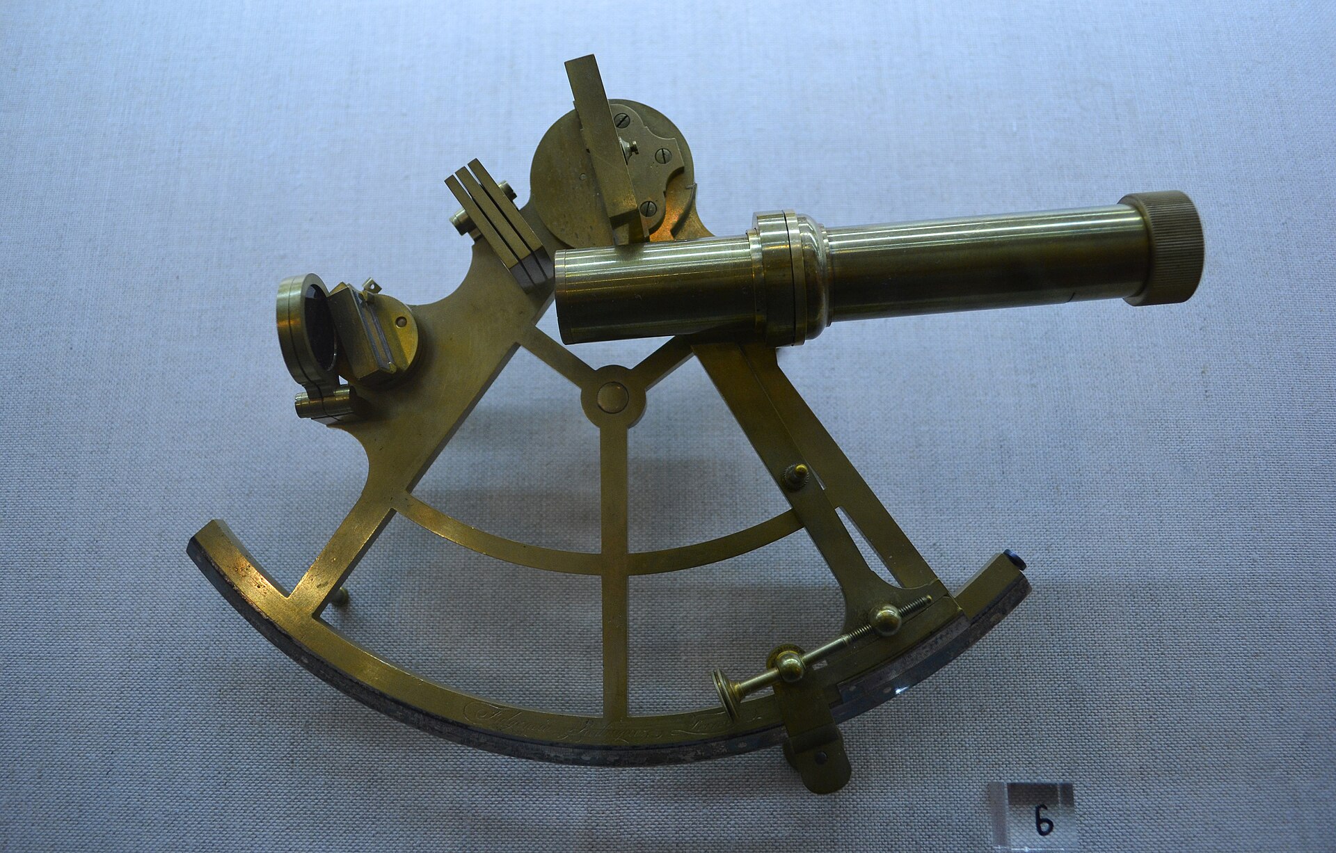
The sextant is a hand-held optical instrument that measures the angle between two visible objects - classically between a celestial body and the sea horizon - and was the navigator's primary tool for fixing latitude and longitude at sea. Its doubly reflecting principle, developed independently by John Hadley in England and Thomas Godfrey in Philadelphia about 1731, let the observer bring star and horizon into a single view, and enlarging the first octant to a sixth of a circle produced the sextant proper, made by John Bird in 1759. Refined by makers such as Ramsden, Bird, Dollond and Hughes, and extended by artificial horizons, micrometer drums and aviation bubble sextants, the instrument carried navigation through the age of the Nautical Almanac and the lunar-distance method, and was tested for emergency use aboard the International Space Station in 2018.
In this article
- 1Overview
- 2Principle and Scale Geometry
- 3Origins and Independent Invention
- 4From Octant to Sextant: Design Evolution
- 5The First Marine Sextant and the Lunar Method
- 6Instrument Makers and the Dividing Engine
- 719th-Century Forms and Notable Instruments
- 8Artificial Horizons and Accessories
- 9Aviation and Space Applications
- 10Modern and Space Station Use
- 11Post-War Standards and Contemporary Relevance
- 12Key Dates
- 13Frequently Asked Questions
- 14Timeline: from the cross-staff to the space station
- 15Knowledge graph
Overview
A sextant is a doubly reflecting optical instrument in which two mirrors, one fixed and one movable, bring a celestial body onto the horizon.Its purpose is to determine the angle between the horizon and a celestial body such as the Sun, the Moon, or a star, an angle used in celestial navigation to find latitude and longitude.
The instrument's characteristic geometry follows from that double reflection: a 60-degree arc measures angles up to 120 degrees. Navigational sextants were used to measure the angular altitudes of celestial bodies at sea, enabling mariners to determine latitude and local time, and also to find longitude by the lunar distance method against precalculated tables.
Designed for use in navigation, surveying and hydrography, a sextant of this kind could find latitude by measuring the height of the midday Sun or a suitable star at night. Longitude was found by comparing local noon with a chronometer set to a fixed meridian, or from the angle between the fixed stars and the Moon after lengthy calculations using tables in the Nautical Almanac.
1. Principle and Scale Geometry
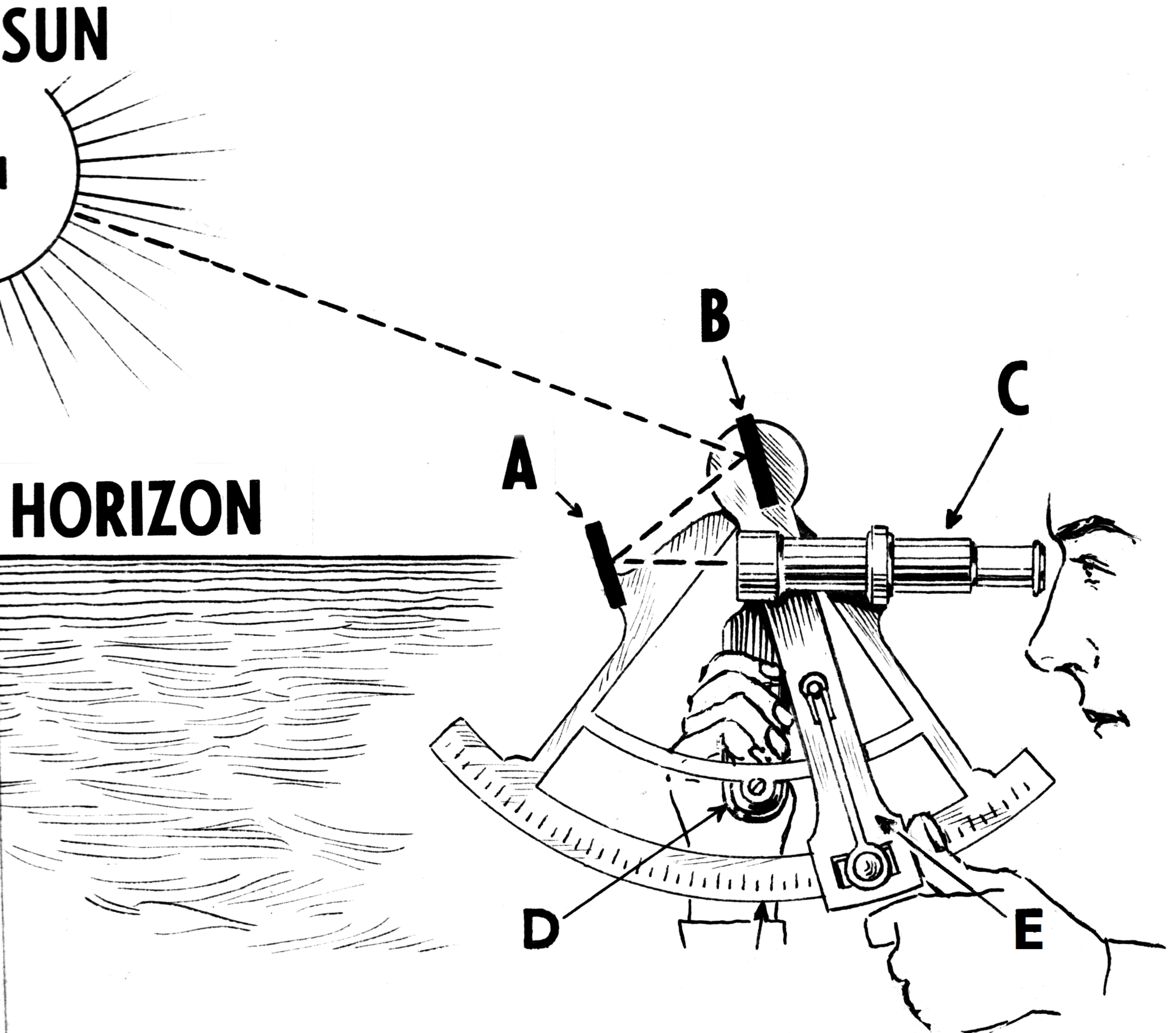
The sextant works by double reflection. Two mirrors — one fixed, one movable — bring the image of the Sun into coincidence with the horizon, so that the observer sees the two together and reads the angle between them. Because the instrument is doubly reflecting, a 60-degree arc measures angles up to 120 degrees.
In its classic nineteenth-century form the sextant settled into a recognisable pattern: a silver arc of 60 degrees divided into 120 graduations, with radii of 8 inches down to 6 inches.
2. Origins and Independent Invention
Before the sextant took its familiar form, earlier schemes for a double-reflecting instrument were drawn up but never realized in metal. Robert Hooke published plans for such a device in 1674, and Isaac Newton devised a similar one, yet no instruments were built from either plan. The idea therefore waited for a later generation of makers to bring it into being.
That moment came almost simultaneously in two distant places. John Hadley in England and Thomas Godfrey in Philadelphia arrived at the instrument independently, about 1731. Godfrey's double-reflecting sextant of 1730 was used at sea that December, while Hadley's paper on his quadrant was read to the Royal Society on 13 May 1731, and a second instrument was built before that year was over.
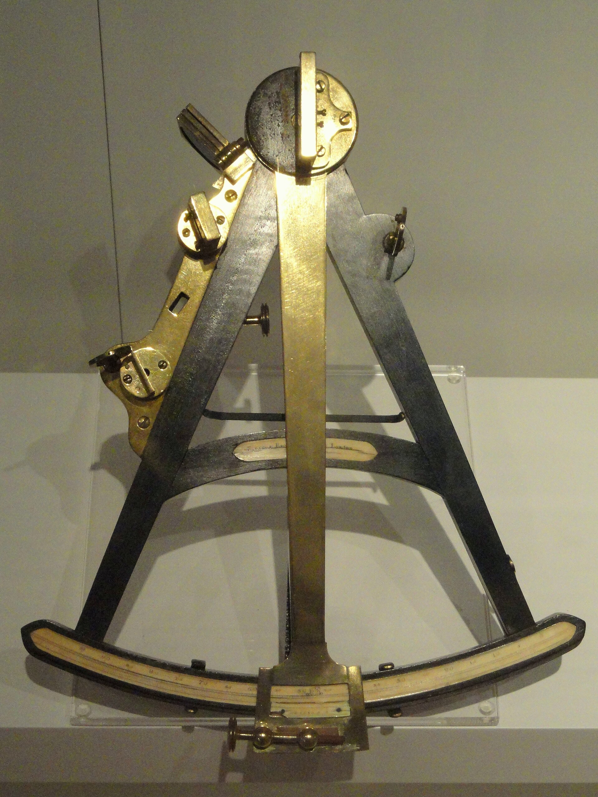
Hadley's first reflecting octant was built jointly with his brothers George and Henry in 1730. He had invented the reflecting octant in 1730, showed his new quadrant to the Royal Society in 1731 and published his description in the Philosophical Transactions. Upon trial at sea, three observations of the distance between two stars with Hadley's brass octant differed from Flamsteed's land observations by only about a minute.
The Royal Society of London went deeply into the matter of who invented the sextant and awarded 200 pounds each to Hadley and Godfrey. The question of priority carried weight because the instrument promised to answer a problem of long standing: the shipwreck of Sir Cloudesley Shovell's fleet on the Scilly Islands in 1707 had led Parliament to put up money for finding longitude at sea.
3. From Octant to Sextant: Design Evolution
The octant, spanning an eighth of a circle, was enlarged into the sextant, spanning a sixth, so that measurement could reach up to 120 degrees for lunar-distance observations. Captain Campbell enlarged an octant into a sextant in 1757.
The design accumulated refinements: a magnifying glass for the scale, a telescopic sight with cross-wires, an arc extended from an octant to a sextant, and a stout handle at the back. Hadley fixed a spirit level to the instrument so that a meridian altitude could be taken when the horizon was not visible.
The vernier had been used well before the sextant, records of it appearing in an article by its inventor Pierre Vernier in 1631, and the sextant adopted it more than a century later.
John Bird produced the first sextant in 1759, with a mahogany frame and an ivory scale so large and heavy that it needed a support socketed into the observer's belt.
4. The First Marine Sextant and the Lunar Method
The first marine sextant grew out of a commission from James Bradley, who asked the London instrument maker John Bird to produce a brass copy of a repeating circle designed by Tobias Mayer, a design that was refined during sea trials.
Bradley concluded that Mayer's tables, used together with a good instrument of this sort, could fix a ship's longitude to within one degree — a result that fell within the limits set by the 1714 Longitude Act.
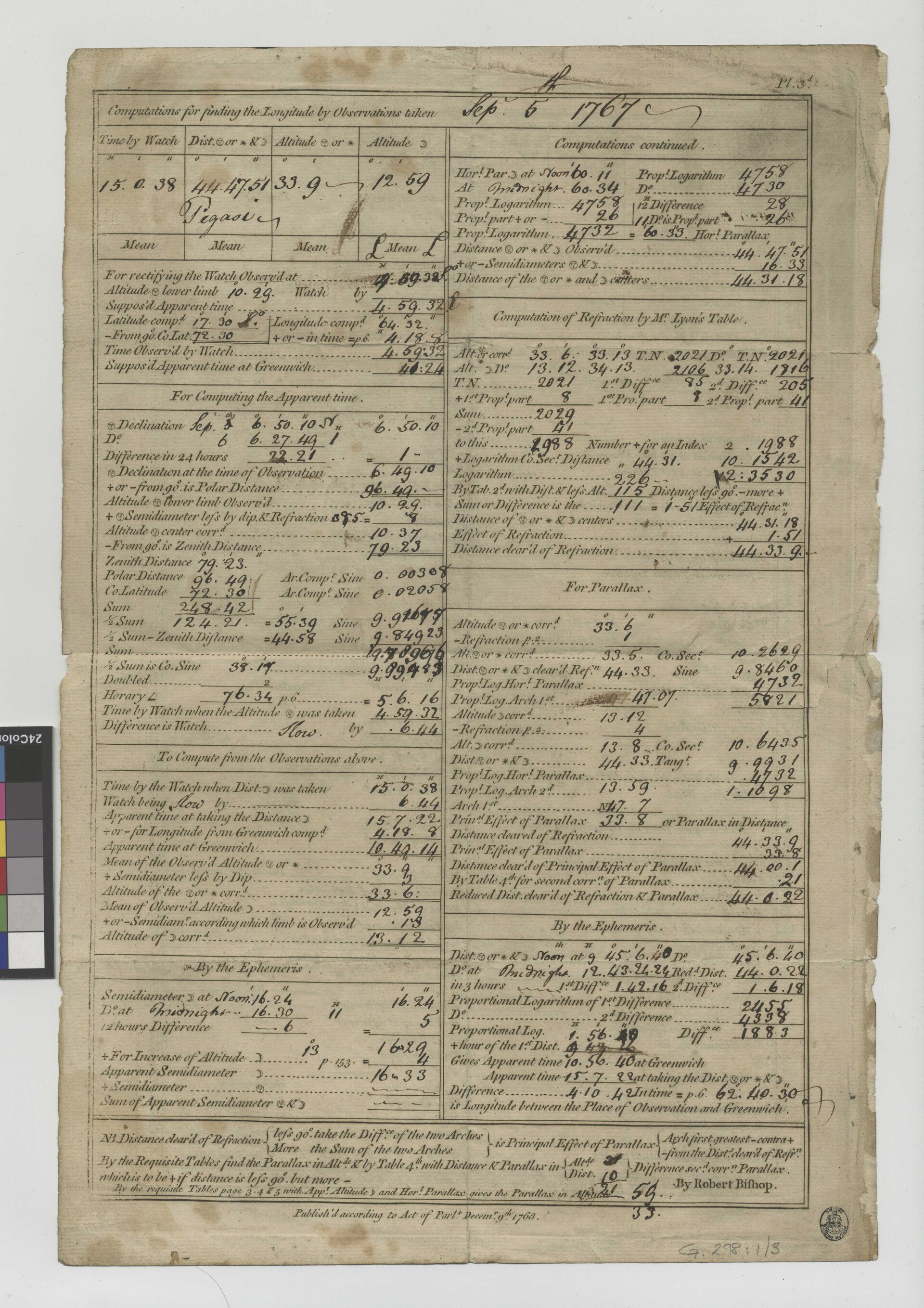
Maskelyne put the lunar method to the test on the voyage to St Helena, undertaken to observe the transit of Venus in 1761, and reported his longitude by lunars with an error of only a degree and a half, against errors of up to ten degrees from dead reckoning.
Maskelyne went on to create the system for producing the Nautical Almanac and Astronomical Ephemeris, with the data for 1767 ready for printing by the end of 1766 and publication the following year. Women rarely had the mathematical training required to work as computers on the almanac, but Mary Edwards gained enough experience to assist in teaching new computers, including her daughters.
5. Instrument Makers and the Dividing Engine
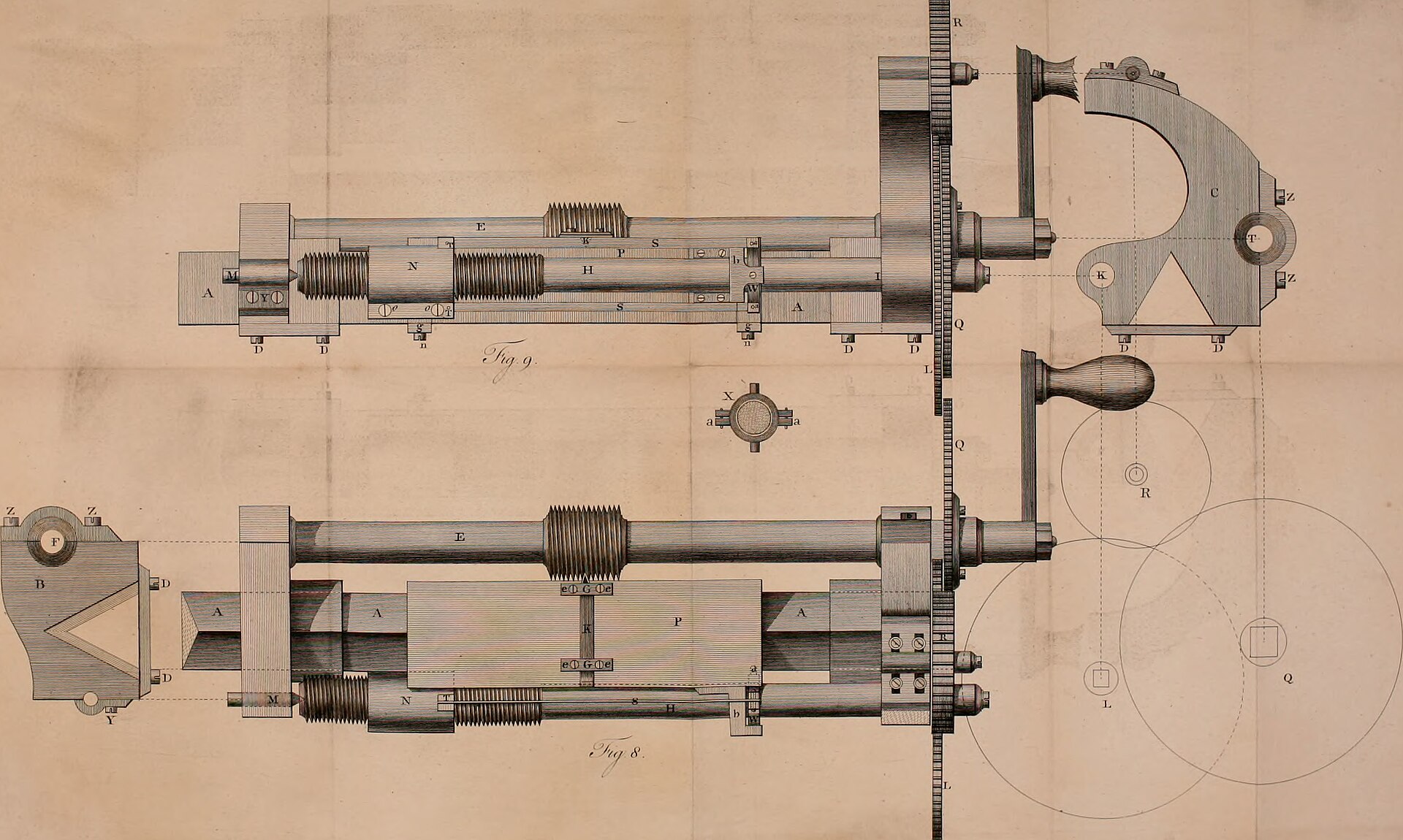
Jesse Ramsden's dividing engine marked scales mechanically with high accuracy and earned him a Board of Longitude prize of 615 pounds. Ramsden produced an instrument for lunar-distance work in 1767, and a second version in 1775 was considerably better, leading to a £300 award from the longitude commissioners two years later.
Astronomer Royal Nevil Maskelyne made recommendations for ensuring accuracy despite unavoidable imperfections in the grinding of glass, which included a hinged brass flap seen on the Ramsden sextant.
6. 19th-Century Forms and Notable Instruments
The Beagle sextant is a double-frame bridge sextant, serial 2029, made around 1831, and was given by Fitzroy to John Lort Stokes. Captain Robert Fitzroy, the original owner, commanded the survey vessel Beagle from 1828 to 1830 and again from 1831 to 1836 while John Lort Stokes served under him on both voyages. Edward Troughton patented the pillar and plate frame in 1788 under patent number 1644, a frame design later seen on the Beagle sextant.
The History of Science Museum in Oxford holds a sextant owned by Tennant, made in 1847 by the London firm Troughton and Simms. British colonial powers in South Asia worked to standardise measurement during the 1800s, with the East India Company's Madras Presidency setting up a Committee of Weights and Measures in 1798 as an instrument of that standardisation.
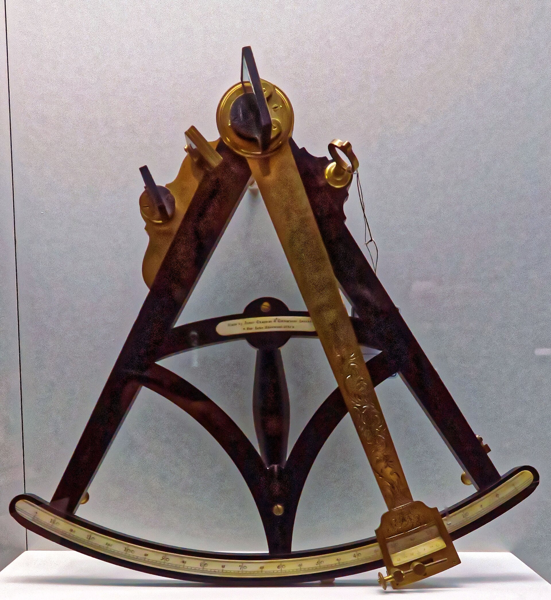
The pocket sextant consists of circular polished brass plates with a lid that, when fitted on the back of the instrument, serves as the handle. This box sextant belonged to Edward Newell Harrison, clerk of HMS Assistance, who went to the Arctic in 1850 and 1851 in search of Sir John Franklin and later died in the West Indies.
The Admiralty-pattern sextant has a brass frame and a wooden handle that contains a battery for illuminating the scale. This sextant was lost when HMS Royalo, a Fowey trawler built in 1916 and taken over by the Navy during 1940 was sunk by a mine off Penzance in September of 1940; divers recovered it at a depth of sixty feet in 1962 and it was presented to the Directorate of Naval Warfare the following year.
7. Artificial Horizons and Accessories
The artificial horizon is an airtight housing containing a gyroscope with a glass body ruled by a series of horizontal lines, driven by an air pump. Admiral Georges Ernest Fleuriais first patented this artificial horizon in 1886 as a reference line for sights when the sea horizon was not visible.
A mercury bath formed a shiny horizontal surface that caught the reflection of a celestial body, while a triangular glass tent kept the wind from disturbing the surface.
8. Aviation and Space Applications
In 1927 the Army Air Corps Fokker C-2 Bird of Paradise became the first airplane to fly from the US mainland to Hawaii, with navigator Albert Hegenberger making his celestial sightings behind a semi-protective windscreen. Before 1927 watches used with sextants for celestial sightings could only be set to the minute, and a 30-second watch error meant a navigational error of up to 12 kilometres, until Weems devised a watch with an adjustable second hand set from radio time signals. Weems devised an Air Almanac in 1932 that greatly reduced the time needed to compute a position, and the Royal Observatory in Greenwich began publishing it in time for World War II.
The Link A-12 sextant, designed with Weems's assistance just before World War II, took multiple sightings and computed an average without manual calculations, compensating for Dutch roll in airplanes. Tens of thousands of the compact A-10 sextant were made during World War II and many stayed in service into the 1950s, with a lighted bubble and a recording disk to determine averages. Retractable periscopic sextants, used from the late 1940s on airliners and long-range military aircraft, removed the risk of astrodome blowouts but had a narrow field of view.
The SR-71's astroinertial navigation unit computed fixes from stars sighted through a lens and updated the inertial system with an accuracy of at least 90 metres, and improved versions serve as a backup to GPS. Sextants measure the angle between two objects, and after guiding navigators on Earth for centuries they proved useful in space on Gemini and Apollo, promising emergency backup navigation for lunar missions. Buzz Aldrin used a hand-held sextant and chart on Gemini XII after a radar problem, and Jim Lovell used the sight of the Earth to guide Apollo 13 home.
To determine position in space an Apollo astronaut located a specific star with a single-power, wide-field telescope and then took a fix with a sextant, a procedure descended from centuries-old methods used at sea and in the air. A pioneering transatlantic flight carried an artificial-horizon sextant designed by the Portuguese admiral Gago Coutinho and flown with Sacadura Cabral as pilot; the Coutinho sextant's design was based on two spirit level tubes, one to keep the sextant horizontal and the other to keep it vertical.
9. Modern and Space Station Use
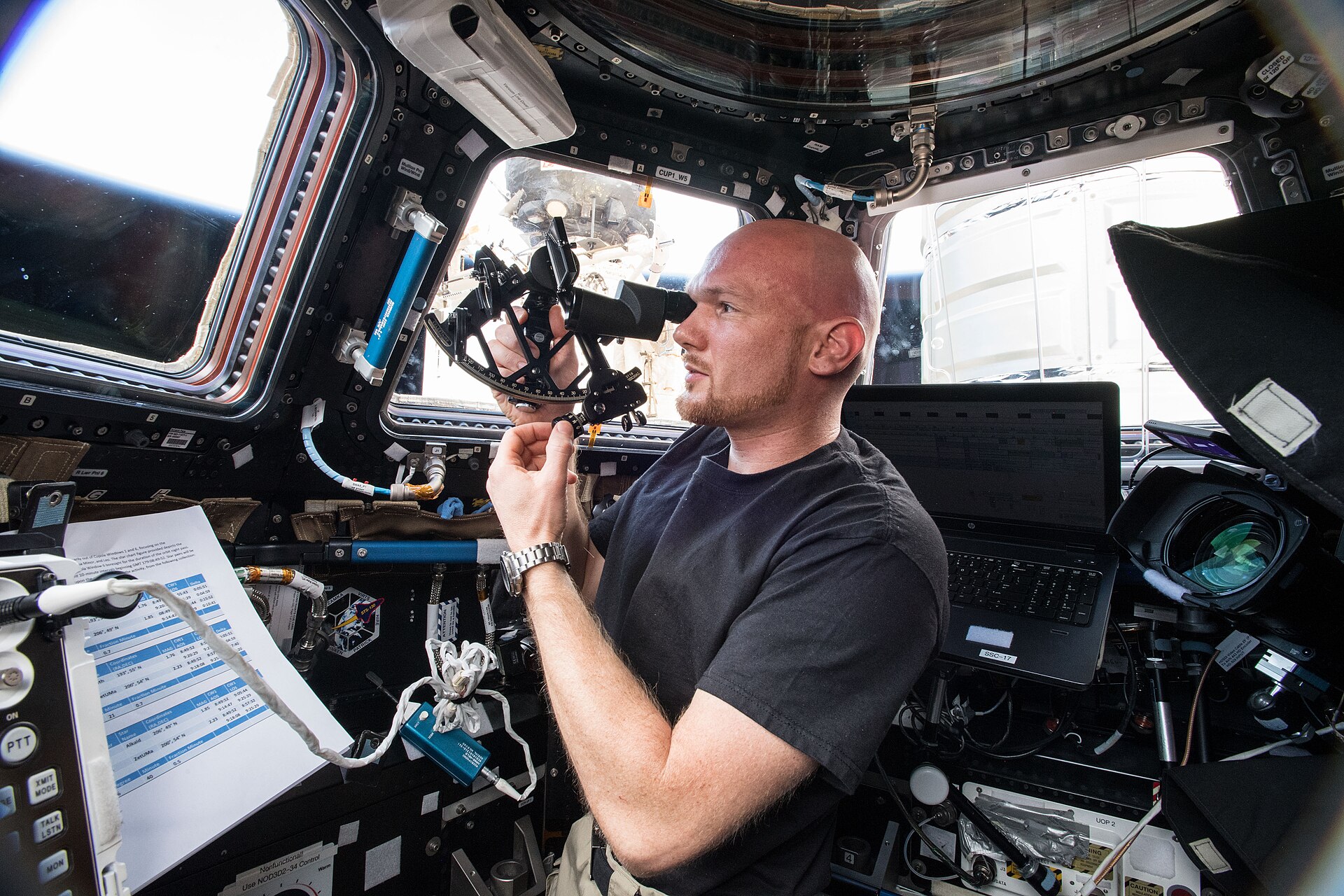
In the ISS Cupola two crew members took sightings on star pairs, star and moon limbs and the moon's diameter, achieving results within the accuracy goal of 60 arcseconds despite window refraction and minimal training.
A sextant provides the manual capability to perform star and planet-limb sightings and estimate vehicle state during loss of communication, and its simplicity and independence from primary systems make it useful as an emergency survival backup.
As part of the NICER investigation, the Station Explorer for X-ray Timing and Navigation Technology, also called SEXTANT, tested using pulsars in GPS-like systems and completed a first in-space demonstration during 2017 and in 2018 researchers reported that real-time autonomous X-ray pulsar navigation is clearly feasible.
10. Post-War Standards and Contemporary Relevance
The standard of excellence for post-war sextants was set by the C. Plath firm in Germany, whose instruments could include a quick-release drum micrometer reading to one-tenth of an arc minute.
With the sextant and knowledge of the time, a geographical position could be derived within a few kilometres, allowing humans to travel, explore, transport and supply the globe with far greater confidence and efficiency.
Maritime user requirements derived from the International Association of Lighthouse Authorities place the new generation of sextants in the ocean and coastal phases of a voyage, where accuracies of less than 100 metres are required.
11. Key Dates
-
1707Scilly Islands shipwreckThe loss of Sir Cloudesley Shovell's fleet prompted Parliament to fund the search for longitude at sea. 6John Hadley (1682-1744) · MacTutor History of Mathematics Archive, University of St Andrews ↗
-
1730Octant and sextant
-
13 May 1731Hadley's paper readHadley's paper on his quadrant was read to the Royal Society; he had built a second instrument before that year was over. 5
-
2017SEXTANT in-space demonstrationThe Station Explorer for X-ray Timing and Navigation Technology, part of the NICER investigation, completed a first in-space demonstration. 16Navigation Technology (ISS Research) · NASA ↗
-
2018Pulsar navigation reported feasibleResearchers reported that real-time autonomous X-ray pulsar navigation is clearly feasible. 16
12. Frequently Asked Questions
What was the first marine sextant?
James Bradley commissioned the London instrument maker John Bird to make a brass copy of a repeating circle designed by Tobias Mayer, and the instrument, refined during sea trials, became the first marine sextant.18Longitude found: Nevil Maskelyne and the lunar method · Royal Museums Greenwich ↗
Who devised the earliest plans for a reflecting instrument?
Robert Hooke published plans for a double-reflecting instrument in 1674 and Isaac Newton devised a similar one, but no instruments were built from either plan.5
How accurate is a sextant in space?
In the ISS Cupola two crew members took sightings on star pairs, star and moon limbs and the moon's diameter, achieving results within the accuracy goal of 60 arcseconds despite window refraction and minimal training.15AAS 19-064 Sextant Navigation on the International Space Station: A Human Space Exploration Demo · NASA Technical Reports Server ↗
Why did navigators move away from plumb-line instruments toward optical ones?
On a rolling deck the plumb-line quadrant was hard to keep exactly vertical and the wind could blow the plumb bob off line, faults that pushed makers toward optical systems.2The History of the Sextant (Peter Ifland lecture) · University of Coimbra, Physics Museum ↗
What did the kamal and the cross-staff have in common?
Why is the angle of Polaris useful to a navigator?
At the equator Polaris sits on the horizon, and between the equator and the North Pole the angle of Polaris above the horizon is a direct measure of terrestrial latitude.2
Has the sextant's optical principle changed since the eighteenth century?
Even a 1988 instrument uses exactly the optical system John Hadley proposed in 1731 and the principle has not changed.13The History of the Sextant (continued) · University of Coimbra, Physics Museum ↗
Why do some navigators still keep a sextant aboard?
Old-line navigators have refused to give up the nautical almanac, the chronometer and the sextant for electronic navigation, wary that batteries go dead.13 Recent risks to radio-frequency positioning from jamming and spoofing have resurfaced the need to train sailors again in the art of celestial navigation.17A Return to the Sextant - Maritime Navigation Using Celestial Bodies and the Horizon · Sensors (MDPI) via PubMed Central ↗
How does a sextant fit into modern navigation practice?
Global navigation satellite systems remain the most accurate form of navigation reference for a ship, so the optical technique serves as an alternative, a back-up or a sanity check for GPS.17
13. Timeline: from the cross-staff to the space station
- 1594John Davis introduces his quadrantThe celebrated English navigator Captain John Davis came out with a quadrant; the observer first had to sight in two directions, an error corrected by turning the instrument around.
- 1674Hooke's double-reflecting planRobert Hooke came out with plans for a double-reflecting instrument in 1674 and Isaac Newton devised a similar one about the same time, but no instruments were built from either plan.
- 1730Hadley and Godfrey invent the reflecting instrumentHadley invented a quadrant, actually a double-reflecting octant, for measuring the altitude of the Sun or a star above the horizon, independently of Thomas Godfrey of Philadelphia.
- 13 May 1731Hadley's paper read to the Royal SocietyHadley showed his new quadrant to the Royal Society and published a description of the instrument in the Philosophical Transactions of the Royal Society.
- 1757Campbell enlarges the octantA Captain Campbell enlarged an octant into a sextant in order to more fully meet the needs of navigation.
- 1759John Bird makes the first sextantThe first sextant was produced by John Bird in 1759, with a mahogany frame and an ivory scale; it was so large and heavy that it needed a support socketed into the observer's belt.
- 1761Maskelyne tests the lunar method at St HelenaOn the voyage to St Helena to observe the transit of Venus, Maskelyne reported his longitude reckoning by lunars in error by only a degree and a half, against up to ten degrees from dead reckoning.
- 1767First Nautical Almanac data preparedMaskelyne created the system for the Nautical Almanac and Astronomical Ephemeris, with the data for 1767 ready to be printed by the end of 1766.
- 1775Ramsden's improved sextantA second version of Ramsden's instrument, produced in 1775, was considerably better and led to him being awarded a prize by the longitude commissioners two years later.
- circa 1831Fitzroy's Beagle sextantThe serial number indicates manufacture around 1831, suggesting Fitzroy bought the instrument for the Beagle's second voyage, during which he gave it to John Lort Stokes.
- 1886Fleuriais patents his artificial horizonAdmiral Georges Ernest Fleuriais first patented this artificial horizon, an airtight gyroscope housing that provided a reference line when the sea horizon was invisible.
- 1927Weems's second-setting watchWeems devised a watch with an adjustable second hand that could be set using radio time signals, cutting the error caused by watches that could only be set to the minute.
- 2017Pulsar navigation demonstrated in spaceThe Station Explorer for X-ray Timing and Navigation Technology, or SEXTANT, completed a first in-space demonstration of using pulsars in GPS-like systems.
- 2018Sextant tested aboard the ISSTwo crew members took sextant sightings in the ISS Cupola module on star pairs, star and moon limbs and the moon's diameter.
References (19)
- 1John Hadley — Encyclopaedia Britannica WebView source
- 2The History of the Sextant (Peter Ifland lecture) — University of Coimbra, Physics Museum Web↩View source
- 3Sextant by Jesse Ramsden with case (1928-924) — Science Museum Group, London 1928 WebView source
- 4Double-frame brass sextant (1911-231) — Science Museum Group, London 1911 WebView source
- 5The Evolution of the Sextant (Proceedings, November 1936) — U.S. Naval Institute 1936 Web↩View source
- 6John Hadley (1682-1744) — MacTutor History of Mathematics Archive, University of St Andrews 1682 Web↩View source
- 7The 300-year-old tool helping stranded astronauts get home — BBC Future WebView source
- 8Jesse Ramsden (1735-1800) — MacTutor History of Mathematics Archive, University of St Andrews 1735 WebView source
- 9Double Frame Bridge Sextant, NAV1174 (Fitzroy/Beagle) — Royal Museums Greenwich, National Maritime Museum WebView source
- 10Pocket sextant, NAV1220 (Franklin search provenance) — Royal Museums Greenwich, National Maritime Museum WebView source
- 11Admiralty Sextant, NAV1229 (HMS Royalo) — Royal Museums Greenwich, National Maritime Museum WebView source
- 12Sextant with Artificial Horizon, NAV1239 (Fleuriais) — Royal Museums Greenwich, National Maritime Museum WebView source
- 13The History of the Sextant (continued) — University of Coimbra, Physics Museum Web↩View source
- 14Celestial Navigation: How Did Aviators Shoot the Sun and Stars? — Smithsonian National Air and Space Museum, Time and Navigation WebView source
- 15AAS 19-064 Sextant Navigation on the International Space Station: A Human Space Exploration Demo — NASA Technical Reports Server Web↩View source
- 16Navigation Technology (ISS Research) — NASA Web↩View source
- 17A Return to the Sextant - Maritime Navigation Using Celestial Bodies and the Horizon — Sensors (MDPI) via PubMed Central Web↩View source
- 18Longitude found: Nevil Maskelyne and the lunar method — Royal Museums Greenwich Web↩View source
- 19Apollo Sextant and Eye Piece — Smithsonian National Air and Space Museum, Time and Navigation WebView source
 The Sun
 The Solar System
 Jupiter